bobspirko.ca | Home | Canada Trips | US Trips | Hiking | Snowshoeing | MAP | About
Byron Hill
Crowsnest Pass, Alberta
June 15, 2013
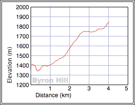
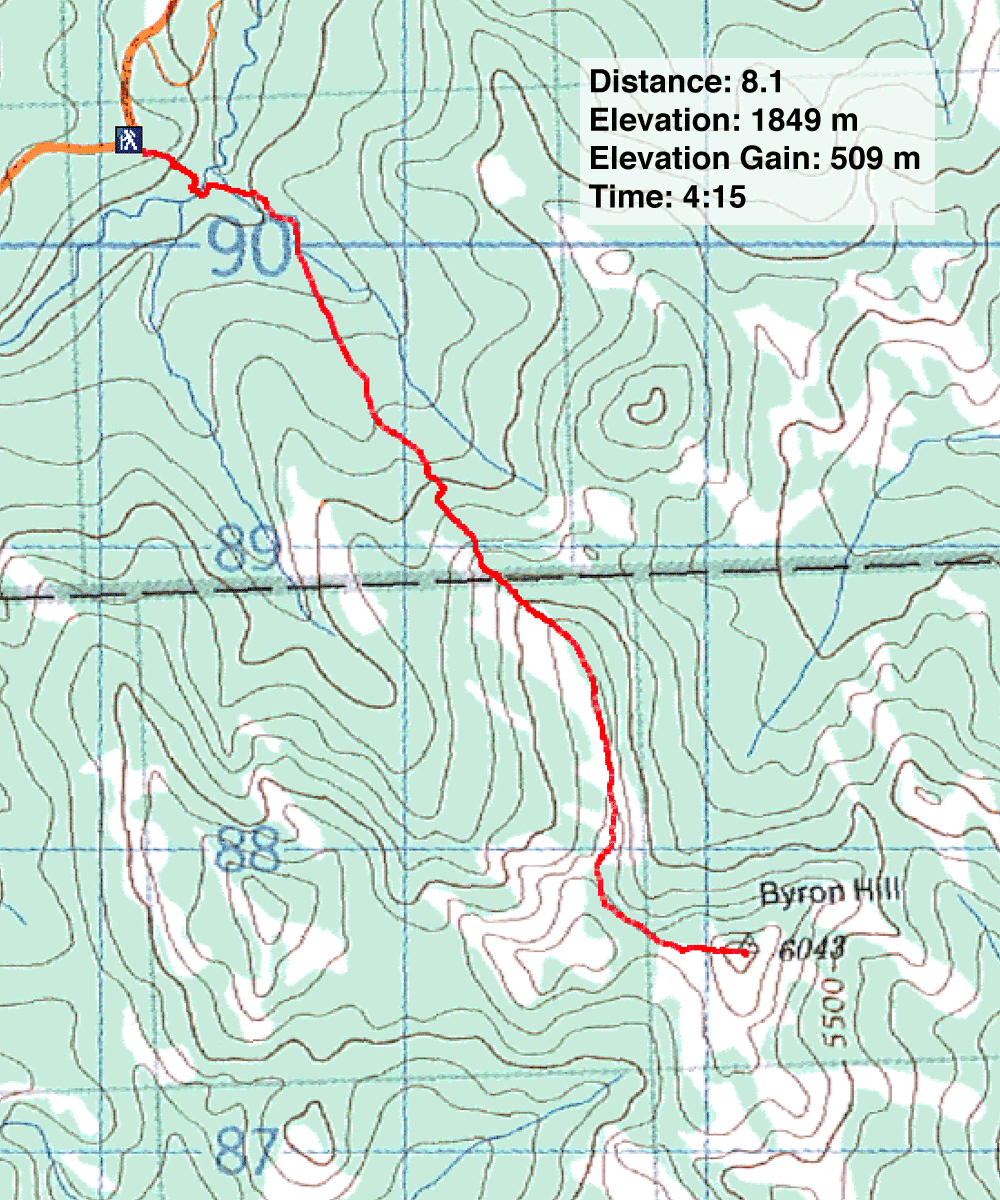
Distance: 8.1 km (5.0 mi)
Cumulative Elevation Gain: 621 m (2037 ft)
Privatization has long since sealed the fate of the old approach to Byron Hill (see our 2008 attempt), but it's been on my mind to return and take a different approach, one using public land. From our attempt, I had determined a good starting point, and after perusing Google Earth and a map, I drew up a route.
From Hwy. 3, I turned onto the East Hillcrest Access and drove 2.4 km to Adanac Road. After travelling 2.2 km up Adanac, I parked at an obvious bend in the road just after a gate. On the left side of the road is a cutline of sorts. I started down.
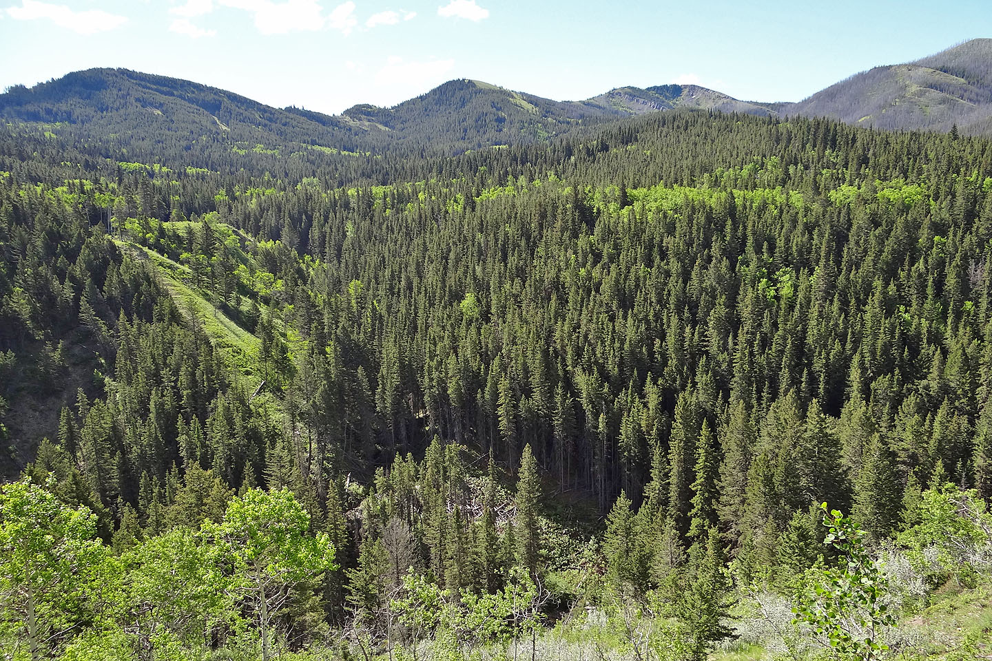
Right off the bat, Byron Hill tried desperately to discourage me, throwing every deterrent in my path, including not having a path. Less than half a kilometre into the route, there is a steep 70-m drop, a creek-crossing and a swath of thicket and deadfall that defies easy penetration. After that, however, Byron Hill turns meek, so obliging you could probably follow an old road all the way to the summit, but that would miss the ridgewalk, the best part of the trip.
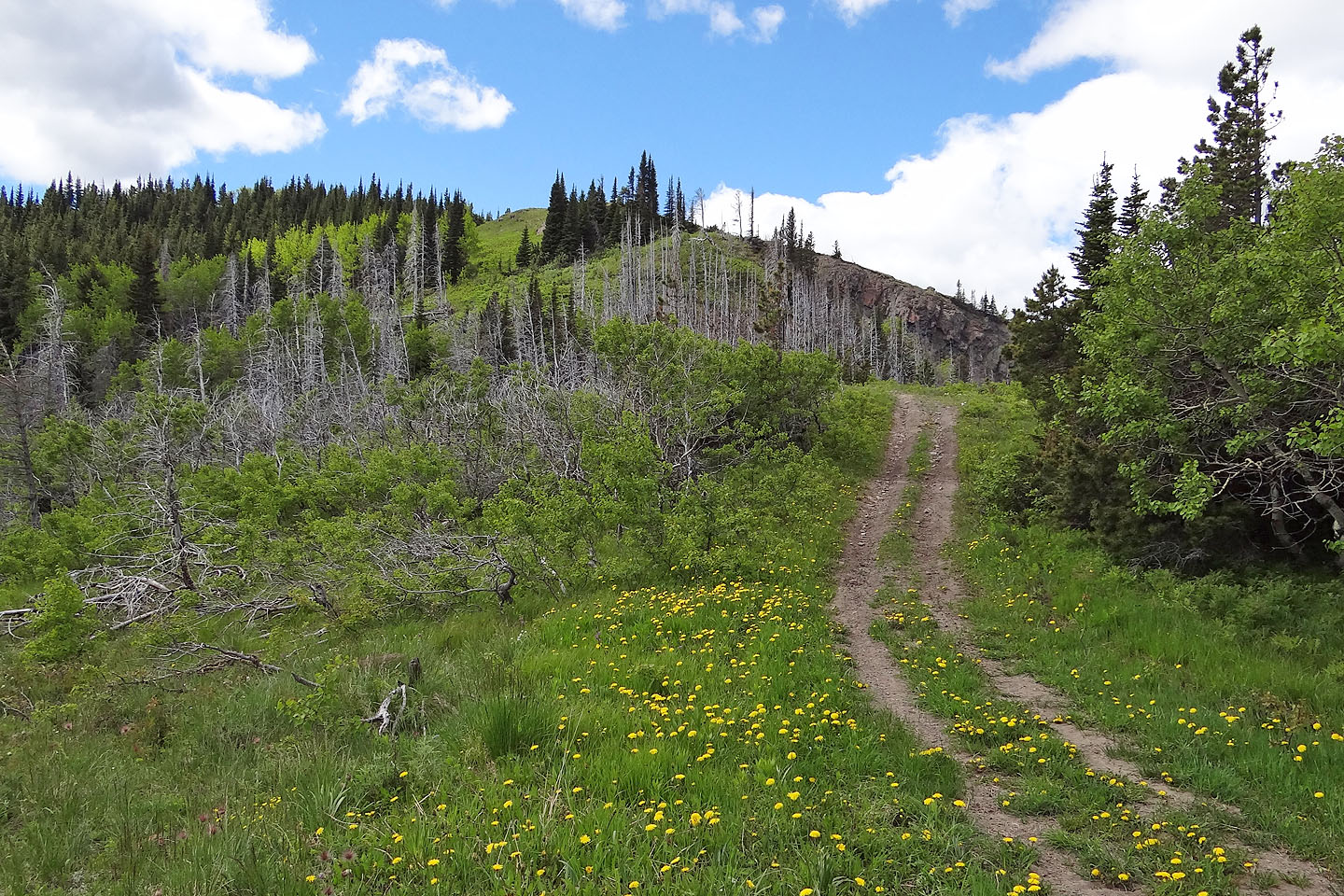
Anticipating high water levels in the creek from spring runoff, I had brought my hip waders. But I needn't have bothered as I faced only calf-deep water. After fording the creek, I picked up a trail on my right that led into the woods. Unfortunately, this trail ends abruptly and goes well off-route. As I learned on my descent, it's best to thrash up the abominable cutline and get to an old road.
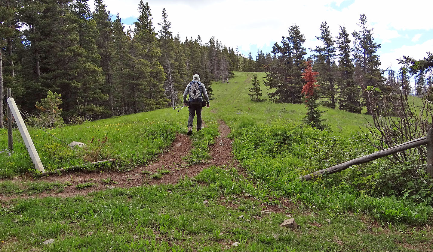
The road winds through the forest for a time and then cuts through a small meadow. Soon after re-entering the woods, the road makes a sharp right turn, but straight ahead is a trail, one that heads to a ridge and that's where I wanted to go. But after 100 m, the trail bends left. I started down it, but it was taking me well off track. It's better to exit the trail before it turns and continues straight ahead, as much as deadfall allows. I tramped up a steep, wooded slope to gain the ridge.
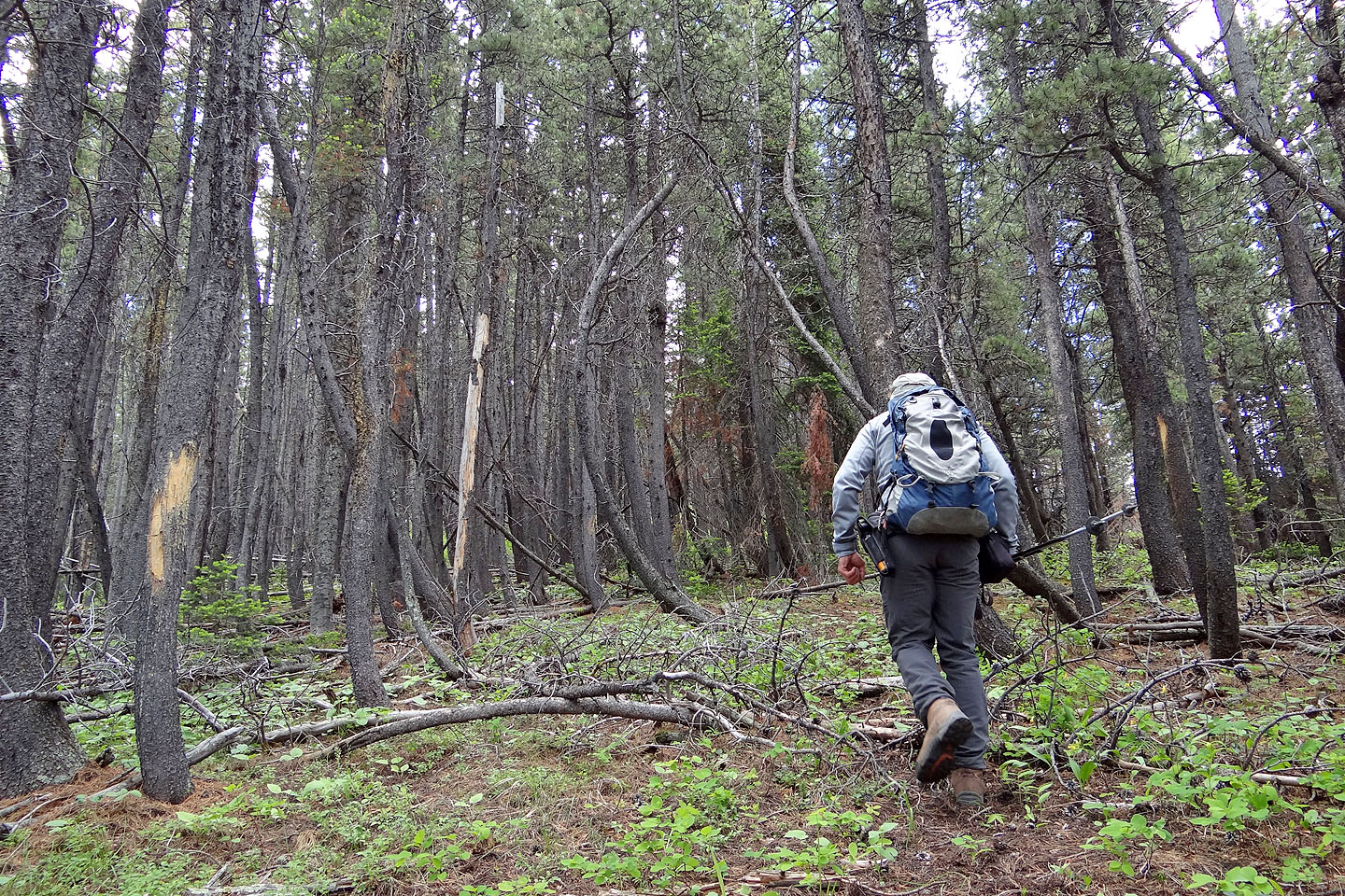
Still in trees, I bushwhacked up the ridge keeping close to the crest. After some time, a grassy slope appeared on my right, and naturally I gravitated to it. I made my way up to a delightful open ridge crest.
Finally I saw my objective, the summit of Byron Hill. I had only to continue traversing the ridge crest and follow it as it bends left to the summit. I covered the last several hundred metres to the summit on an old road cut into treed slopes. (Google Earth shows this road leading back to the road I had exited earlier.)
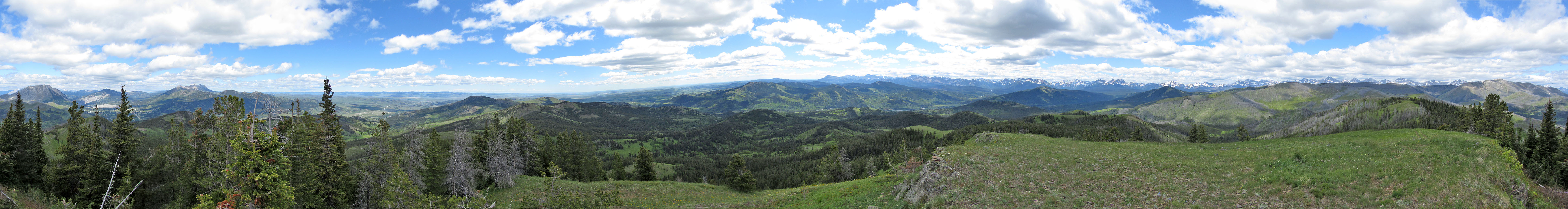
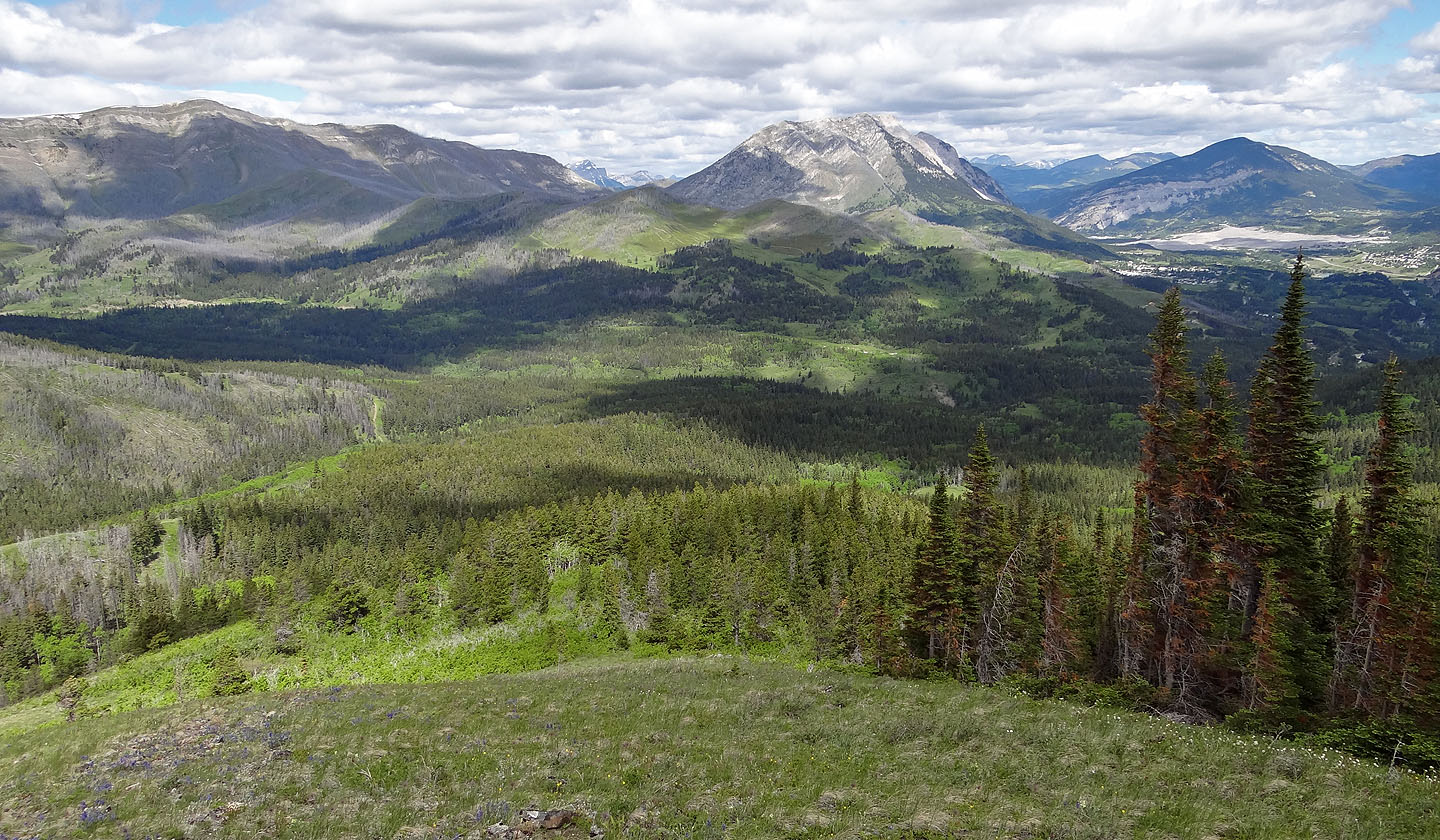
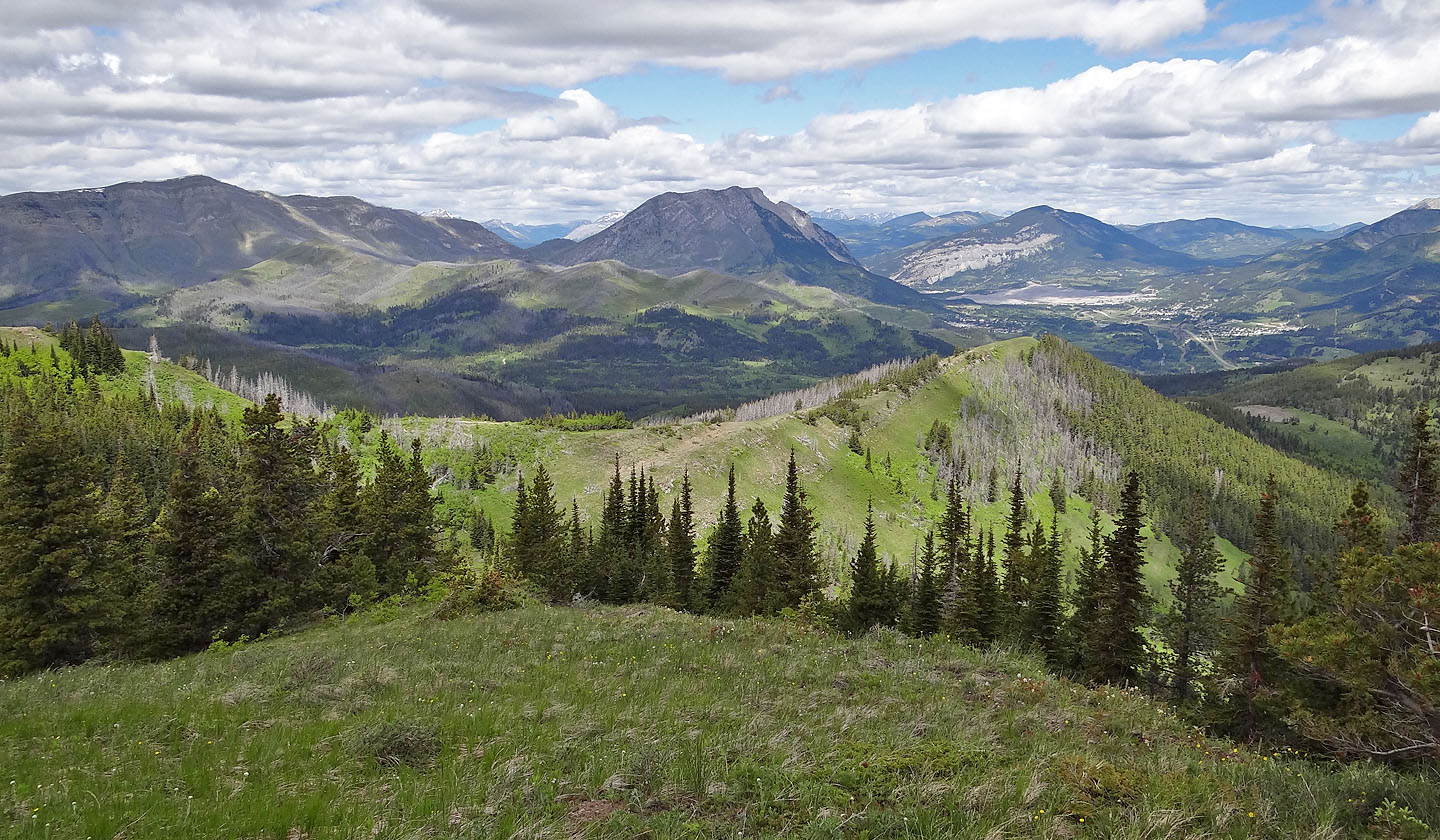
From the summit, trees slightly obscured sights of the Livingstone Range to the north but gave way to good views of the Flathead Range west and the peaks of Castle Wilderness south. After taking a few photos, I headed back the same way.
Despite the troublesome start, I enjoyed my little trek, but after two attempts and one success, I'm not hankering to return. Bye-bye Byron.
View before dropping down to the creek: the grassy strip (bottom left) leads to
the road. The summit is near the centre of the skyline but not visible.
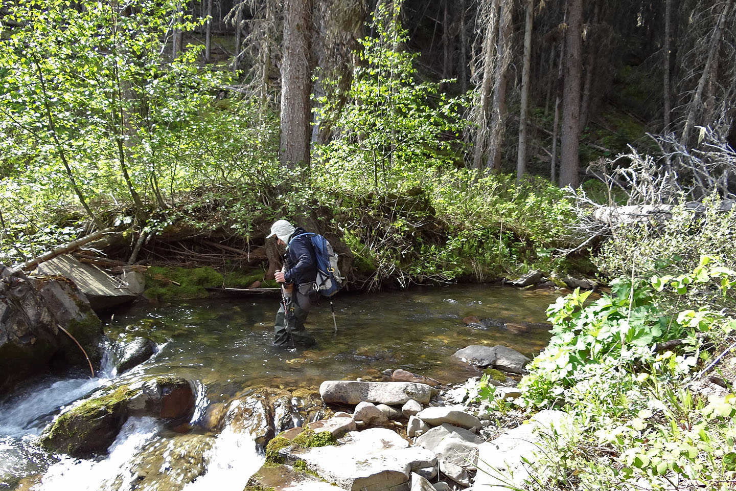
Crossing Byron Creek
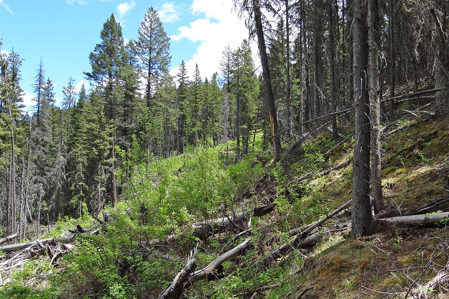
The bushy, log-strewn cutline leads to the road
After crossing a second creek, the cutline rises
Looking back before reaching the old road
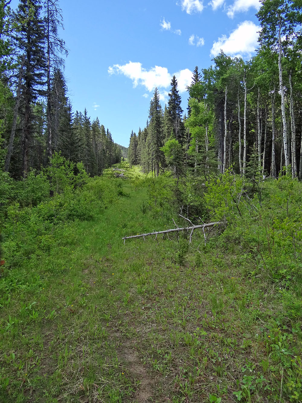
After taking a few bends the road straightens
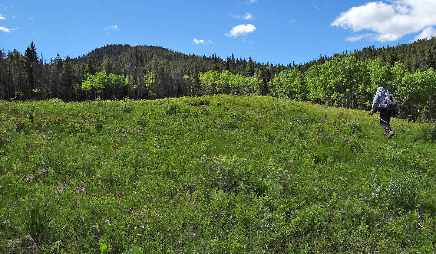
The road breaks out onto a meadow
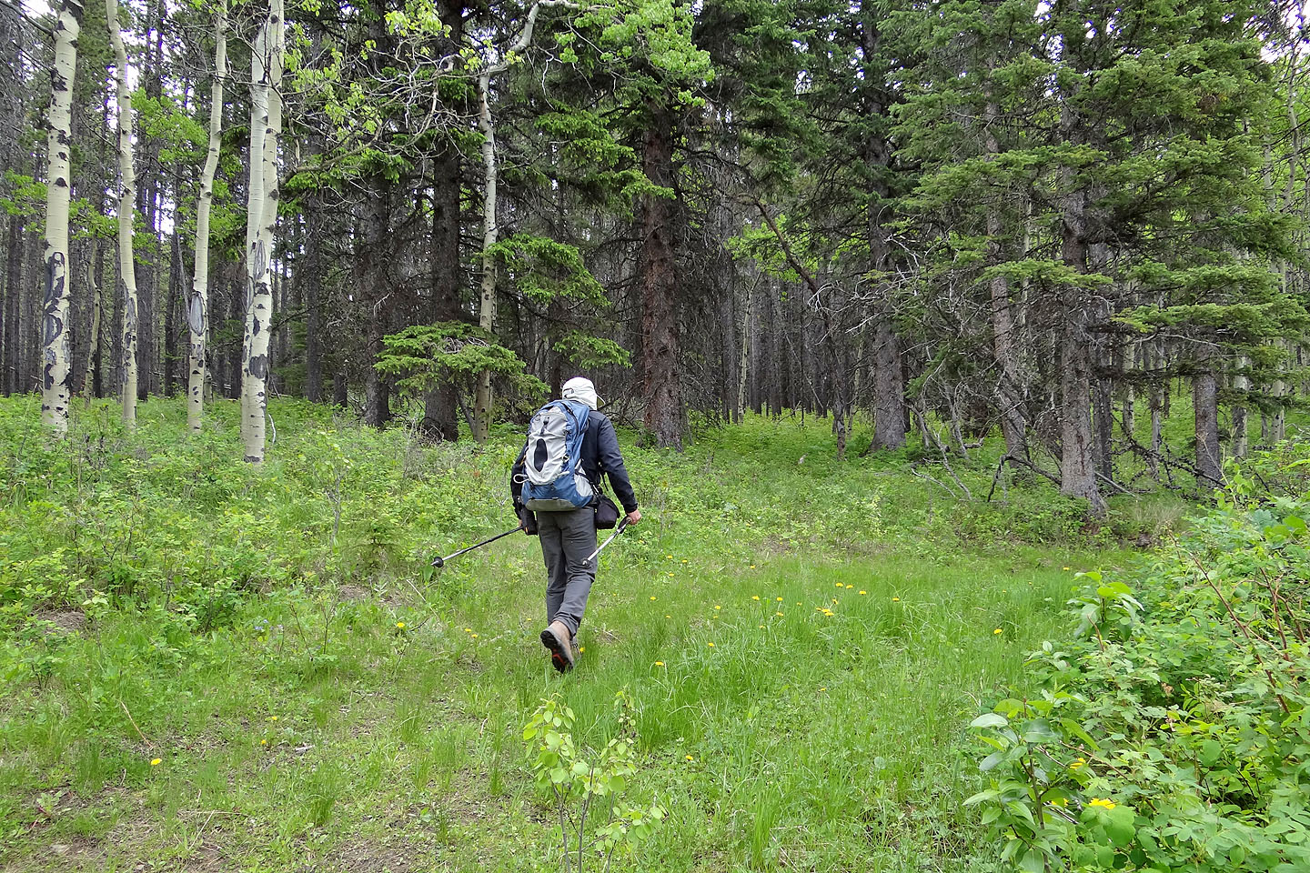
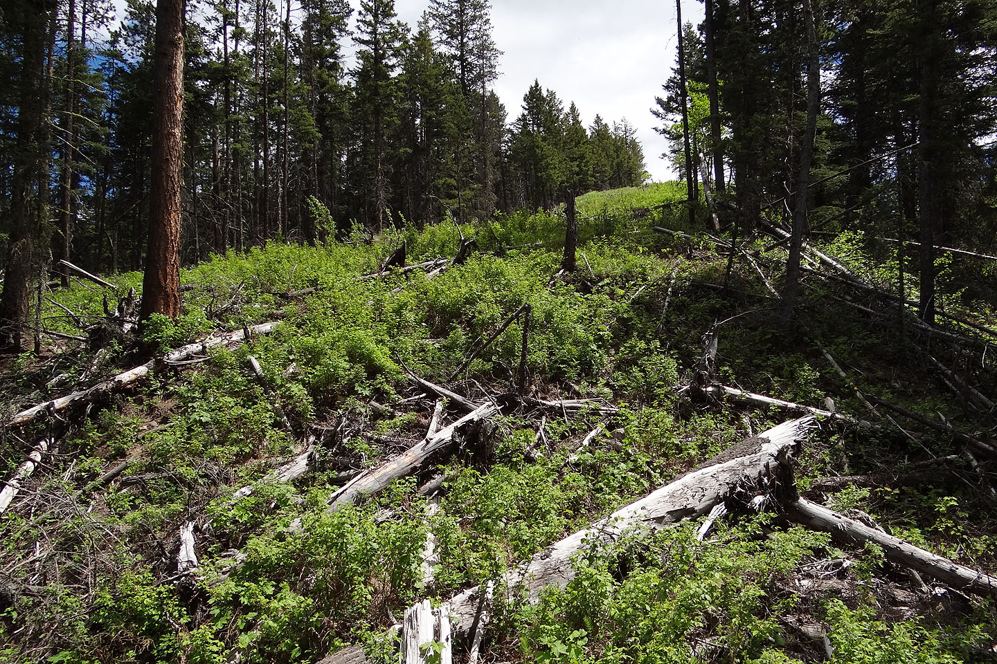
Soon after entering the trees, the road swings right but I took the trail ahead
Following the ridge
Partway up the open ridge, Turtle Mountain comes into view (mouse over for a close-up)
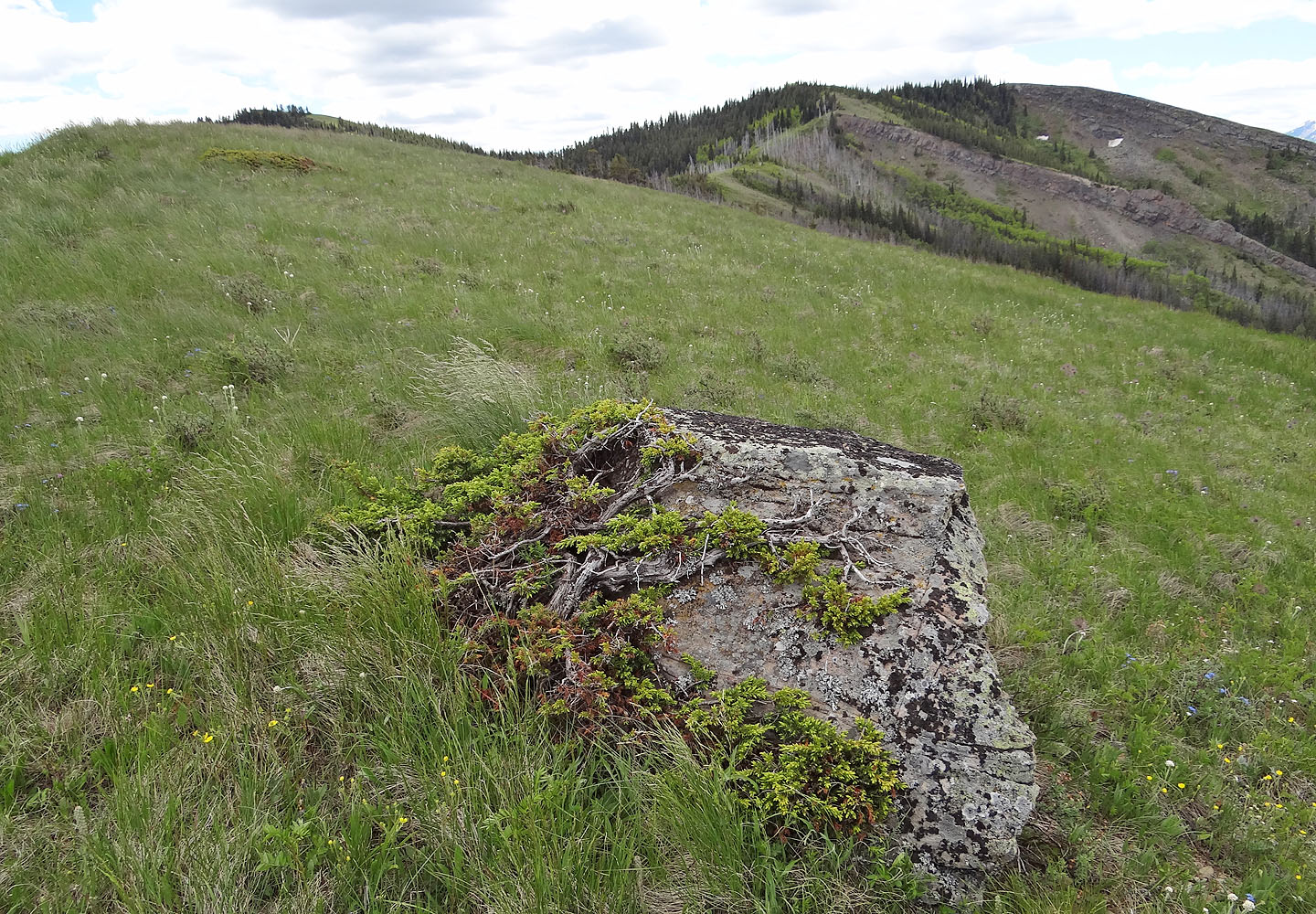
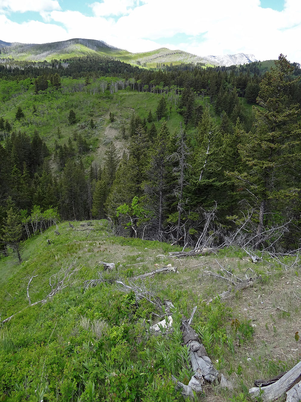
On the right is the high point before the summit
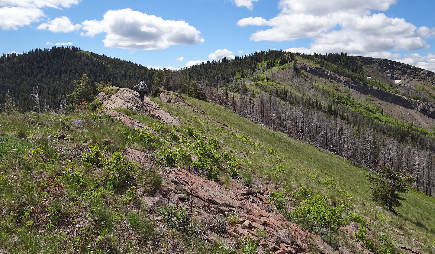
From the ridge crest, the summit appears on the left
Hillcrest Mountain (mouse over for a close-up)
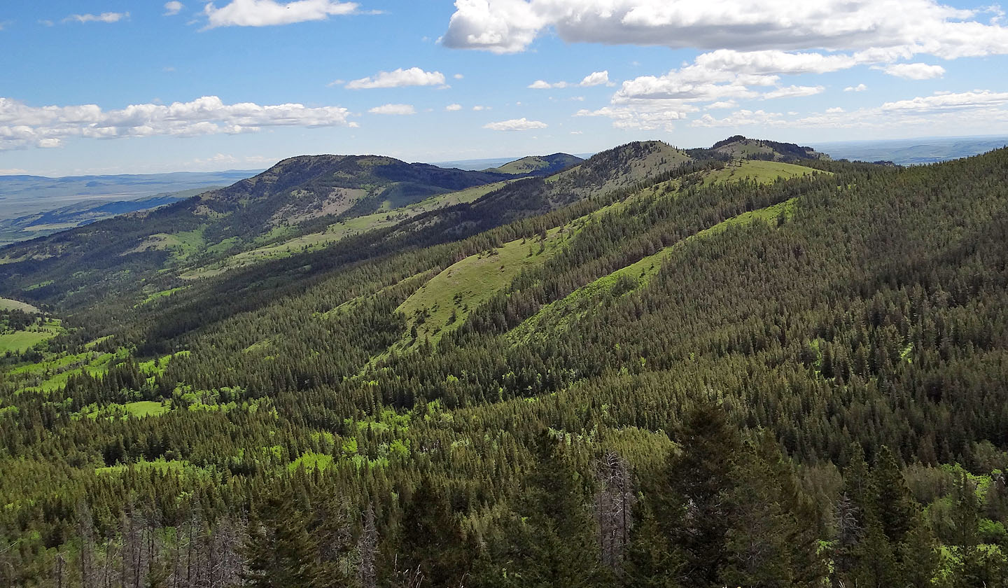
Burmis Mine Ridge to the east
This road heads toward the high point before veering left to a pass
On the pass, a side road leads to the summit of Byron Hill
Looking down at the ridge I traversed
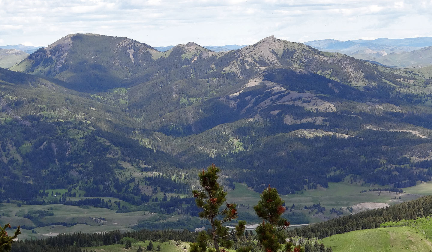
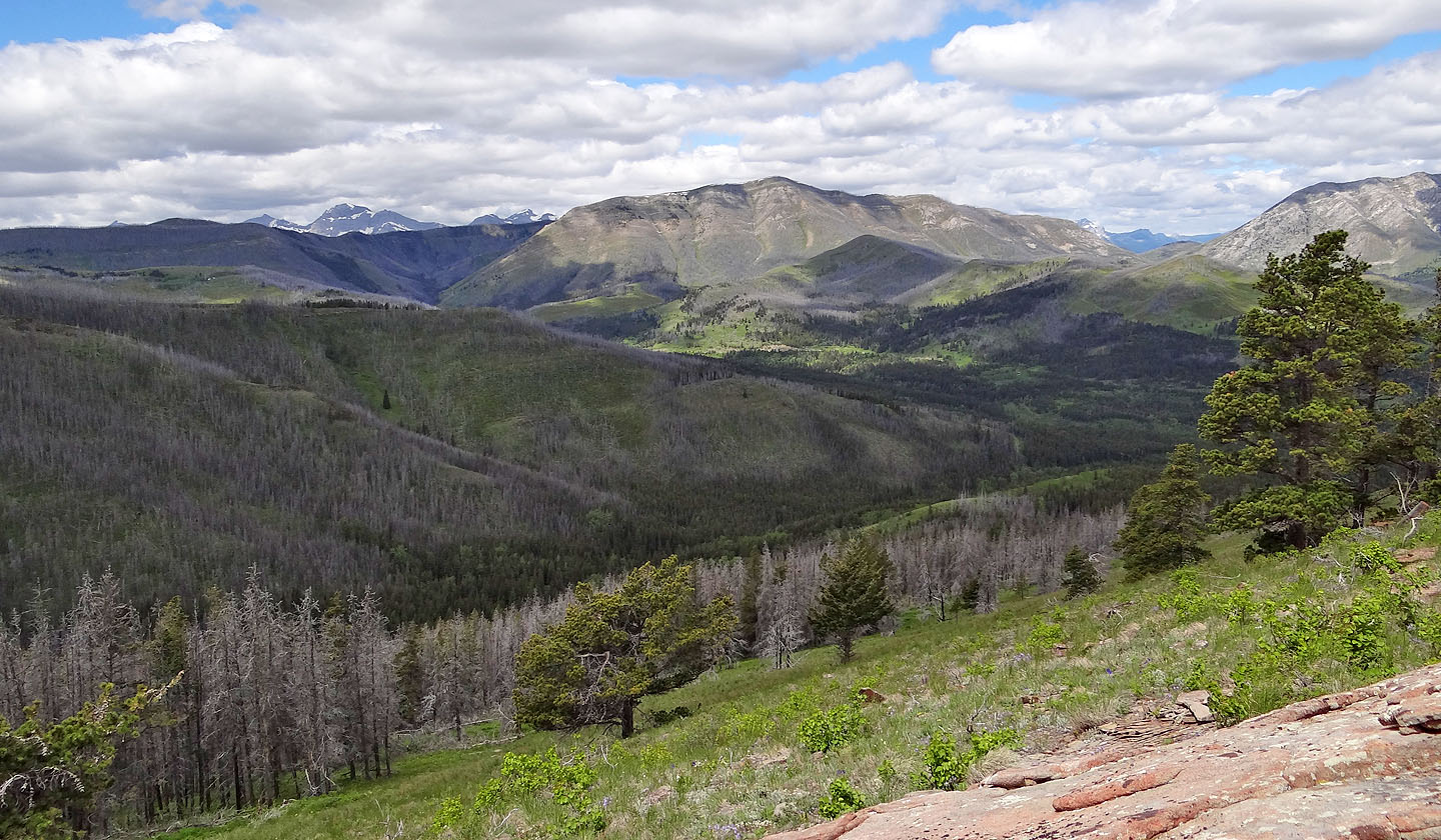
Robertson Peak and Tallon Peak with an unnamed point in between
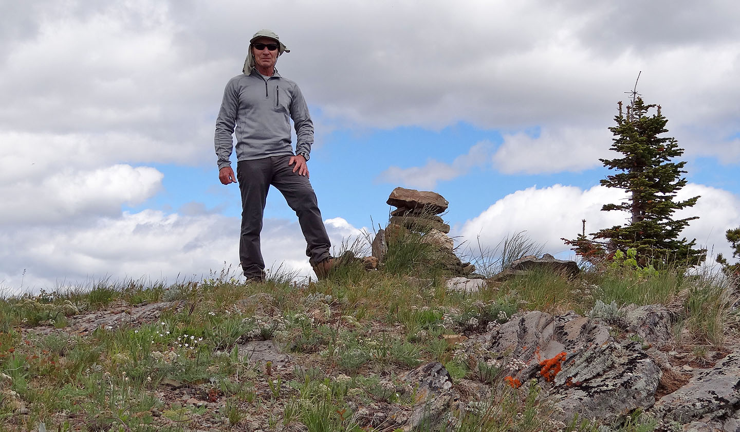
On the summit
82 G/9 Blairmore