bobspirko.ca | Home | Canada Trips | US Trips | Hiking | Snowshoeing | MAP | About
East End of Loaf Mountain
Castle Provincial Park, Alberta
May 30, 2005
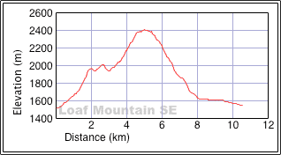
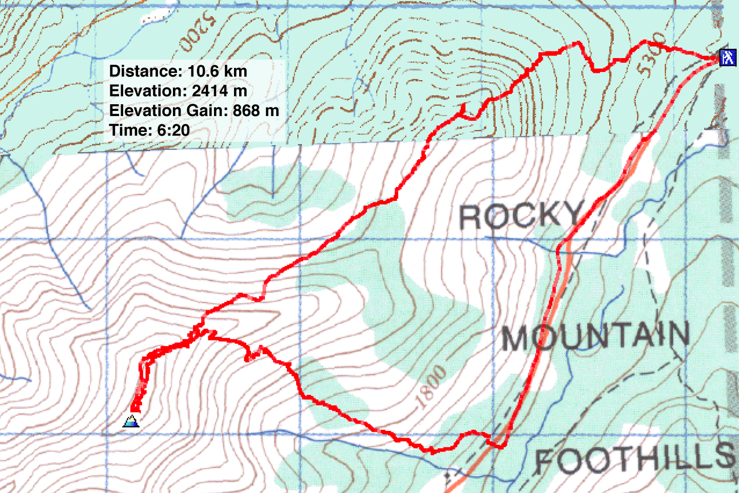
Distance: 10.6 km (6.6 mi)
Cumulative Elevation Gain: 966 m (3169 ft)
When I headed up the east end of Loaf Mountain, I never expected to be fleeing down it in fear for my life. The day started auspiciously with warm weather and a blue sky with a few fluffy clouds. I was familiar with driving here: head down Hwy. 6 and turn right on Spread Eagle Mountain Road. Drive to the end and turn right onto Yarrow Road. About a half kilometre after crossing the Spionkop Creek bridge, I turned left and parked at a gated road.
I considered ascending this point when I observed it on my attempt up Spread
Eagle Mountain a couple of weeks earlier. By following the ridge, I reasoned,
I might be able to reach the east peak of Loaf Mountain. Two weeks ago
there was fresh snow, but now as I started up the lower slopes, the snow
was gone and wildflowers flourished.
The route along the ridge hits a couple of high points before reaching the east peak.
At the second high point, I paused to consider my next move. Continuing on the
ridge crest meant encountering cliff bands, but if I angled across the open slope
I would avoid these and lop off some distance as well.
The slope was a mix of scree, solid rock and vegetation, so I made good
time. After passing the last cliff band I headed for the ridge crest. After that
I stuck to the ridge making a few detours on the right.
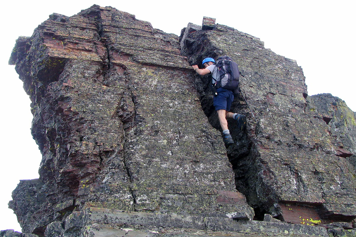
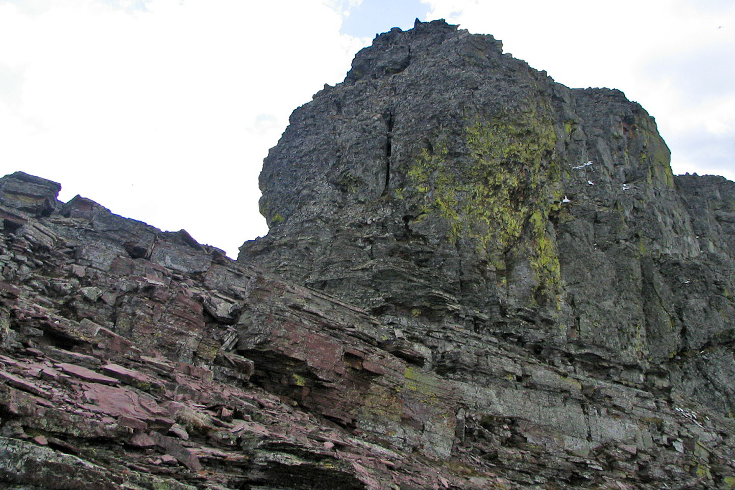
Eventually I reached a shoulder. The shoulder ended with a huge outcrop
that appeared insurmountable. So far the ascent had been a moderate scramble.
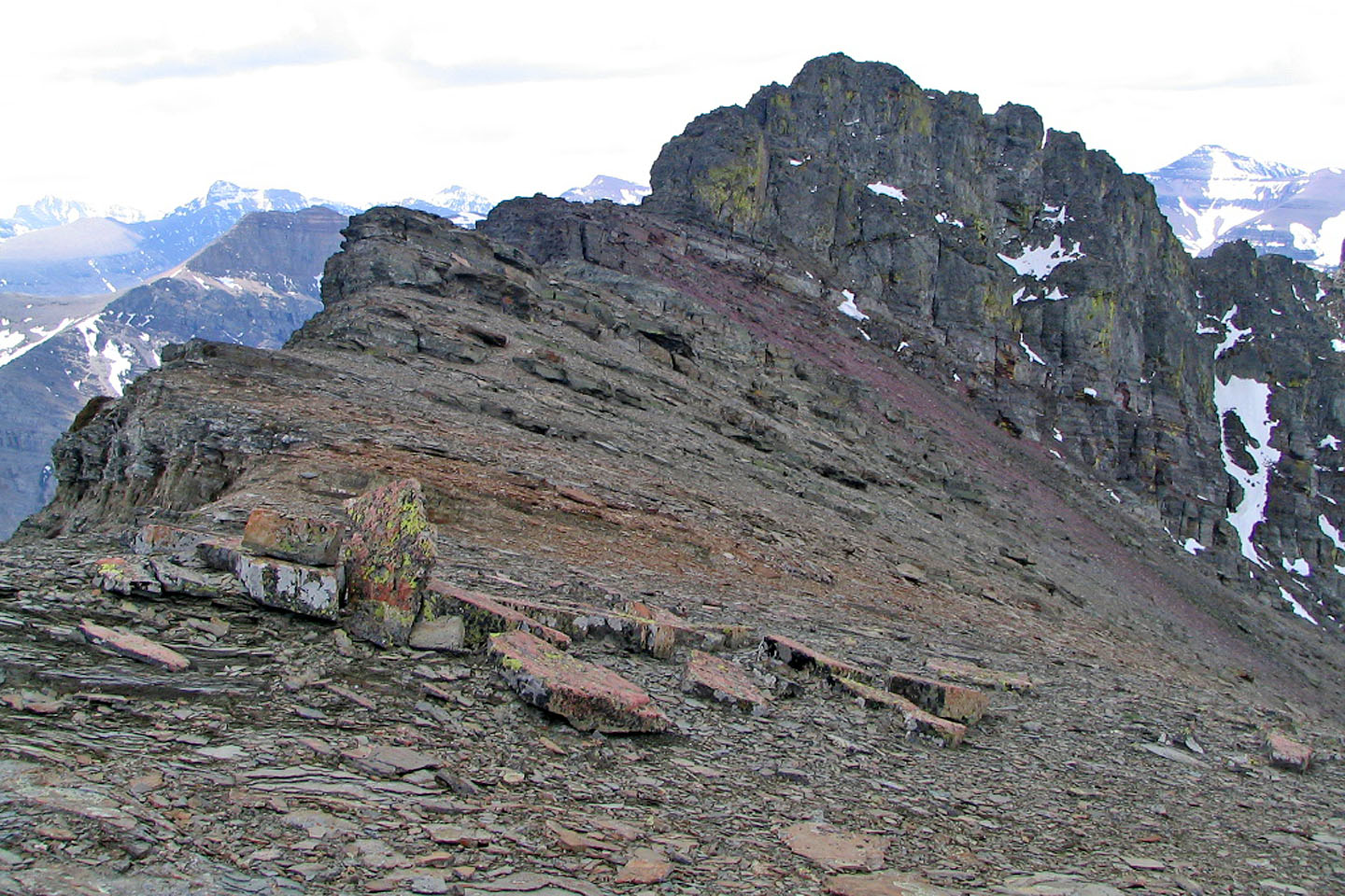
I expected to see a cairn here but there was none.
The left end of the outcrop resembled a small toe. On close inspection, I discovered a cleft. After scrambling
up it, I found a tiny cairn at the top. Beyond the toe, the ridge dropped sharply. Continuing on looked too difficult, and in lieu of what was to come, that was a good thing. I was probably less than 20 metres below the east peak.
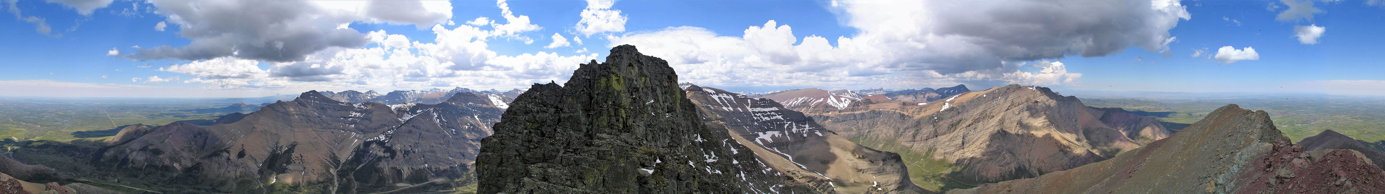
The clouds had been slowly building throughout the day, but there was still plenty
of blue sky as can be seen in my panorama. It was warm and calm. The possibility of
a storm never occured to me.
When I started my descent I felt the first hint of trouble. Something
was irritating my left elbow. Annoyed and thinking it was a fly, I kept trying
to brush it off, but I didn’t bother to see what it was; my eyes
were focused on my footing.
Suddenly I heard, or I should say experienced, an enormous boom,
so loud my eyes flew open in shock. It had no source: it was above and
all around me! The unexpected thunder galvanized me to hasten my descent.
Unfortunately I had to follow the ridge. Wherever I could, I tried to stay below the
crest but I had little leeway.
The sensation in my elbow came from the hair on my arm standing on end in
the electrically charged air. And now the tingling started again, this time
in both elbows. Furthermore, my GPS receiver started buzzing. I was flying down the mountain now, running
down scree and scrambling almost without thinking. Another thundercrack
resounded all around me. The sensation suddenly left my arms and my GPS grew quiet.
As I continued racing down the ridge, the bizarre cycle repeated every
few minutes. My arms tingled and sometimes my GPS buzzed, followed by a thunderous
crash before everything returned to normal. I didn’t see any lightning,
but my back was to the storm. I didn't dare pause to look behind me.
At one point I stopped to check a downclimb. Without thinking, I
grabbed the metal shaft of my trekking pole and
received an electric shock! It was sharp enough for me to exclaim, “Ouch!” Several
minutes later, again without thinking, I touched the metal of my pole and
received another jolt, this one nastier than the first. The message was
clear: don’t touch the pole metal!
Down I went, charging and discharging with each round of thunder. Finally
I reached a point where I could leave the ridge and head straight down
the slope. I hardly noticed that I was now under a big black cloud or
that the wind had picked up and was pelting me with rain mixed with snow;
I was still in T-shirt and shorts. Nor was I concerned that I might
encounter a rock band. I needed to get down fast!
Having turned to flee down the slope, the storm was no longer behind me
but on my right. As I descended I caught a glimpse of lightning.
On the next flash, I counted three seconds before the thunder reached me:
the lightning strike was one kilometre away! I wonder how close it was
when I was on top of the ridge.
Throughout the ordeal the frequency of thunder increased, and now it was
continuous. As one roll ended another one began. When I was far down
the slope, knee-deep in vegetation, I paused to watch the lightning and
listen to the thunder. I felt safe here. Sometime after leaving the ridge, my
elbows had stopped tingling but I waited a long time before I dared to
touch the metal shaft of my trekking pole!
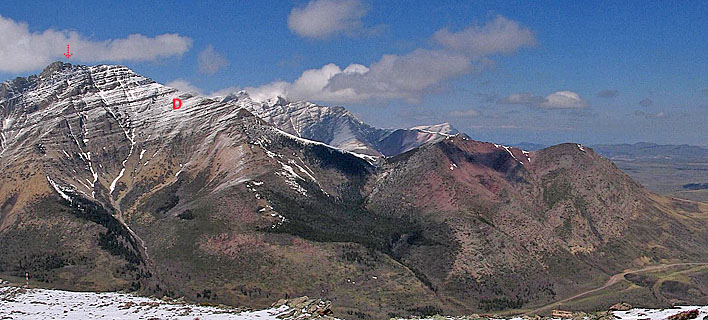
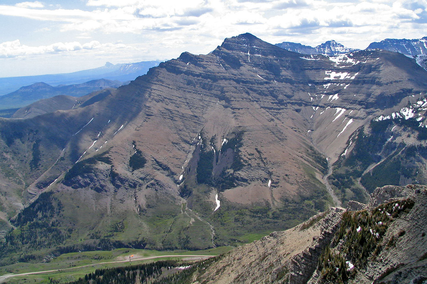
The east end of Loaf Mountain seen from Spread Eagle Mountain. Starting on
the far right, I mostly followed the ridge until I reached a cairn indicated by the
arrow. "D" indicates the approximate place
where I hastily left the ridge on my descent.
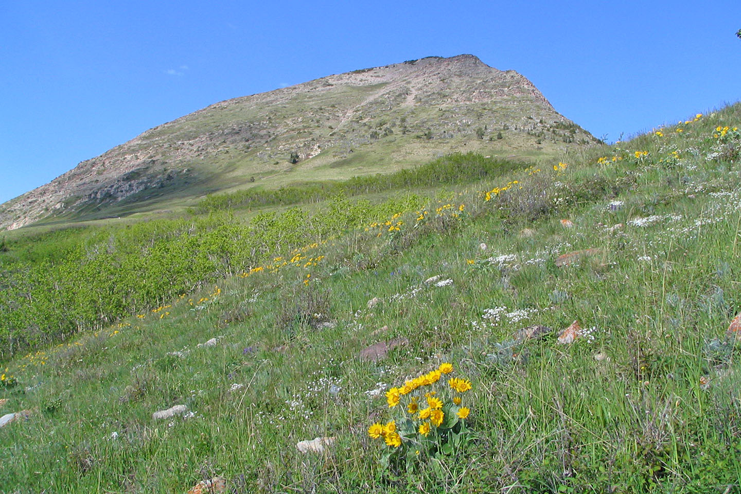
The lower slopes
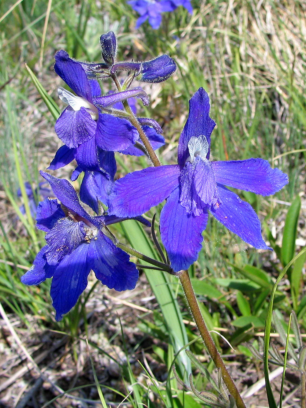
Plenty of wildflowers like this larkspur
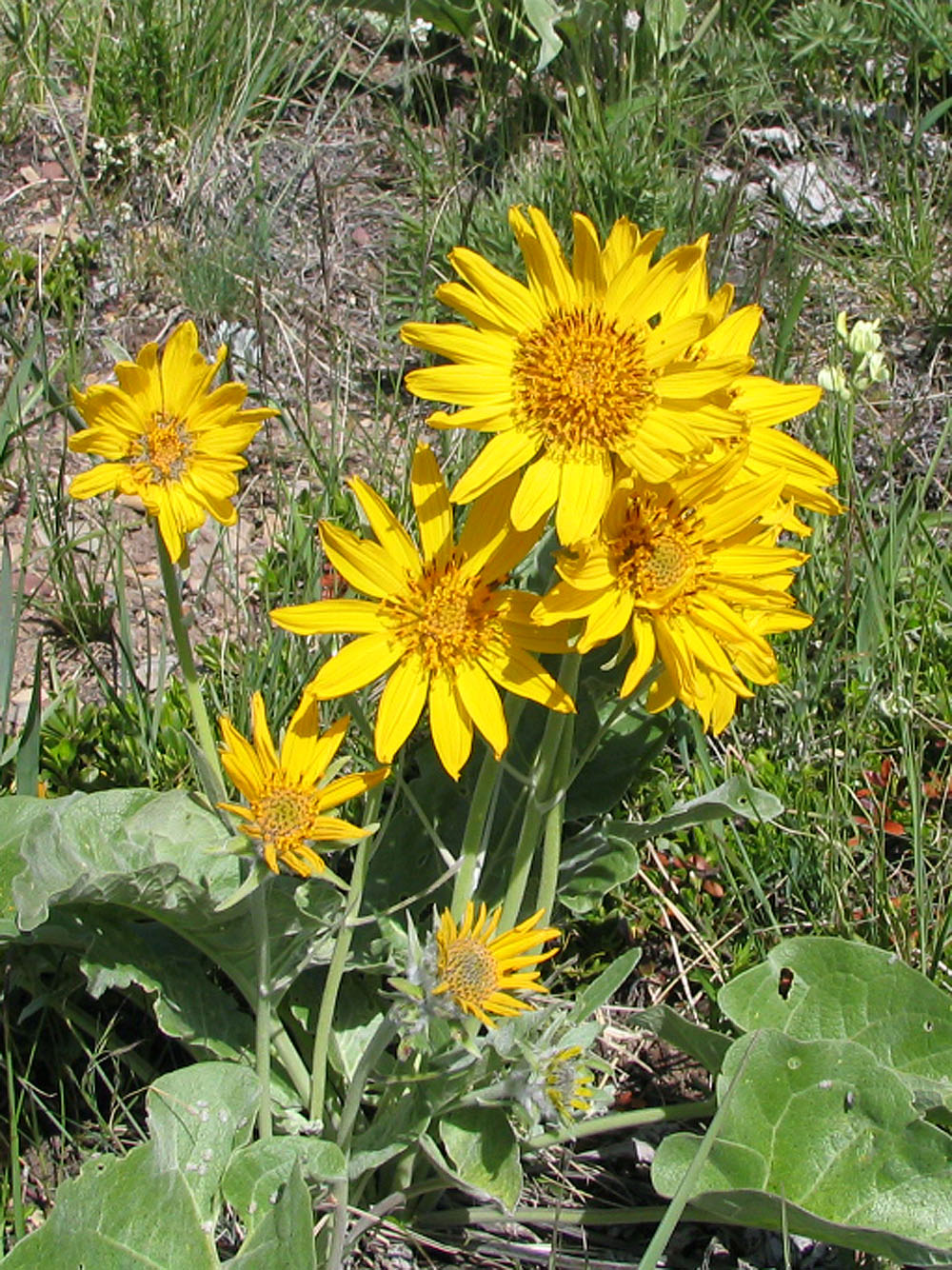
Balsamroot
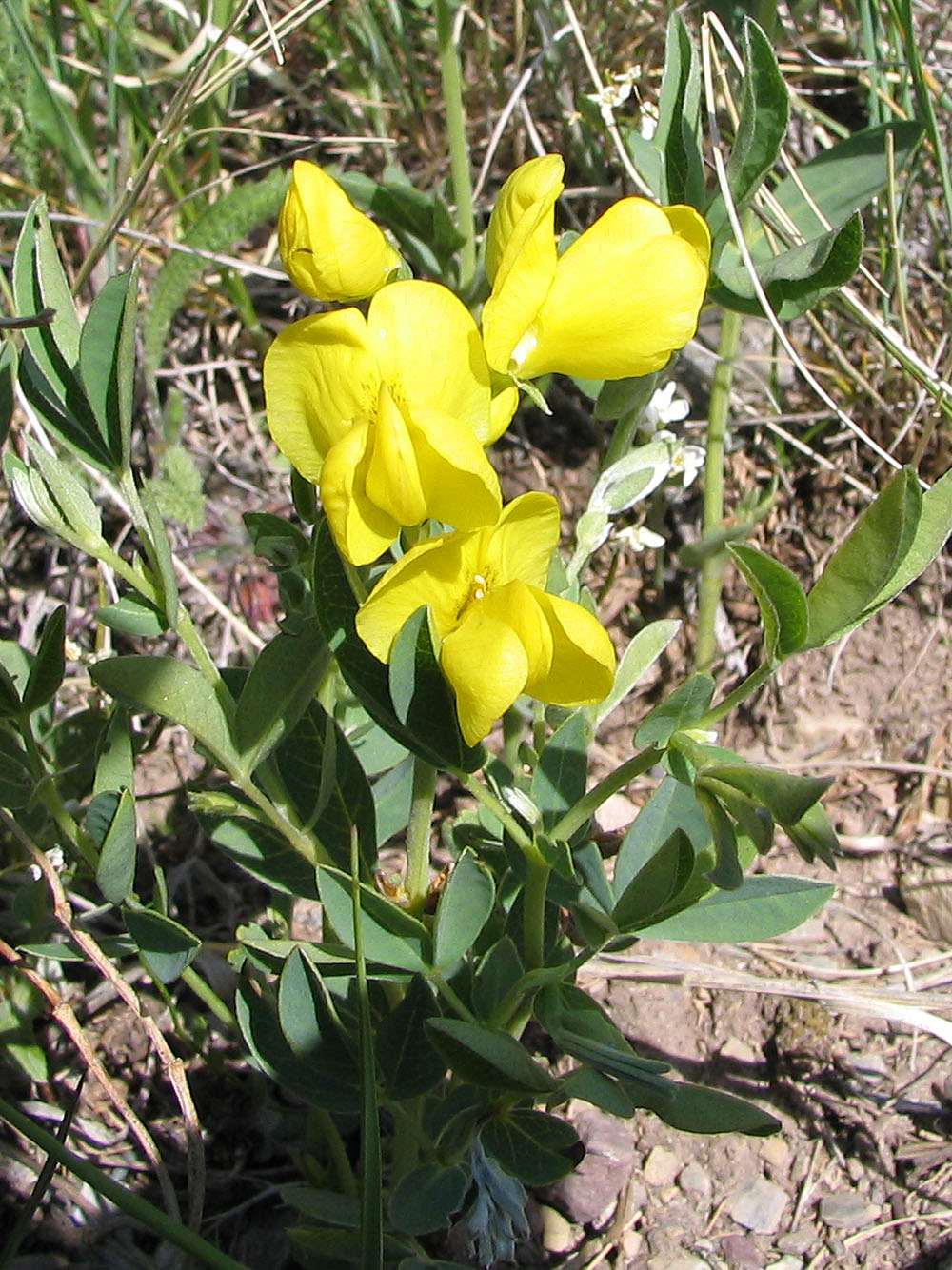
Golden bean
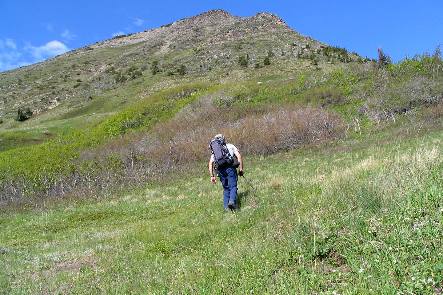
This shot taken a few minutes into my trip
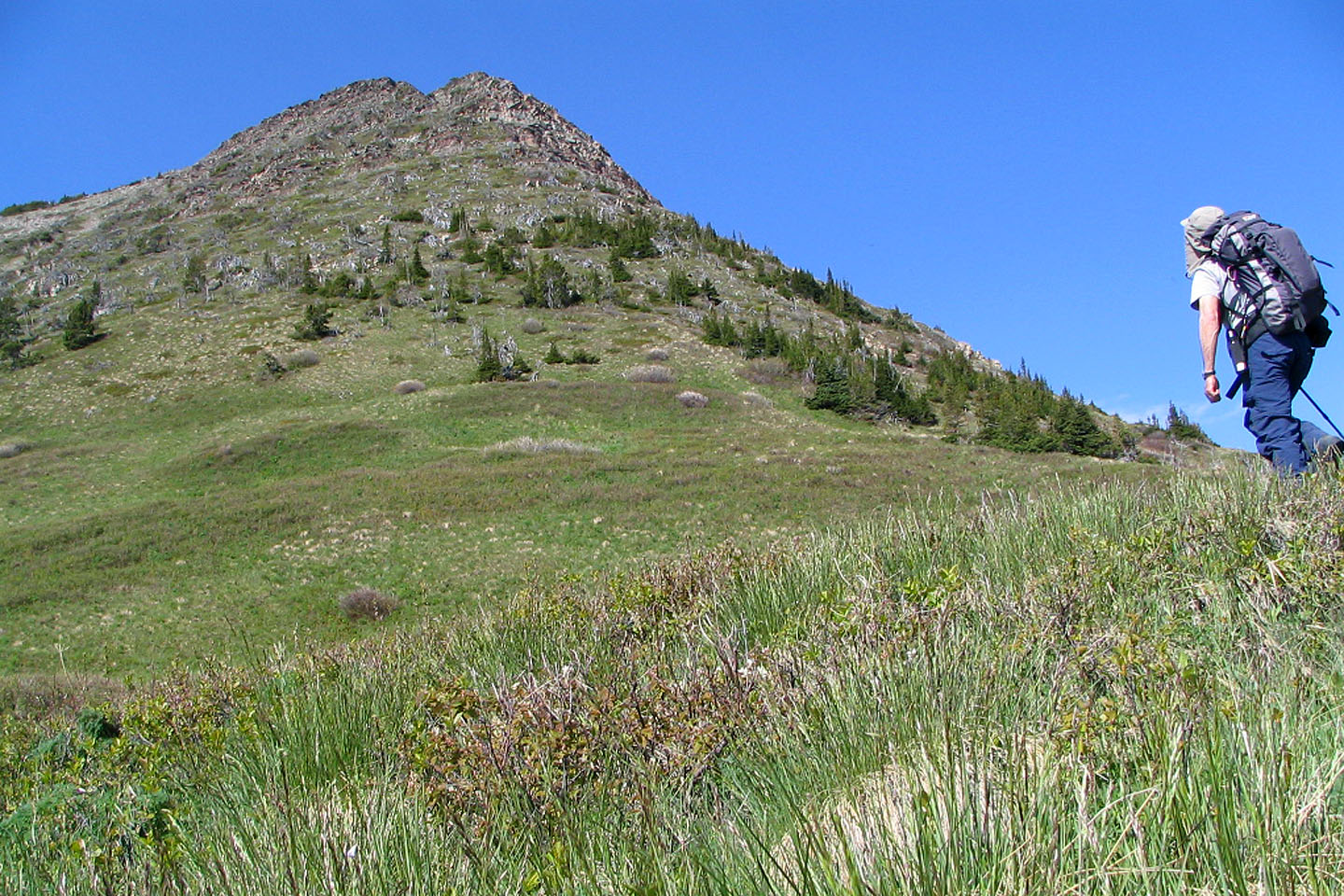
Heading for the first rise
Drywood Mountain lies north
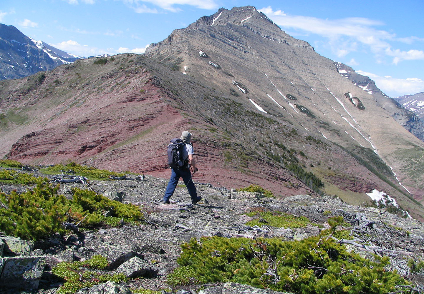
On my way to the second high point
A striking band of red rock on the second high point
When I realized I would lose 80 m of elevation here I started looking to avoid the elevation gain on the way back
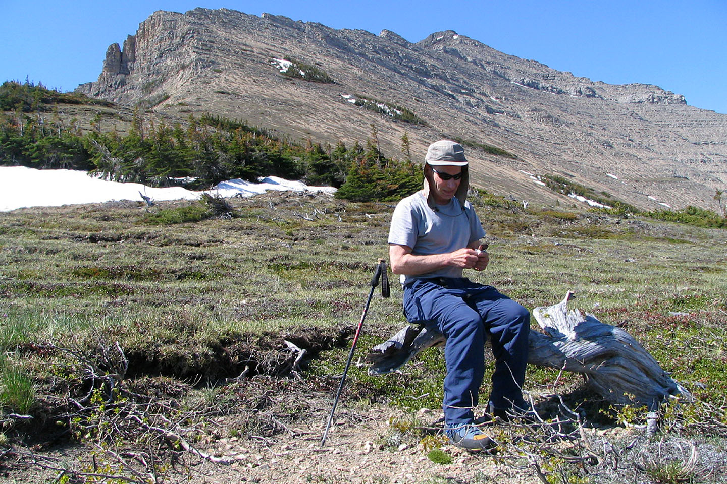
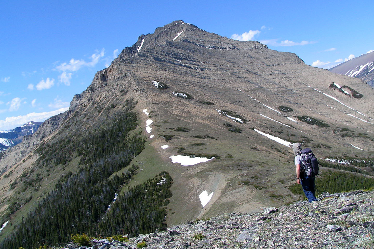
At the col, a log makes a comfortable chair as I break for a snack. From
here, I'll angle right so I can get around the cliff bands above me.
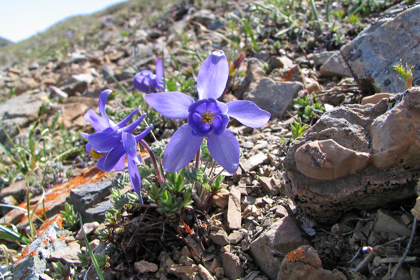
On the open slope I came across Jone's Columbine wildflowers
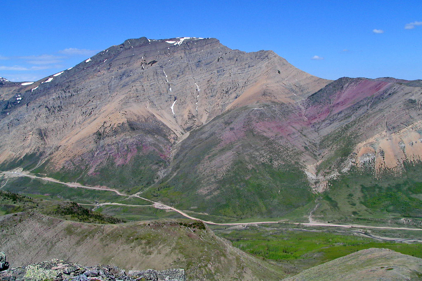
Spread Eagle Mountain lies south
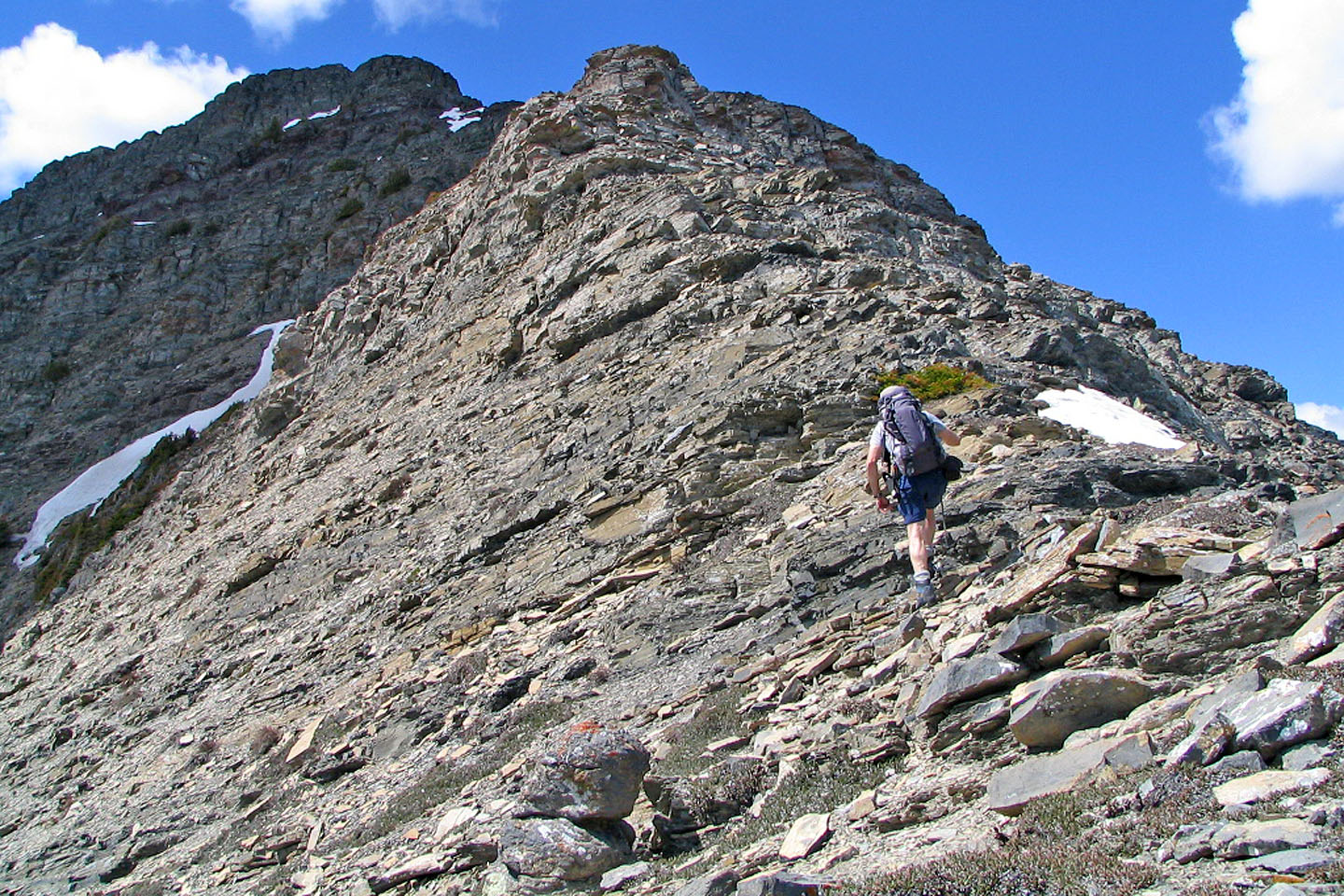
I left the open slope and started ascending the ridge
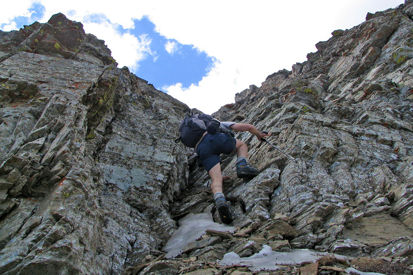
On the ridge I'm kept busy with scrambling sections like this crack ...
... and this chimney
On a shoulder, the way ahead is barred by an cliffs.
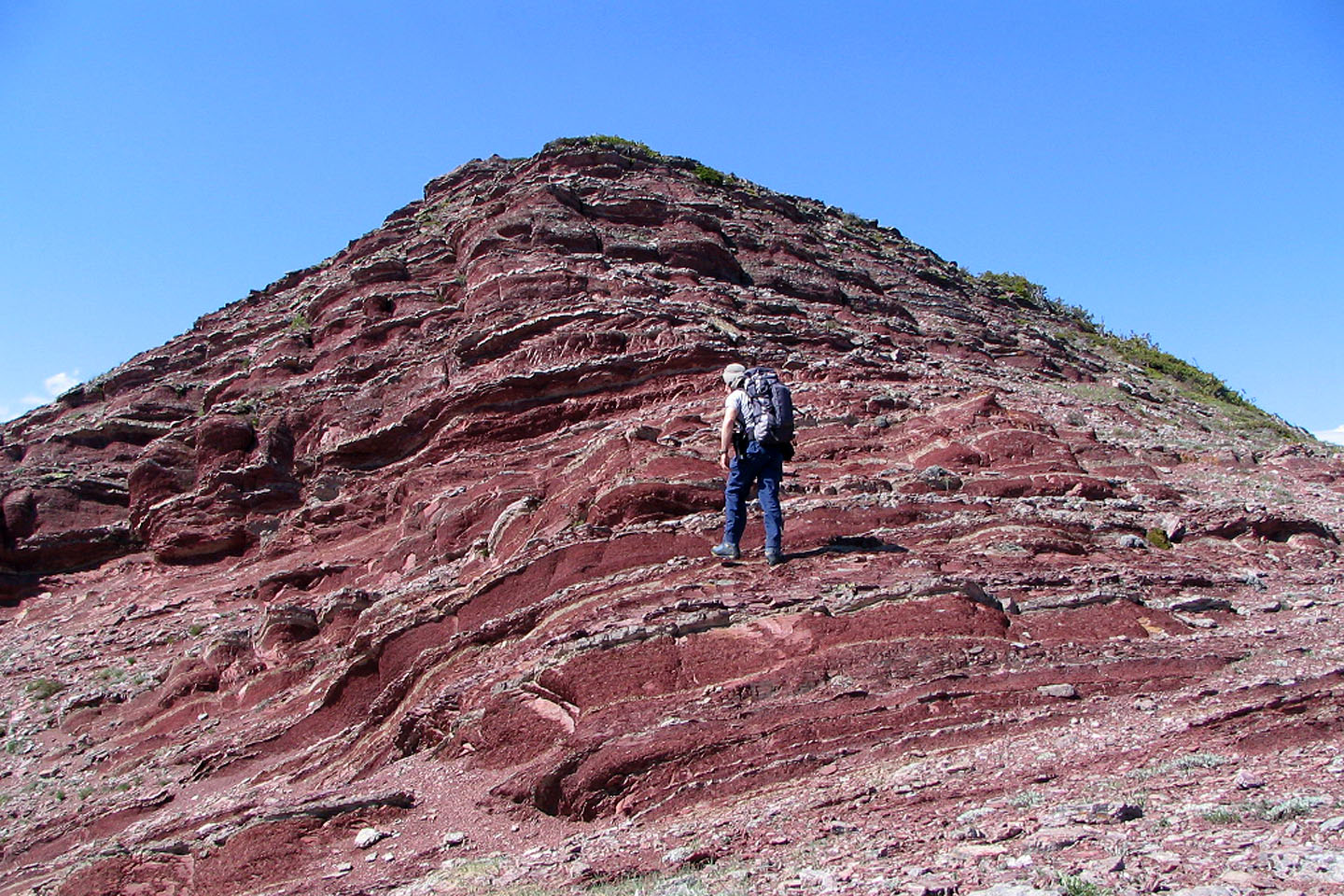
The left end (centre) looks like a little toe and I headed for it.
A closer view of "the toe" and it's not looking any better
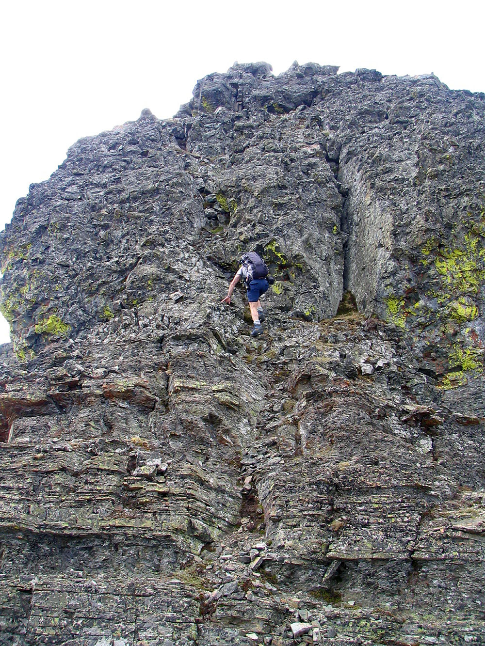
On closer inspection, there's a cleft!
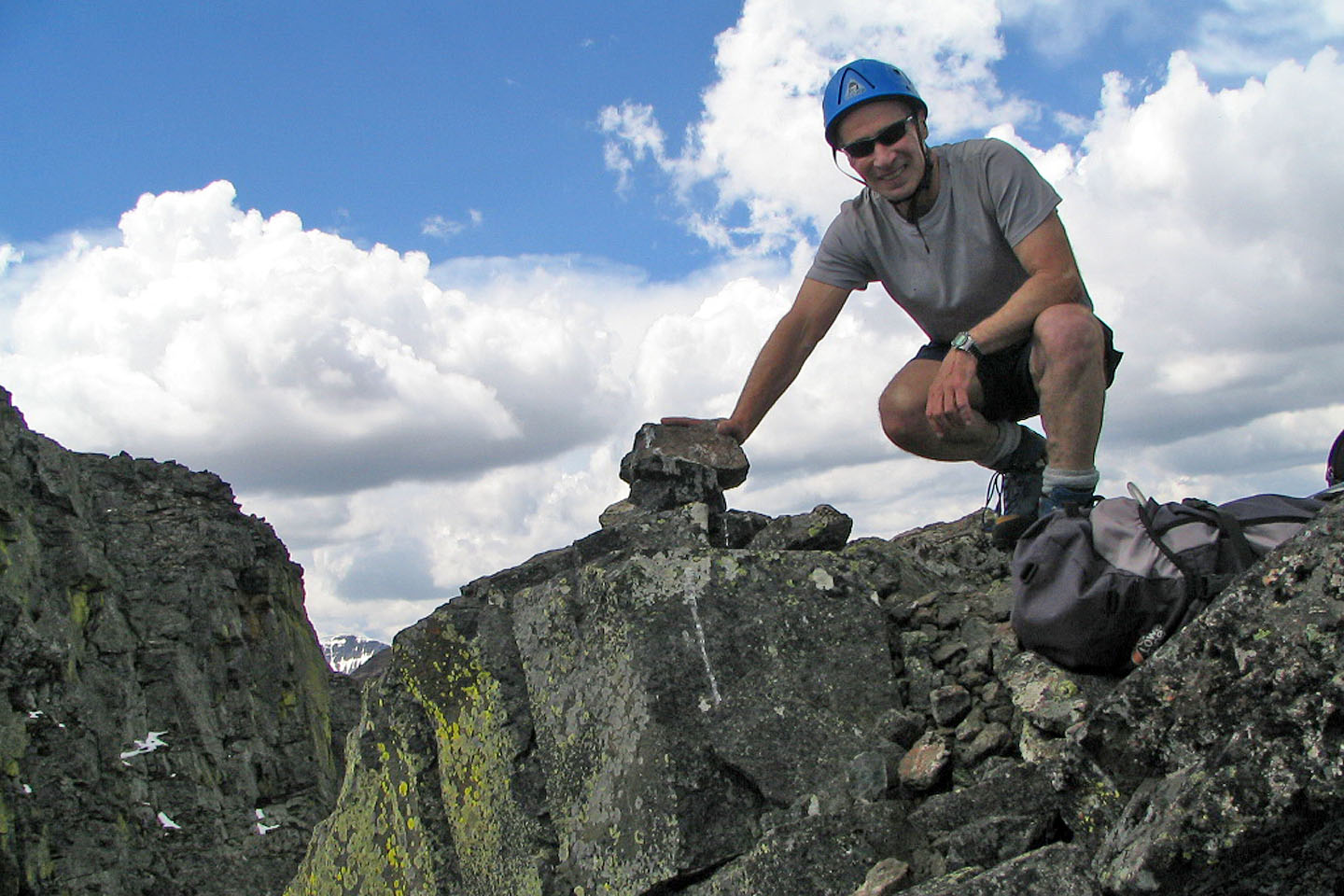
A cairn marks my summit. A few minutes later, I would be fleeing a thunderstorm.
82 G/8 Beaver Mines, 82 G/1 Sage Creek