bobspirko.ca | Home | Canada Trips | US Trips | Hiking | Snowshoeing | MAP | About
View from Mount Haig
Gravenstafel Ridge and Mount Haig
Castle Provincial Park, Alberta
June 21, 2008
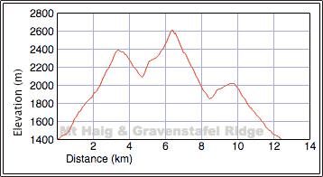
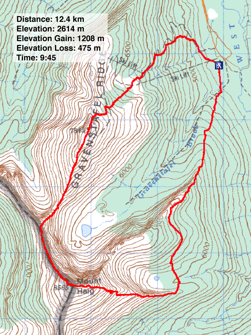
Distance: 12.4 km (7.7 mi)
Cumulative Elevation Gain: 1657 m (5436 ft)
After learning of Vern Dewit's and Wietse Bylsma's successful early season ascents of Mount Haig and Gravenstafel Ridge the previous week, Dinah and I decided on the same trip. Like them – and unlike the guidebook route – we did the trip in reverse.
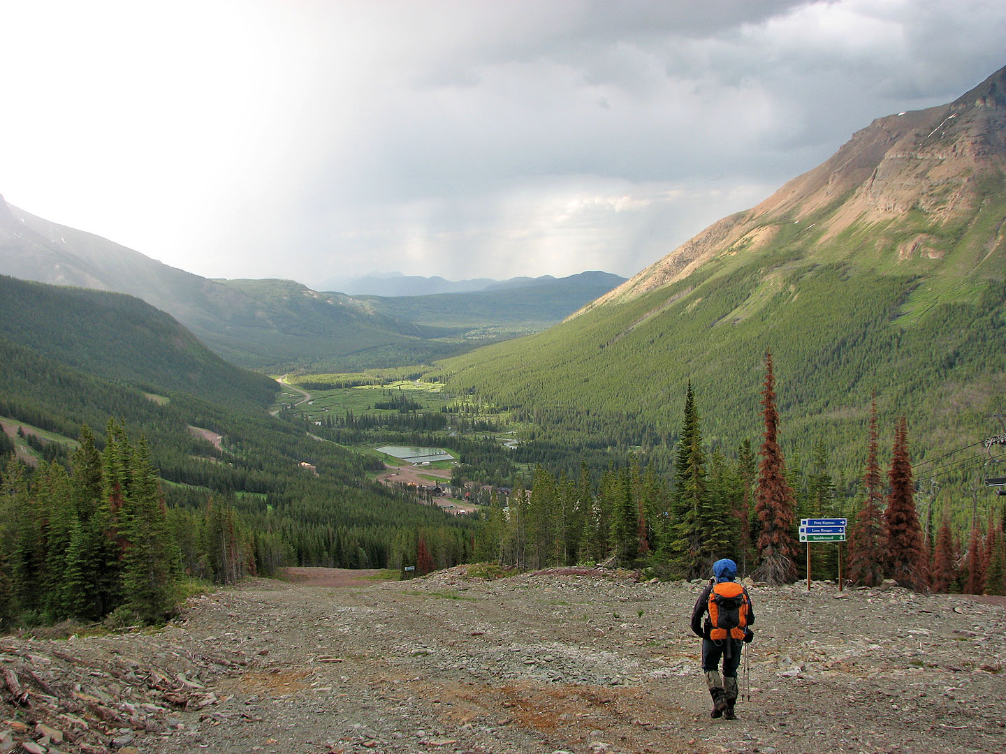
After parking at the Castle Mountain Ski Resort, we learned that a grizzly sow with two cubs had been recently seen on the open slopes on Gravenstafel Ridge. We decided to avoid those slopes and instead ascend the treed slopes on the right. We hiked up the road a short distance before leaving it for a cleared corridor through the trees.
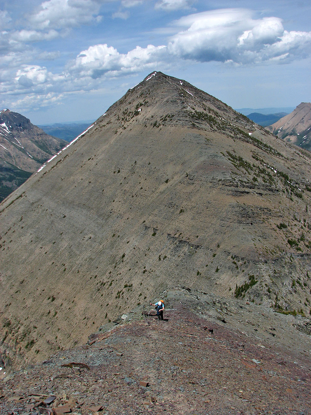
The plod to the summit of Gravenstafel was slow and uneventful. The previous night we watched a TV show about the formation of the Rockies and learned that they are eroding at the rate of 6/100 mm a year. I was wishing this mountain would erode faster!
After taking photos from the top of Gravenstafel Ridge, we headed down to Gravenstafel-Haig col, scrambling over or around short cliff bands. From the col it's mostly a scramble with mild exposure unless one attempts to ascend the right side of the ridge! After the scrambling, we hurriedly hiked to the summit without stopping to remove our helmets. Clouds were moving in and a thunderstorm seemed imminent.
Since Mount Haig is the highest peak around, there were great views in all directions. Two huge summit cairns attest to the popularity of this mountain ascent. Soon after we started our descent, we heard thunder.
Thus far the counterclockwise route worked well for us. But as we came down the backside of the mountain, we encountered a series of cliff bands. These would be easily negotiated going up since weaknesses would be spotted quickly, but coming down is a different matter. We followed the tops of cliffs, peering over edges, looking for and finding places to descend.
Finally there were no more cliff bands, and we hiked to the valley below. From here, the recommended route climbs 375 m to the top of the northeast ridge. Having done the northeast ridge in winter, we had little incentive to revisit it. Besides, we were in the midst of a mild thunderstorm so it was safer to stay low. After ascending partway up the northeast ridge, we contoured north to hit the crest. This shortcut saved us 200 m of elevation and some distance than if we had gone to the top of the ridge. Once on the ridge, we made our way to the chair lift and followed it back to the parking lot.
I suspect either route – clockwise or counterclockwise – has its advantages and disadvantages, but however it's done, this is an enjoyable scramble!
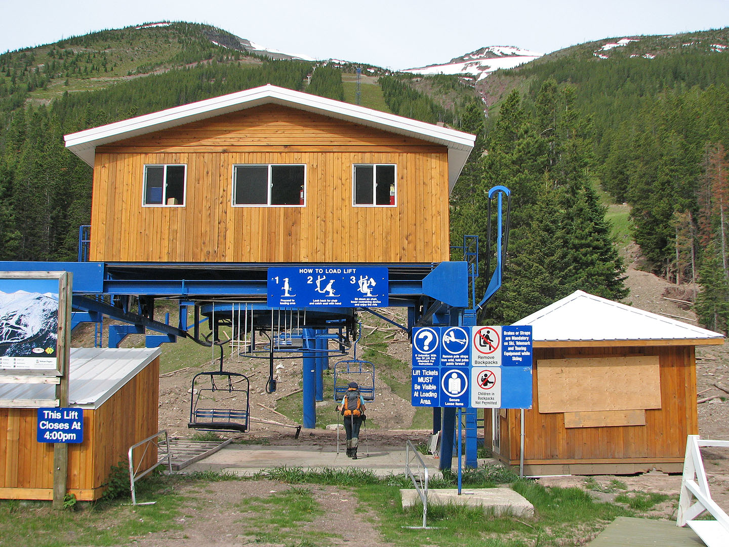
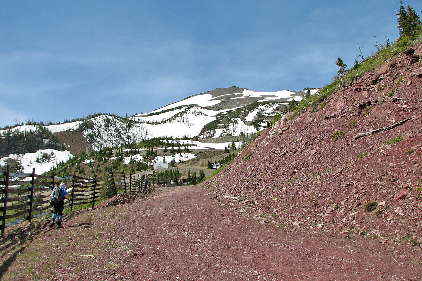
We started at the chair lift but soon headed right to reach the road
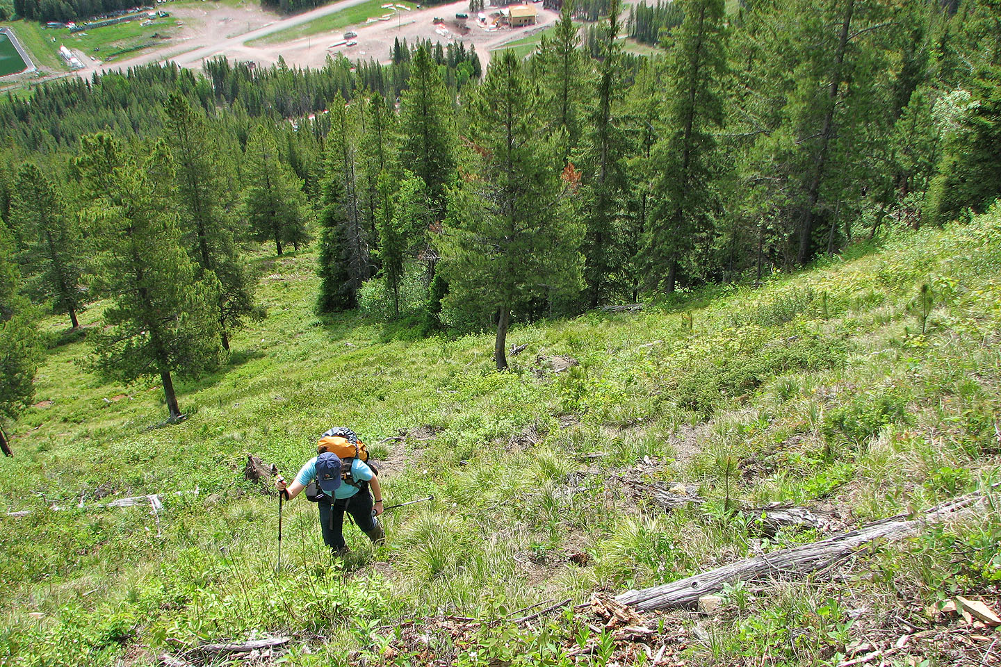
Coming up through a break in the trees
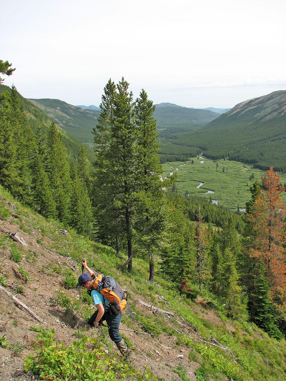
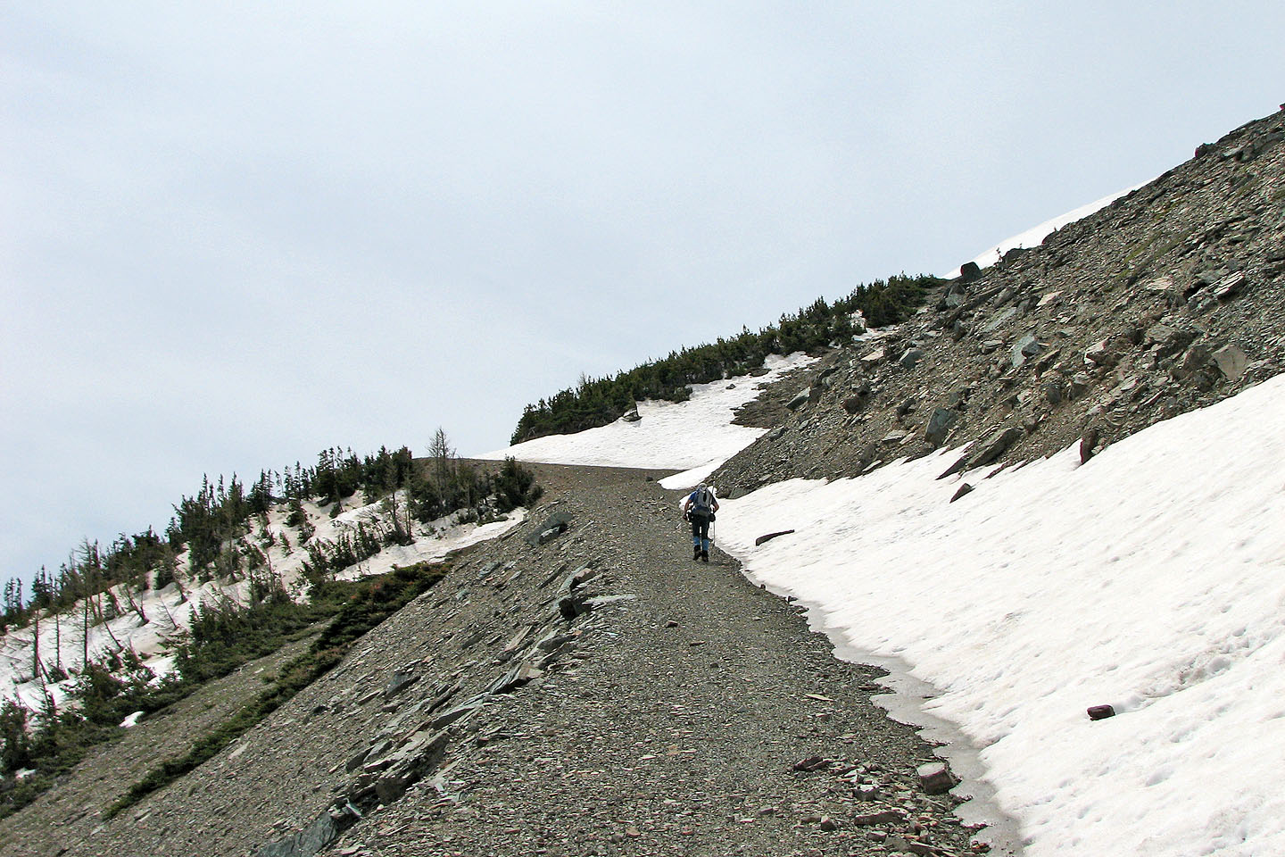
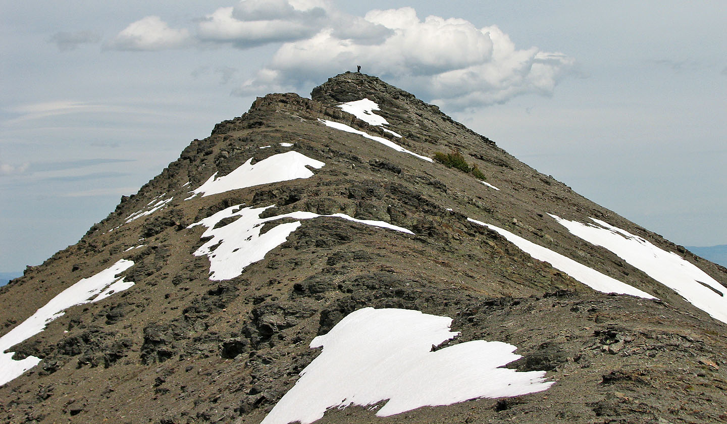
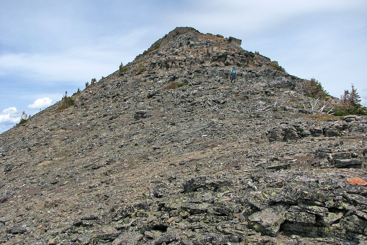
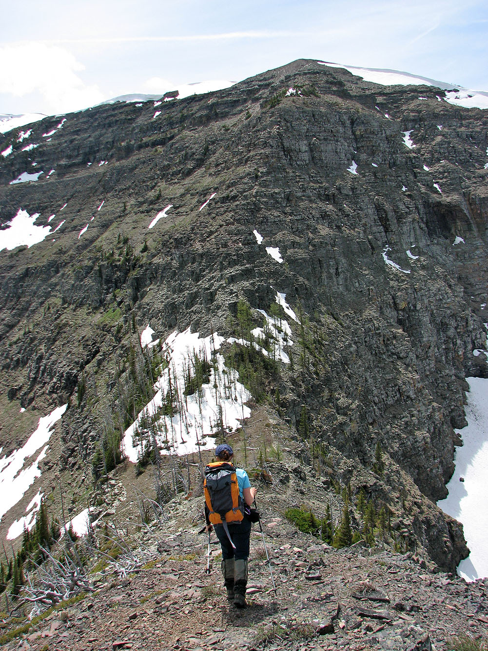
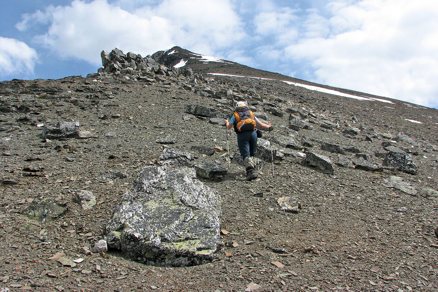
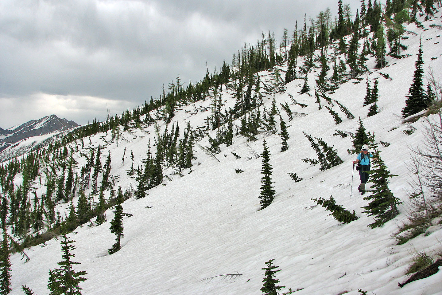
The ascent is mostly a steep hike to the summit of Gravenstafel Ridge
We mostly avoided the road which snakes up the mountain
Our first good view of the summit
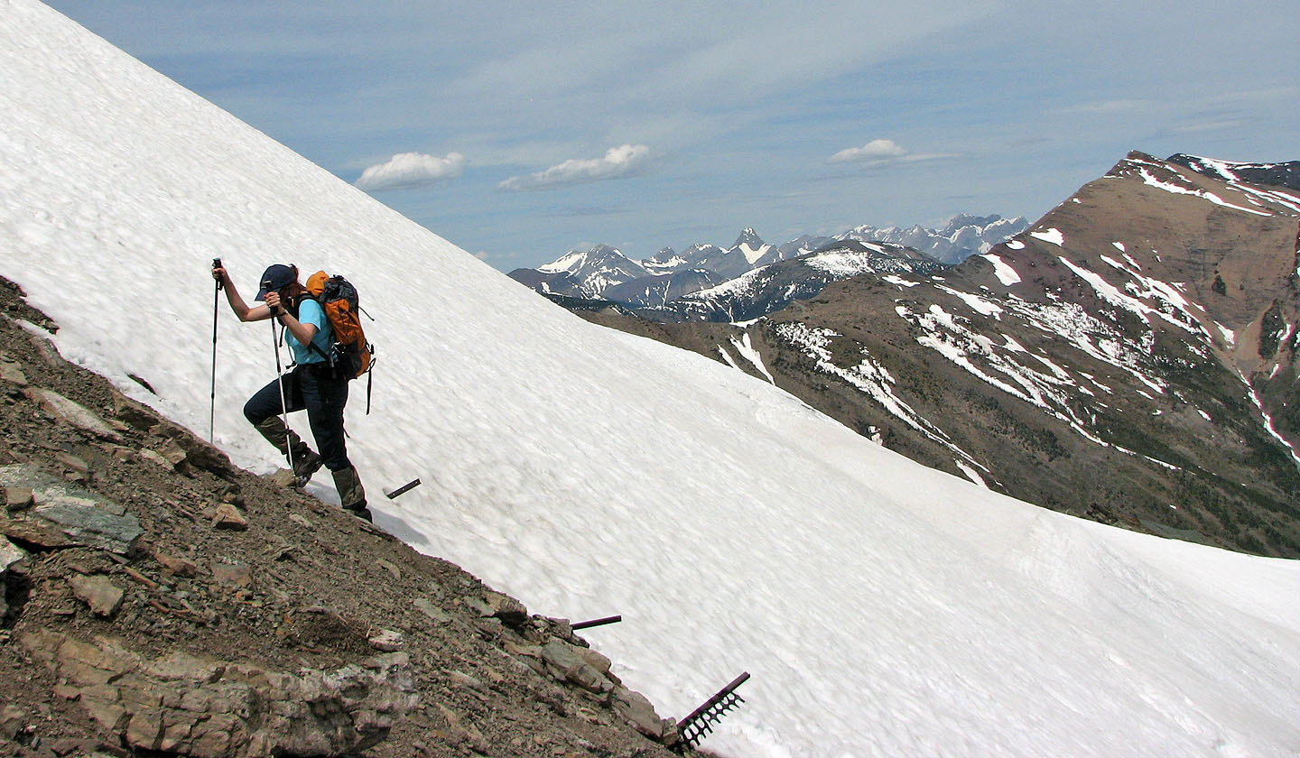
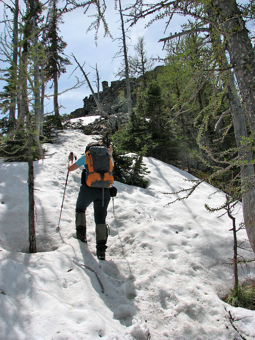
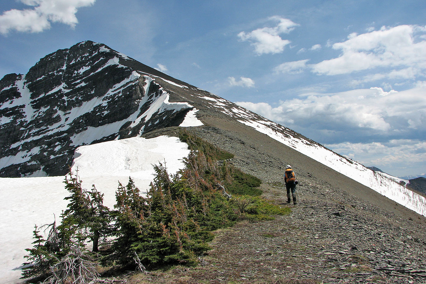
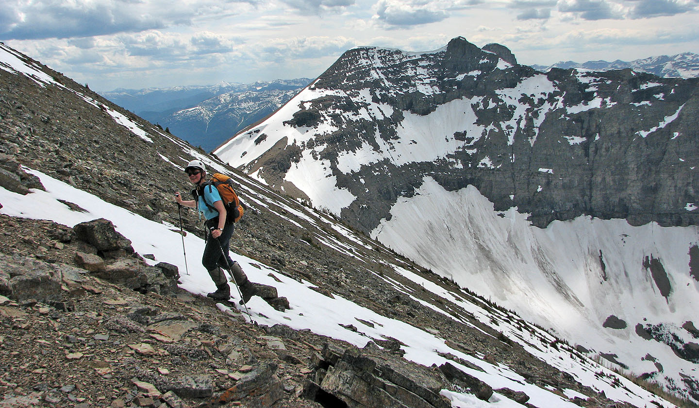
If it weren't for the snow we'd be hiking on vegetation and debris.
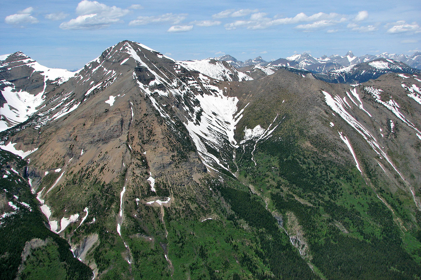
Southfork Mountain in the background.
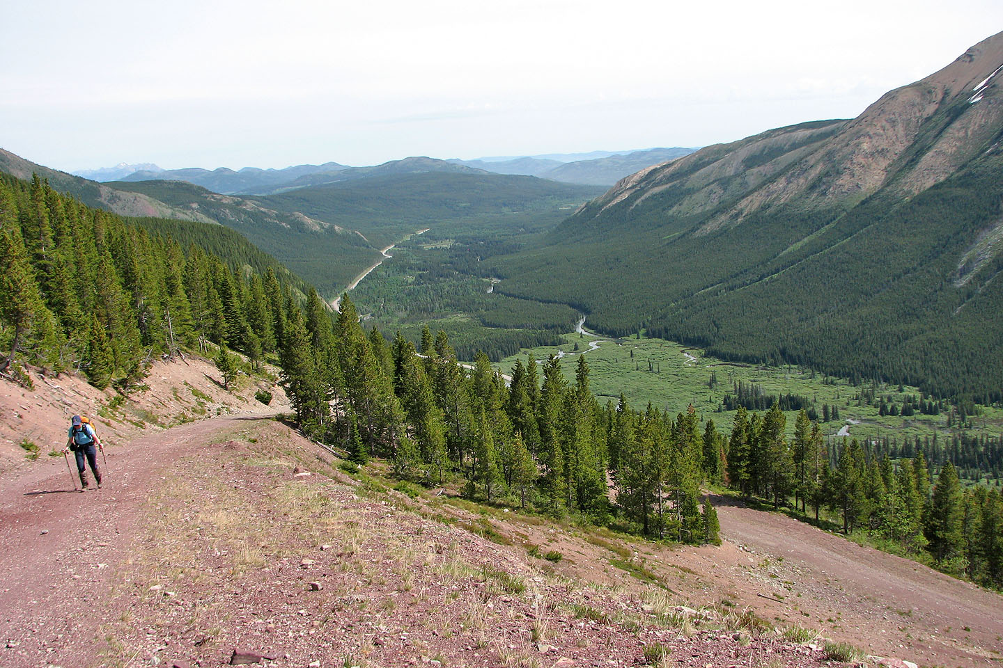
Back on the road for a short distance
The prominent peak in the background is Mount Darrah (mouse over)
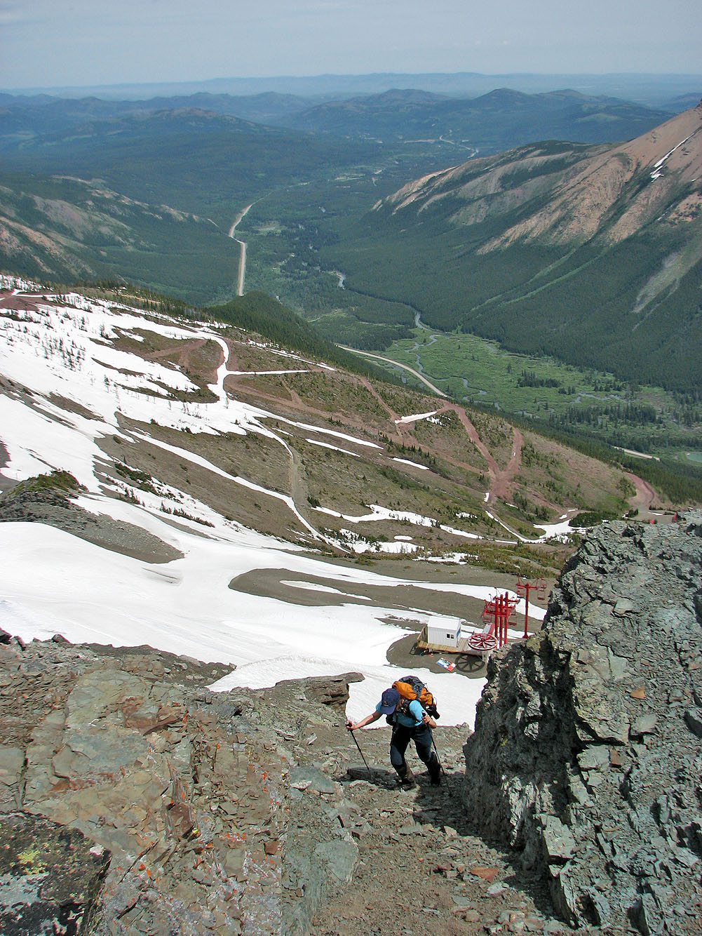
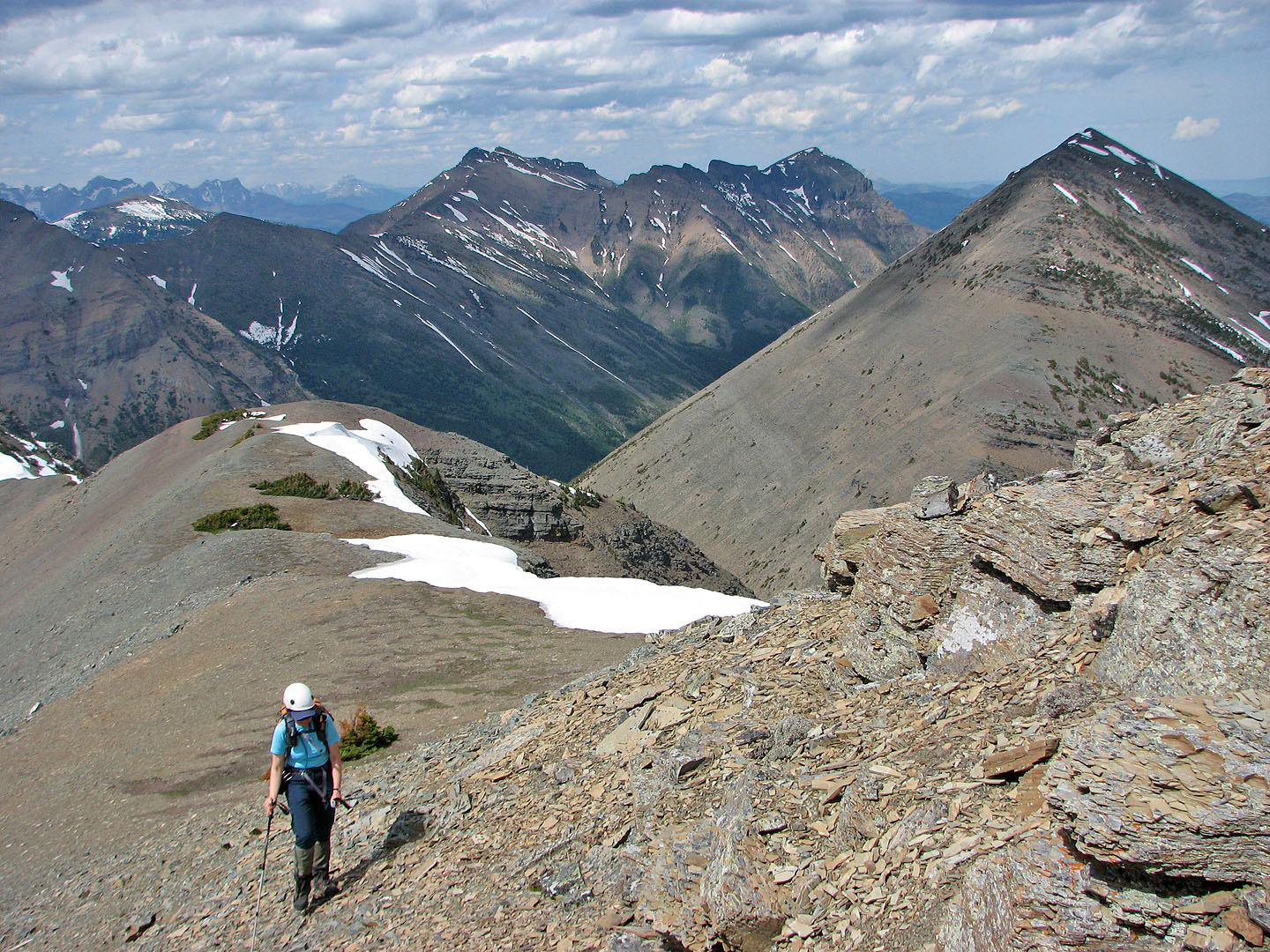
Almost at the false summit
Syncline Mountain (right) in the background
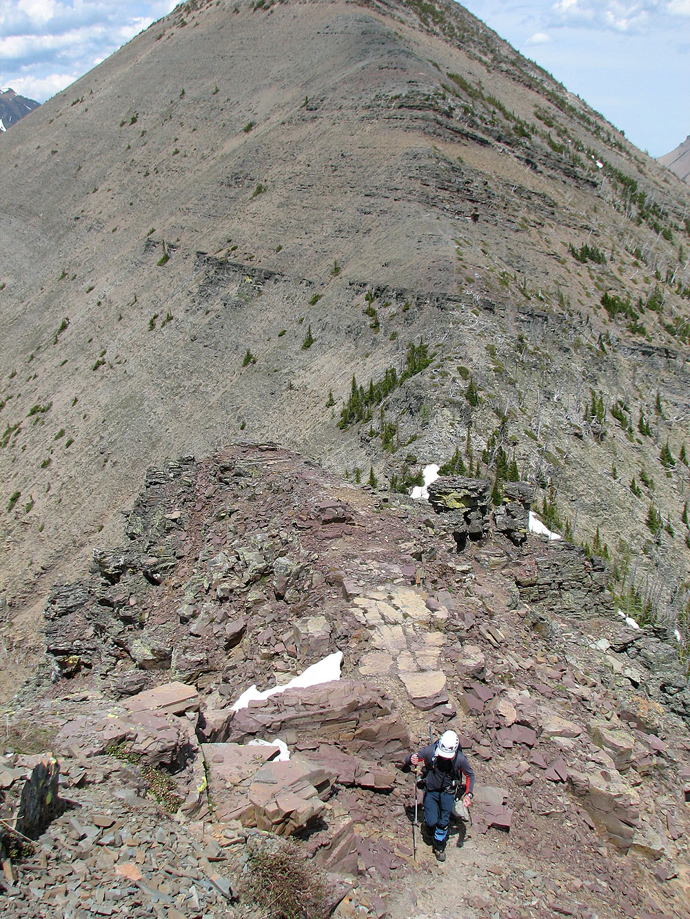
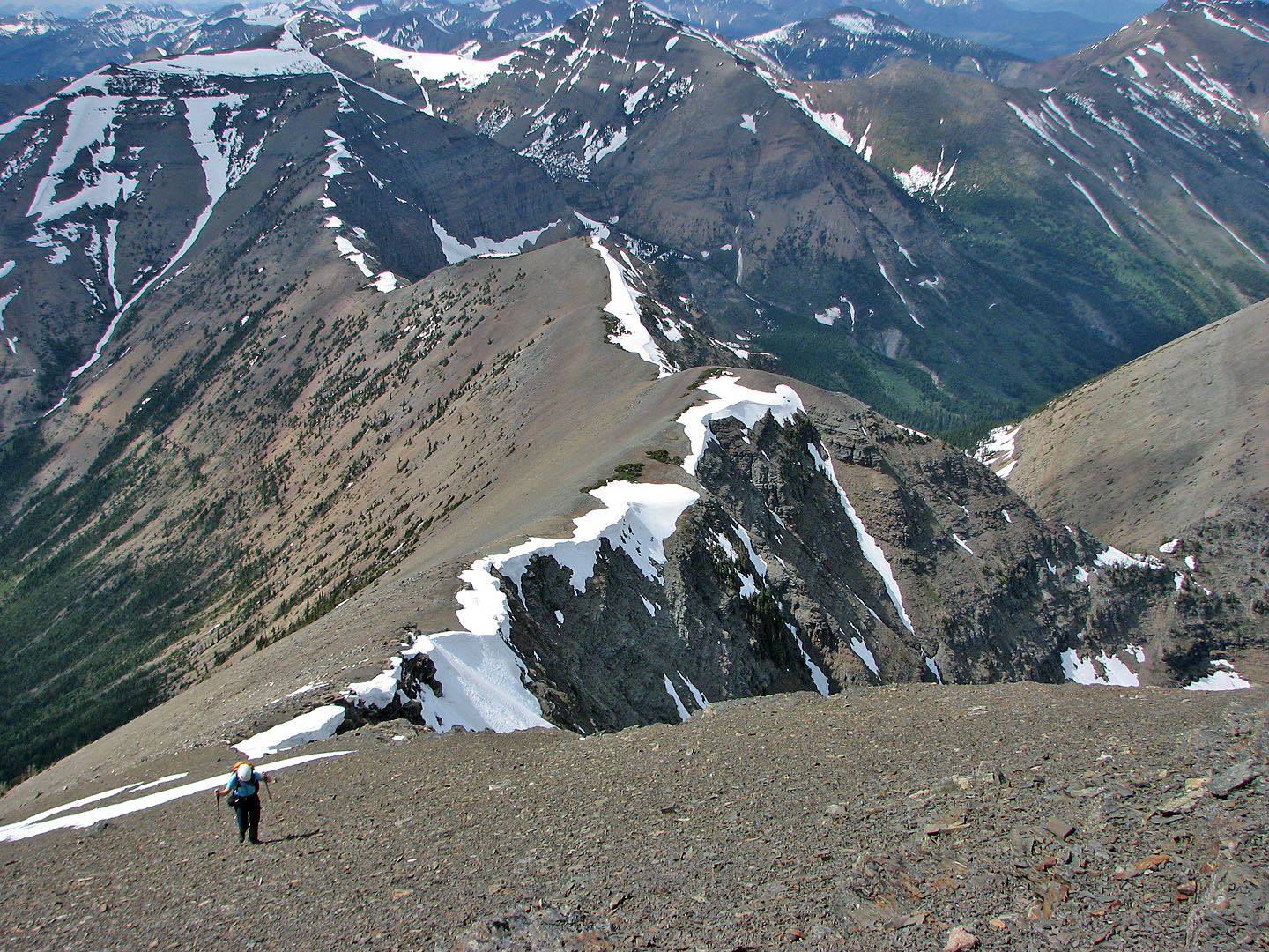
We followed the ridge to the summit of Gravenstafel
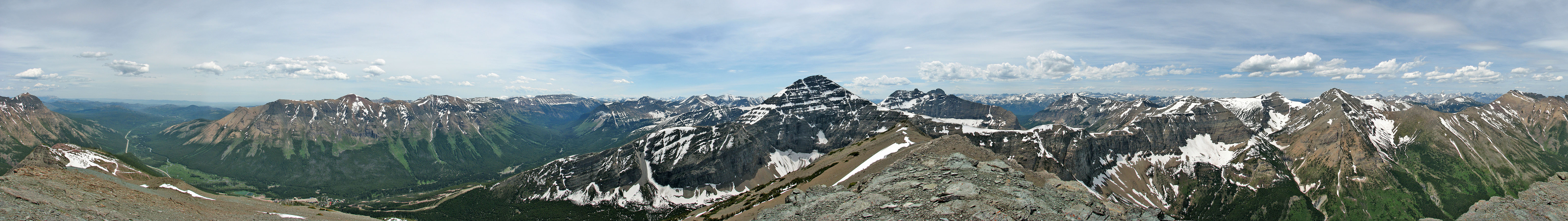
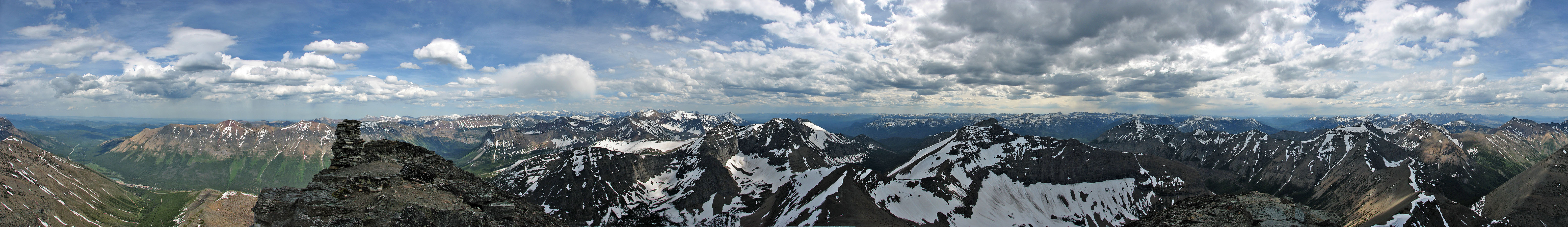
Panorama from the top of Gravenstafel Ridge. Mount Haig in the centre.
I hung back on the summit while Dinah headed to the col and took this picture looking back
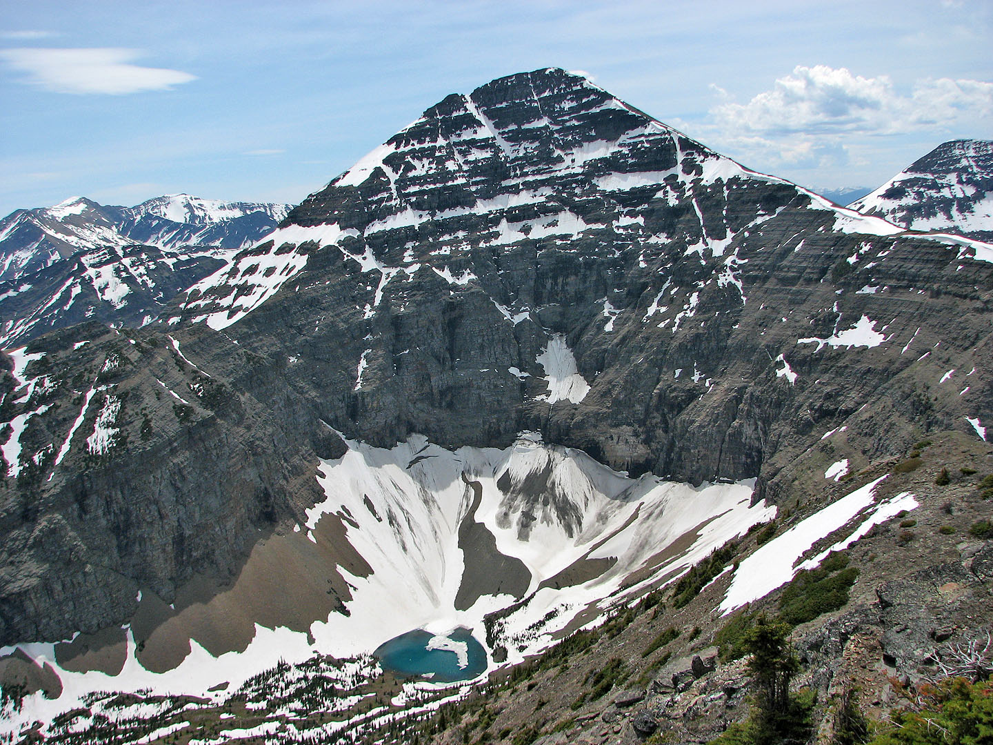
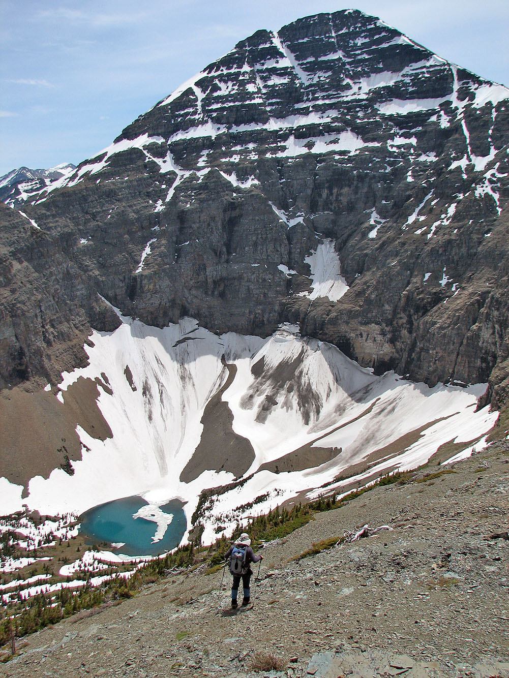
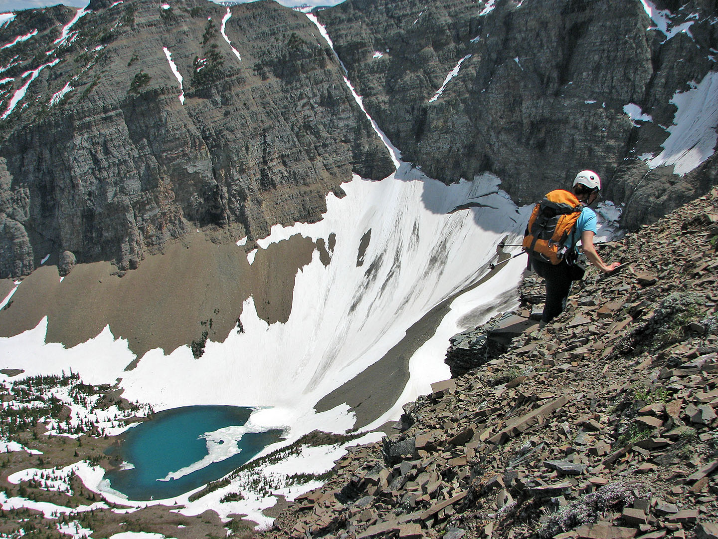
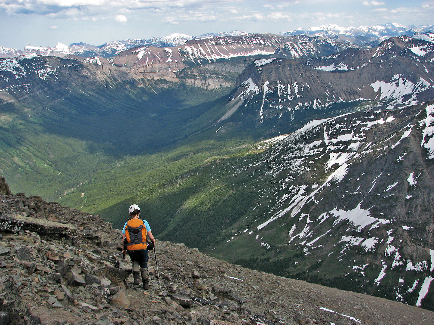
We made our way to Mount Haig. At its base is a beautiful tarn (mouse over).
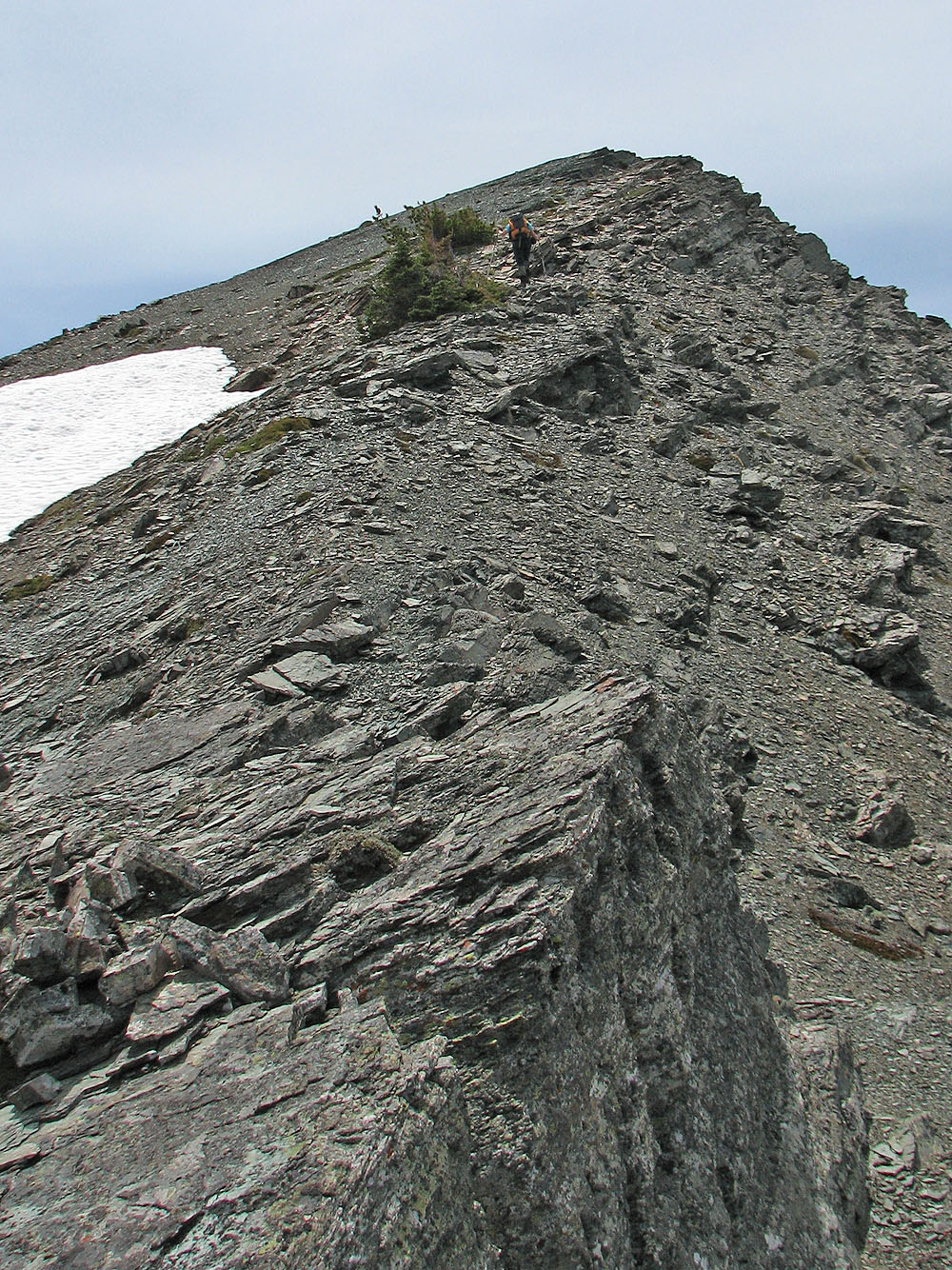
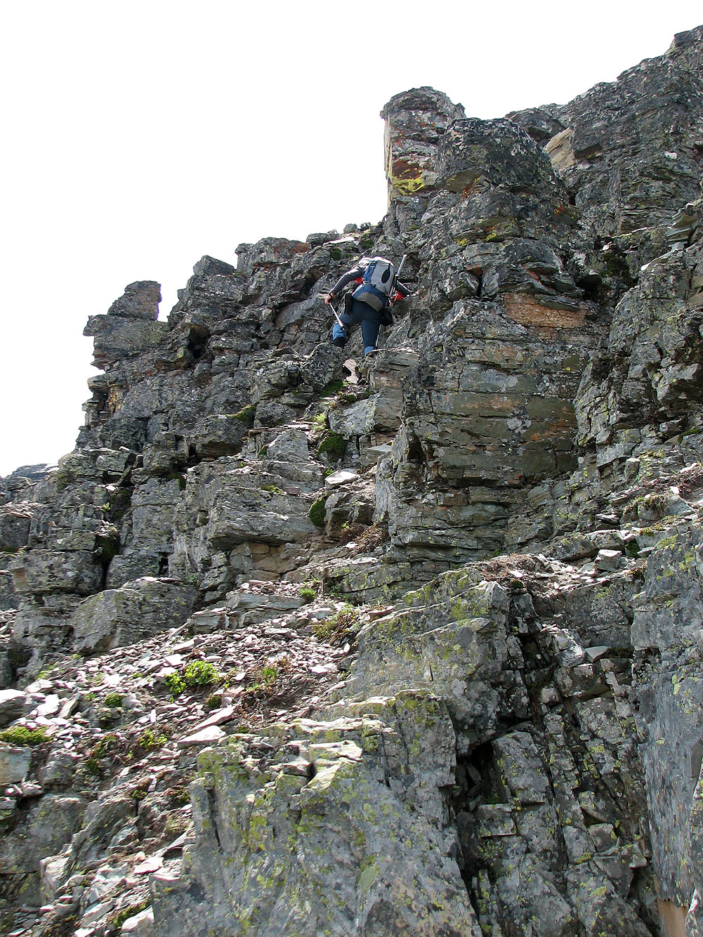
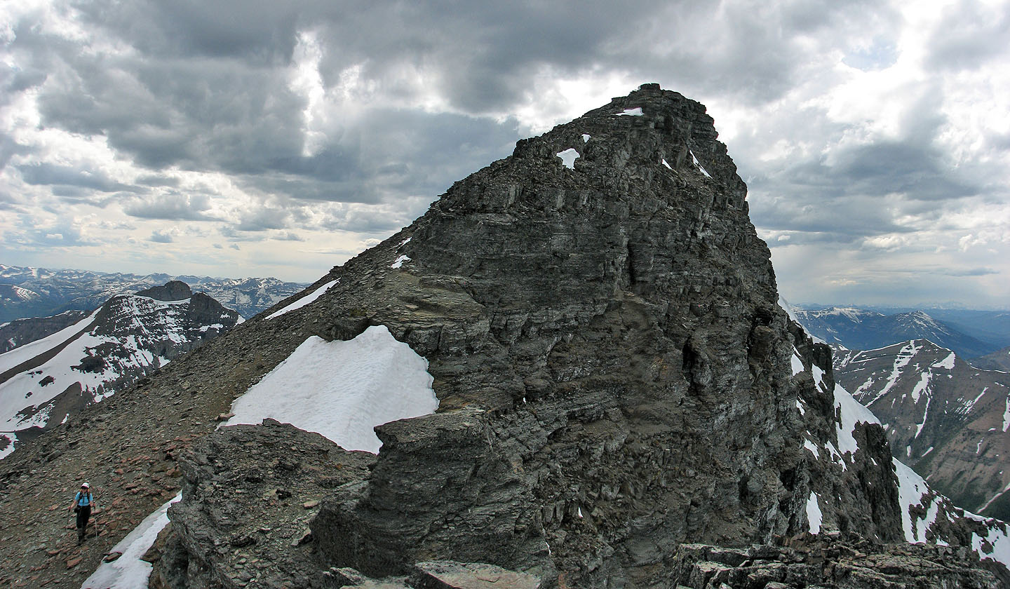
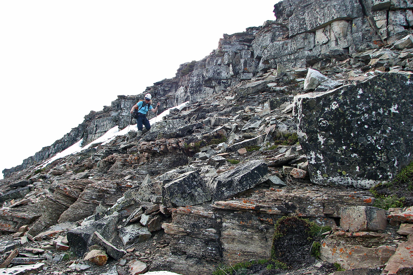
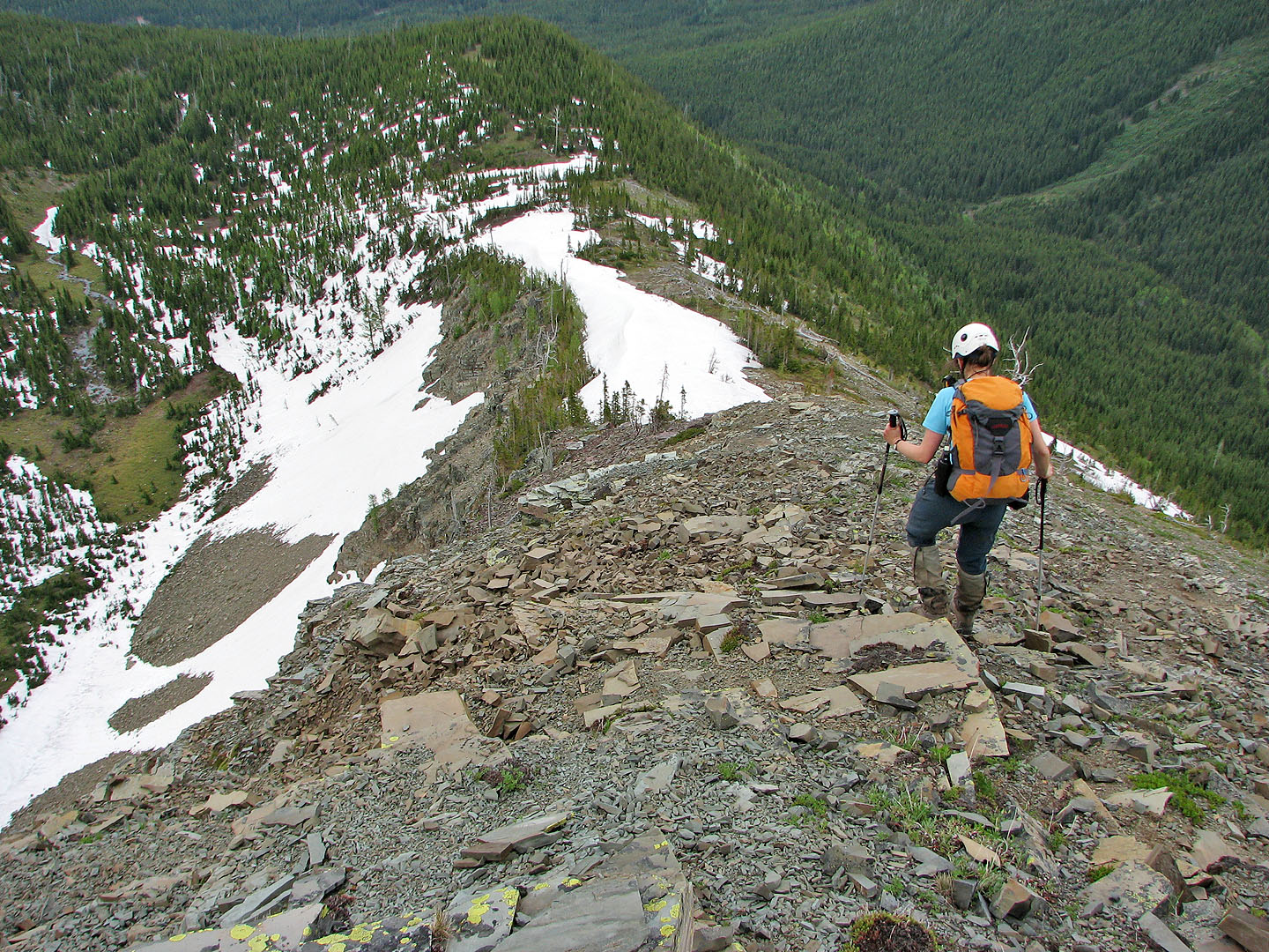
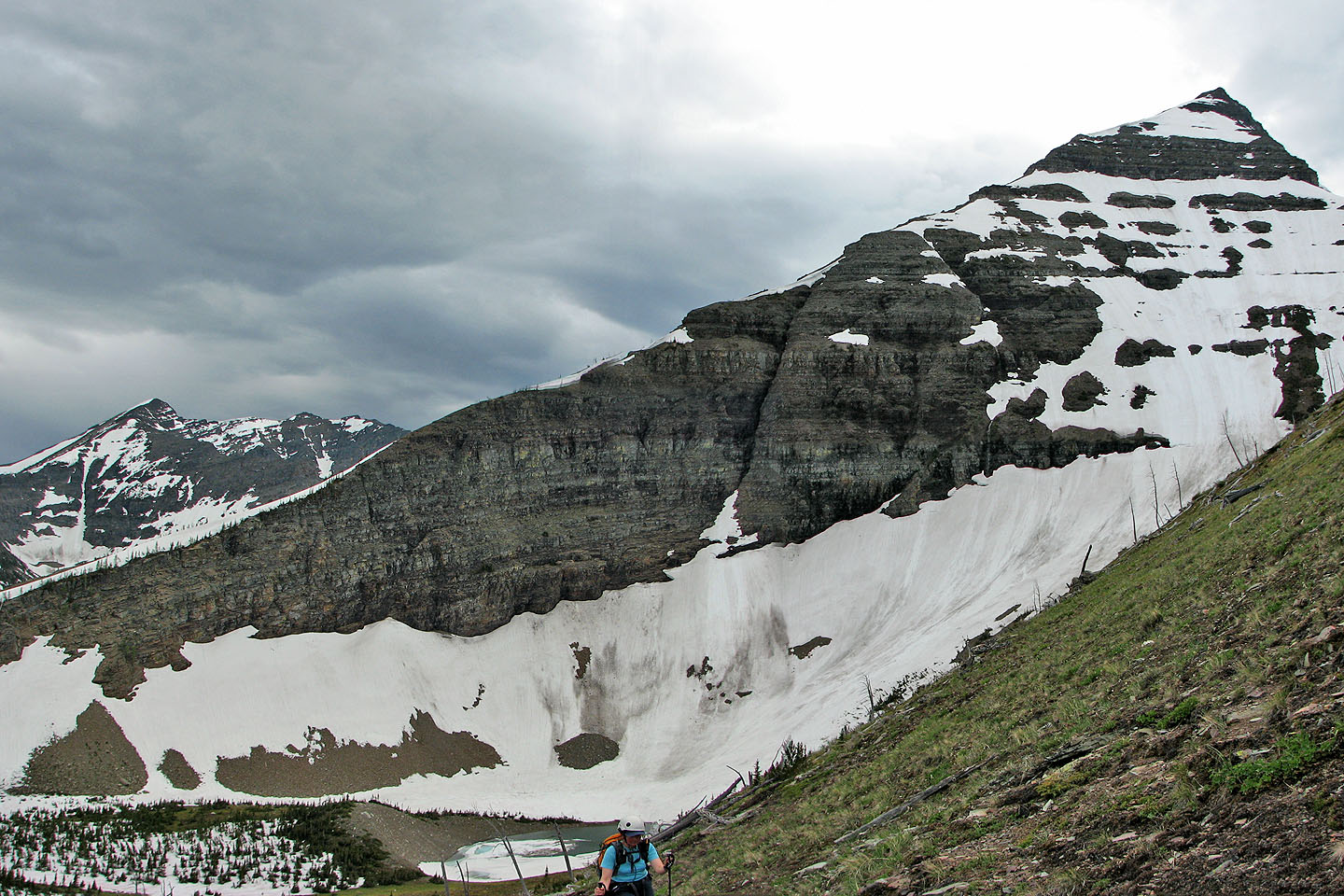
Mostly short cliff bands on the ridge
Some like this one are interesting
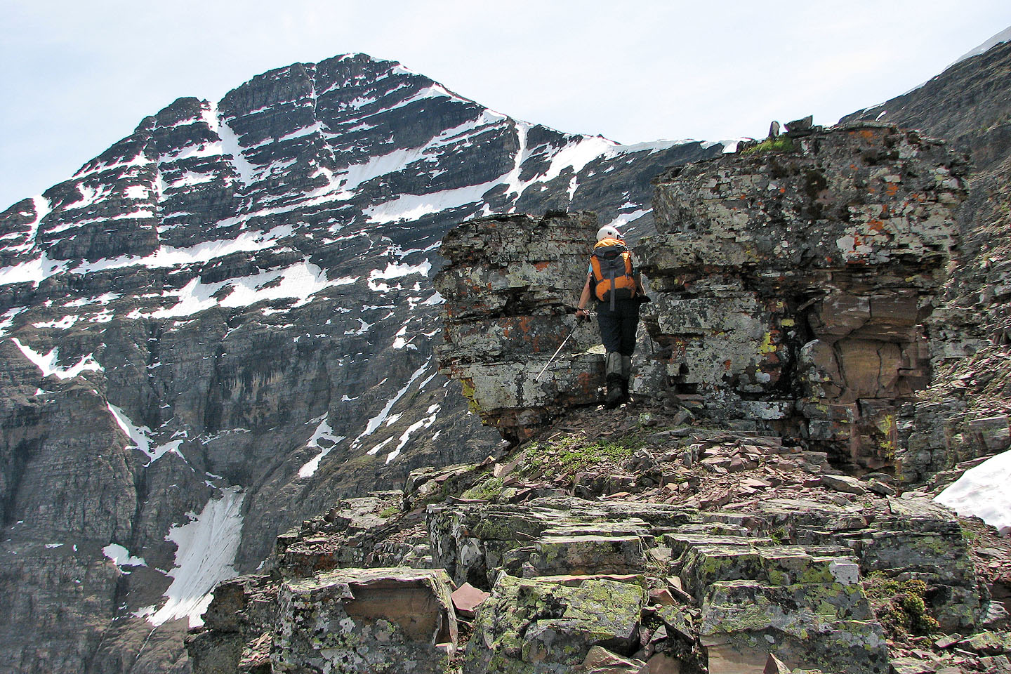
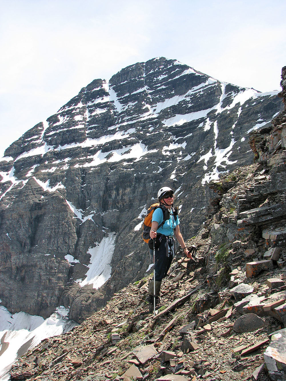
But the best scenery lies ahead
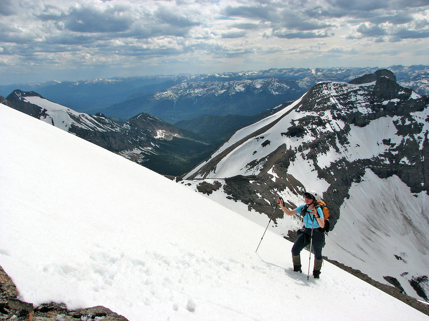
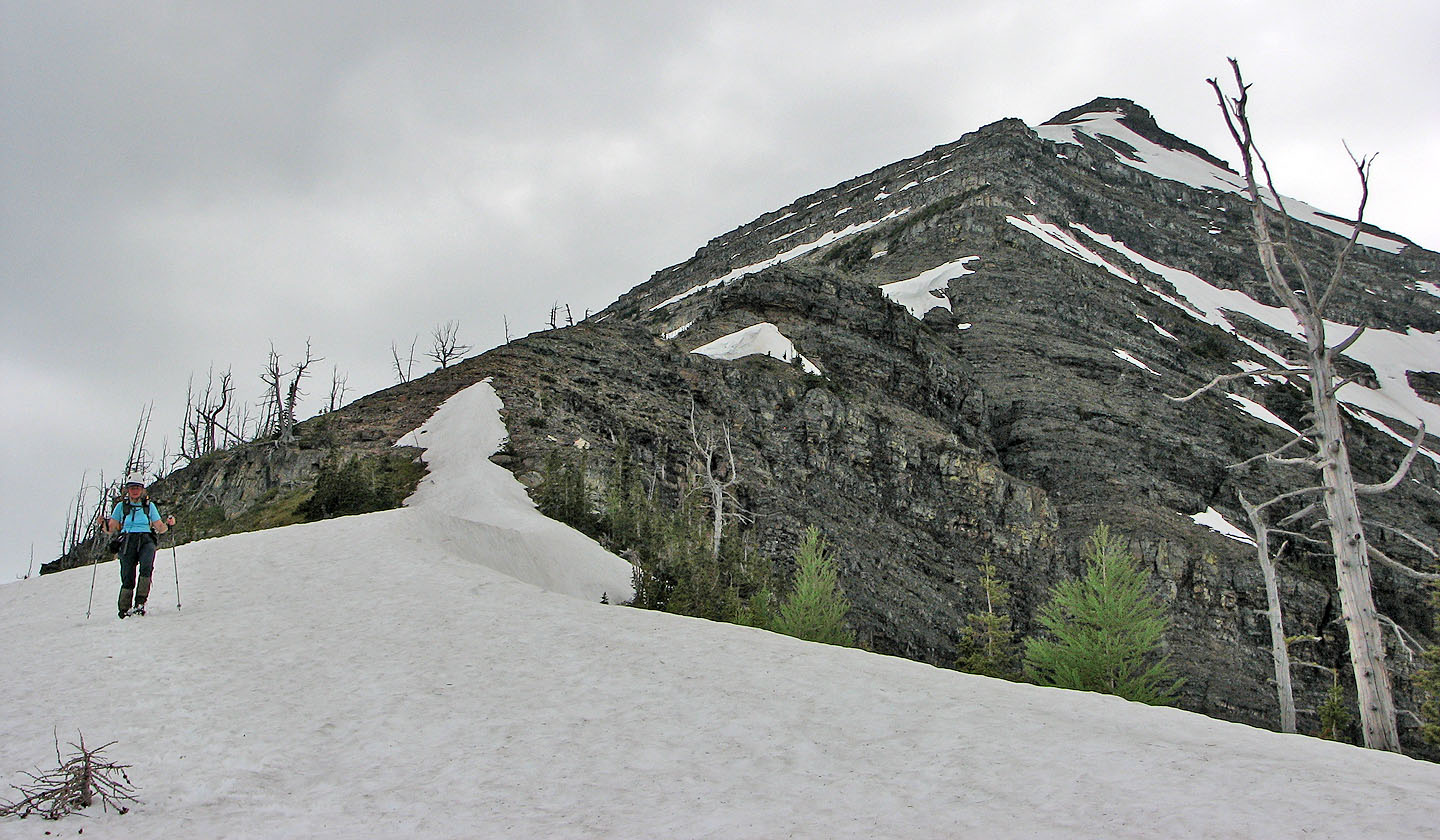
We'll soon tackle the steep climb after the col
Starting up from the col
The left side of the ridge offered easier and less exposed terrain
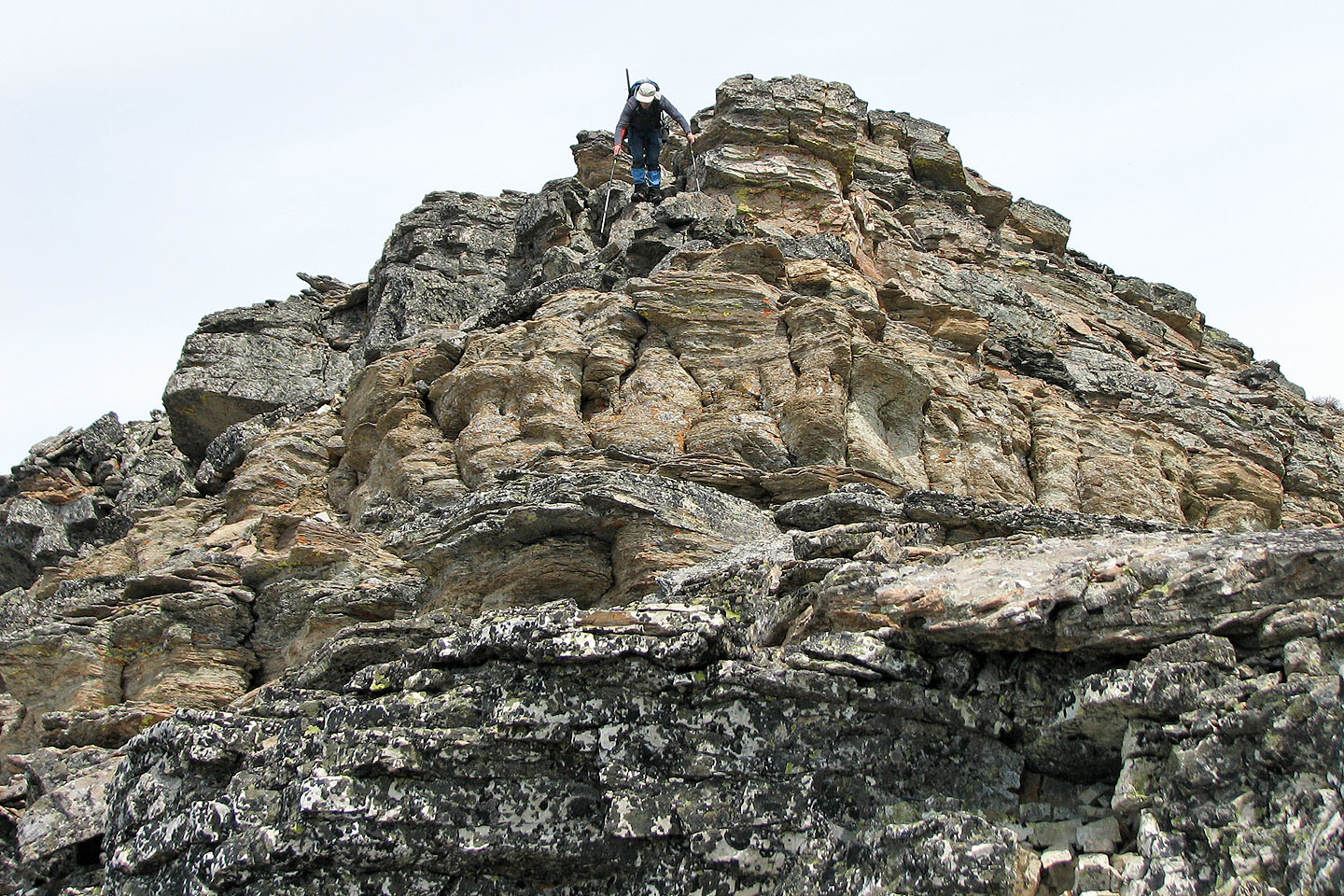
Dinah makes her way through a pair of rock pillars
Colourful rocks after the pillars
The rock pillars can still be seen
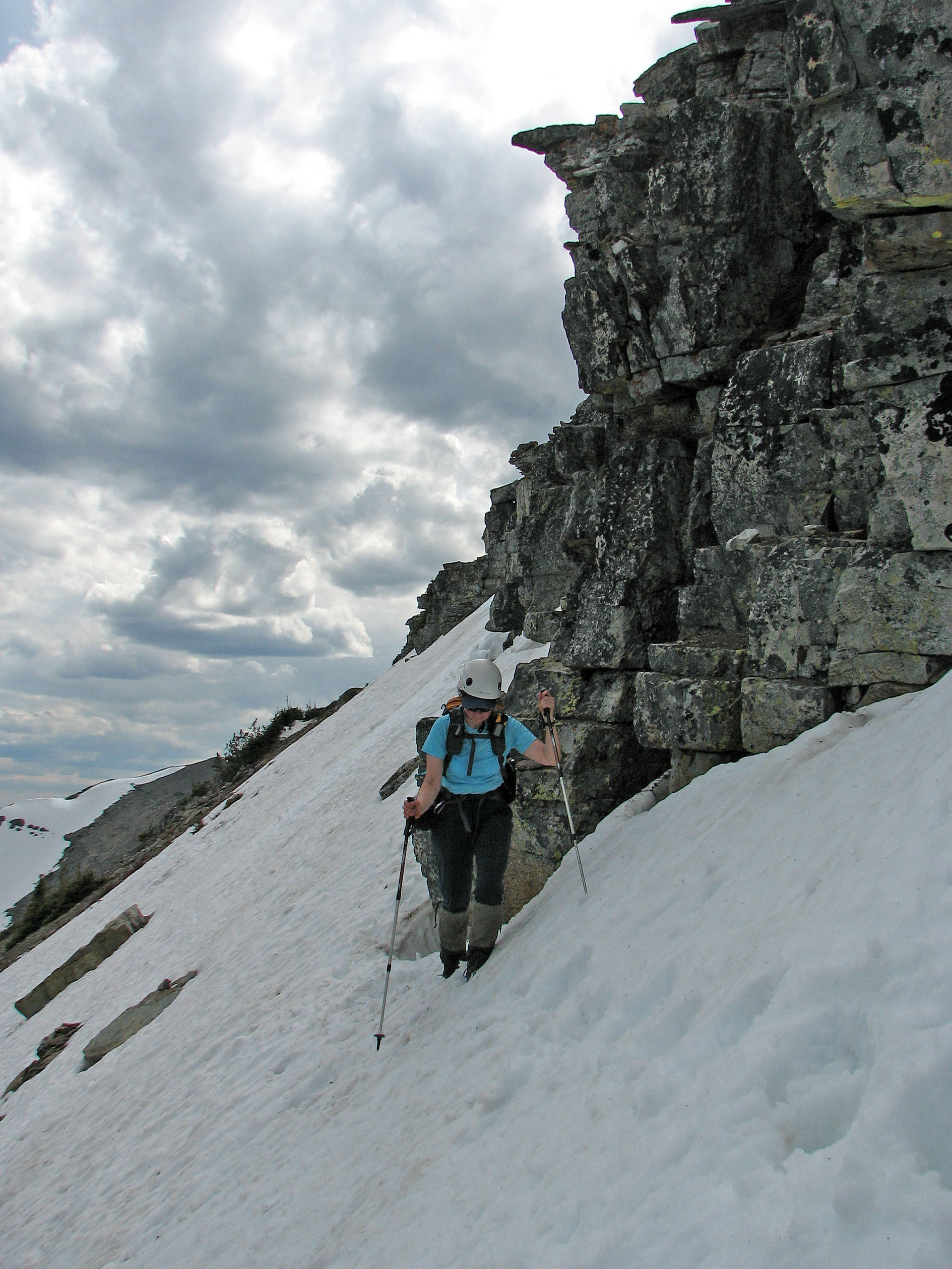
Mild exposure in some places
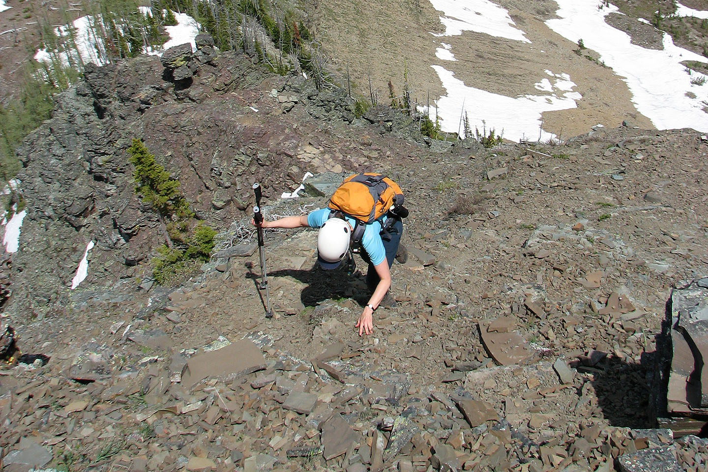
Dinah looks for a way up
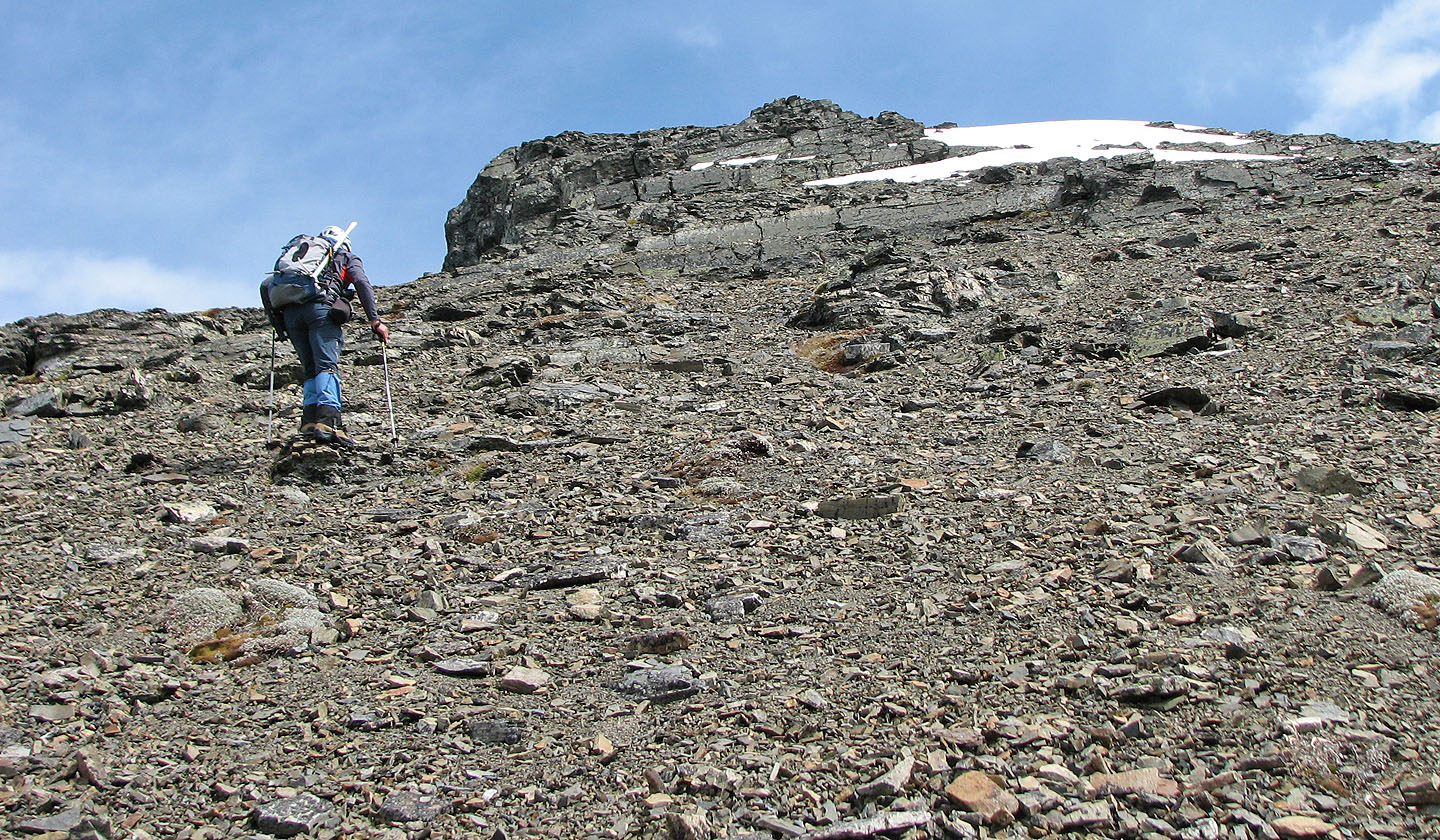
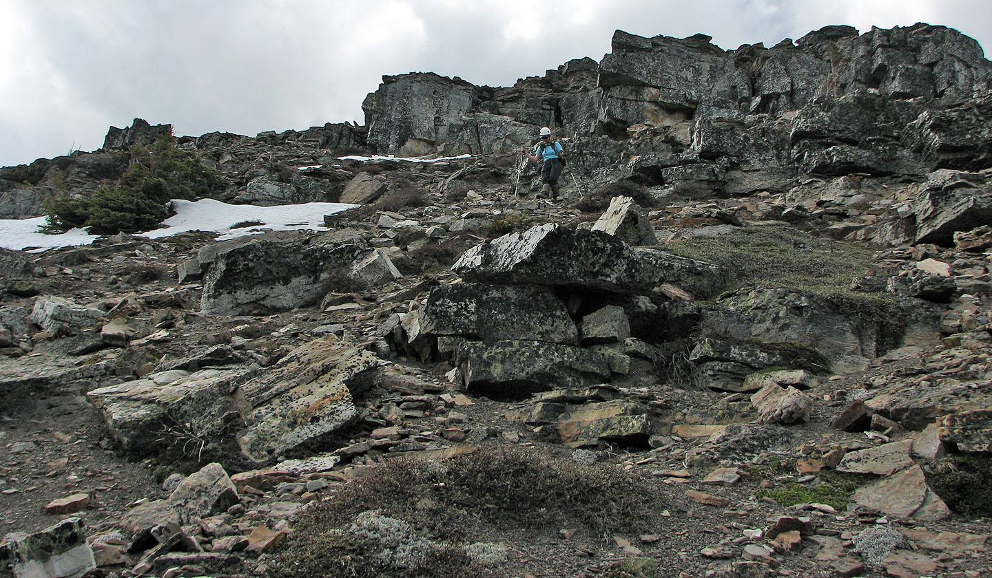
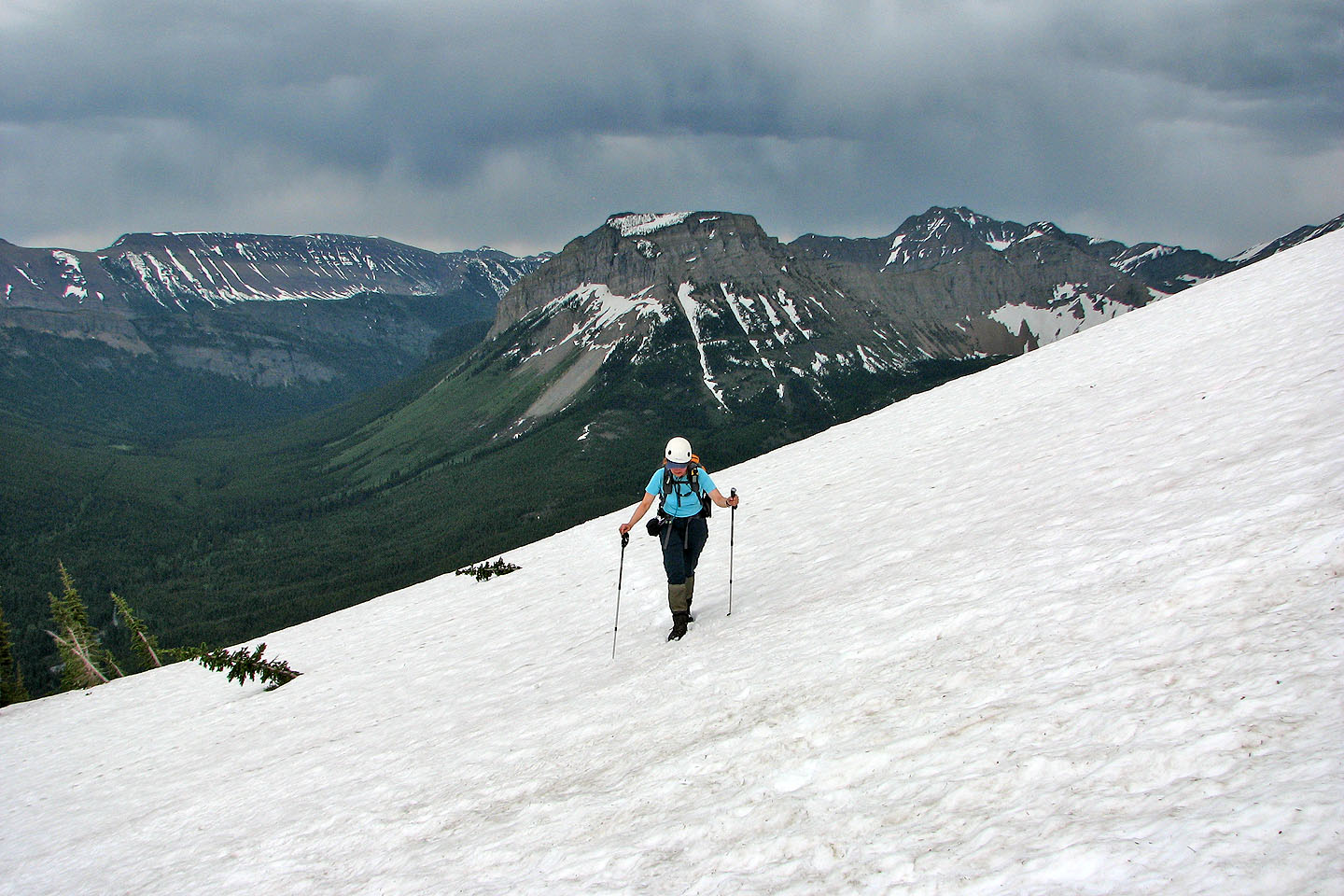
After scrambling up from the col the grade eases considerably
As we climbed we encountered a few gentle grades like this one
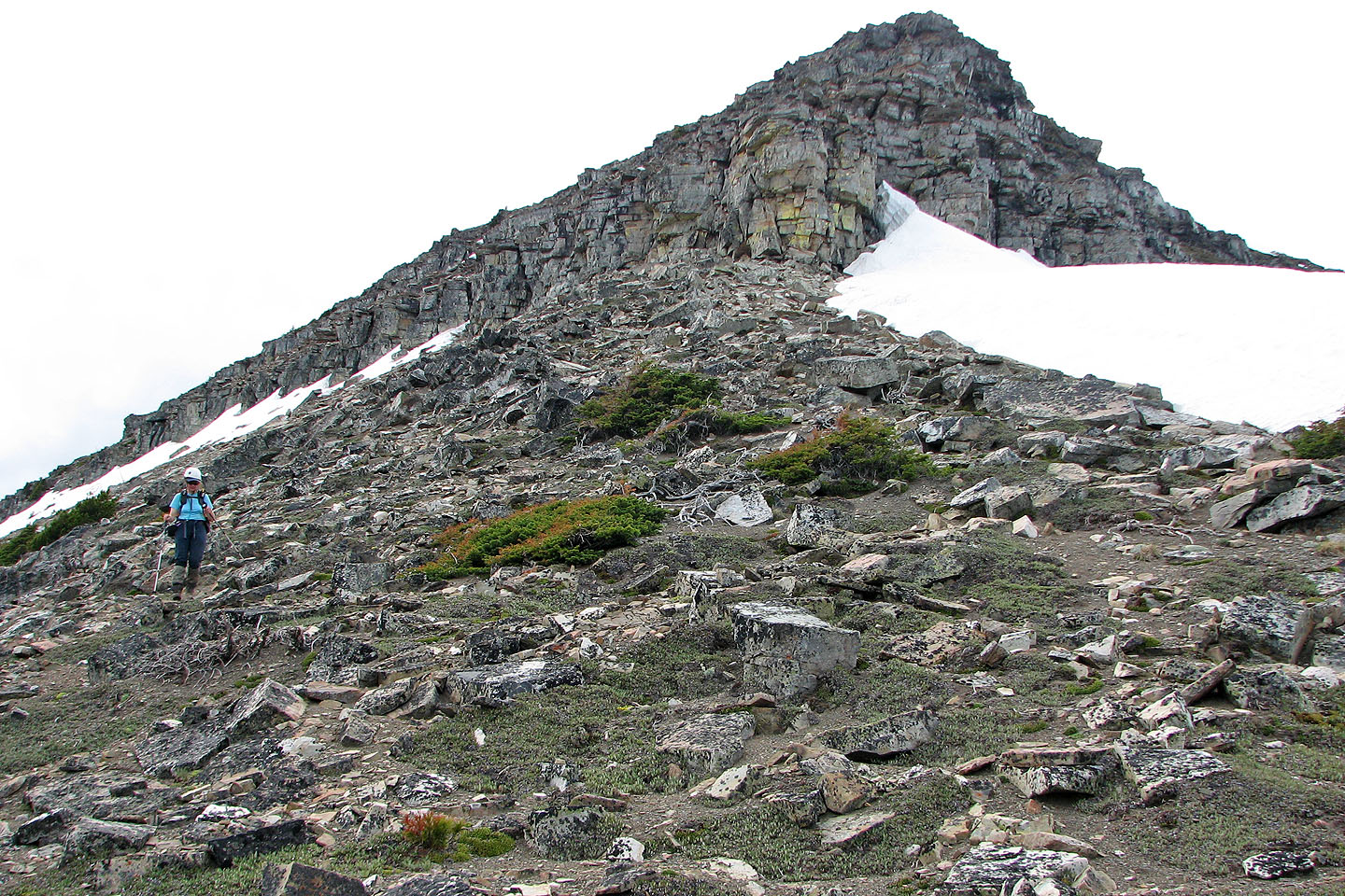
In the middle is the ridge we scrambled up
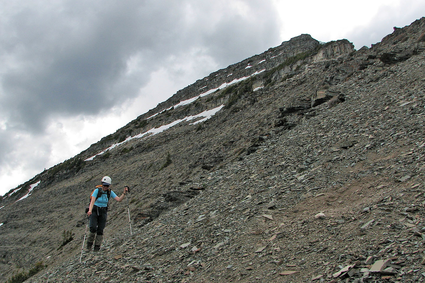
An enjoyable ridgewalk before it steepens
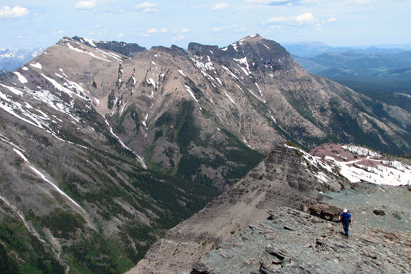
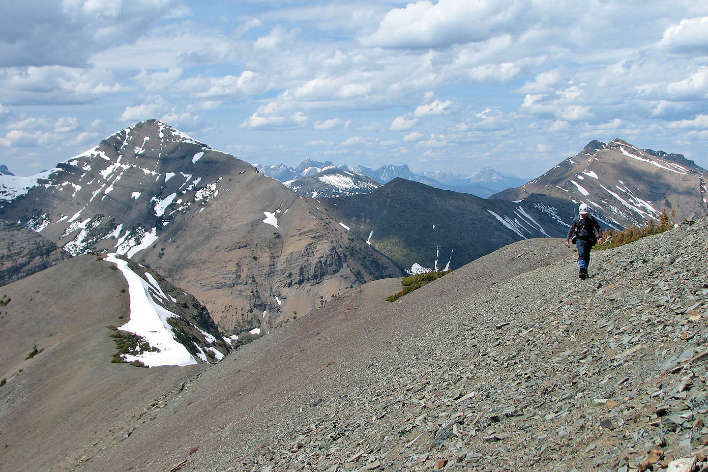
The summit is still some distance away
Unnamed peak to the southwest
Looking back: Mount Gravenstafel and the col we traversed
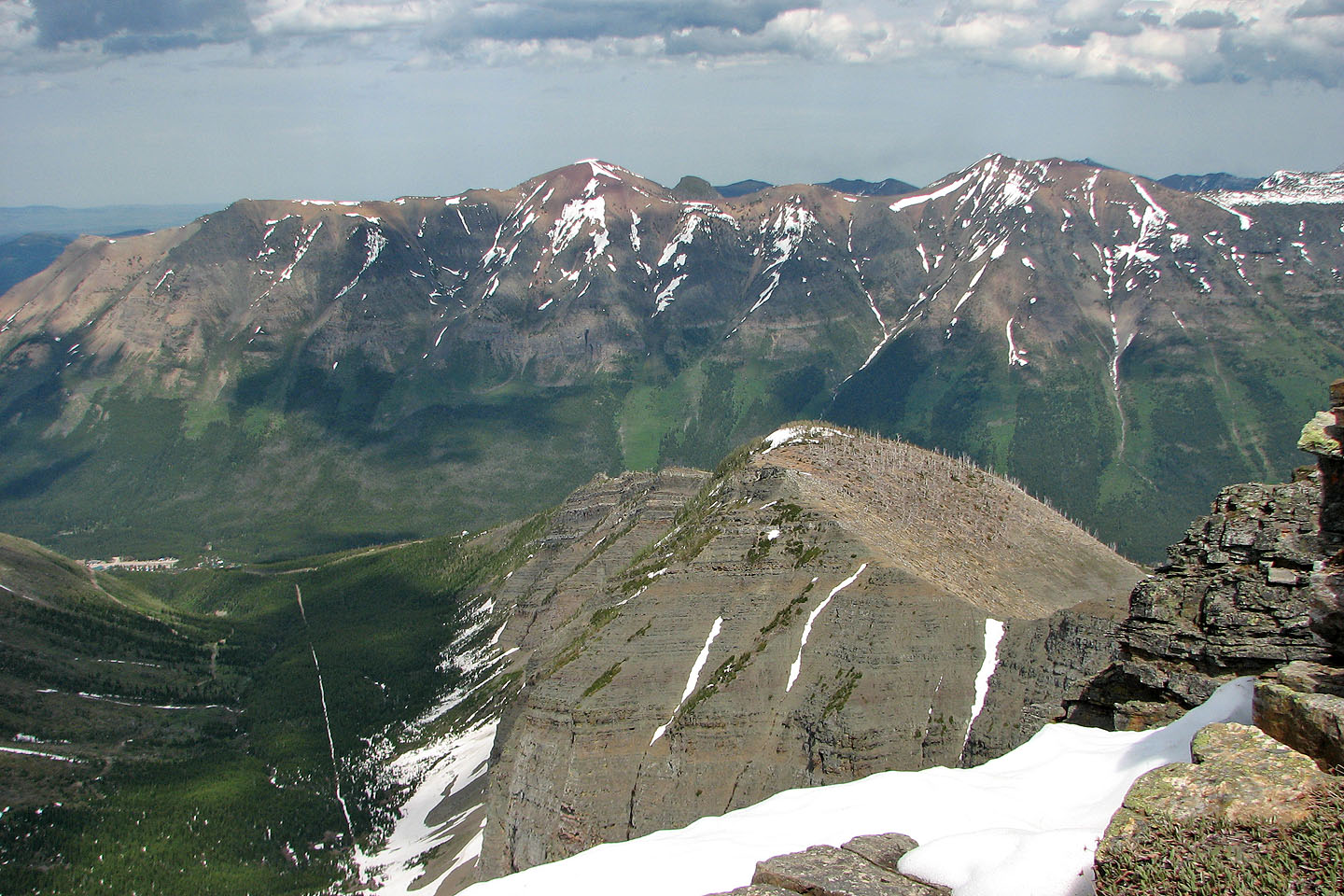
The northeast ridge of Mount Haig with
Barnaby Ridge in the background
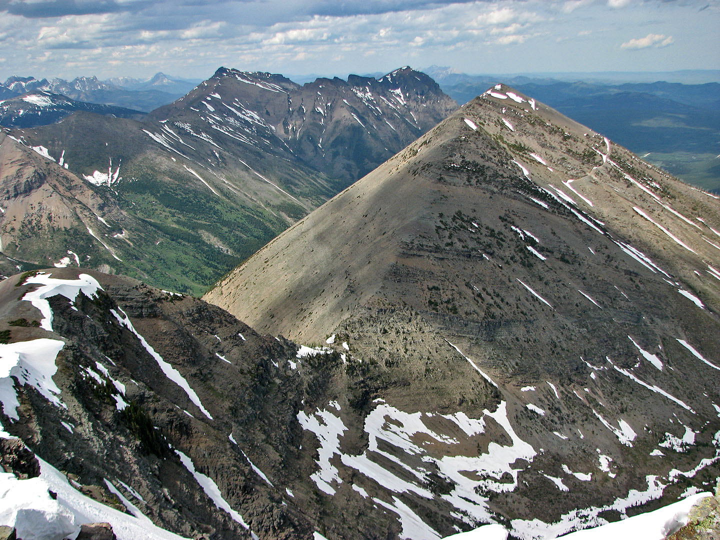
The ridge from the col intersects another ridge that leads back to St. Eloi Mountain (centre)
As we climbed the views to the southwest appear
Almost at the summit
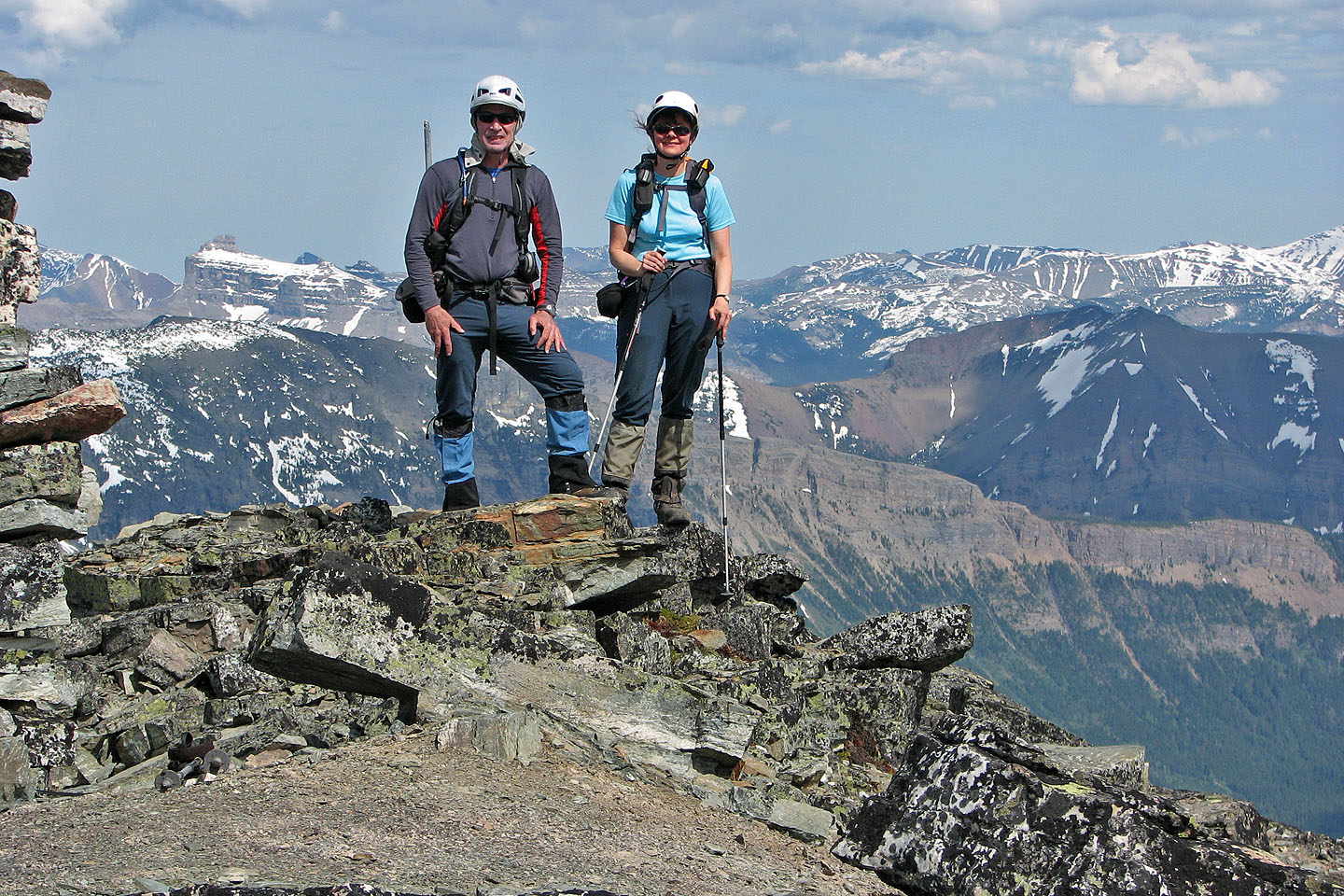
On the summit. Castle Peak on the left.
Starting down the east ridge
Looking back at the summit of Haig
Coming down from one of the cliff bands
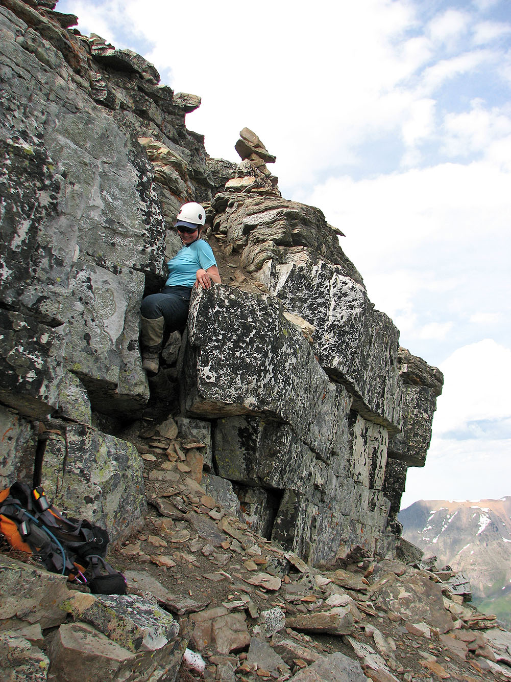
Dinah squeezes down a short cliff band marked with a cairn
Looking back
We traversed snow back to dry rock
Same cliff band seen farther back
A few of the cliff bands in view
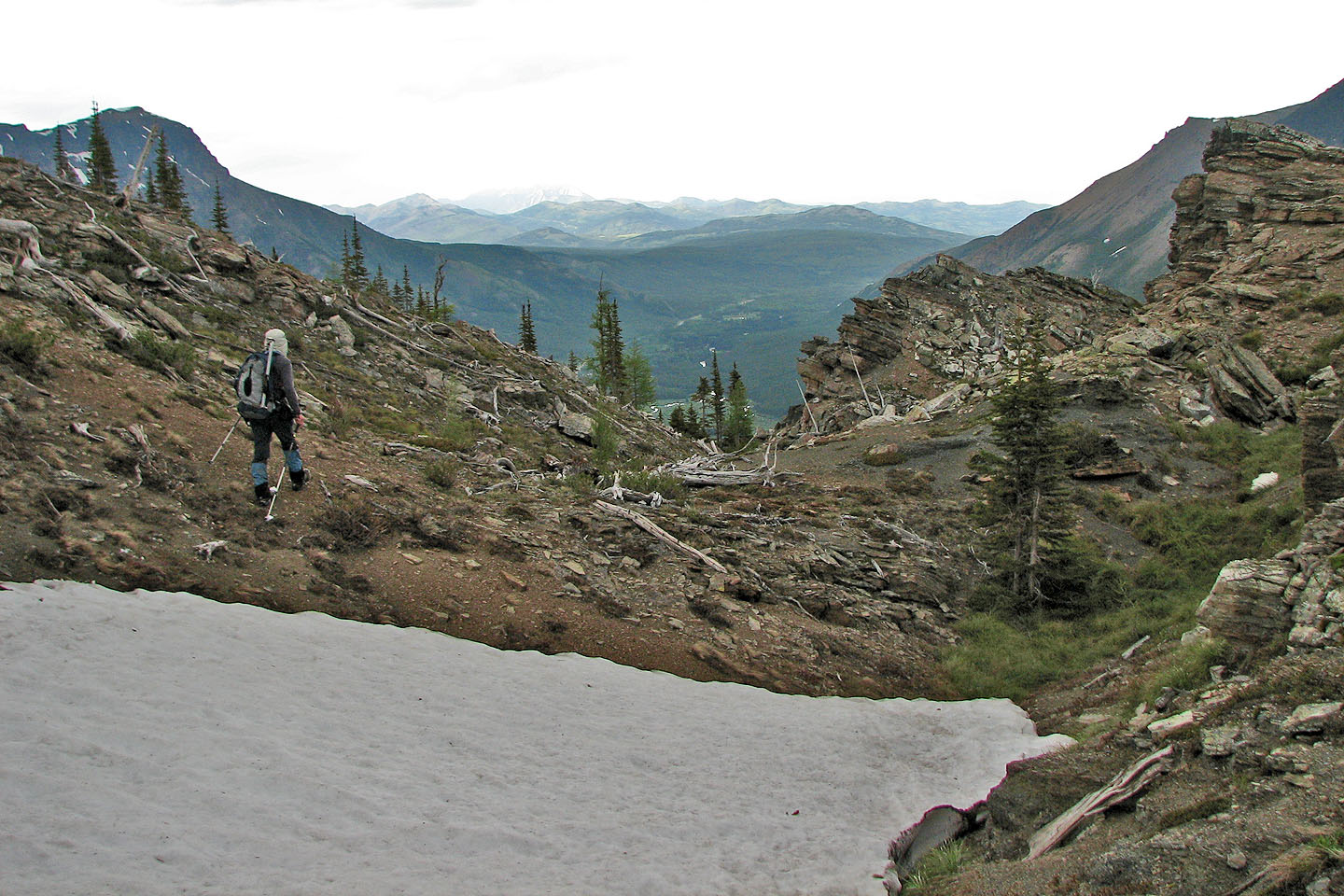
We dropped down to the valley on our left
Looking back at Mount Haig
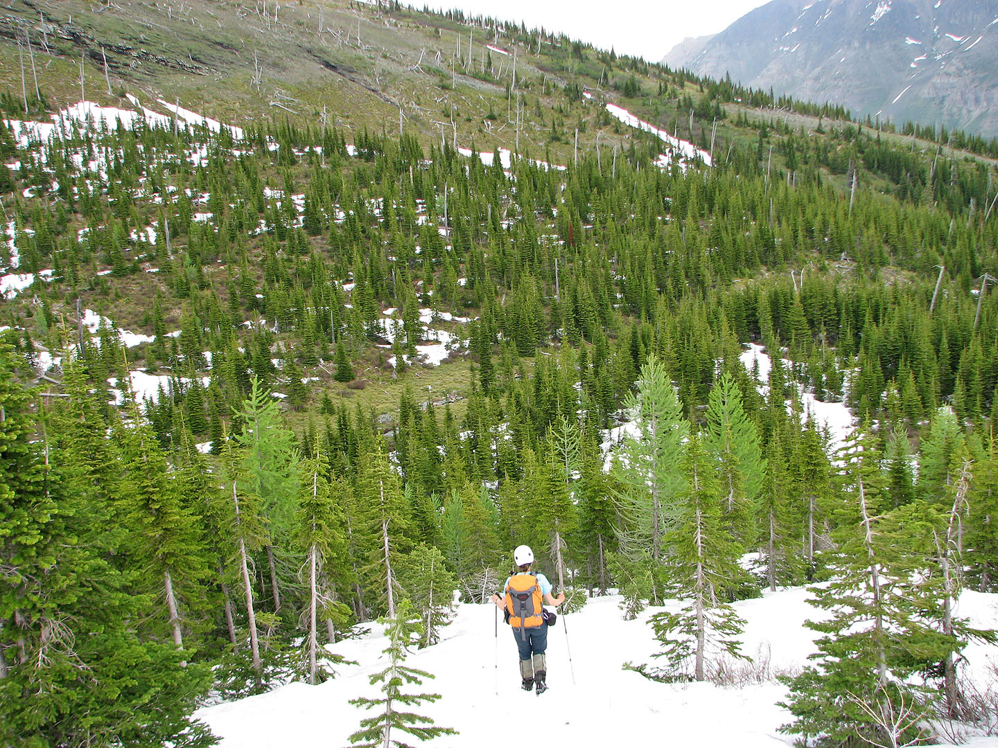
Below is a lush valley that we'll cross
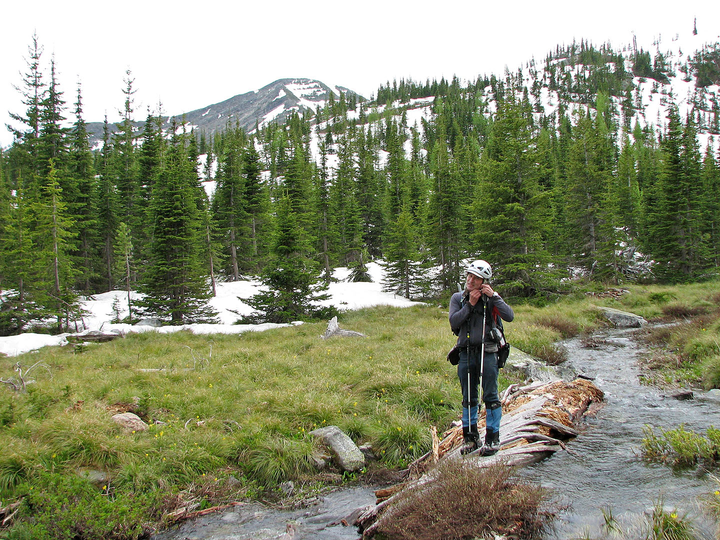
Stopping to remove my helmet in the valley
Ascending from the valley, the tarn below Mount Haig is visible
Sidehilling to gain the ridge
Traversing this slope in dry conditions may not be so easy!
We reached the northeast ridge and minutes later it began to rain
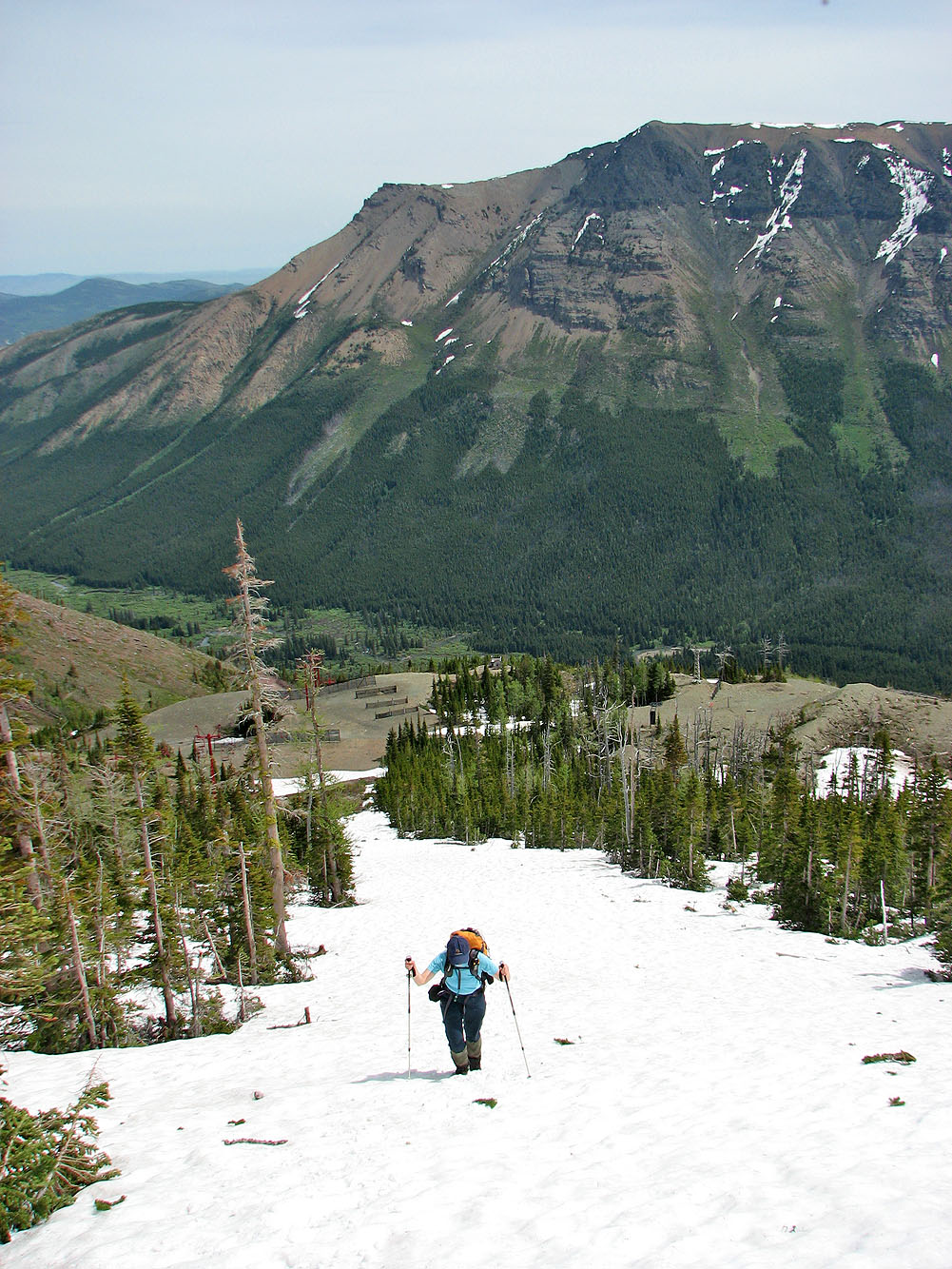
It began to clear as we headed back to the parking lot
82 G/8 Beaver Mines