bobspirko.ca | Home | Canada Trips | US Trips | Hiking | Snowshoeing | MAP | About
Whistler Mountain and Lookout
Castle Provincial Park, Alberta
April 21, 2006
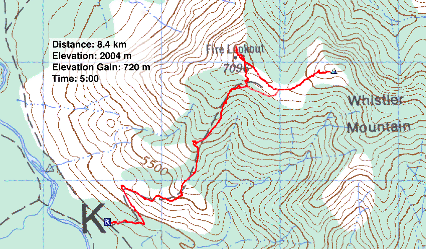
Distance: 8.4 km (5.2 mi)
Cumulative Elevation Gain: 850 m
(2789 ft)
After summiting Table Mountain the previous year, almost to the day, I assumed the nearby Whistler Mountain would be in season now. But we were surprised by the amount of snow in the area. The only snow we encountered on Table Mountain was just below the summit, but when we drove to the park this April, the snow extended to the base of the mountains.
We followed directions to the trailhead from a park warden we encountered. Just before the Beaver Mines Lakes campground, we turned right and drove a short distance down a road, passing a few campers. This brought us to junction number 7 (943715), a T-intersection.
On our left, the road immediately crosses a broad but shallow stream. With my low-clearance Hyundai, it seemed unlikely we would get far down the South Castle River access road, but the warden suggested we should try. We crossed it without difficulty.
The road was replete with potholes, and we drove no faster than 20 kph. At one point a mud puddle stretched across the road, and I stopped to check its depth before proceeding. After covering 5.5 km, we reached the trailhead (944669), unmarked save for a yellow sign that said, "Trail closed to motorized vehicles." We started on the trail an hour and a half later than I expected, but thankfully we didn't have to hike up the road.
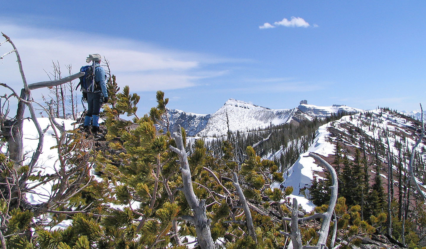
The trail rose steeply in trees, but in ten minutes we reached an open slope. Whenever the trail led back into the trees, though, we were forced to slog in deep snow. Following the snow-covered trail where it was etched into a steep slope proved tricky; it was often easier and more prudent to circumvent the trail because of deep snow. In a couple of spots, it felt like we were cutting across avalanche slopes. Strange to say, but we used our ice axes to go up a lookout trail!
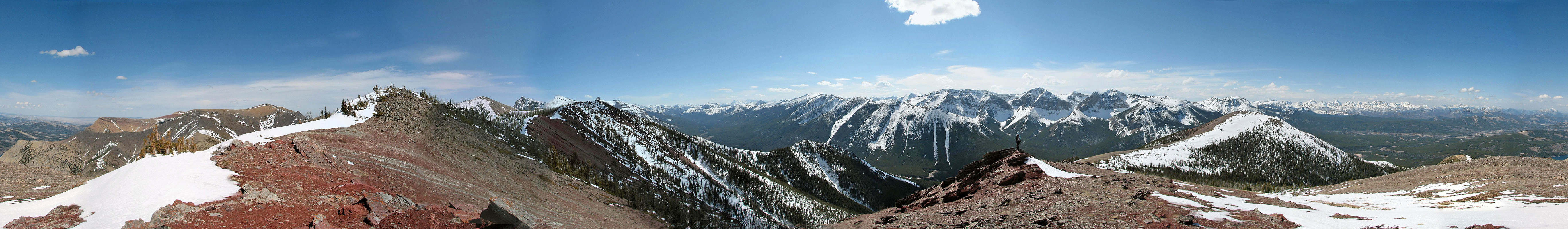
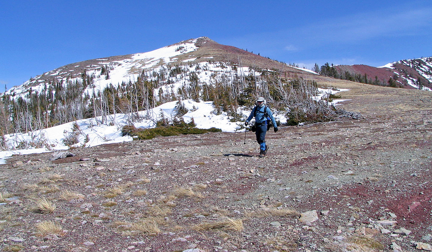
Finally the trees thinned, and we were again hiking on a dry trail. When we reached a plateau, the lookout was on our left, but we headed right to ascend the summit of Whistler Mountain. All around us were snow-covered peaks while we hiked on the colourful rocks of the area.
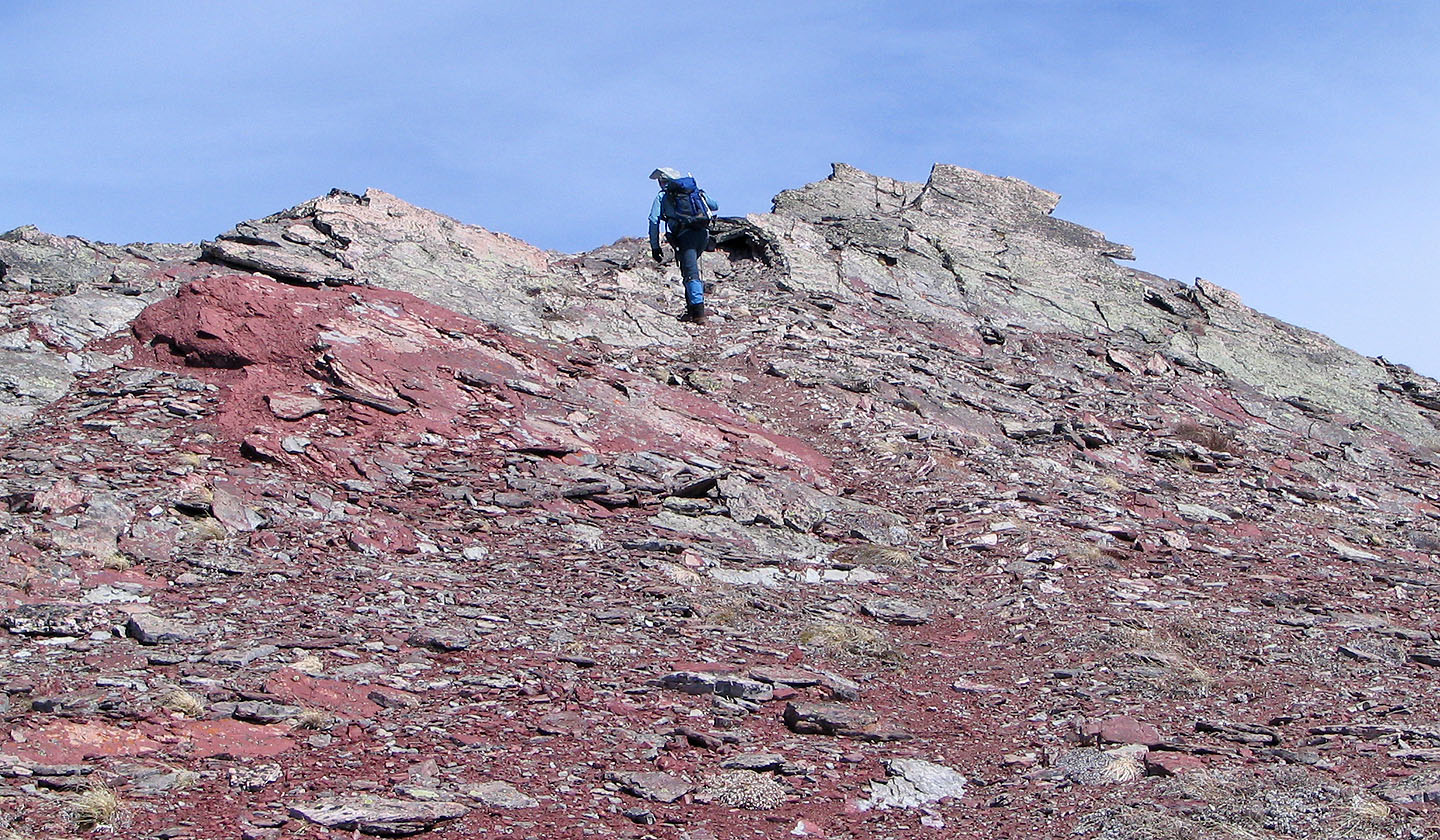
The summit, which held a small cairn, was disappointing as a few trees interrupted the views. We pondered continuing along the ridge to another point that appeared lower than the one we were standing on, but there was no good reason to do so. The wind had been increasing all day and was now making it difficult to stand still let alone hike. Also the lower point appeared to be under a great deal of snow, and its summit was also in trees. Confident that we had reached the summit of Whistler Mountain we started back down. We took a detour, however, to check out the views from the lookout.
When we returned home I was surprised to see the NTS map indicated the lower point we didn't reach was the summit of Whistler. However, later we learned the map is wrong, and we did in fact bag Whistler Mountain (see Sonny's trip report).
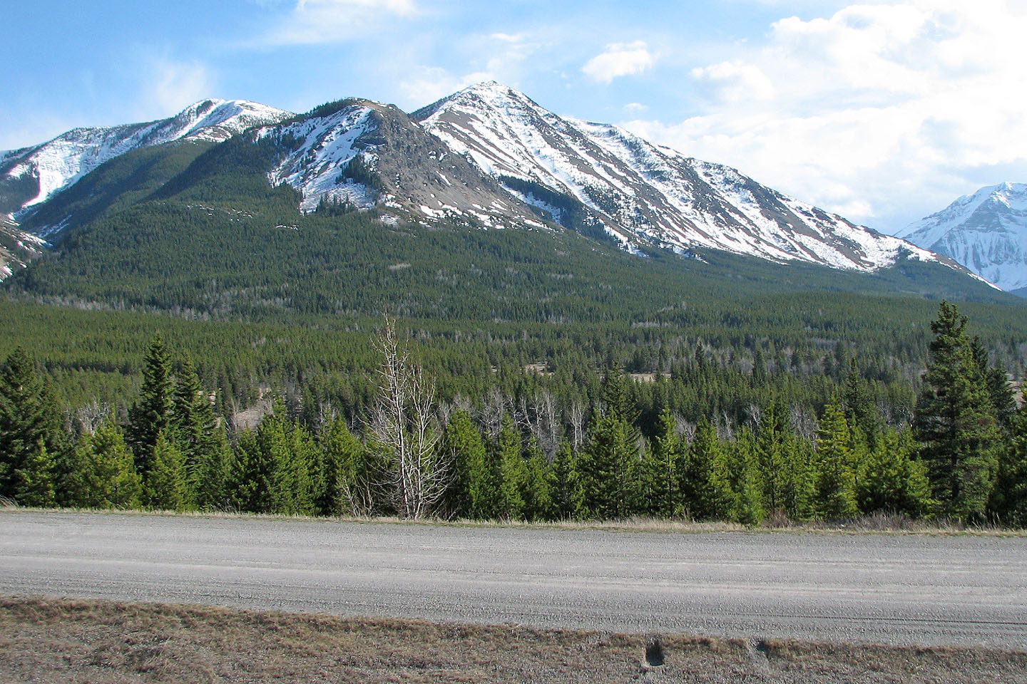
Whistler Lookout in the foreground seen from the road. The trailhead lies behind the right end of the
ridge.
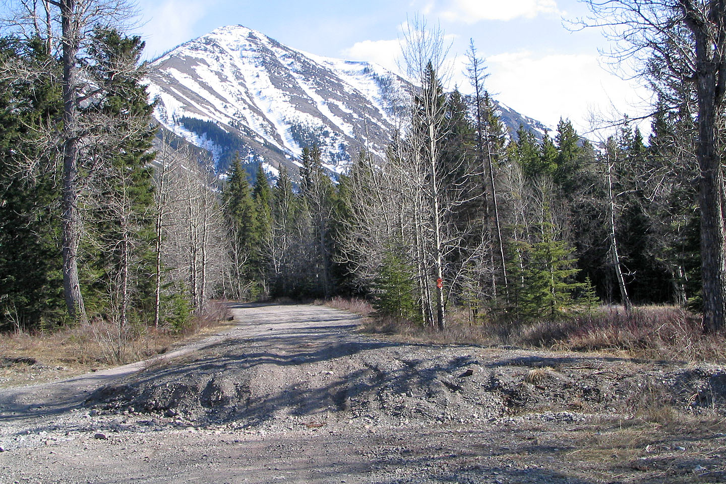
Whistler Mountain Lookout from Junction 7. This road, the South Castle River access, took us to the trailhead.
The views appear soon after starting out
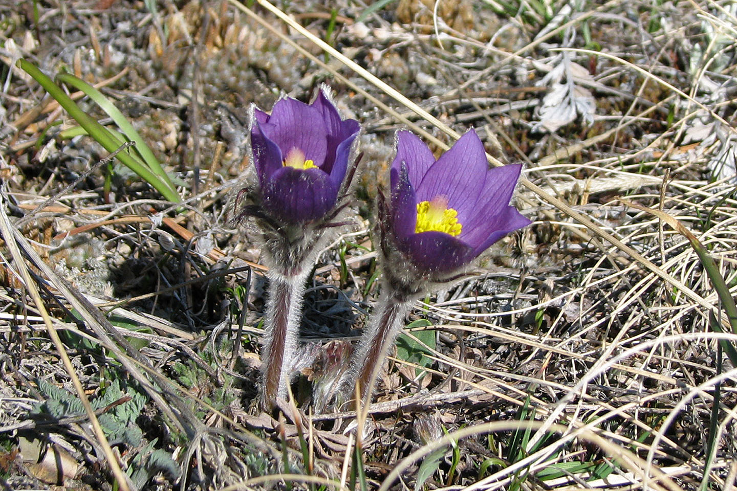
Prairie crocus
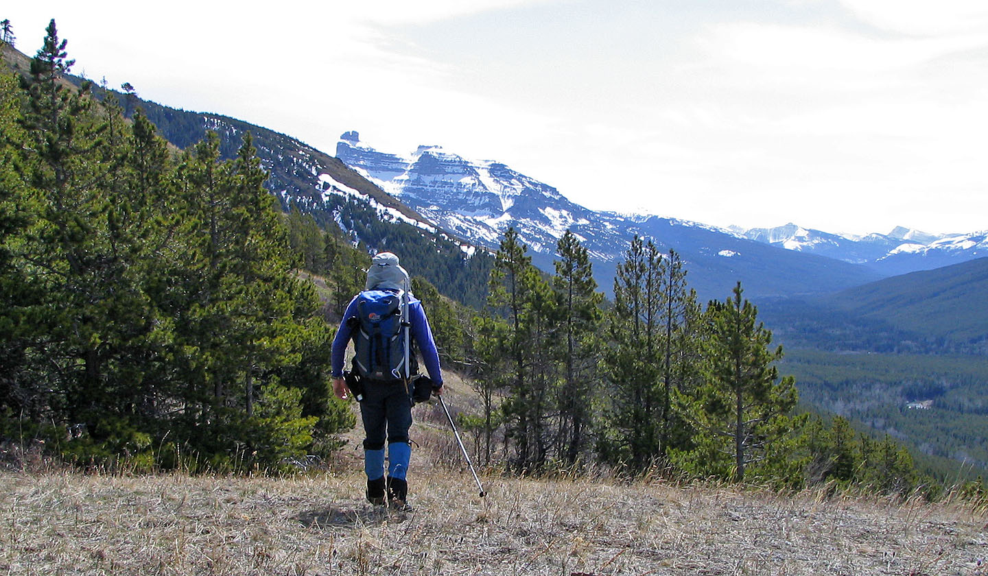
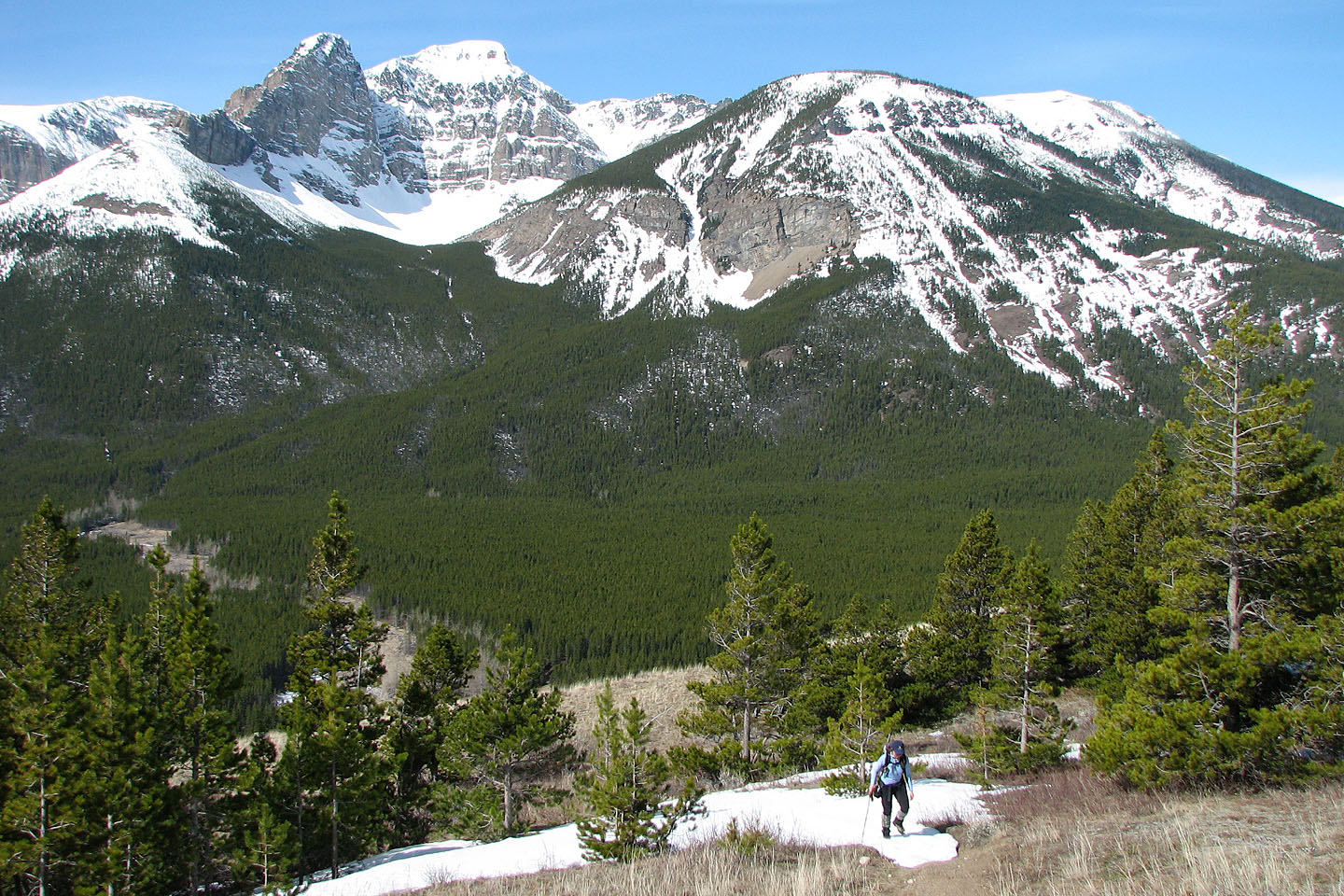
After the first switchback, the trail heads towards Castle Peak
A short time later we hit snow
Dinah displays her "rabbit ears"
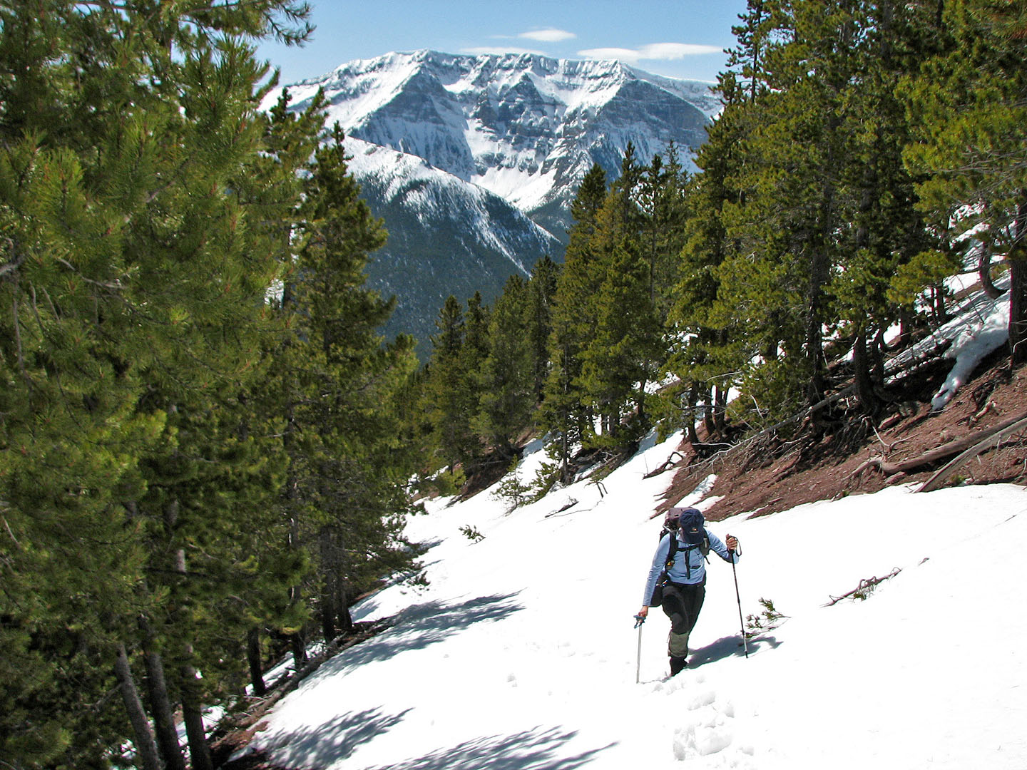
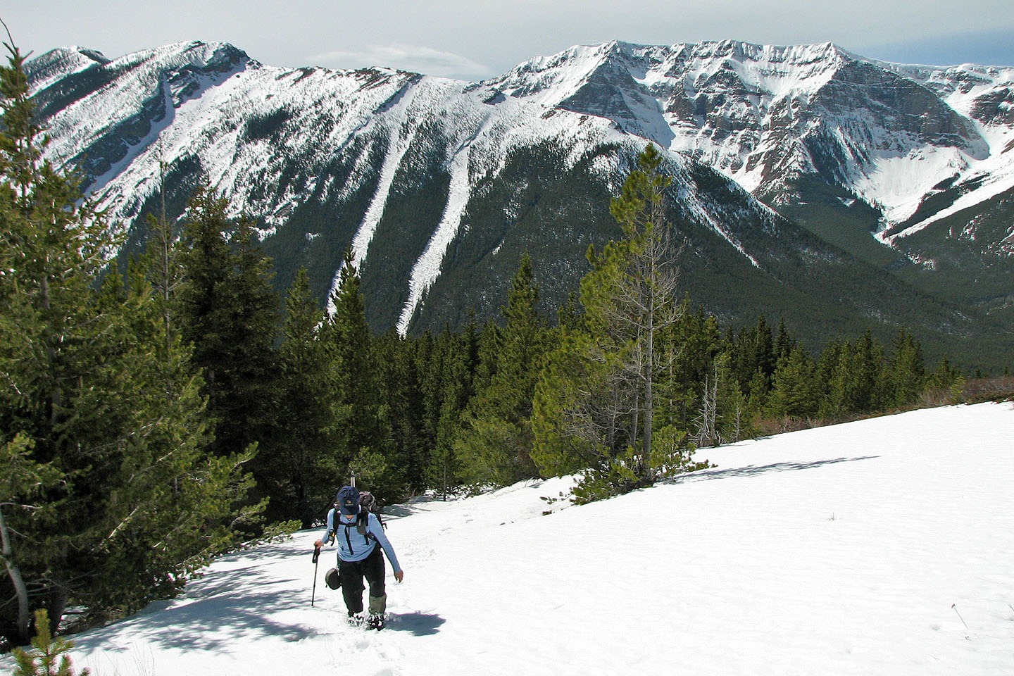
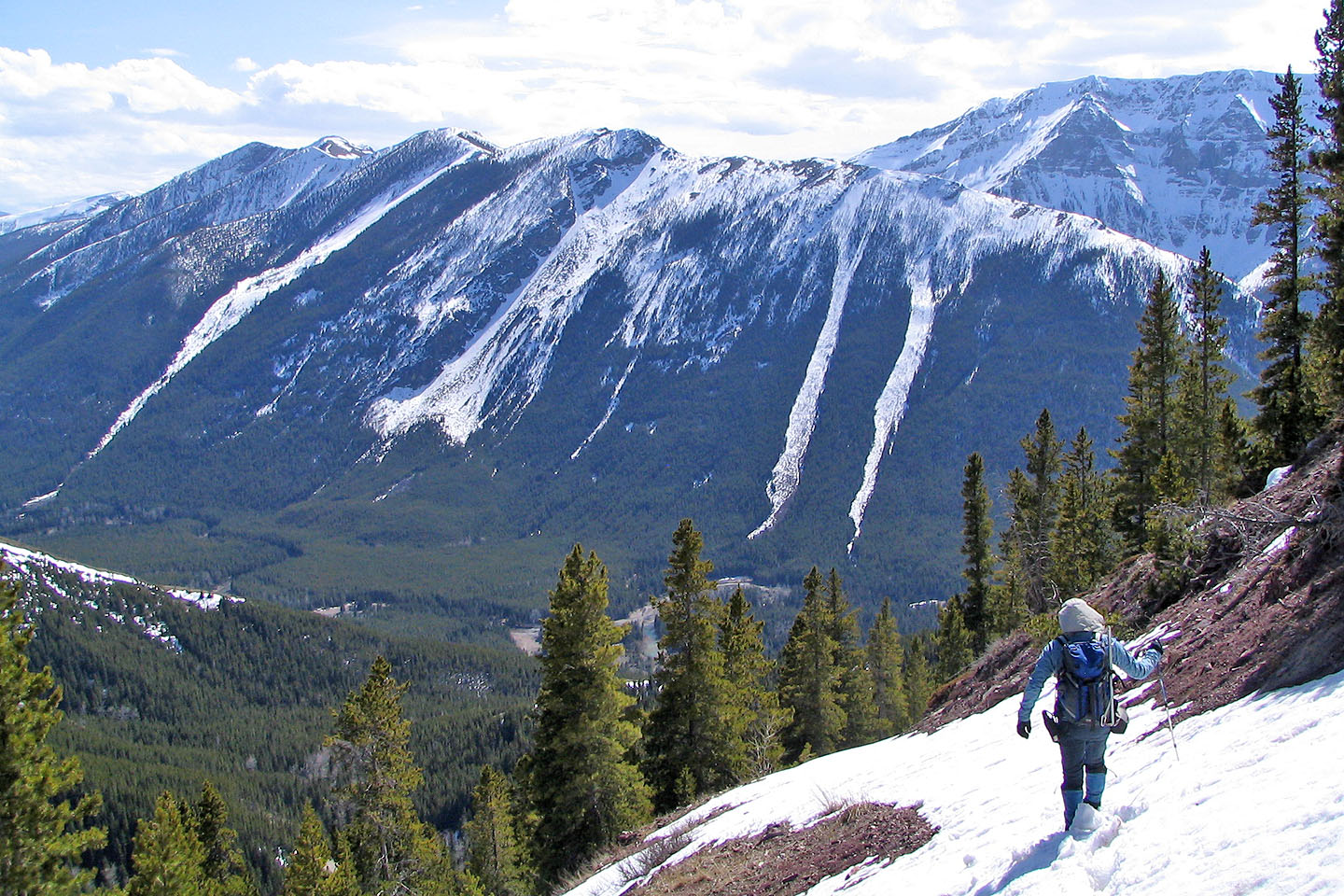
Much of the trail to the lookout is under snow.
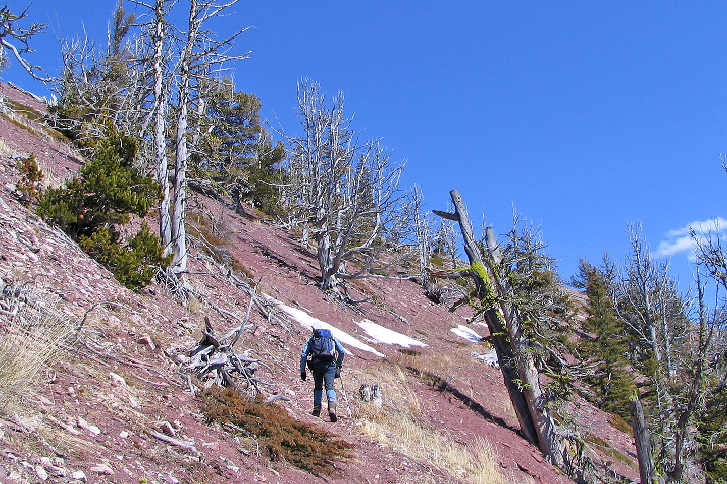
The trail finally becomes free of snow and leads to interesting landscape
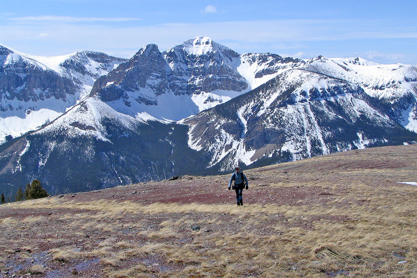
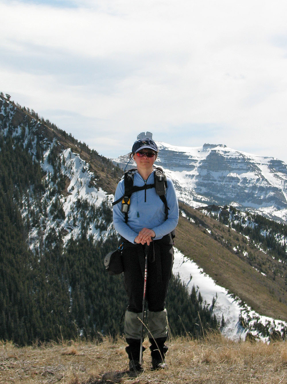
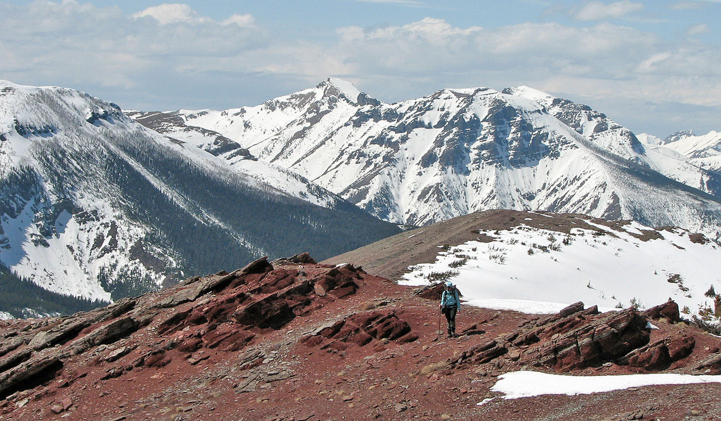
On the plateau. An unnamed peak on
Barnaby Ridge is in the background.
Getting to the colourful rock
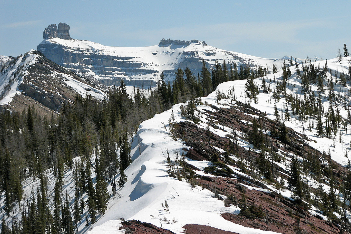
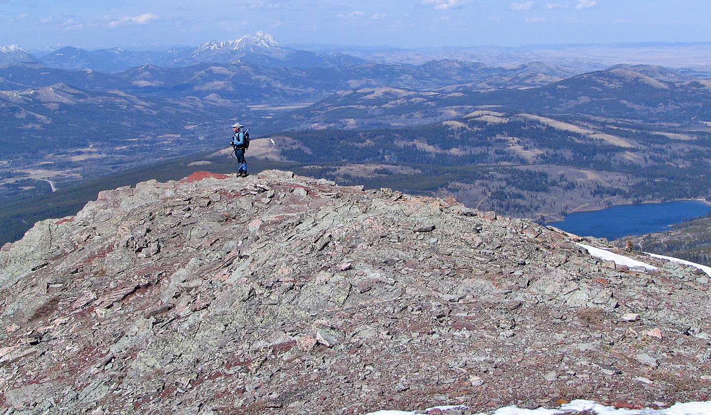
Nearly at the summit. The lookout is behind us.
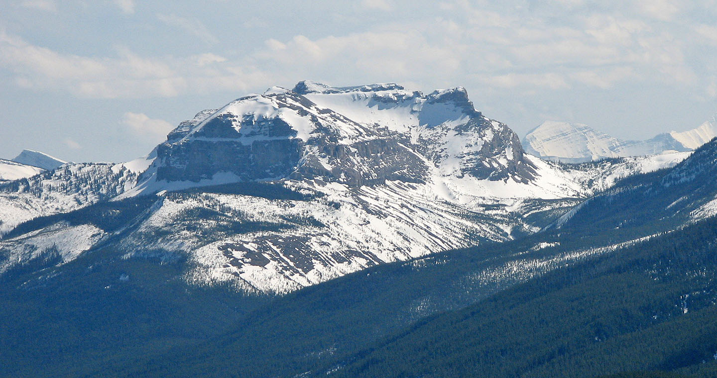
North Castle Mountain (mouse over for a close-up)
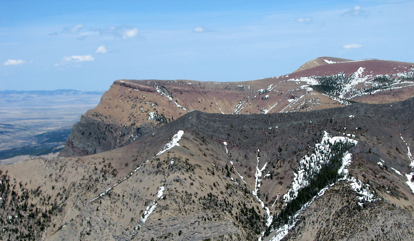
Table Mountain on the skyline
Jutland Mountain lies south
On the summit of Whistler Mountain
Heading to the lookout
View from the lookout:
Hillcrest Mountain and
Turtle Mountain on the left. Beaver Mines Lake on the right.
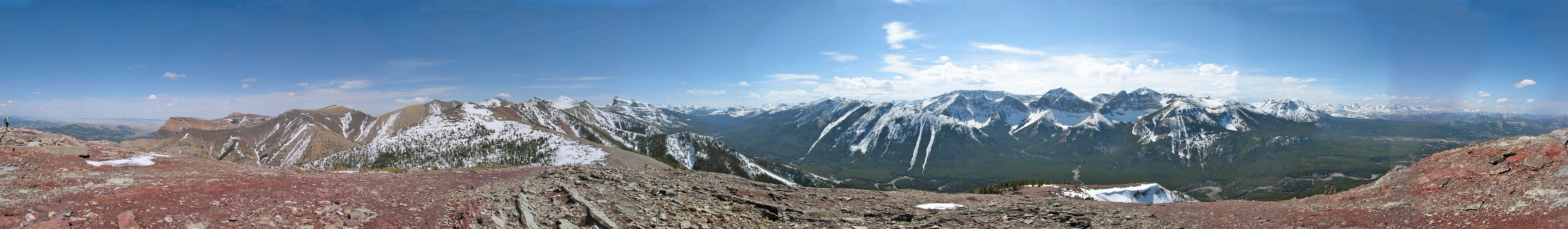
Panorama from the lookout
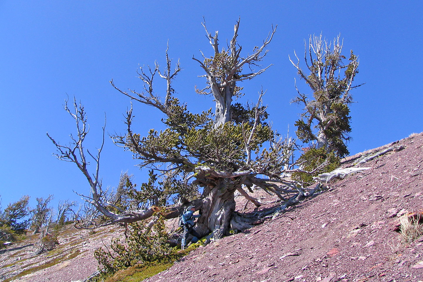
A thick tree below the lookout
West Castle dominates the view to the SE
82/G8 Beaver Mines