bobspirko.ca | Home | Canada Trips | US Trips | Hiking | Snowshoeing | MAP | About
Mount Redoubt
Skoki, Banff National Park, Alberta
September 6, 2003
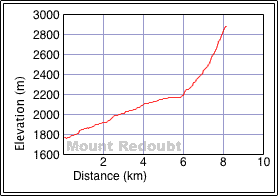
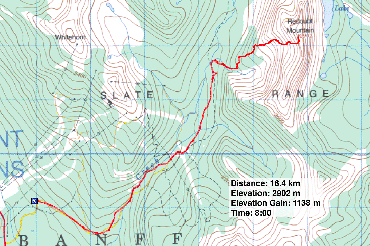
Distance: 16.4 km (10.2 mi)
Cumulative Elevation Gain: 1140 m (3740 ft)
While Dinah and I wanted to climb Mount Redoubt, we balked at ascending the northwest ridge as described in Scrambles in the Canadian Rockies. That route required camping at Hidden Lake, and we wanted a shorter trip. So Dinah and I, along with Kari, Sue and Marcel, took a more direct route using the west slopes of Redoubt.
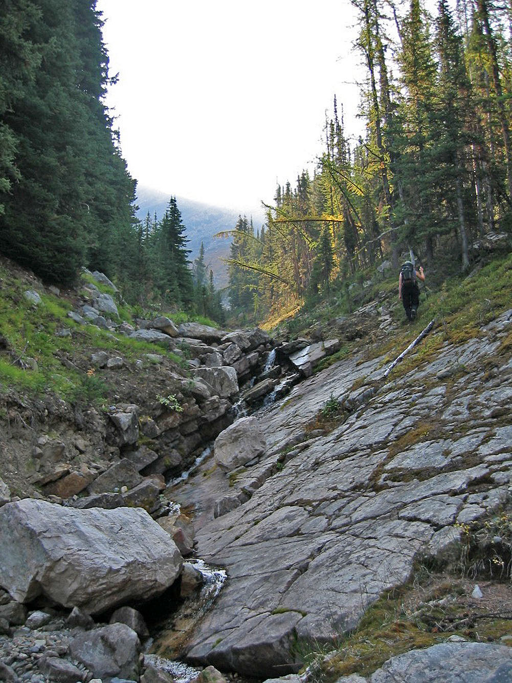
Our approach starts at Fish Creek parking lot but avoids going to Hidden Lake. On the trail to Hidden Lake, we turned off at the drainage where a plank bridge crosses a stream (562017) in a semi-open area. This is the second planked crossing along the trail, the first being in the trees. This led to a drainage.
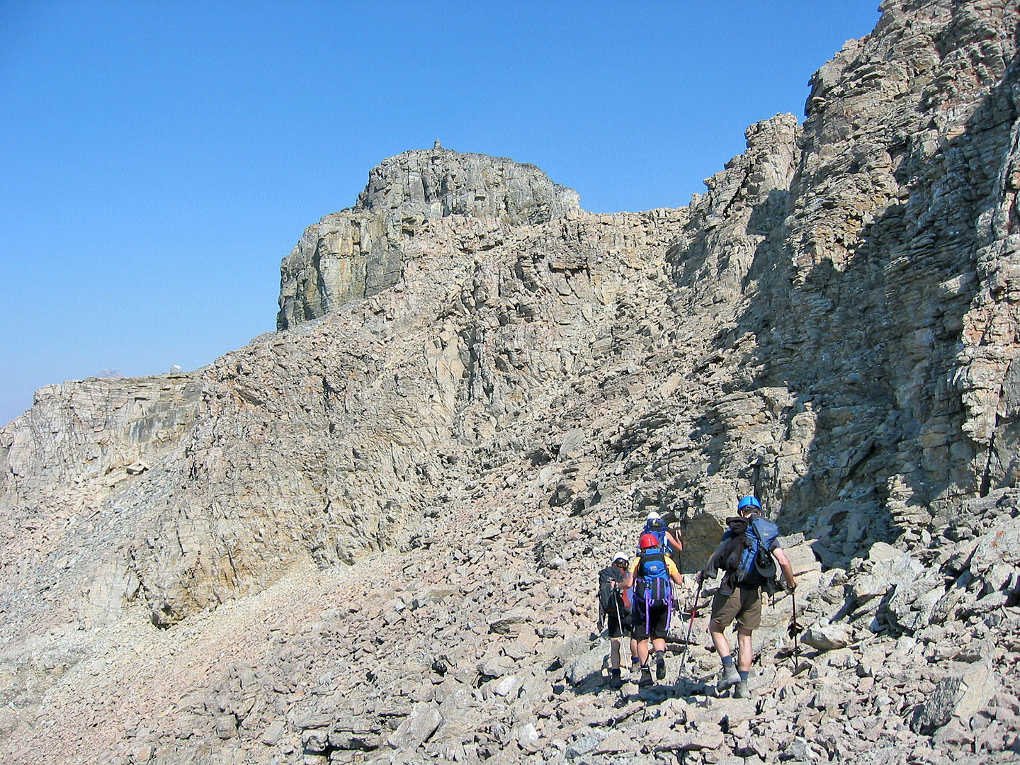
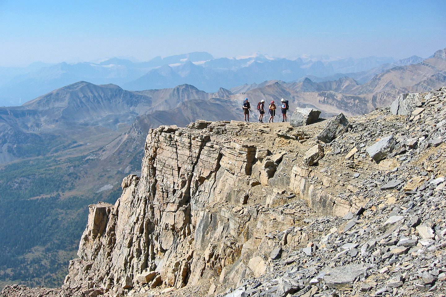
We followed the drainage as it turned left before reaching a pleasant clearing at the base of the mountain. From there, an obvious gully leads to the ridge crest. A break in the cliffs on our left took us to the crest with the summit block ahead of us. We followed the west side of the base of the summit block, seeking a break in the cliffs to ascent. Finding one, we scrambled up to gain the top of the summit block. The summit was a short distance away.
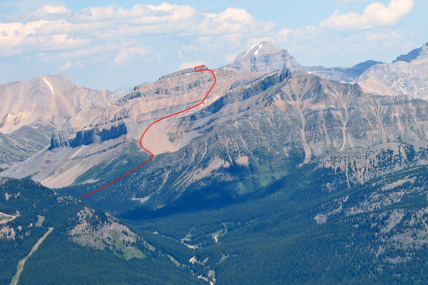
Our approximate route as seen from Sheol Mountain
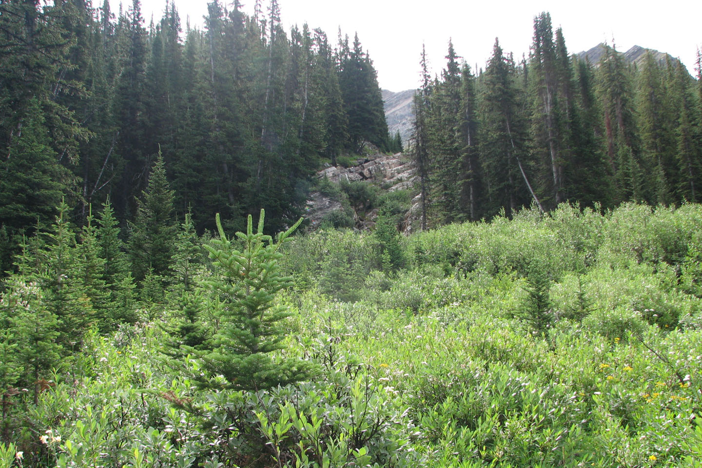
The ascent drainage seen from the trail. There's a faint path left by the trees.
View of the drainage after scrambling up the rocks
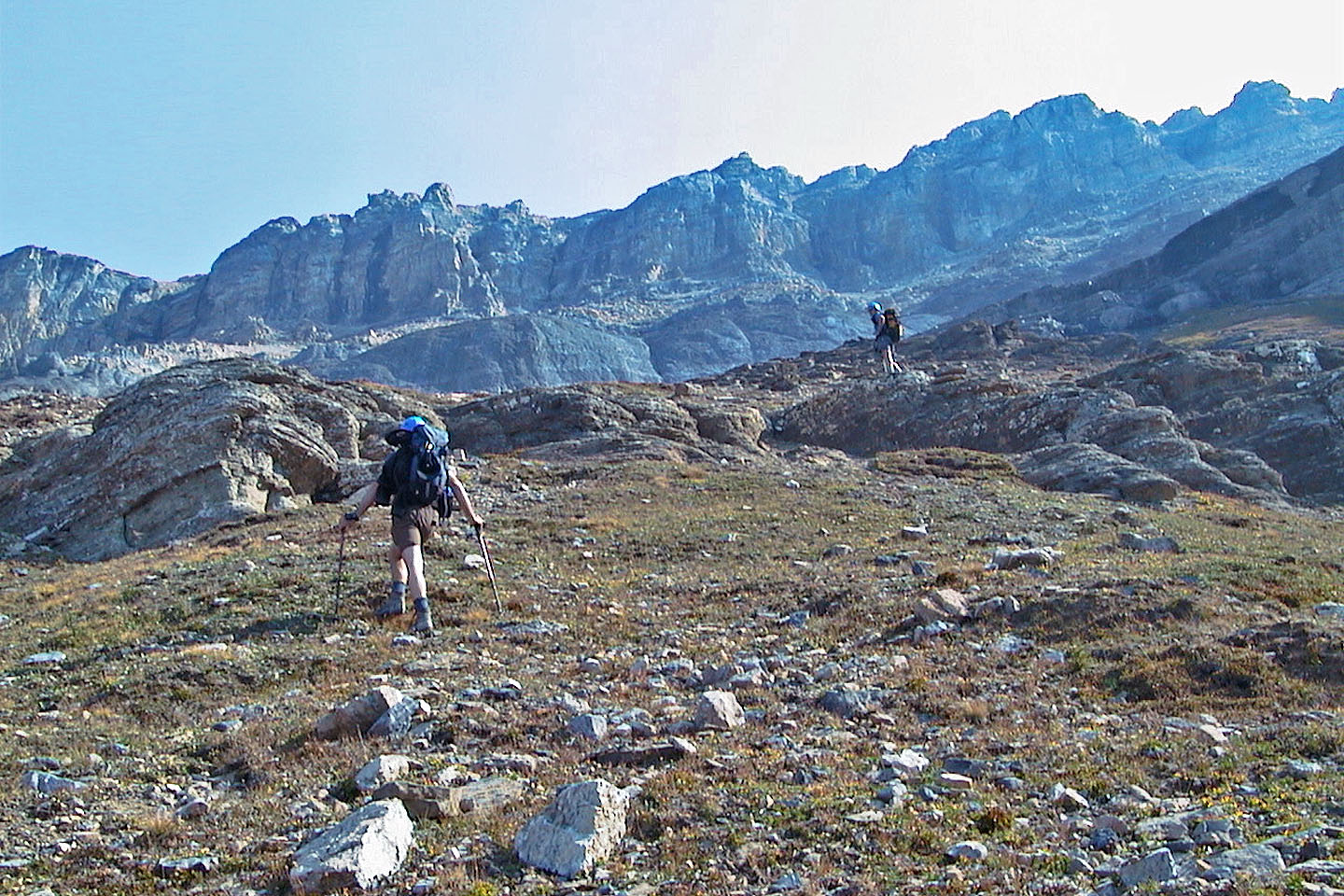
Around the corner, we ascended a ridge on the left side of the drainage where it opens up
A flat clearing above the gully before the scree provided a nice rest spot
We'll soon leave the scree bowl and start scrambling
Looking back as we head up to the ridge from the gully
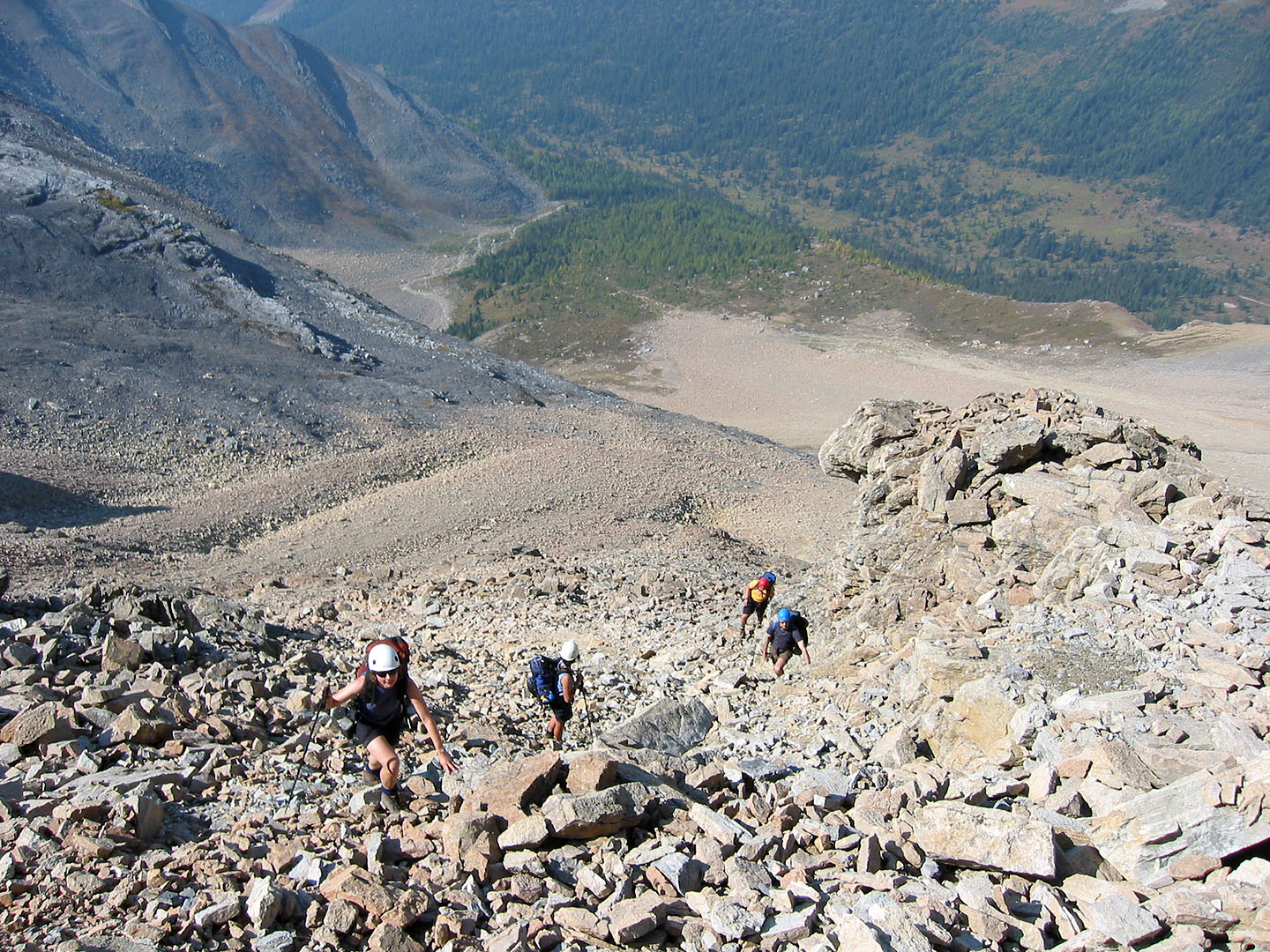
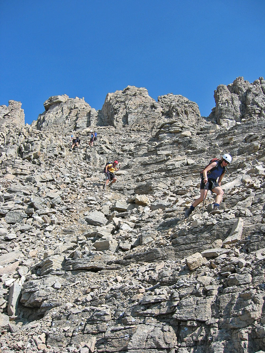
Scrambling up to the ridge
Looking back a short time later
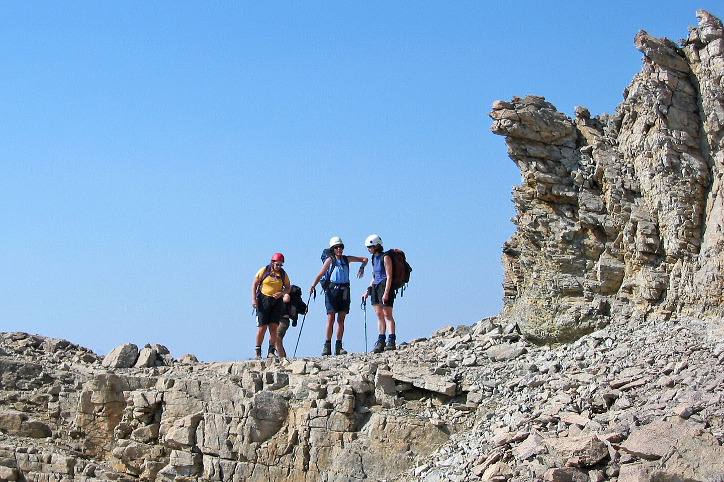
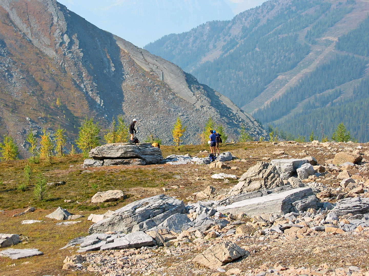
Pausing on the ridge crest
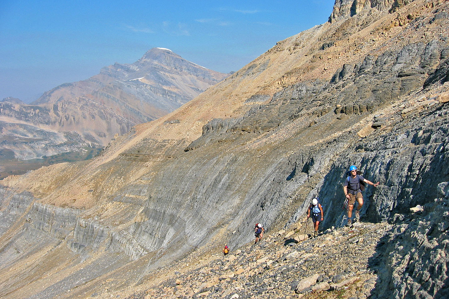
Heading to the summit block
The haze made it difficult to see much of anything
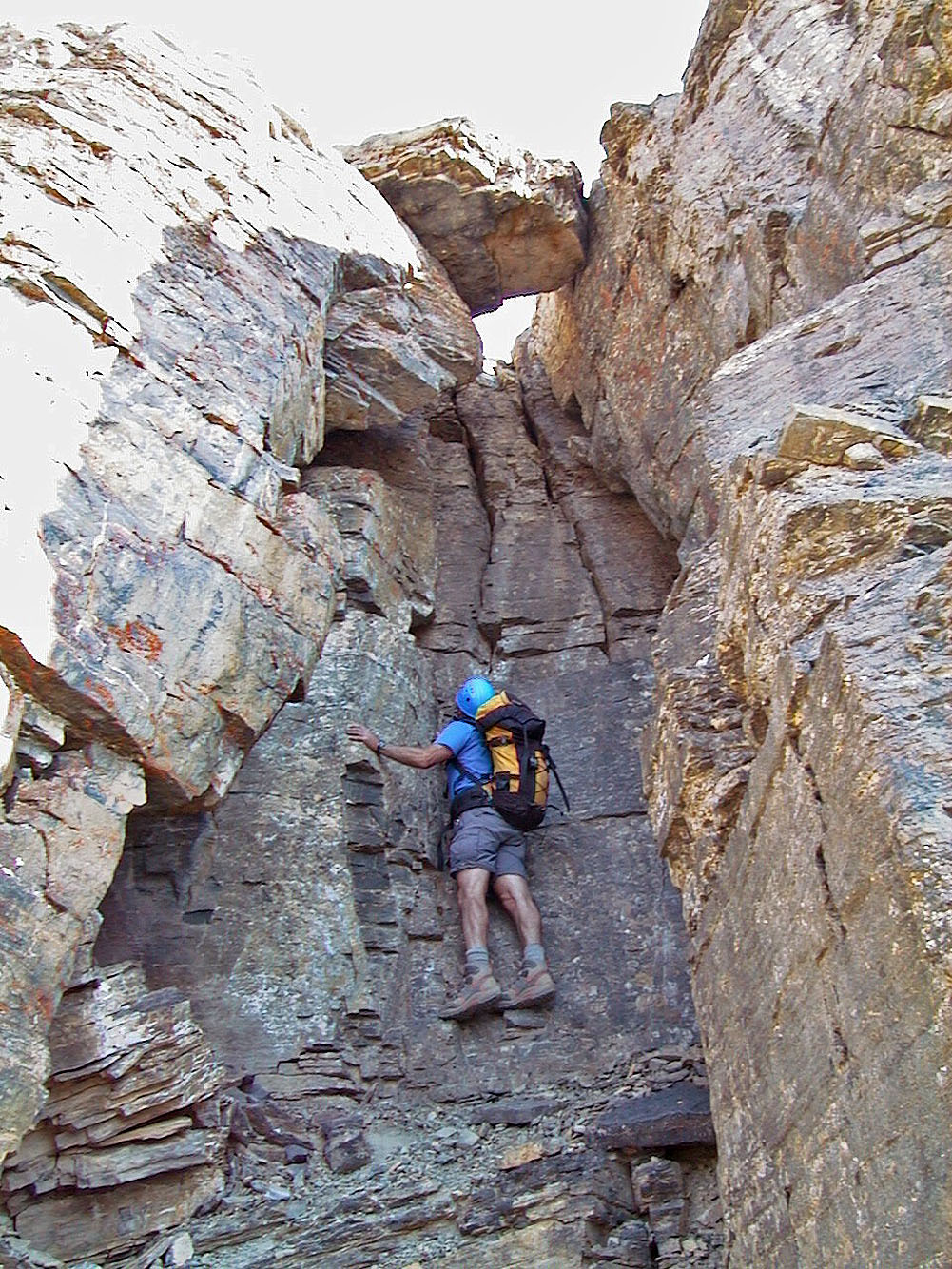
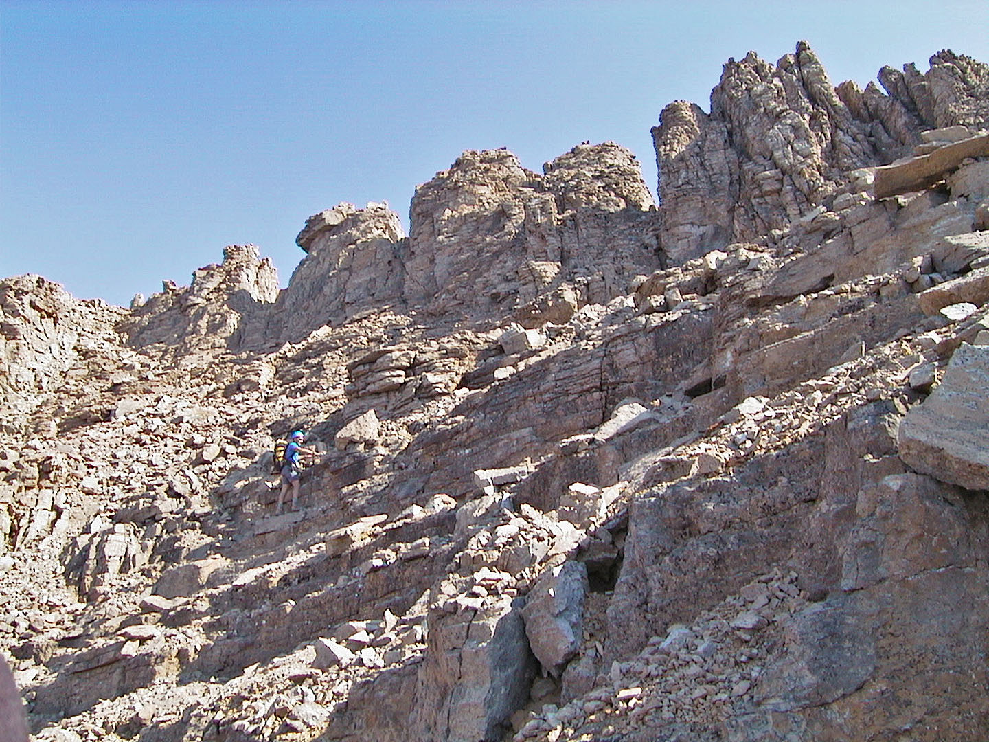
Checking out a way up to the summit block, which we didn't use
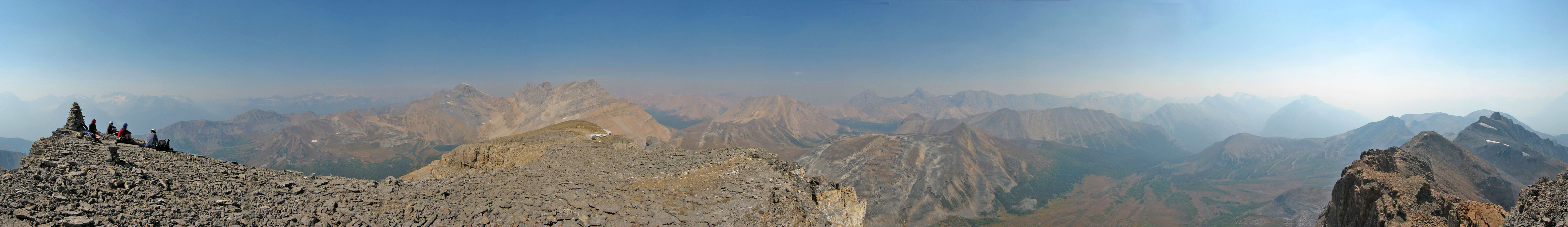
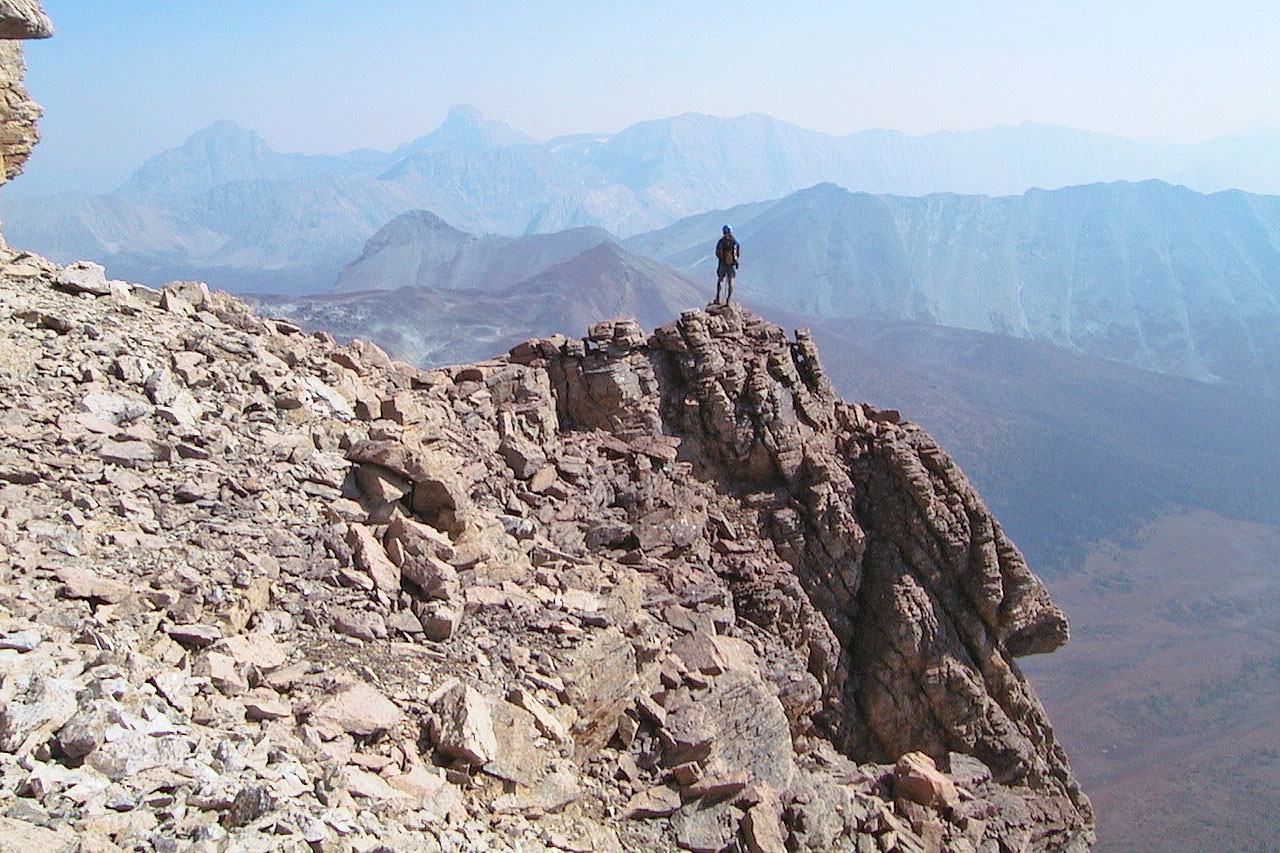
Looking back after gaining the summit block. Mount Richard, Pika Peak and Ptarmigan Peak in the background.
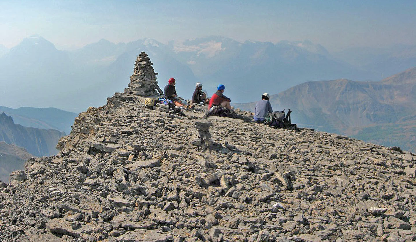
Relaxing by the summit cairn
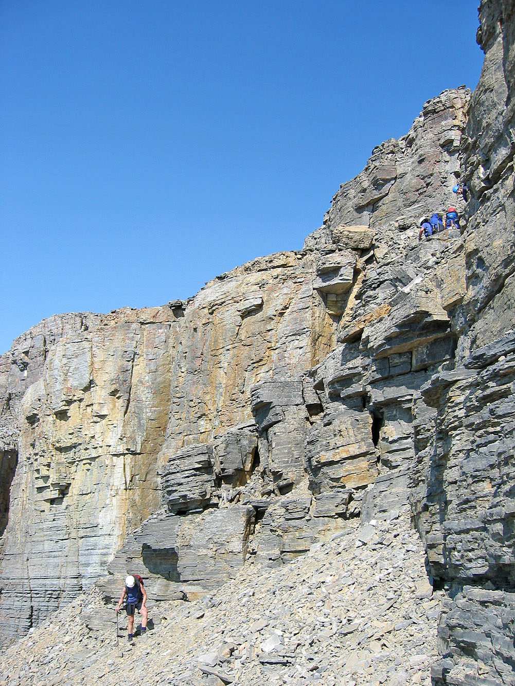
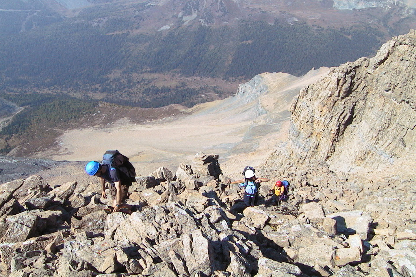
Descending the summit block, a difficult scramble here
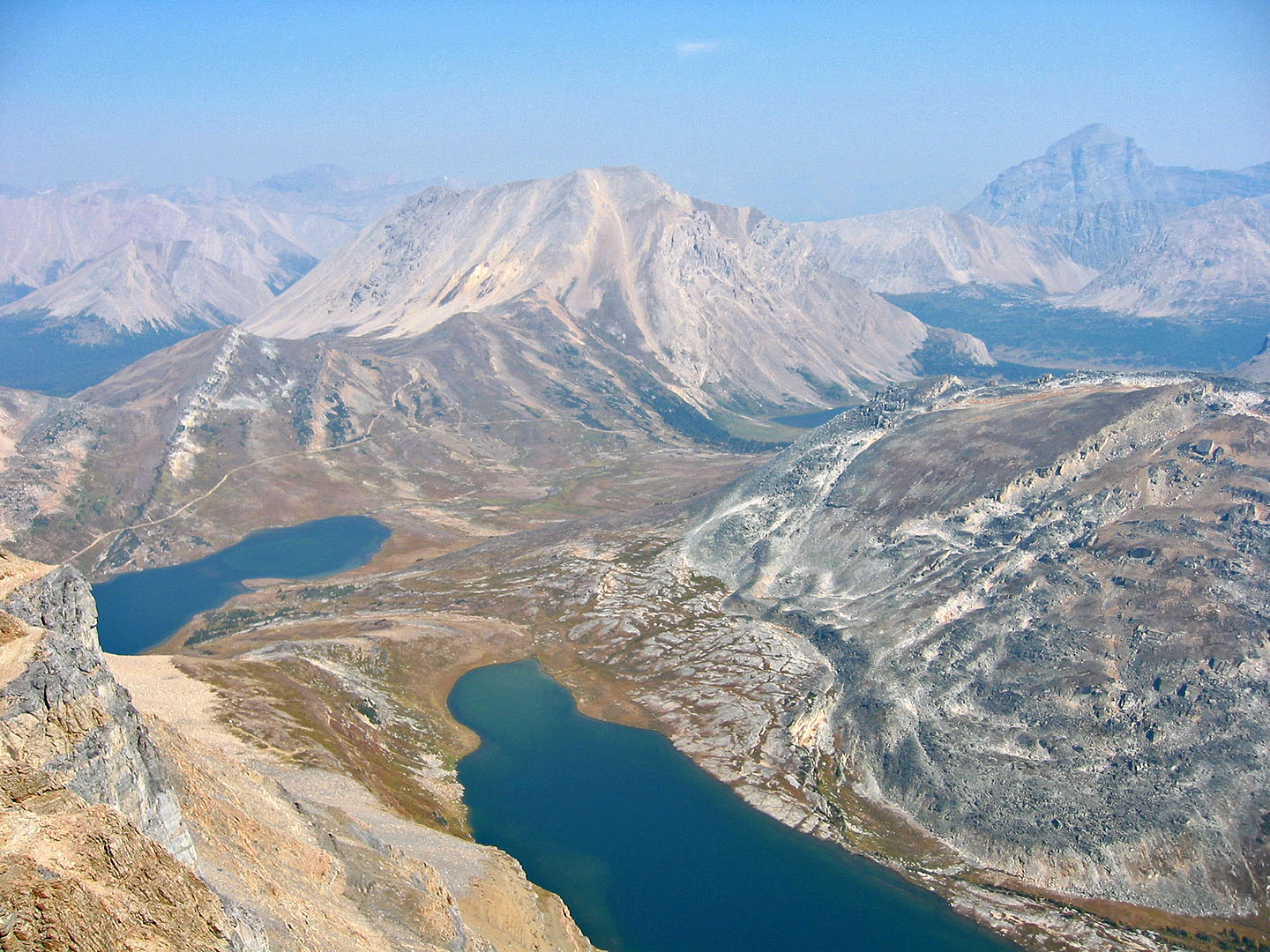
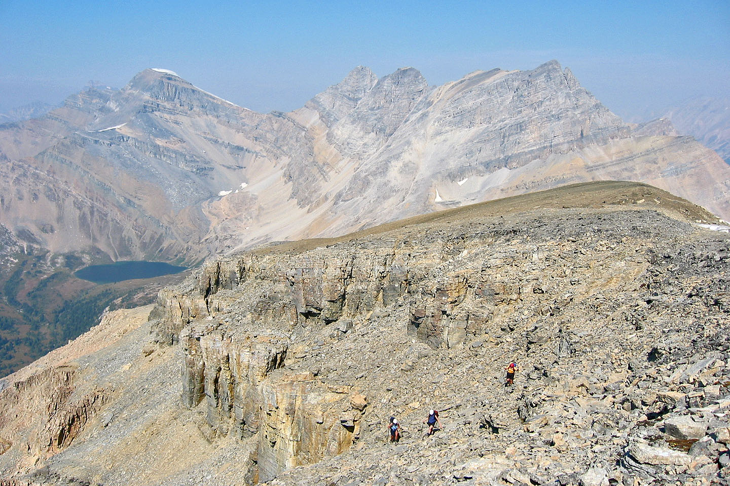
Fossil Mountain (centre) rises above Ptarmigan and Redoubt Lakes
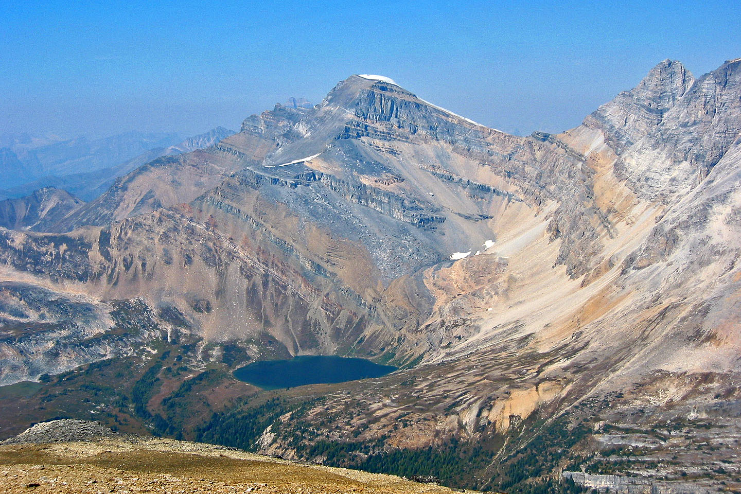
Mount Richardson and Hidden Lake
Heading back along the base of the summit block
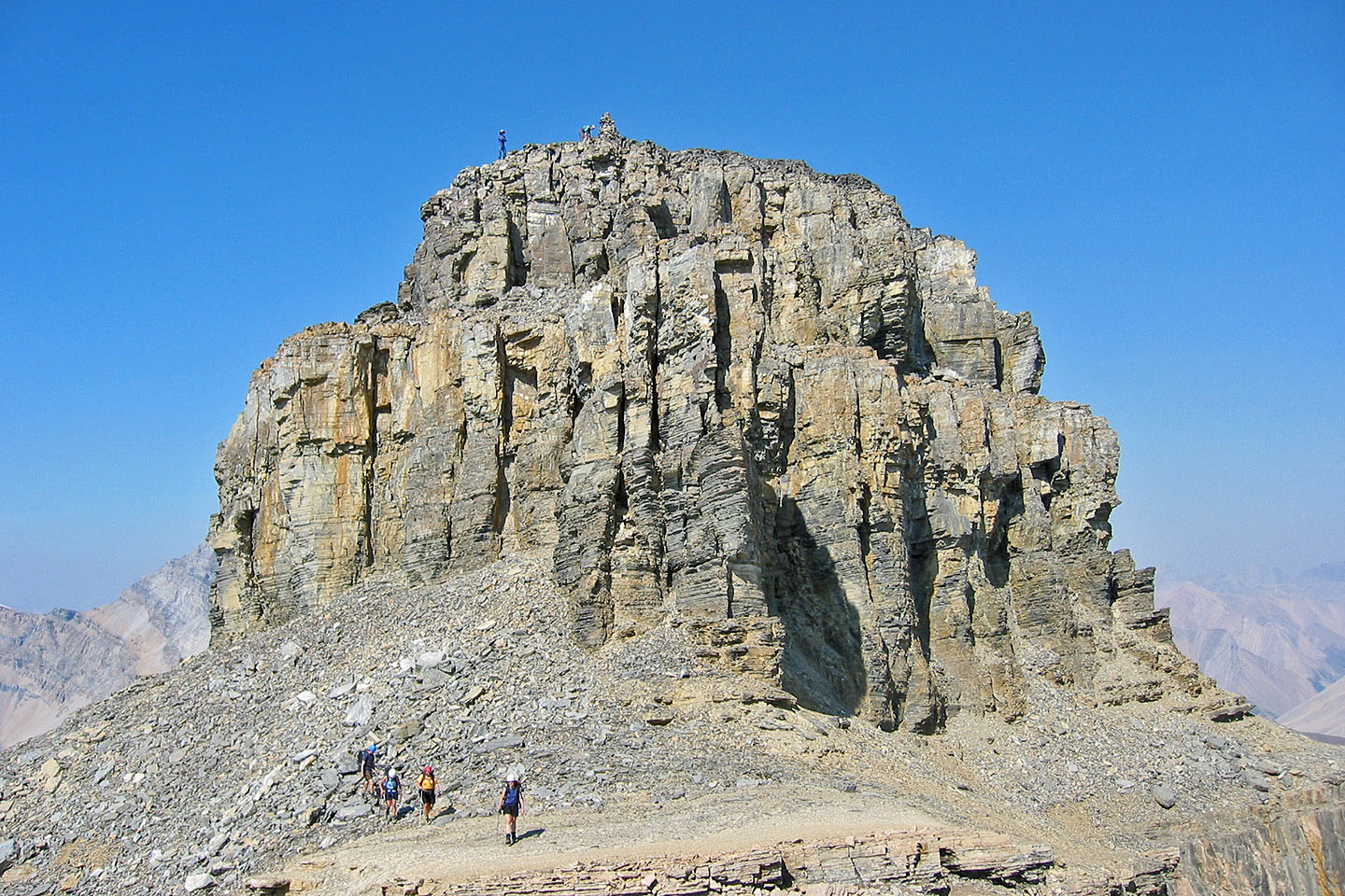
Leaving the summit block. Note the figures on top, not part
of our group.
Heading back down from the ridge
82 N/8 Lake Louise