bobspirko.ca | Home | Canada Trips | US Trips | Hiking | Snowshoeing | MAP | About
Boundary Peak
Jasper National Park, Alberta
August 20, 2016
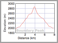
Distance: 7.6 km (4.7 mi)
Cumulative Elevation Gain: 896 m (2940 ft)
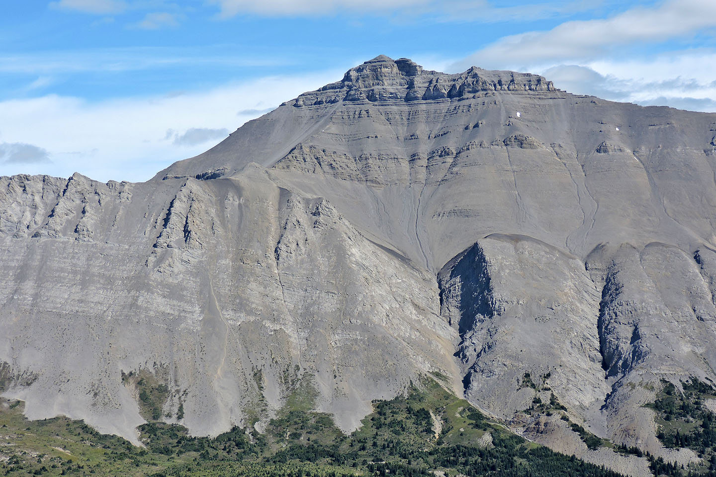
If the number of Internet postings is any indication of a peak’s popularity, then Boundary Peak hits the mark and for a good reason. This peak is little more than a hike, most of it on a trail, yet it provides magnificent alpine views, including a ringside seat to glaciated Mount Athabasca. It’s enough to justify the 3.5-hour drive from Calgary.
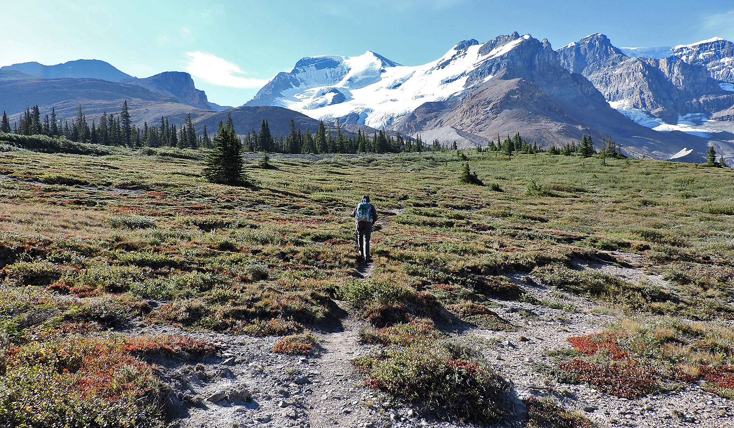
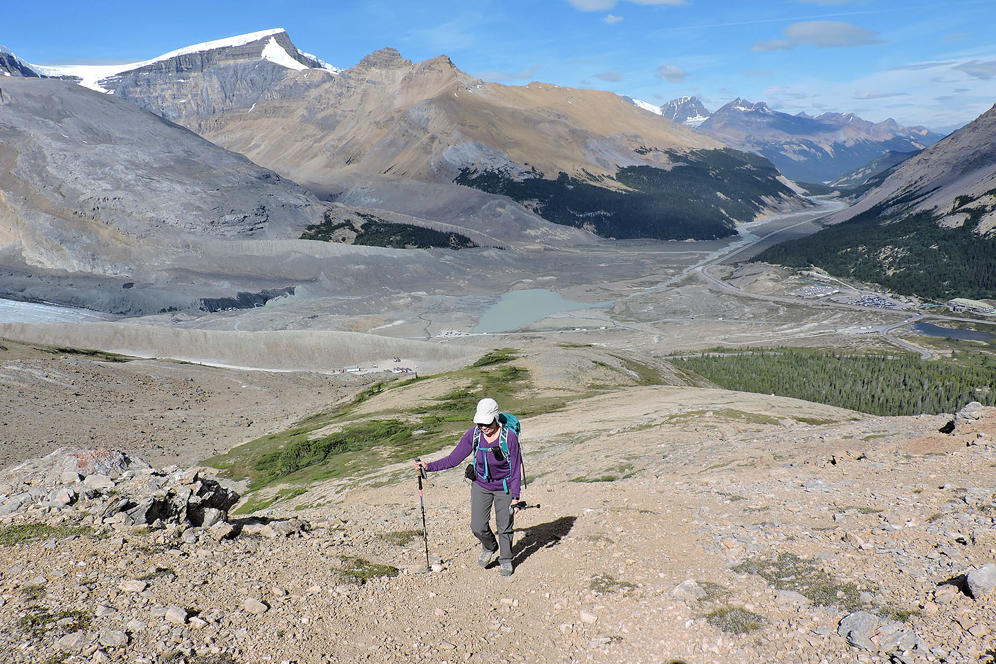
The trip begins at the parking lot across the highway from the Columbia Icefields visitor centre. The trailhead is a kilometre up an access road. The road is closed to public vehicles, but you can walk up it, mindful of buses constantly going up and down. To save time, not to mention pavement pounding, Dinah and I took a shortcut across the meadow to the road. Just before the road crosses a culvert, we found the trail. It starts up an open slope and leads to the base of the northwest spur of Boundary Peak. From there one can ascend the spur or hike up the meadow on the left. We climbed the spur but took the meadow on our descent.
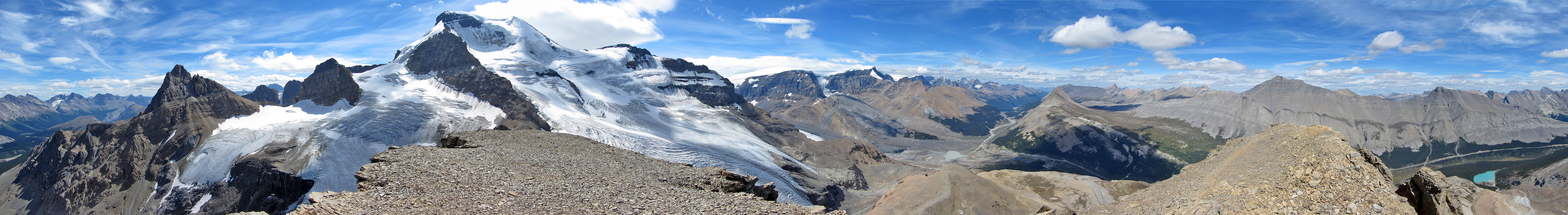
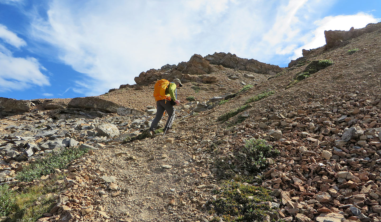
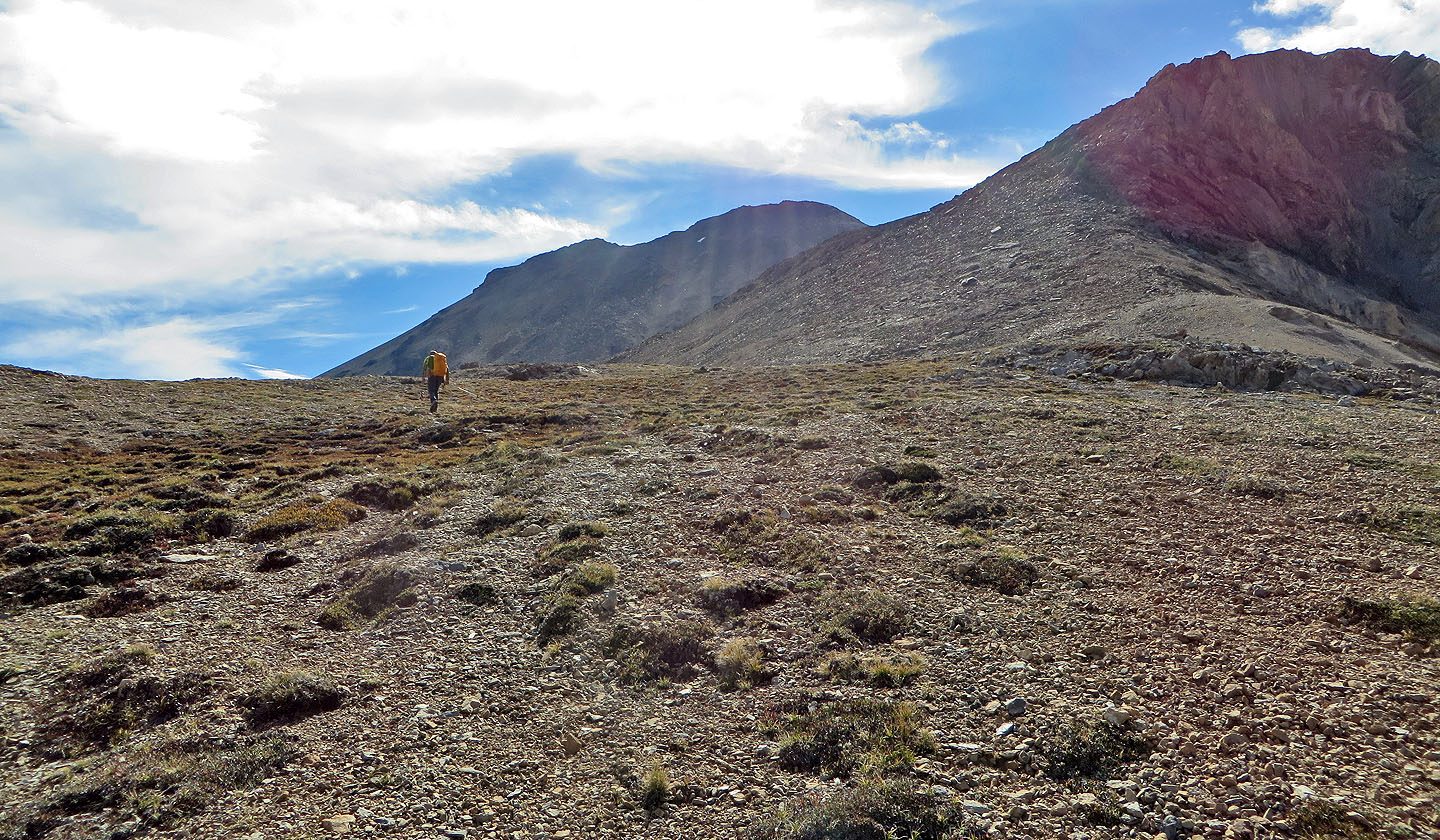
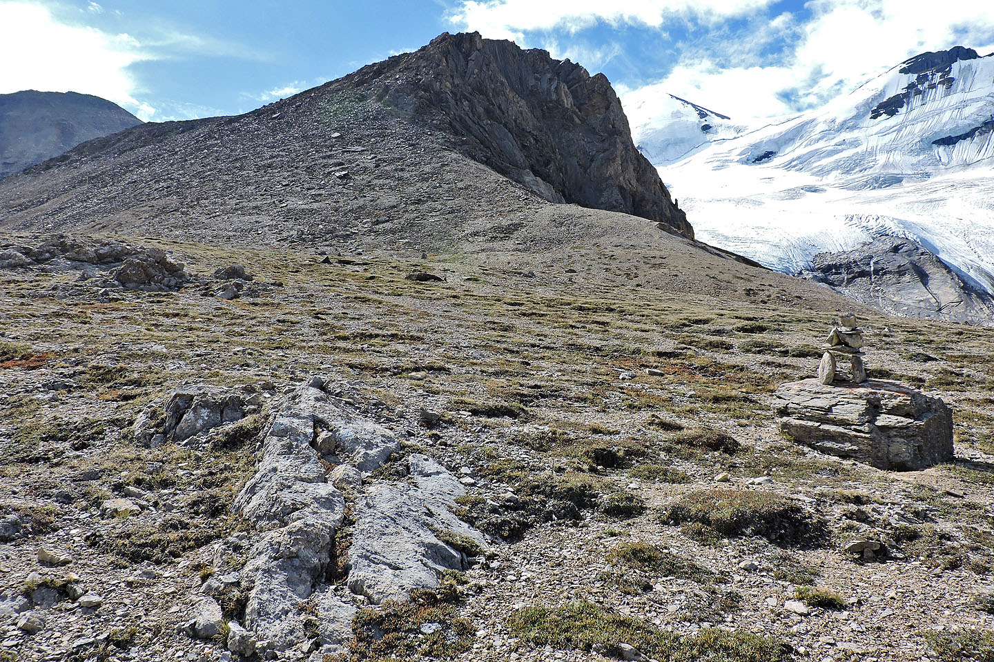
From the broad spur, we studied the west slope of Boundary Peak in front of us. Two steep trails are etched into the scree slope. The one on our left was obvious but a bit out of our way. The one ahead was less distinct, but once we started up it, we had little trouble following it. We slogged our way to the ridge. Turning right, we took the crest trail and easily scrambled up two metres of rock to reach the spacious summit of Boundary Peak.
On top, we met two young guys relaxing, Tao and Peter. They’re from Comox Valley on Vancouver Island and are on an impressive bicycle tour. Peter started from Anchorage, Alaska and joined Tao in Smithers, B.C. Cycling south, they are stopping along the way to take in hikes. Boundary Peak is just one of a few. They plan to cycle all the way back home.
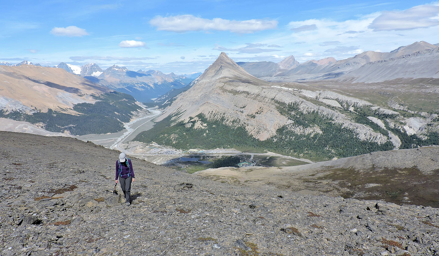
After sharing some stories with them, not to mention a few laughs, Tao and Peter headed back down. Dinah and I soon followed, retracing our steps down the west slope. At the base of the slope, we turned right to reach the meadow. We tried following trails to the meadow, but they had the annoying habit of disappearing. However, we reached the meadow and made our way back to our car.
As we expected, the Icefields Parkway was busy, sightseers and lumbering RVs slowed traffic, but at least we didn’t have to bike back home.
Taking the shortcut to the road. Boundary Peak on the left.
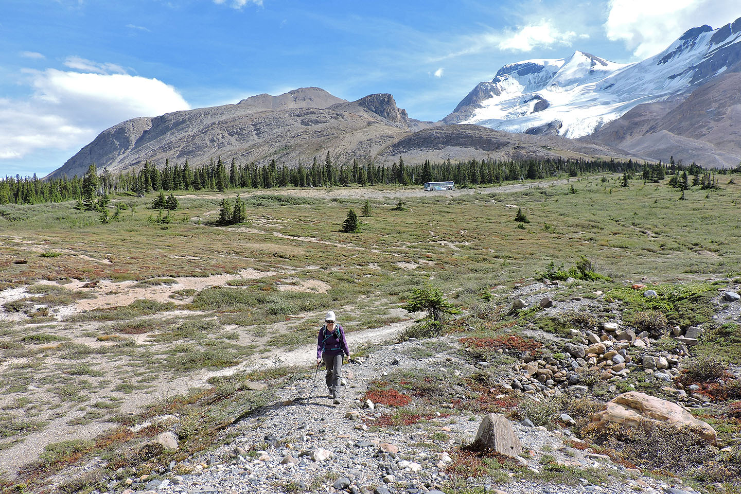
On the trail heading to the northwest spur

Athabasca Glacier in the background
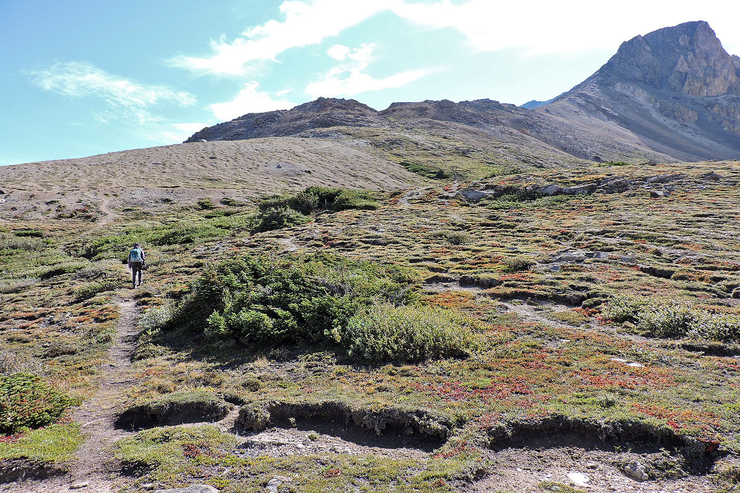
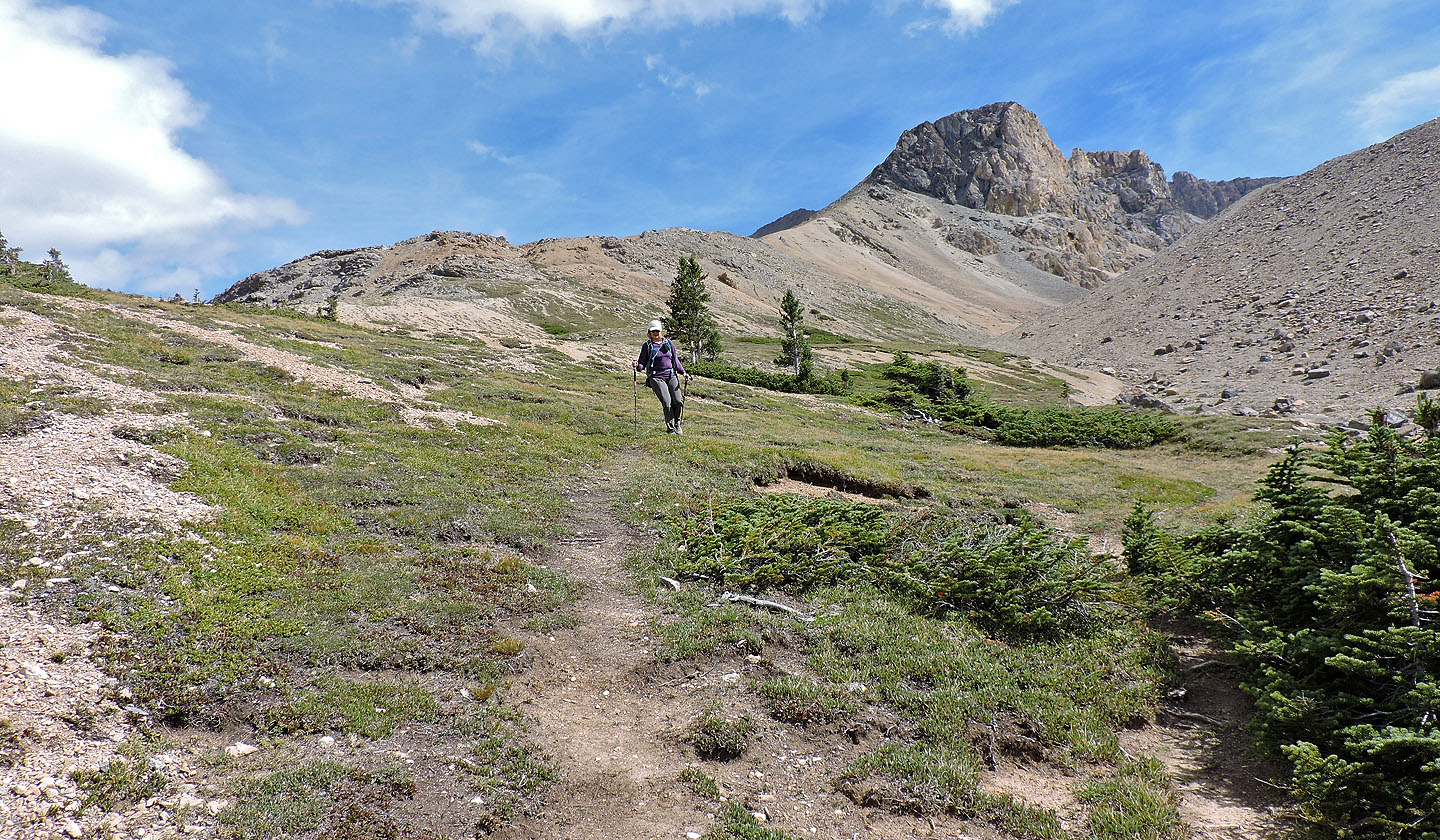
The trail follows the low ridge ahead
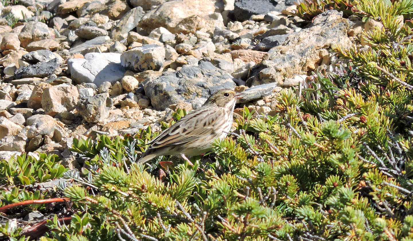
A sparrow forages for food in a low spruce
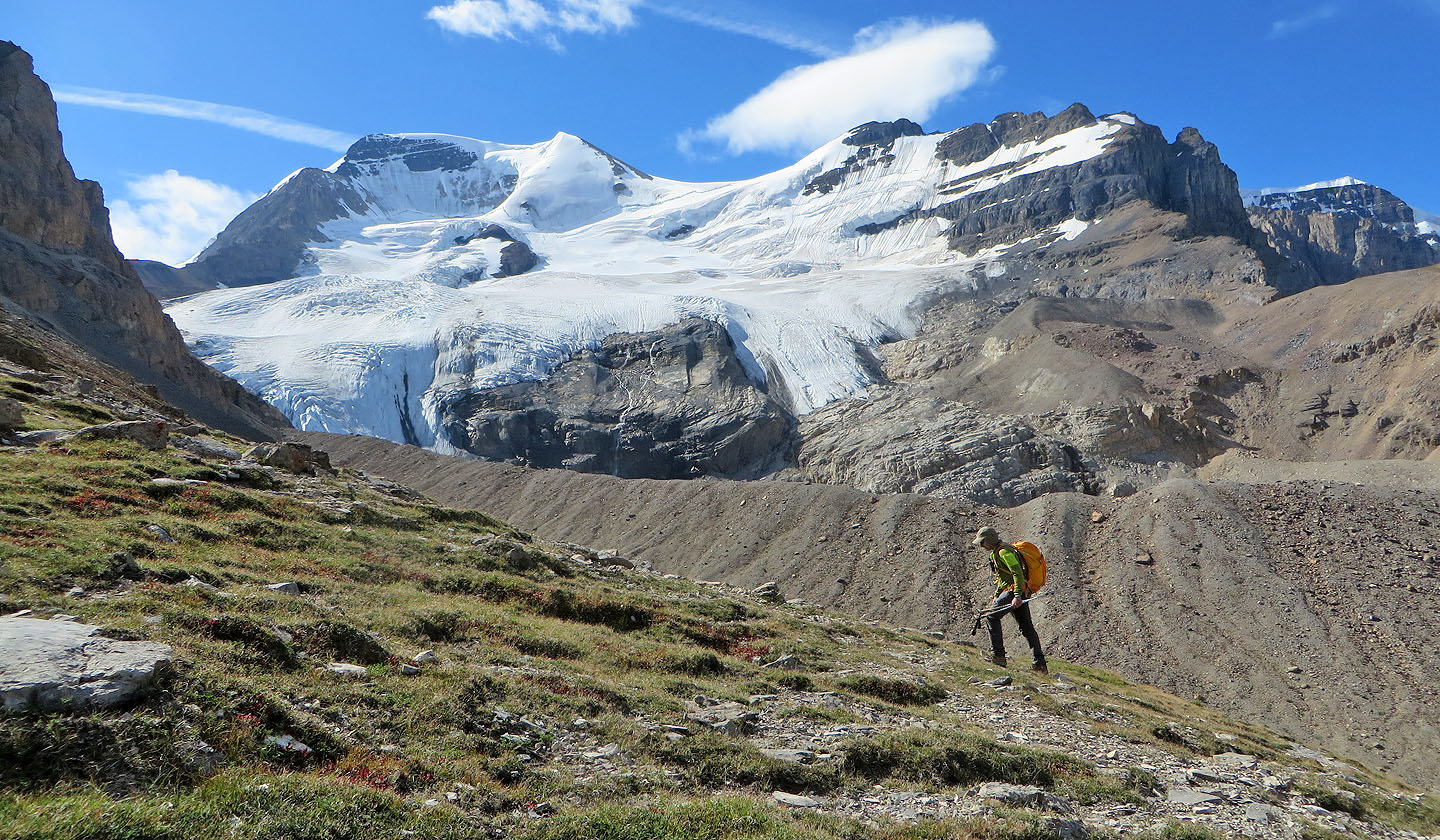
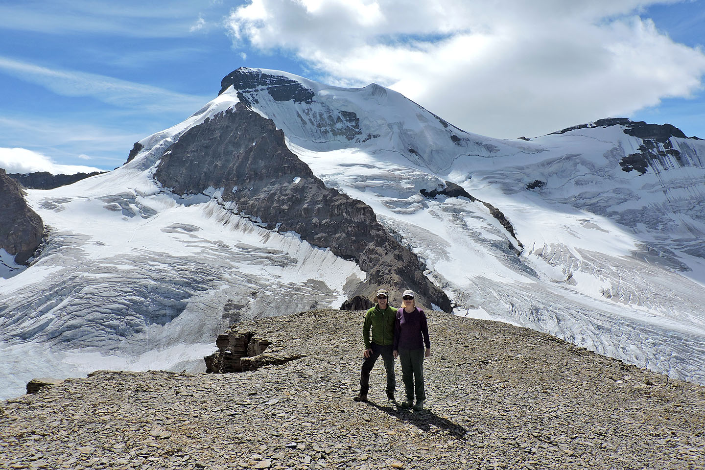
Mount Athabasca fills the view west (mouse over for a closer look)
Continuing up the trail
Looking back
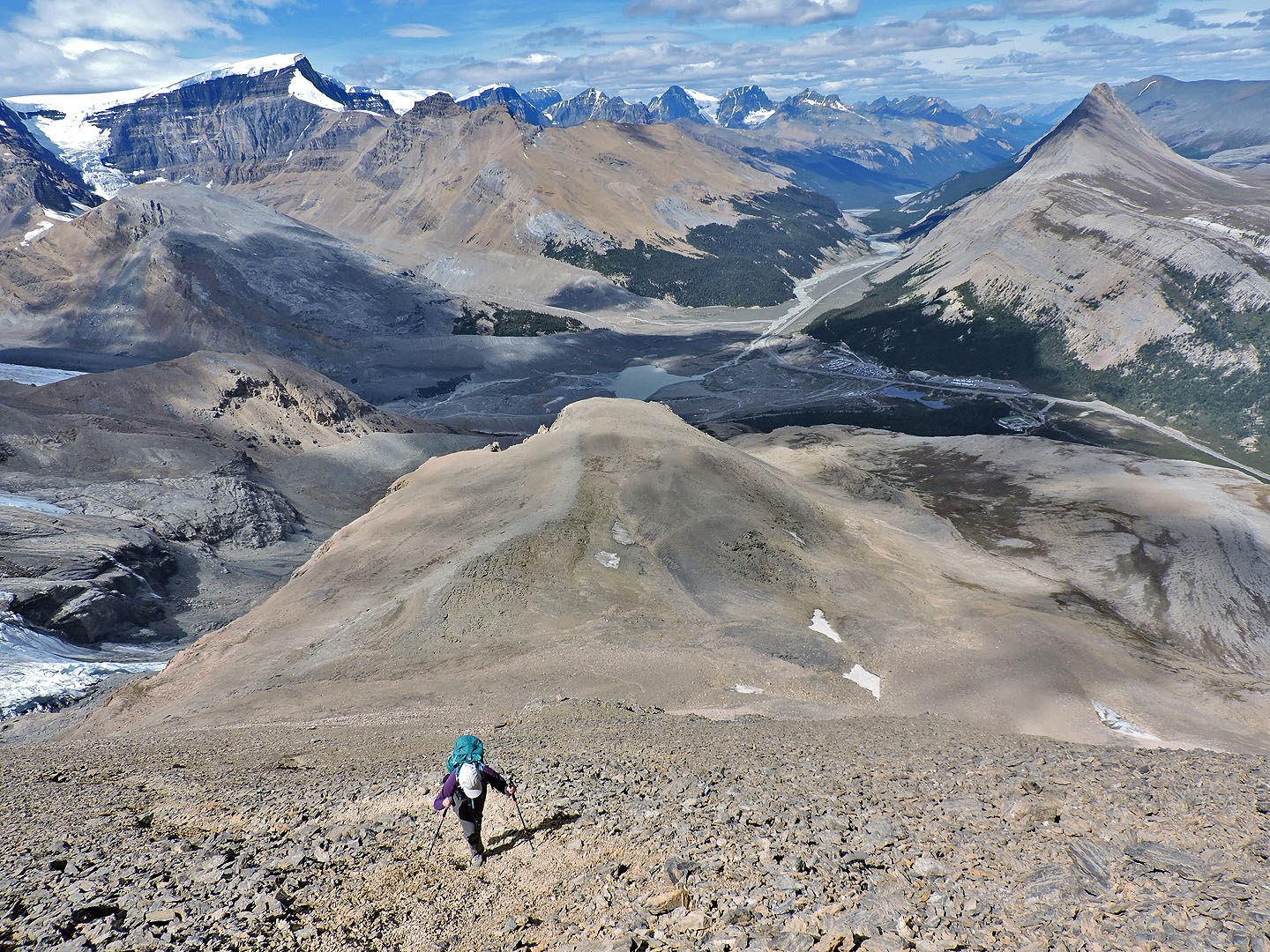
We climbed the spur (right) but used the meadow on our descent. The summit is in the background.
The spur is easily ascended
On the spur looking back at Mount Wilcox
Mount Nigel lies east
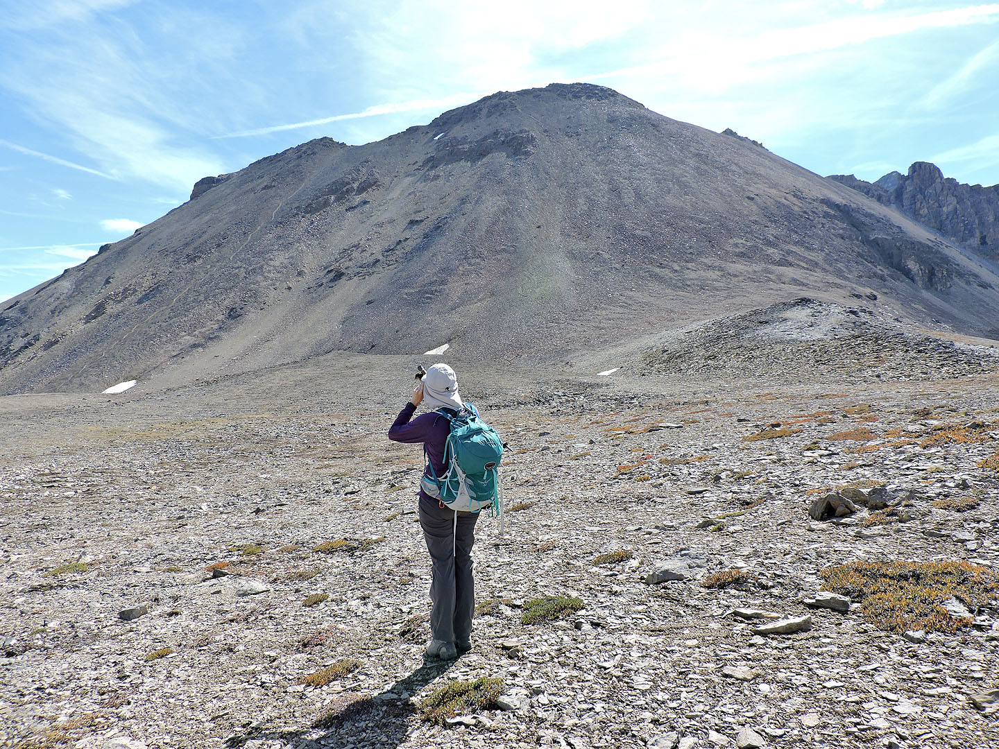
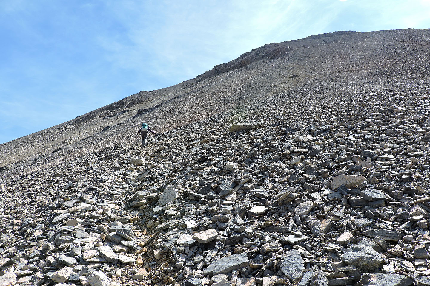
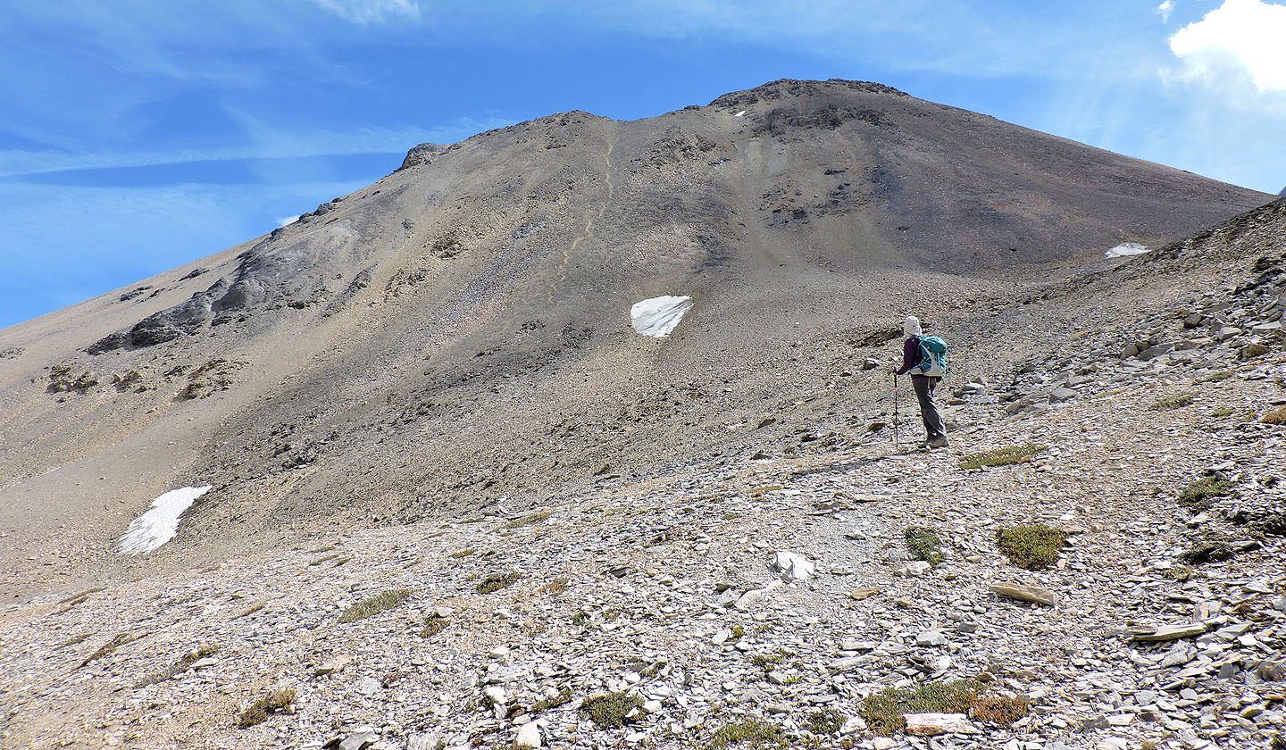
Looking at the west slope from the spur: the trail on the left is obvious, but the trail below the summit is
much less apparent
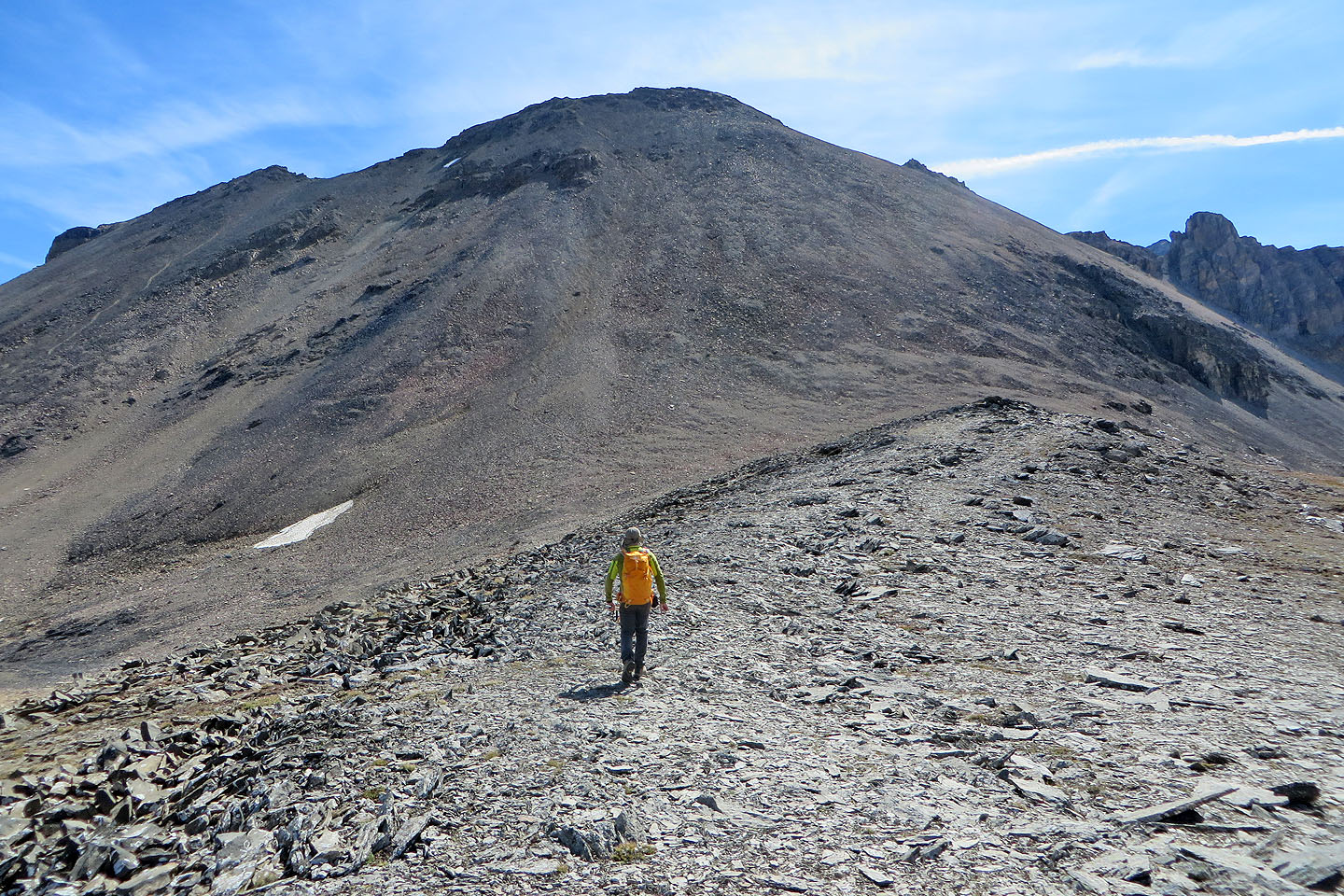
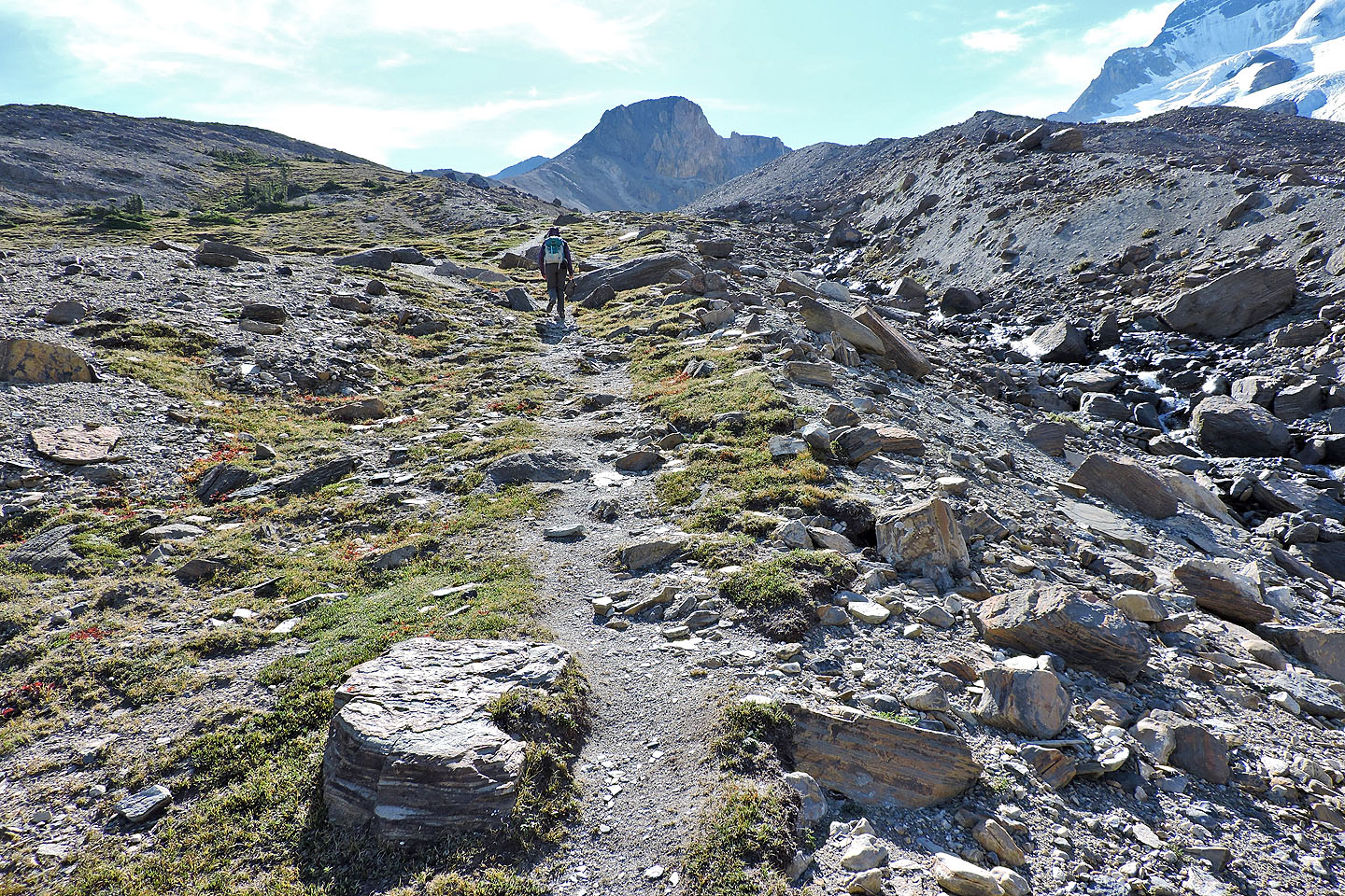
We headed to the lower slope ahead
When we saw the trail, we headed to it
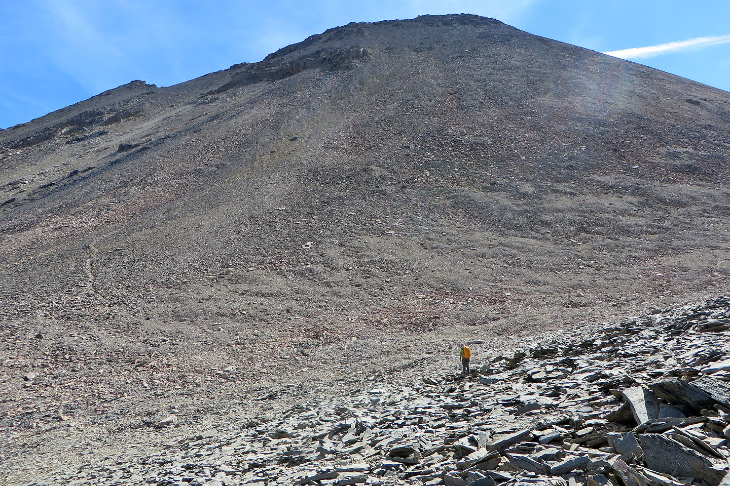
Going up the trail
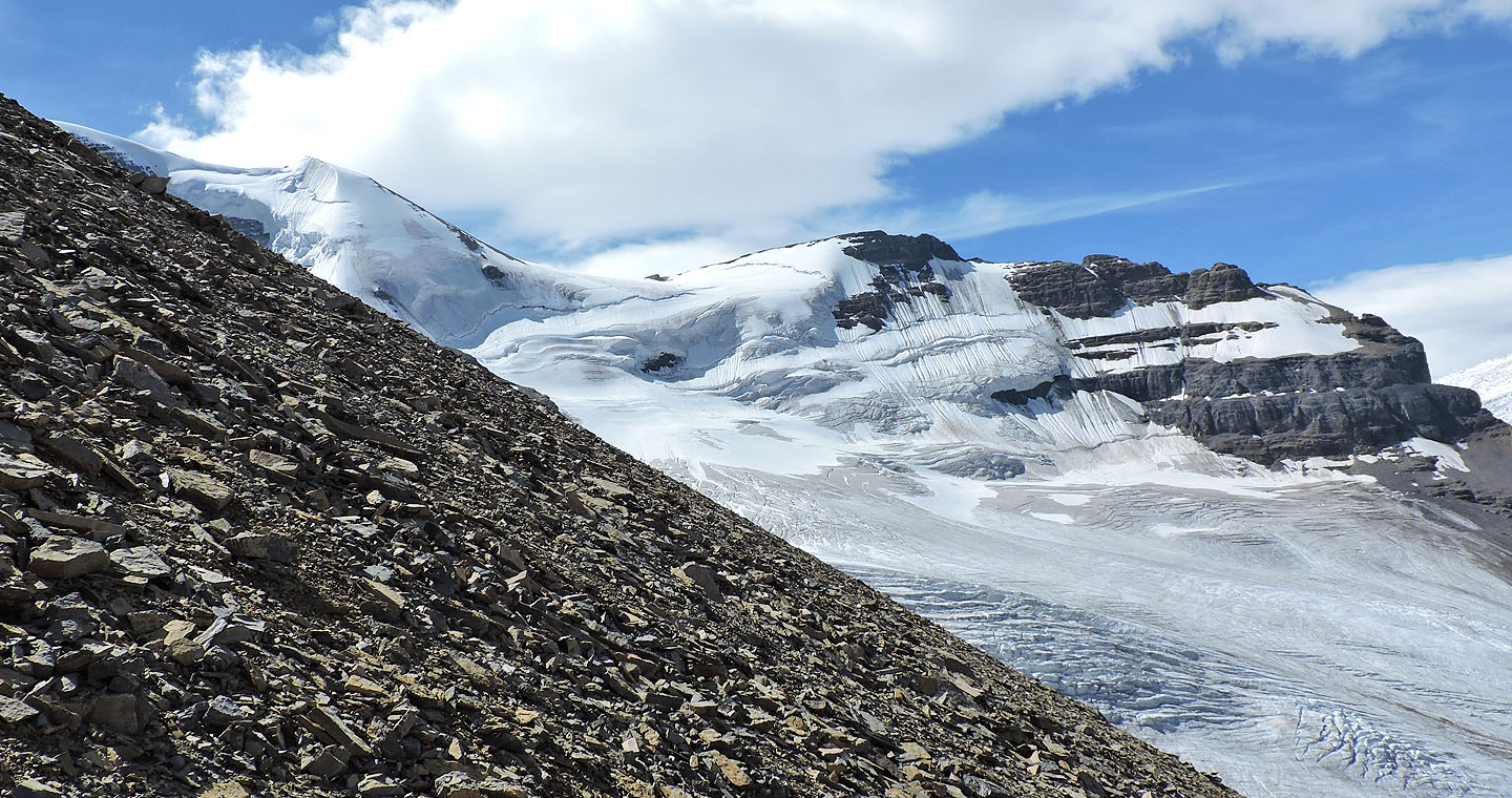
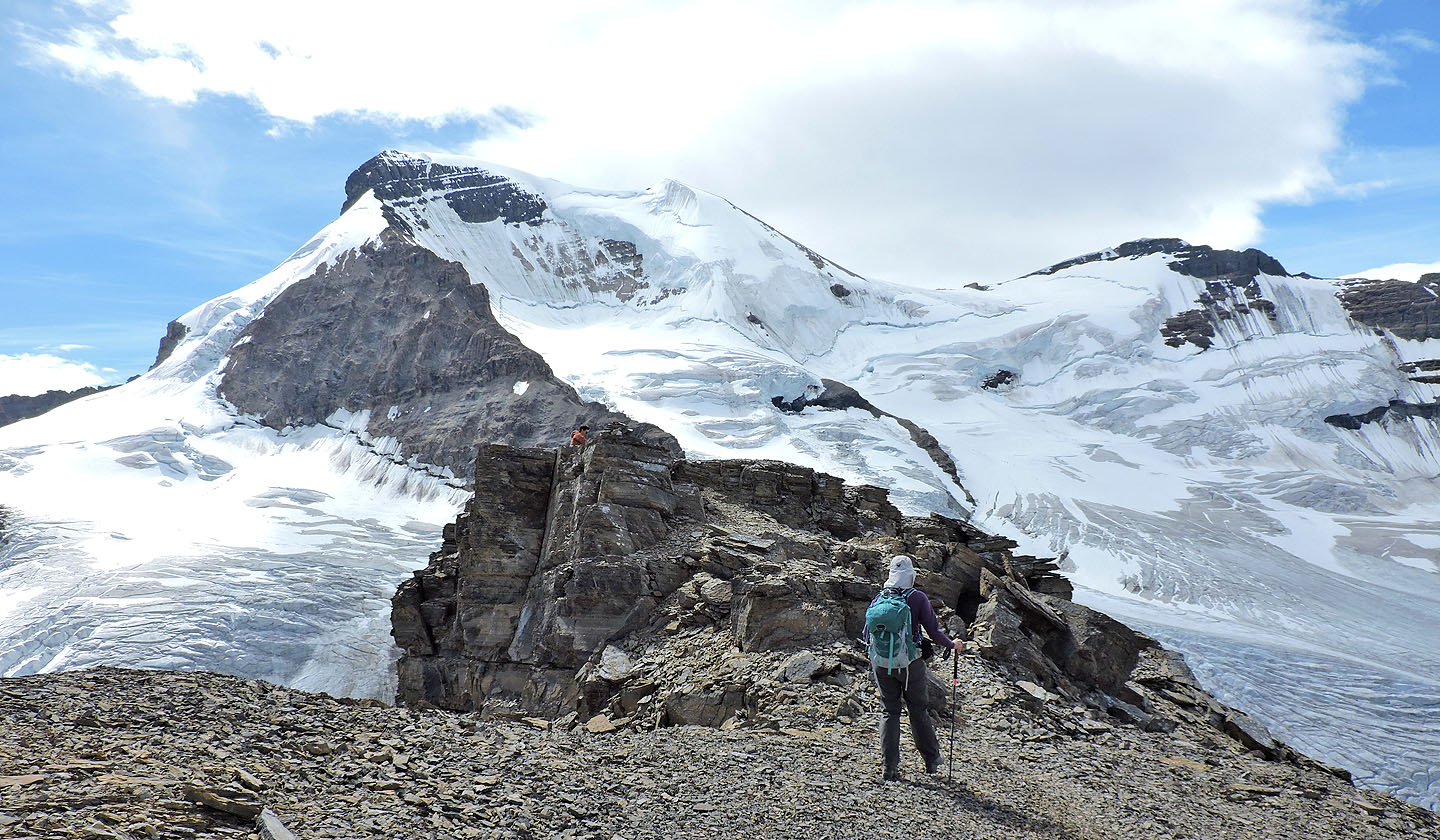
Meanwhile, climbers descended a saddle on Athabasca (mouse over for a close-up)
Looking back
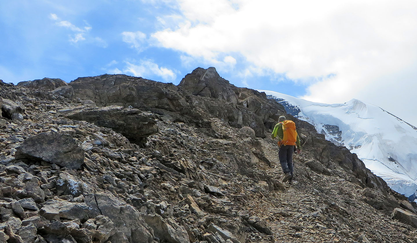
After reaching the ridge there's an easy two-metre scramble before the summit
Coming up to the summit
On the summit
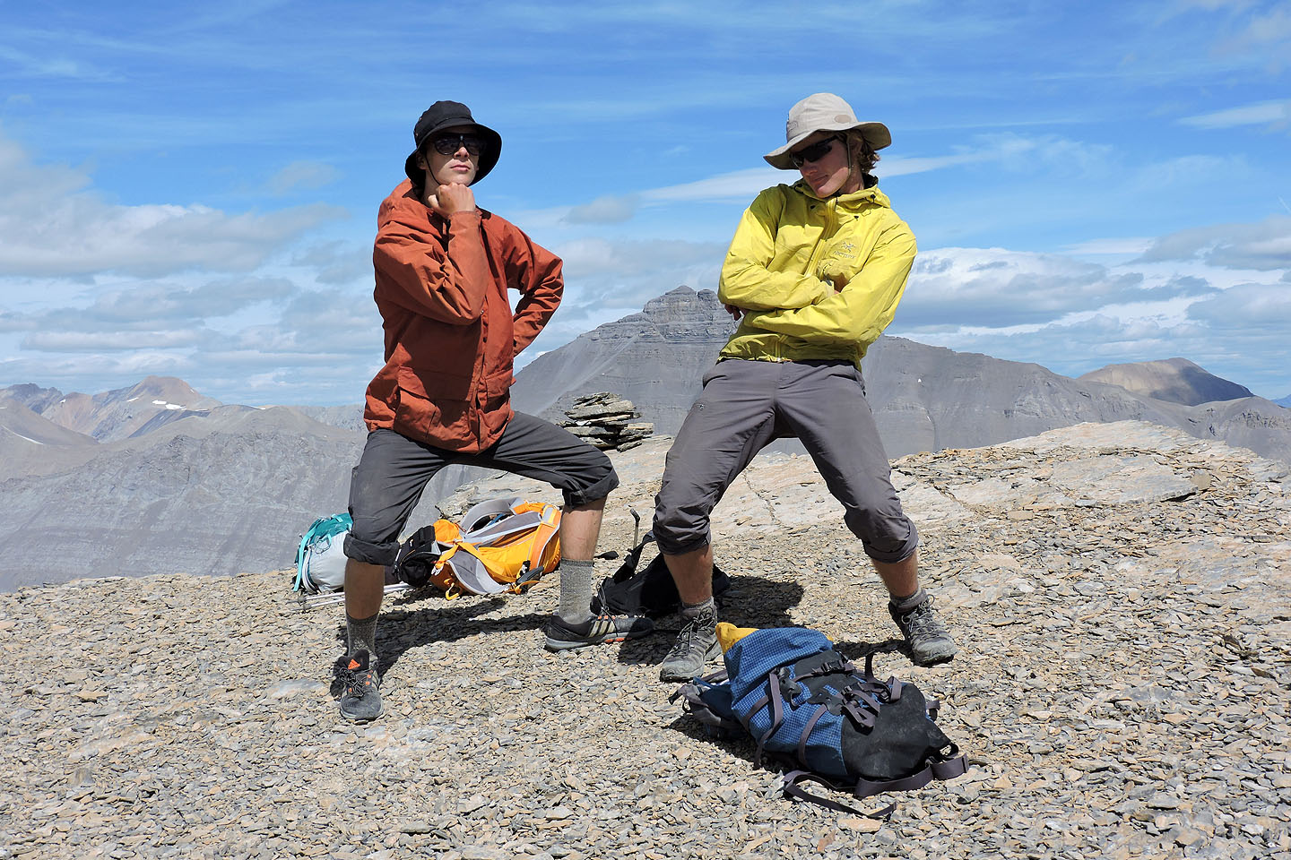
Long hours in a bicycle saddle apparently have left Tao and Peter unable to relax by the summit cairn
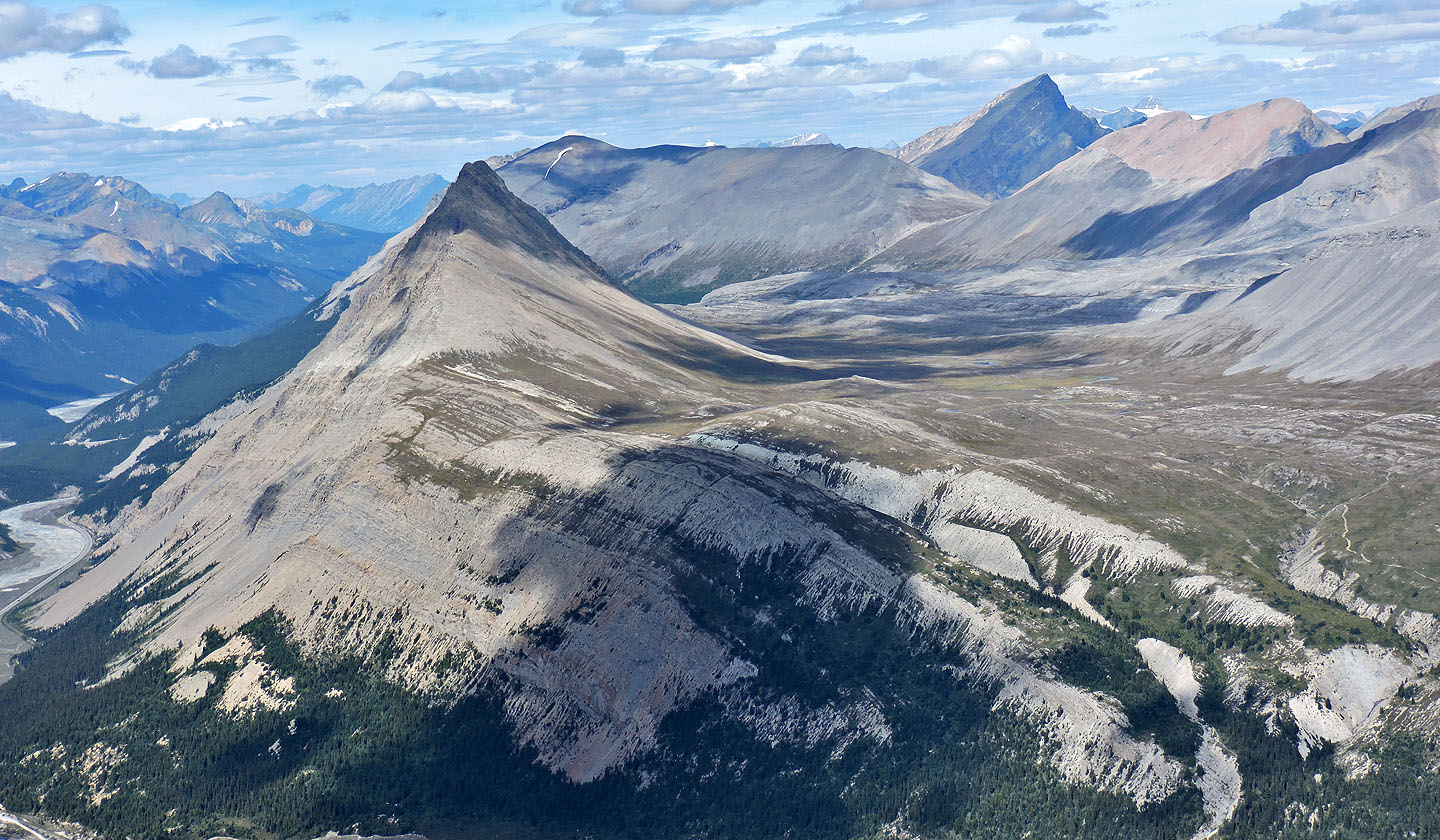
Mount Wilcox, Tangle Ridge and Sunwapta Peak
Looking back at the summit
Heading back down
Taking the shortcut from the road back to the parking lot
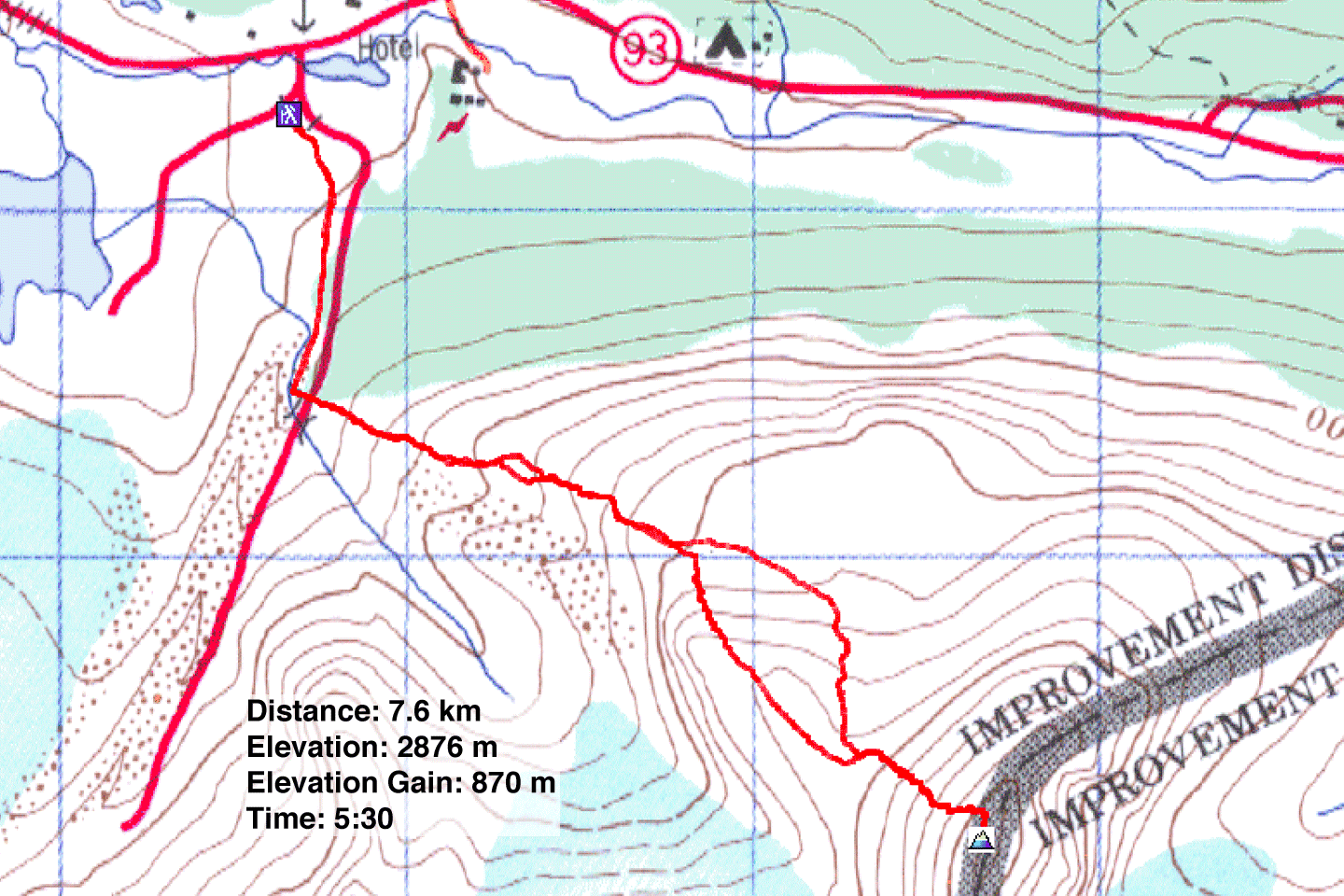
83 C/3 Columbia Icefields