bobspirko.ca | Home | Canada Trips | US Trips | Hiking | Snowshoeing | MAP | About
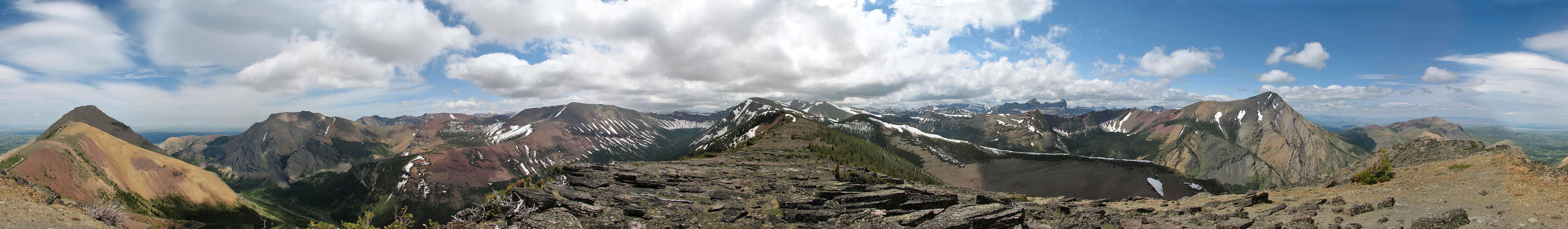
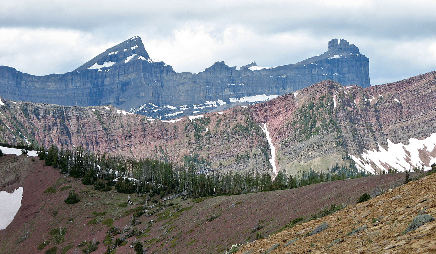
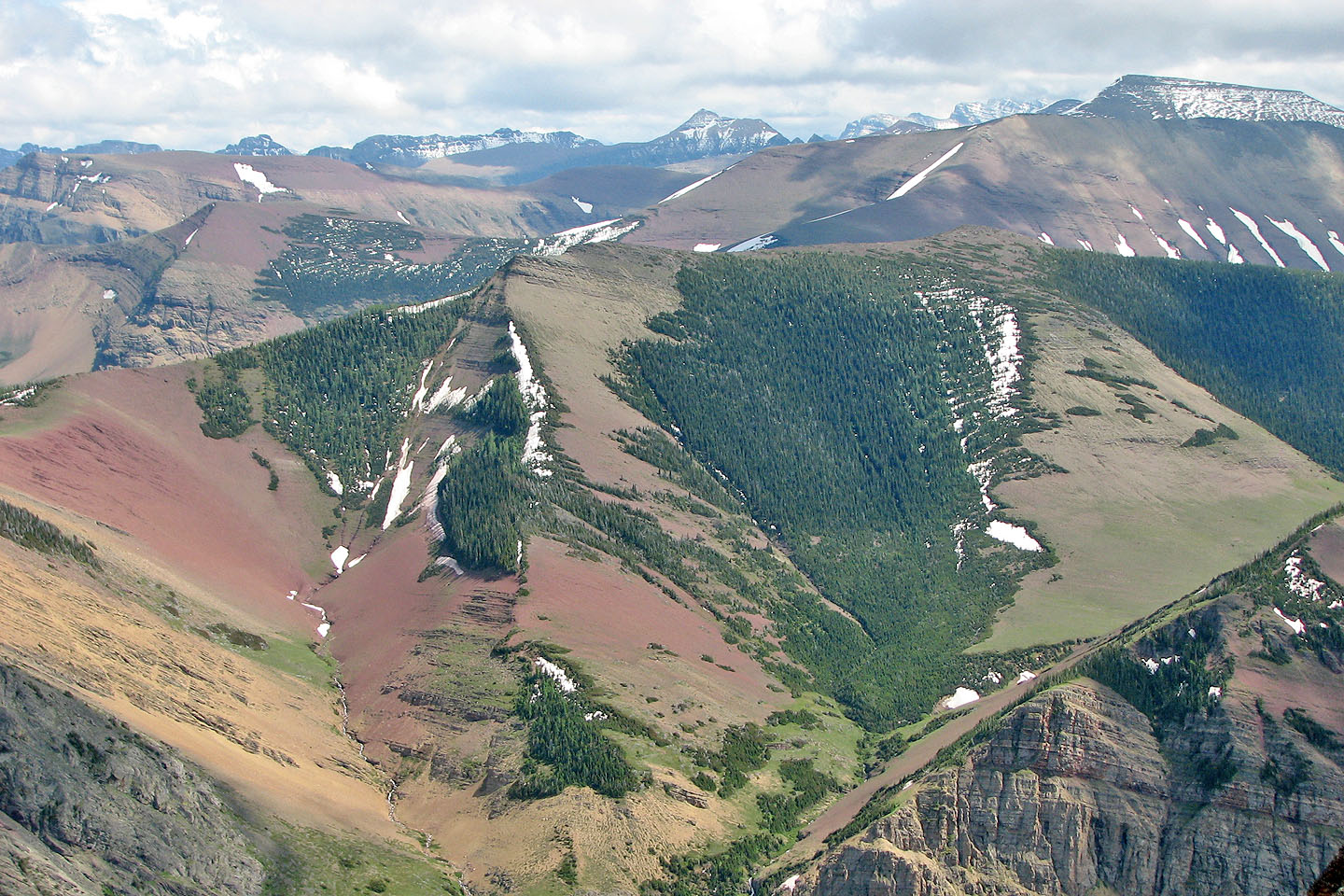
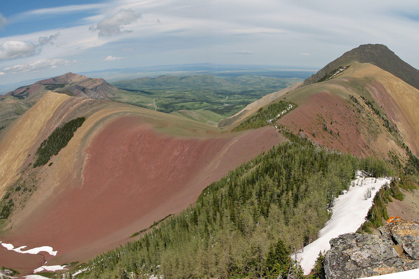
View from centre peak
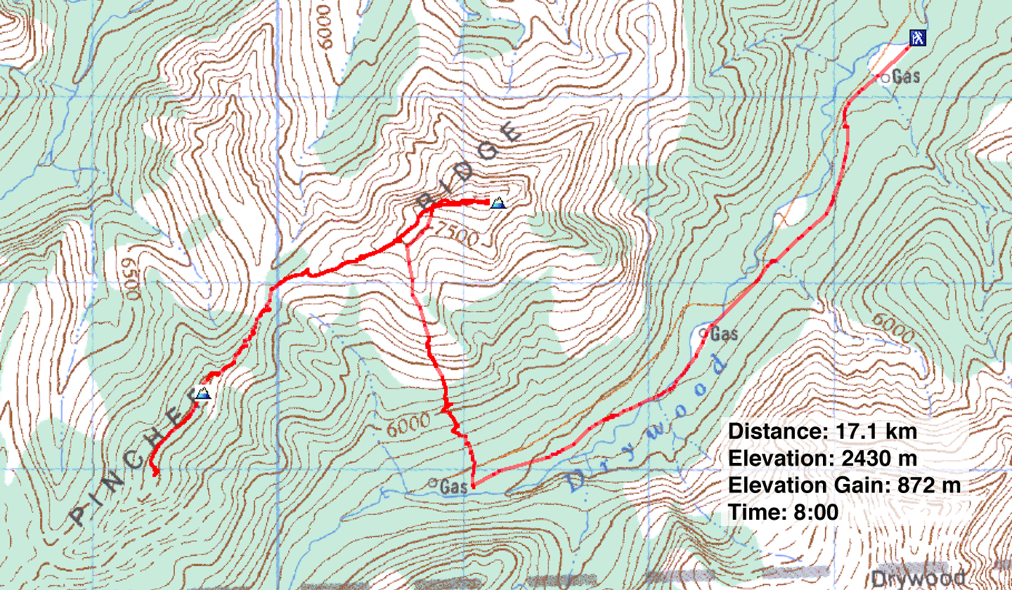
Pincher Ridge, North and Centre Peaks
Castle Provincial Park, Alberta
May 5, 2006
Distance: 17.1 km (10.6 mi)
Cumulative Elevation Gain: 1040 m (3412 ft)
I had two reasons to return to Pincher Ridge. I wanted to bag the peak after a failed attempt on the NE ridge, and I wanted to take in the colours of the area. The latter meant travelling farther down the ridge to ascend the centre peak, which was fine by me.
To reach the north peak, I used the SW ridge. Rather than hike up the road, I decided to cycle it. Unfortunately, strong winds conspired to make travel arduous. The headwind slowed my progress considerably and when the wind caught me sideways, it threatened to blow me off the road!
After a thirty-minute ride, I stopped 100 m before the end of the road where it takes a sudden dip. The right side of the road was wooded, but a dead tree provided a marker to find my bike. I stashed my bike behind the dead tree and set off into the trees. After taking a few steps I realized I was in an obvious corridor. By chance, I had found a hidden, crude path: someone had cleared the undergrowth and flagged a trail!
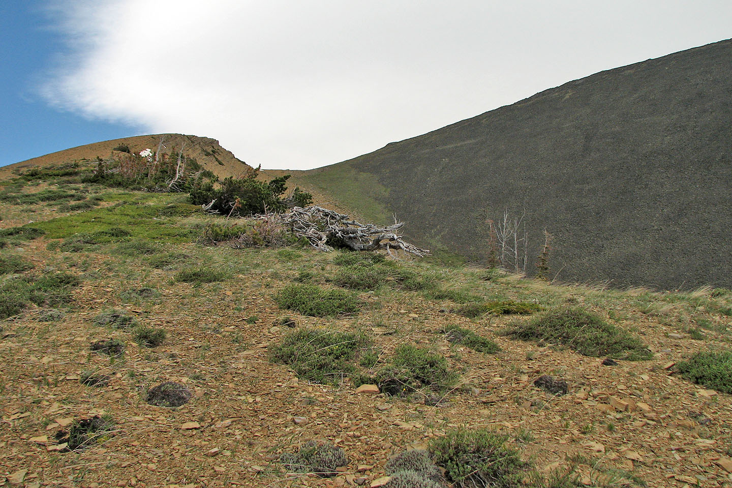
The trail led to the edge of the woods where it disappeared. From there I easily ascended the steep, grassy slope, but when I hit the scree my ascent slowed. Eventually the grade eased, my pace quickened, and the black summit came into view. After a thirty-minute break on the top, I descended to the col between the north and centre peaks. I looked back to view the coloured slopes and was not disappointed! The NE ridge was especially brilliant as if someone had poured different colours of paint over it.
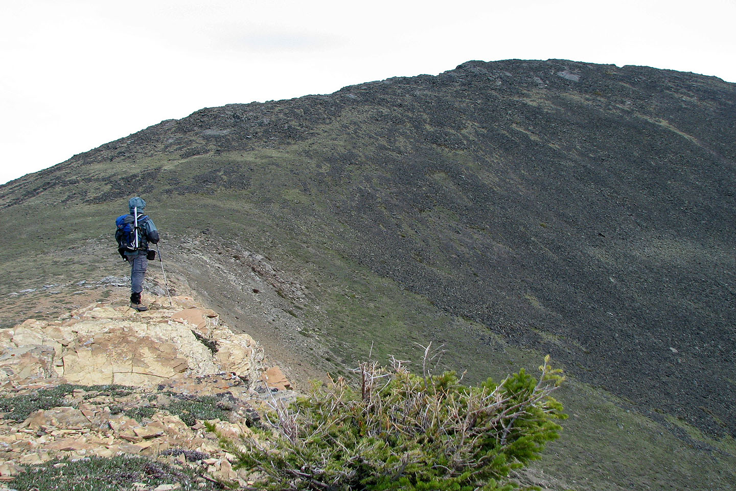
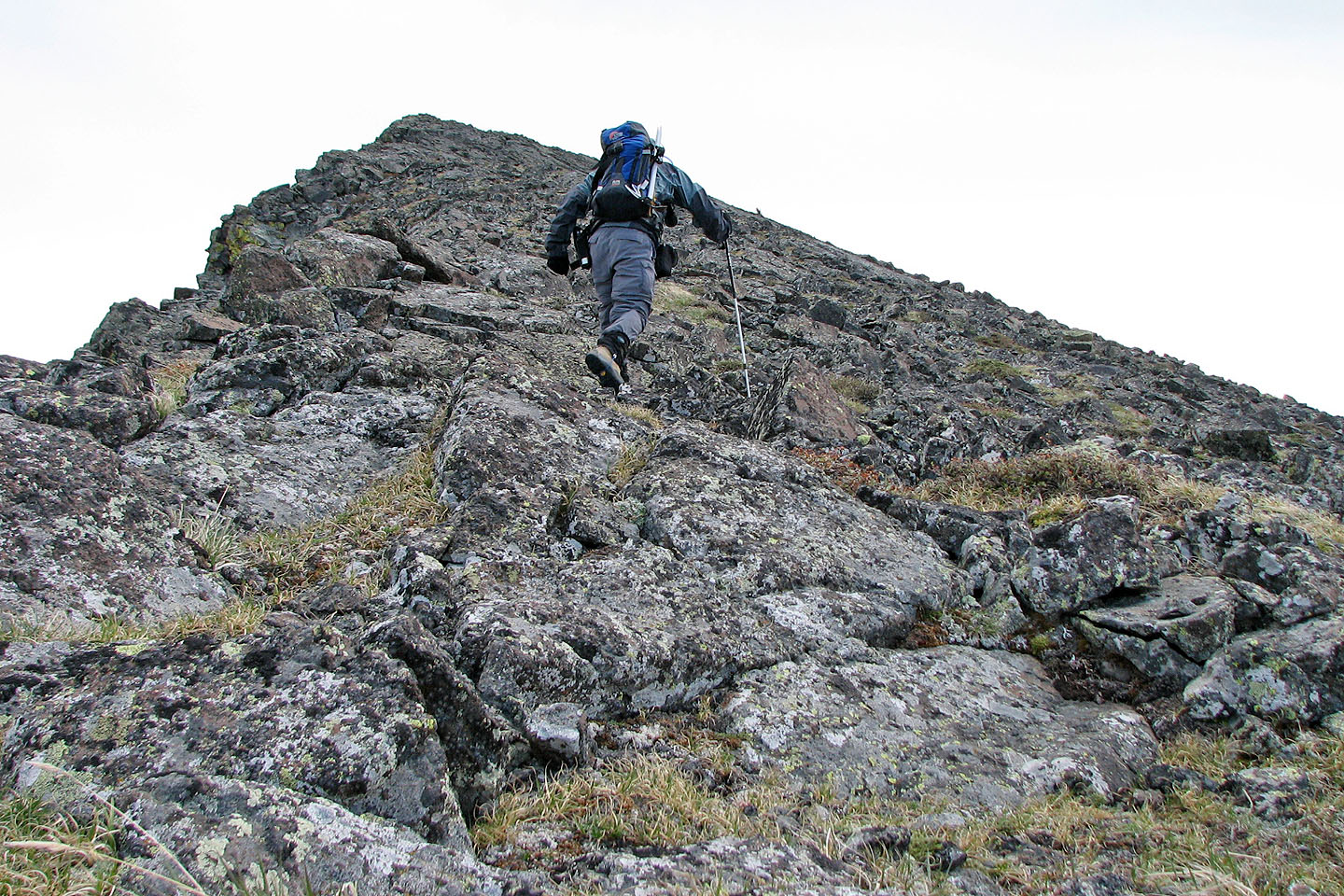
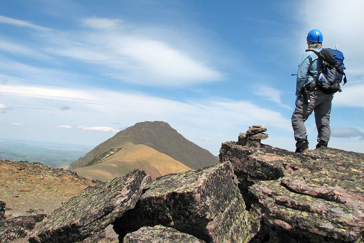
I continued along the col and up the other side towards the centre peak. Before I reached the centre peak, though, I had to negotiate the cliffs below it. The last 10 m was difficult, exposed scrambling, but it brought me to a plateau with a summit bump, 80 m lower than the north peak.
After reaching the summit, I noticed I could quickly and easily hike to the next high point which was the same elevation. I was curious if it was possible to continue to the south peak. When I reached the high point, I could see it did indeed appear that I could have hiked all the way to the south peak. If only I had the time! Reluctantly I turned back.
However, I enjoyed hiking back along the ridge because of the colourful landscape ahead. I returned to the col and soon reached the SW ridge. I ran down the orange scree that I had slogged up earlier and found the trail that led to my bike. I expected my bike ride to be fast and it was! Pushed by the wind and pulled by gravity, I covered the 3.7 km back to my car in 8 minutes. I don't know if I'll ever return to Pincher Ridge, but if I did I think it would be great to do all three peaks!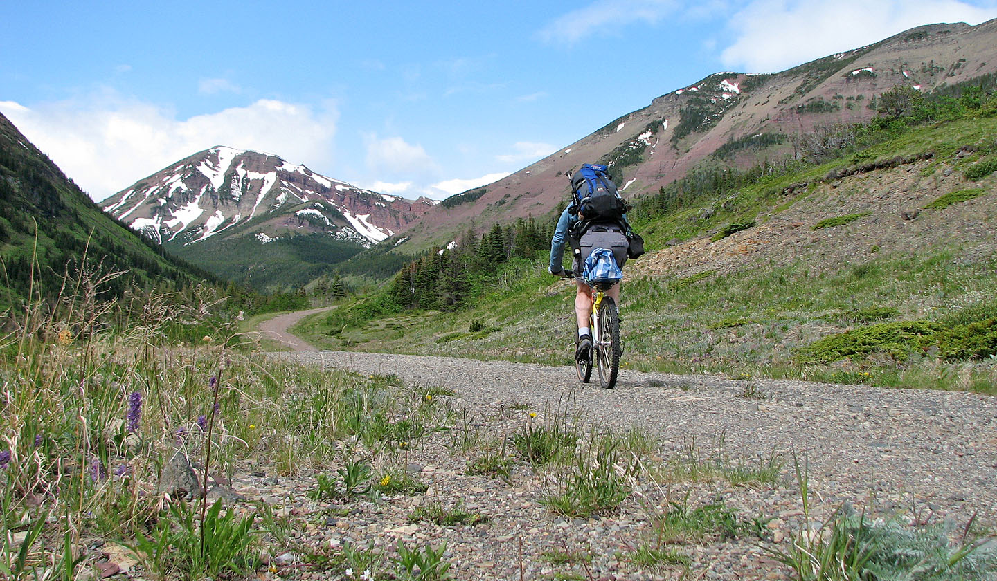
On the road to Pincher Ridge. South and centre peaks seen here.
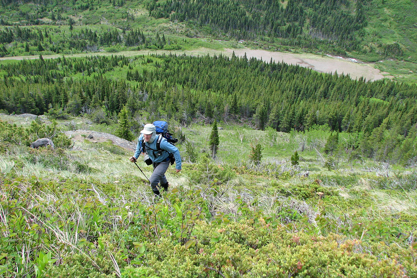
Hiking up the slope near the road. My bike is stashed almost directly below me.
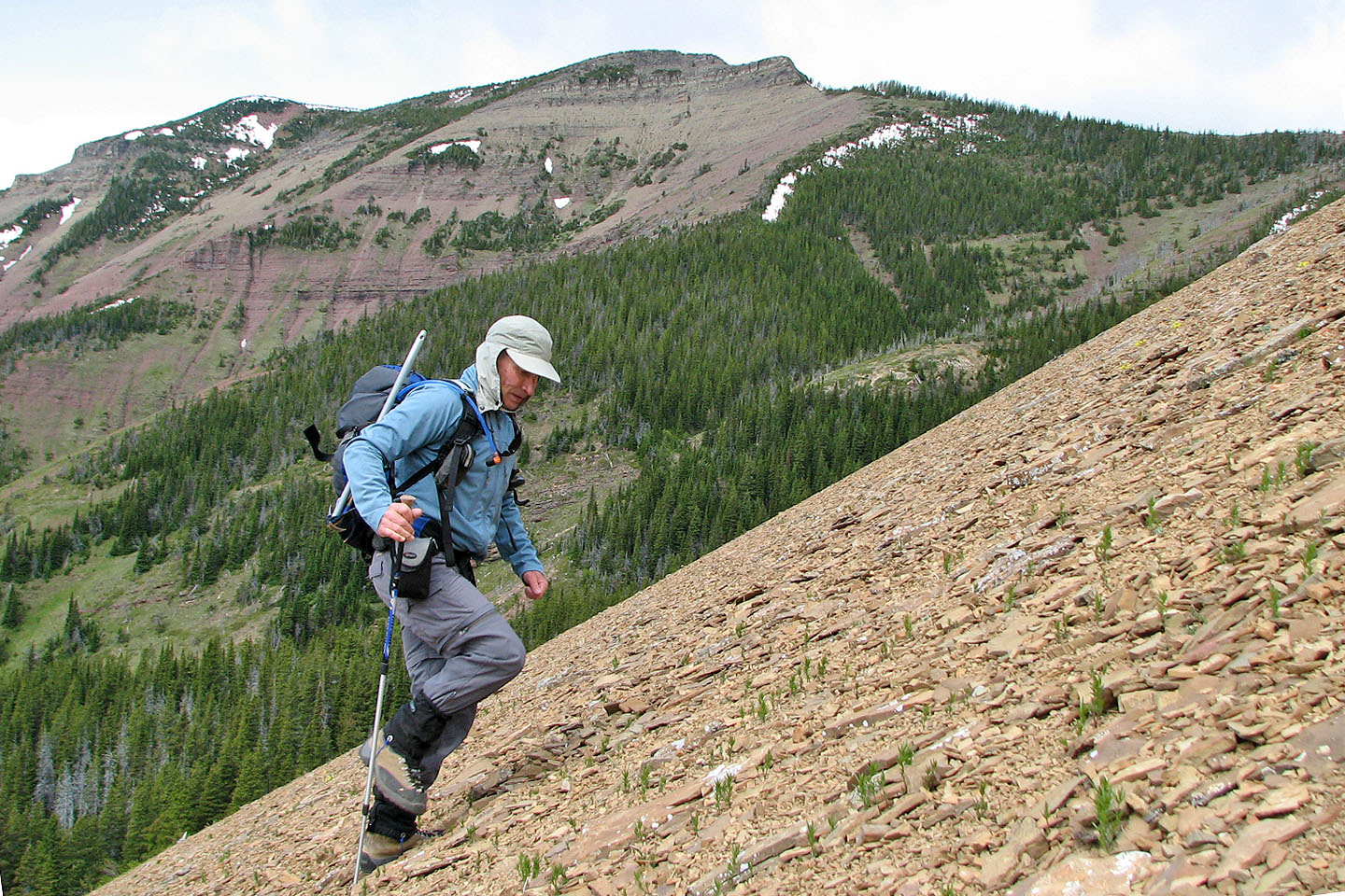
Miserable slog on orange scree. Centre peak is above me.
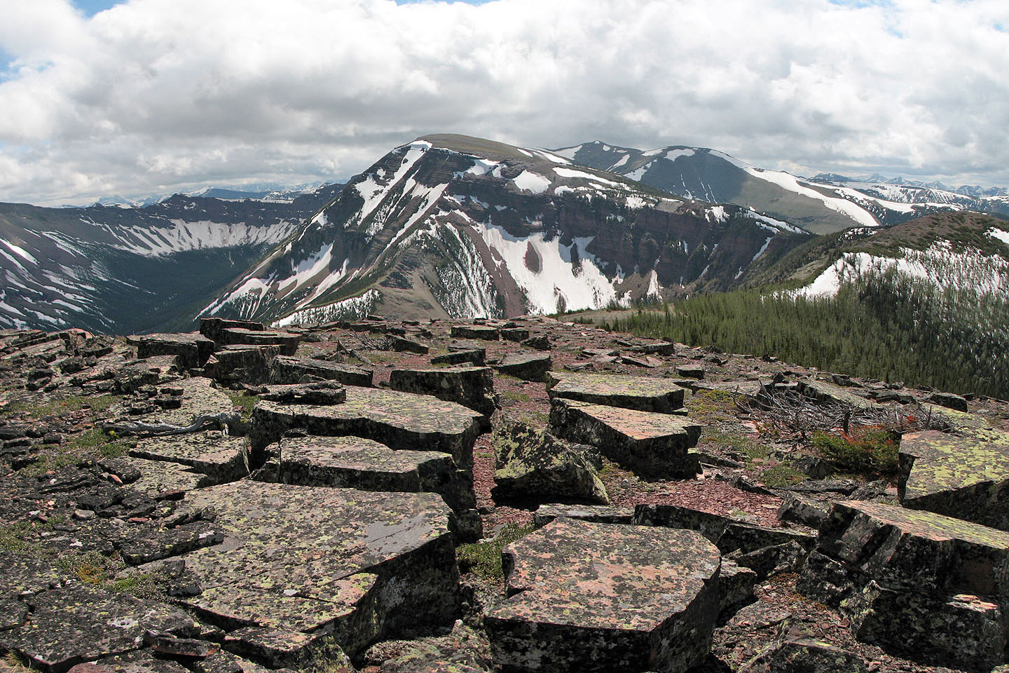
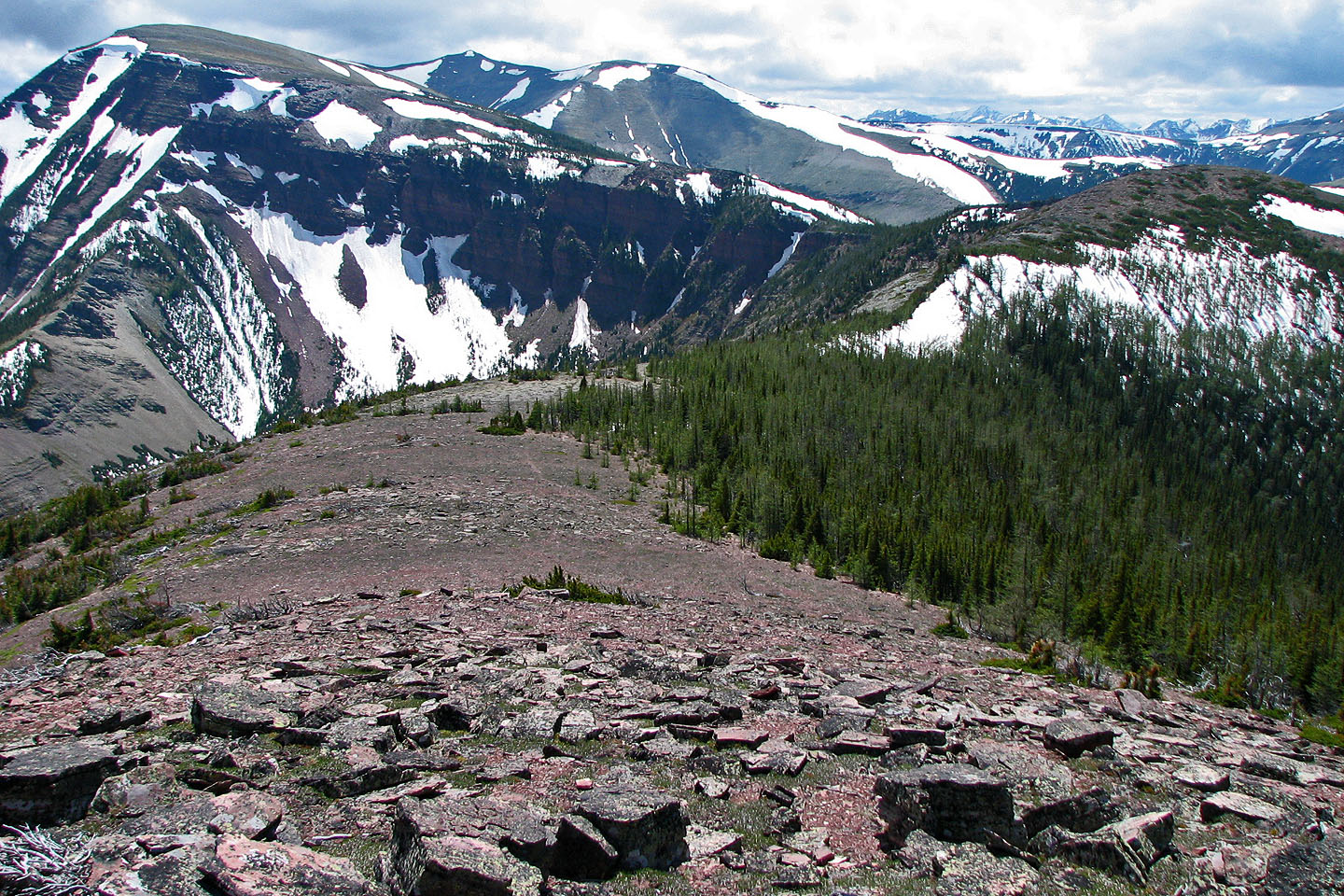
Windsor Mountain and Castle Peak
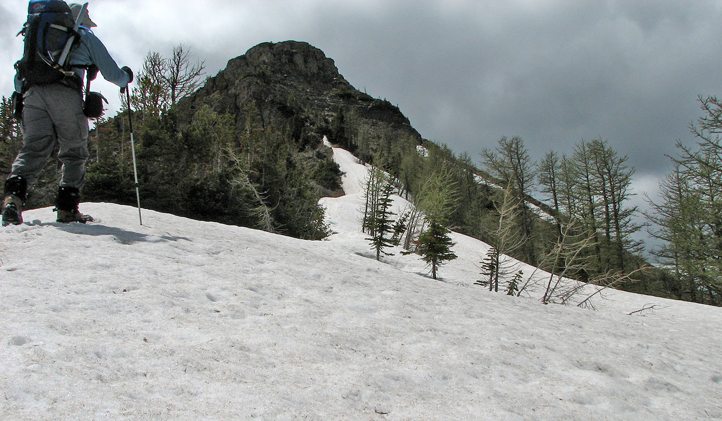
The orange scree leads to the black rocks which, in turn, lead to the north summit
Pincher Ridge's north peak and highest point
Final hike to the top. Here the wind is really knocking me around so I kept away from
the edge. While setting up the camera for this shot I was knocked over
twice and that was from a kneeling position!
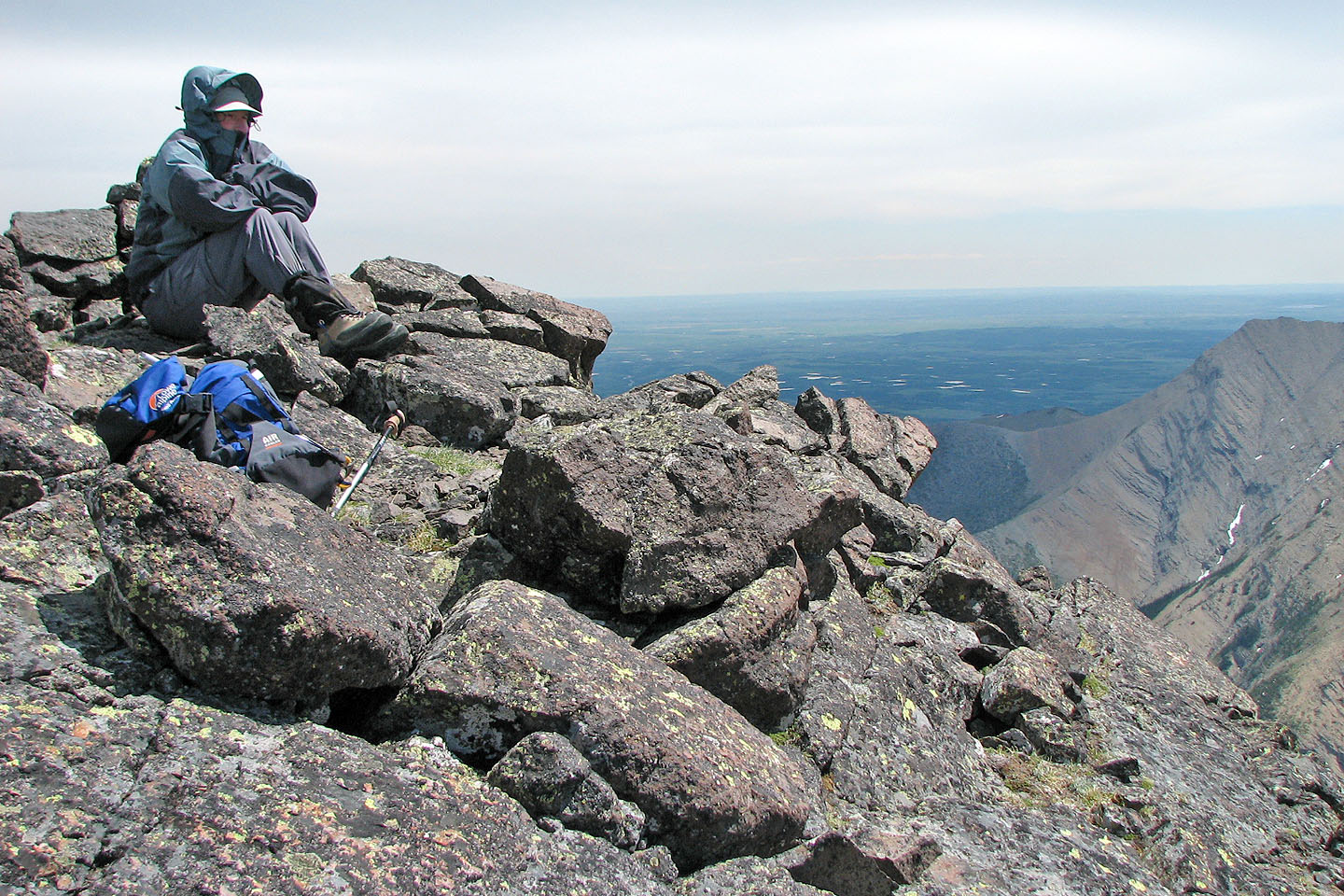
My summit stay was cold and windy
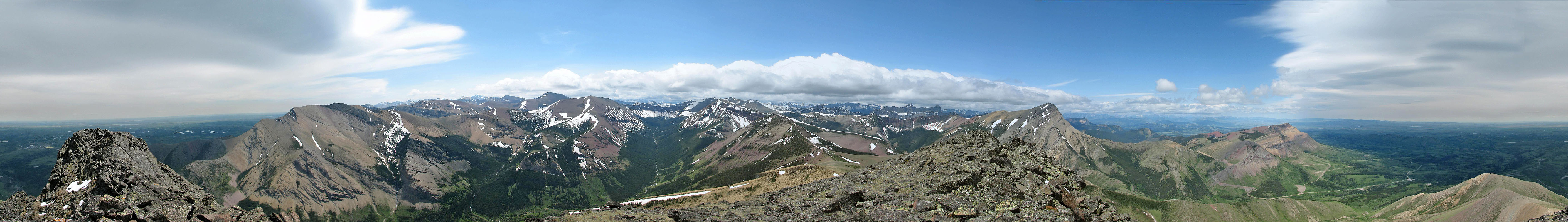 View from the top of the north peak
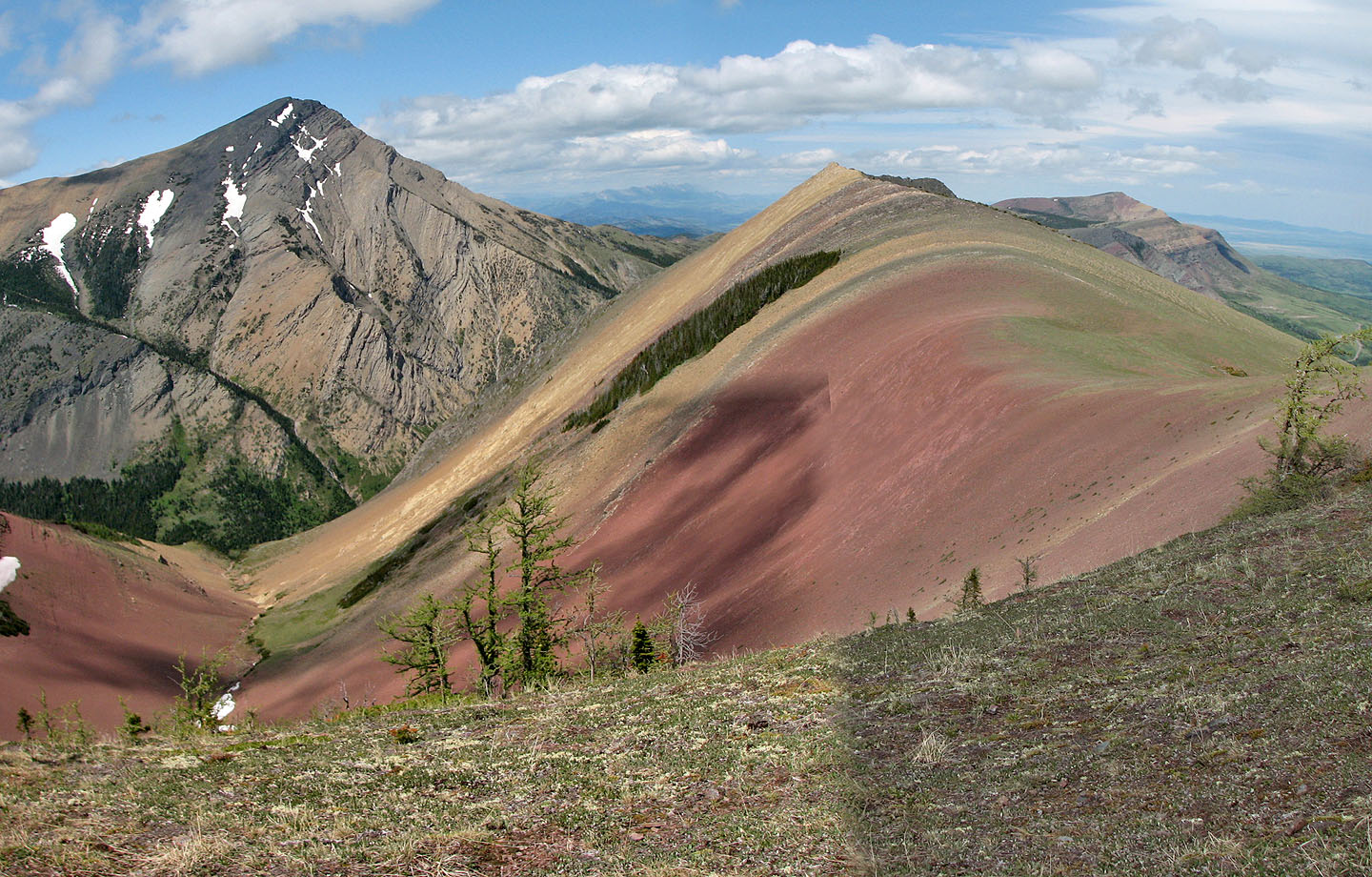
The south and centre peaks of Pincher Ridge
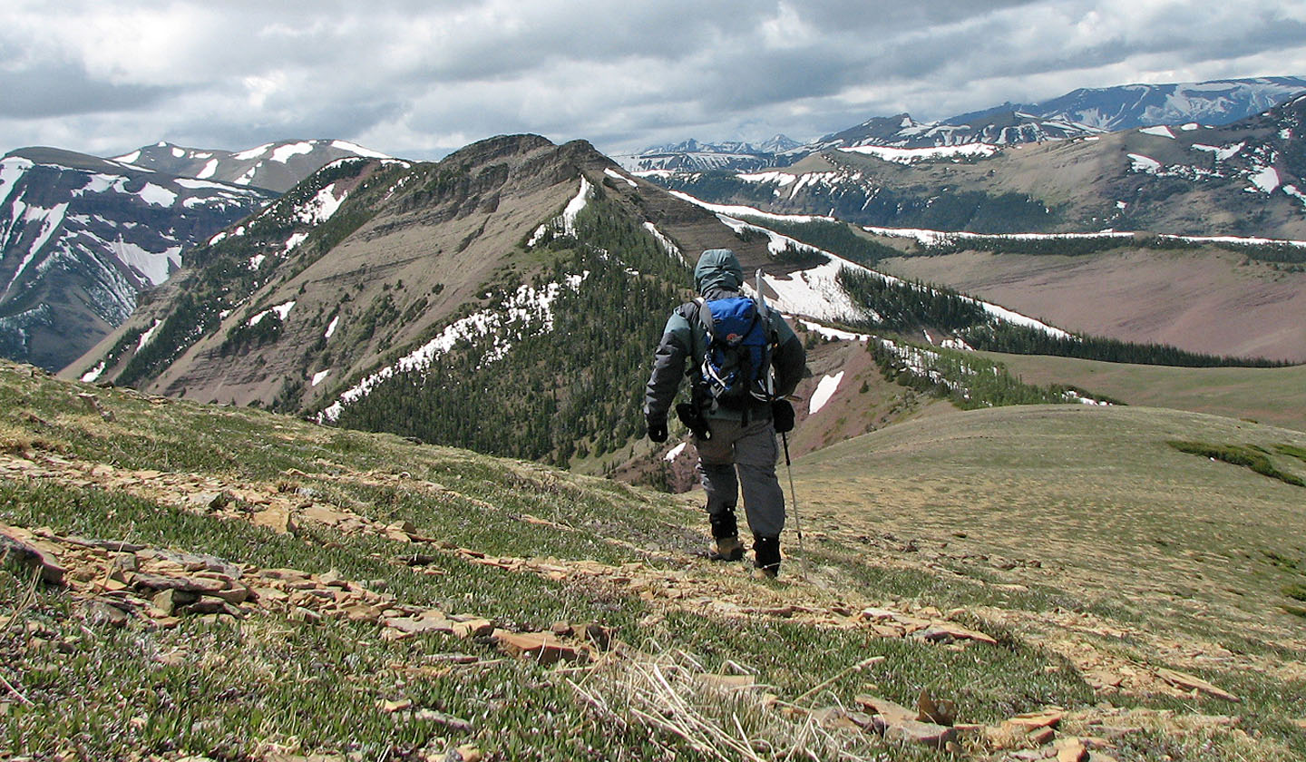
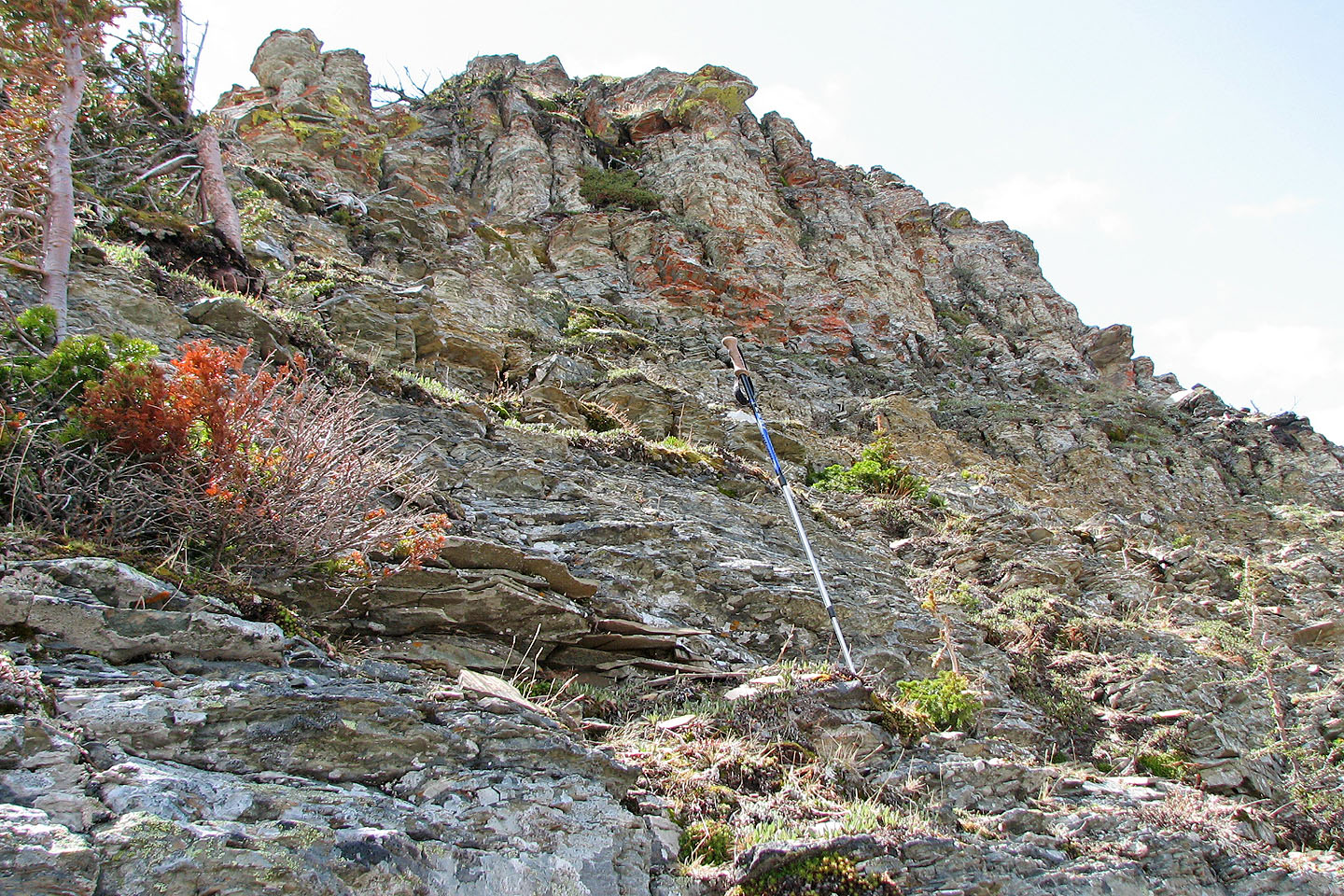
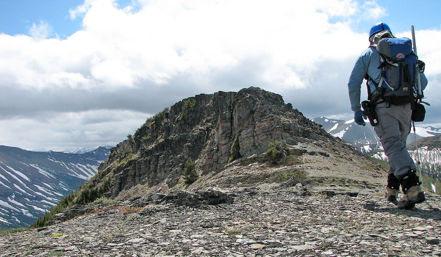
I set off for the centre peak. From here the cliff band looks like it could be a problem.
View of the centre peak from Victoria Peak. Mouse over to see the crux. I
kept to the left side.
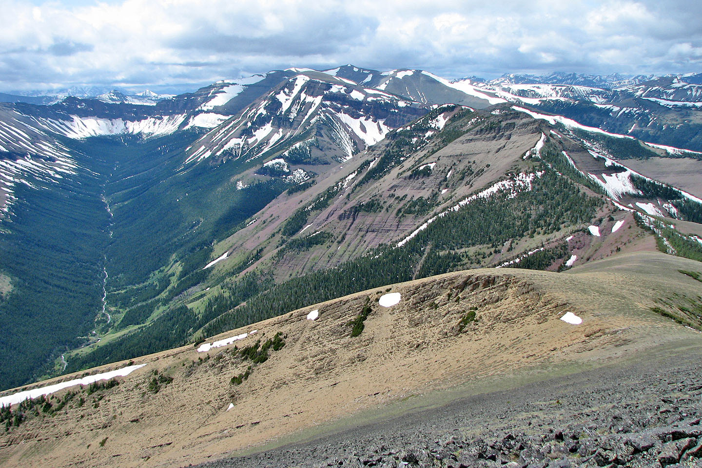
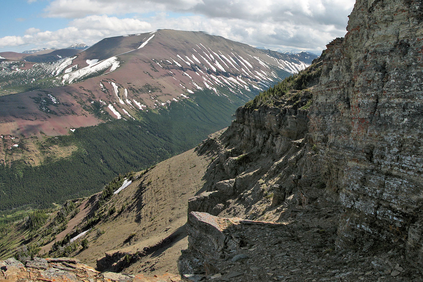
Victoria Peak and the colorful NE ridge of Pincher Ridge
The walk along the col between the north and centre peaks ends with a crux
(mouse over for a close-up)
Coming up to the crux
Looking back at the north peak and the NE ridge. Prairie Bluff in the background.
A cliff band lines the left side of centre peak
Looking back at the north peak from the top of the crux
After the crux it's a hike to the summit of centre peak
There was no cairn on the centre peak so I stacked a few rocks
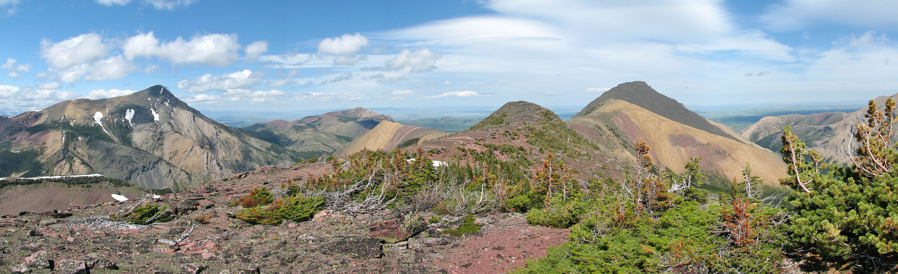
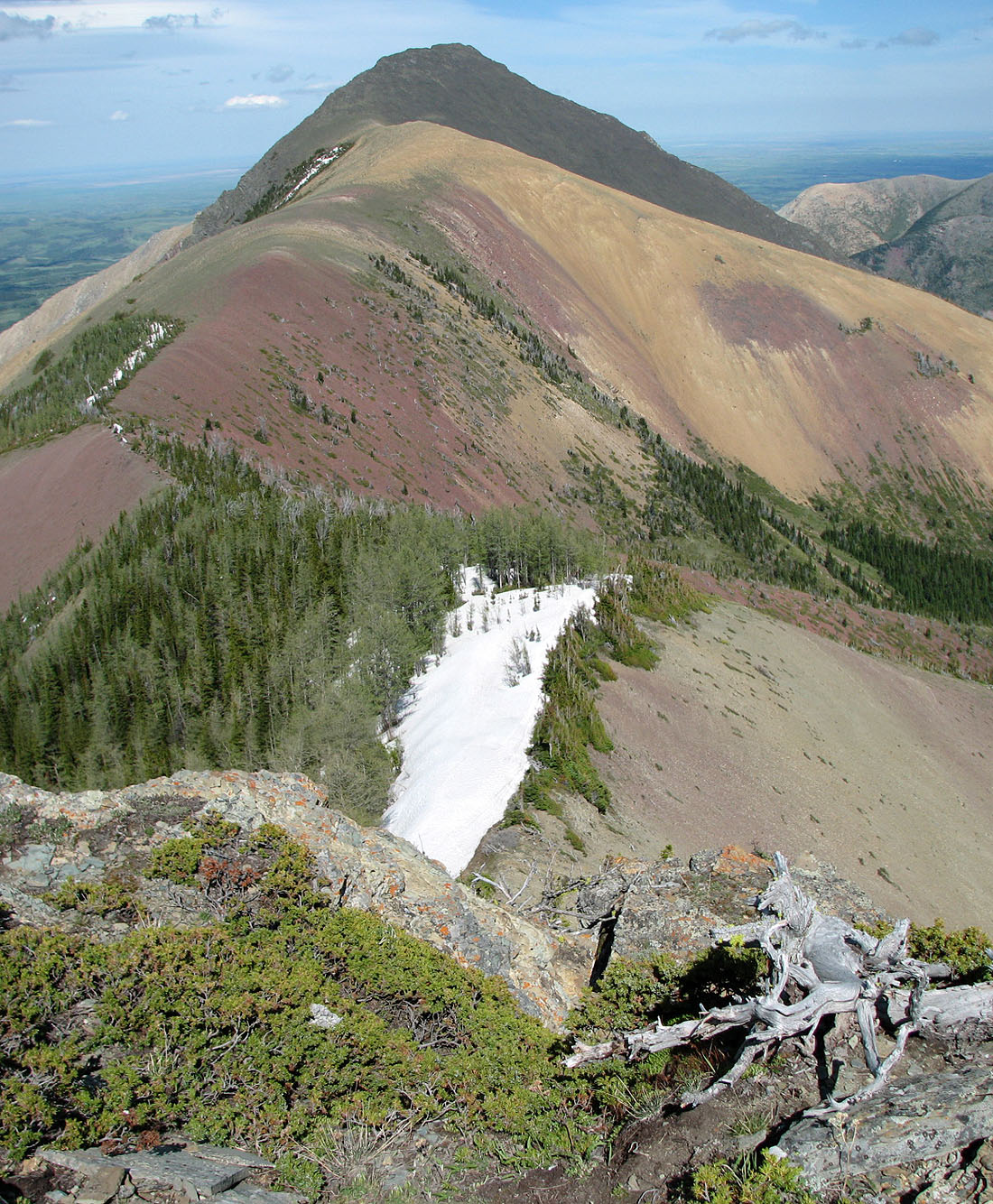
Centre and north peaks seen from 500 m farther down the ridge
South peak
Another view of the south peak shows the gentle connecting ridge. Victoria Ridge in the background.
82 G/8 Beaver Mines