bobspirko.ca | Home | Canada Trips | US Trips | Hiking | Snowshoeing | MAP | About
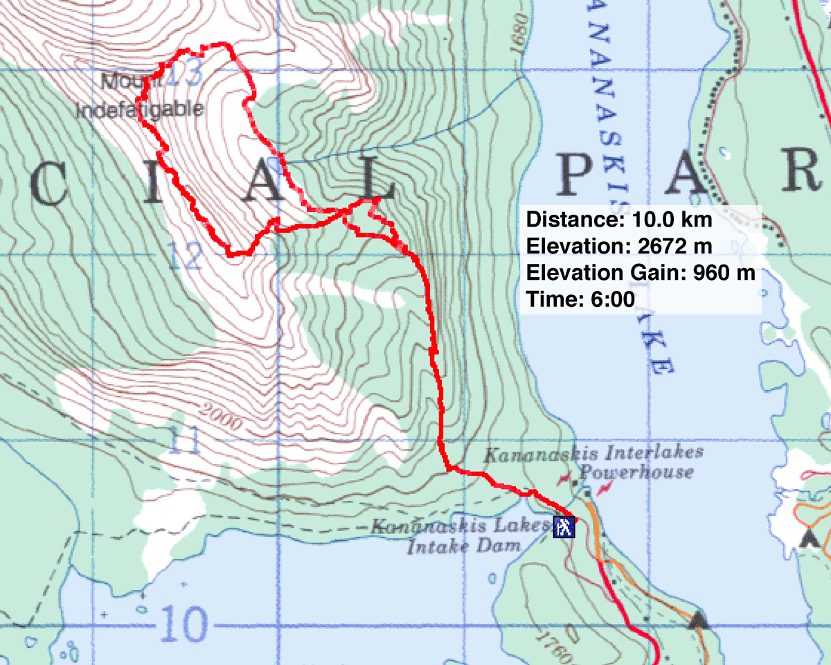
Mount Indefatigable Traverse
Kananaskis, Alberta
July 15, 2005
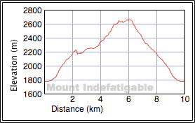
Distance: 10.0 km (6.2 mi)
Cumulative Elevation Gain: 990 m (3248 ft)
For the past two years, the Mount Indefatigable trail has been mostly closed due to bear activity. Open this year, Dinah and I jumped at the chance to bag the peak. Joining us was Phil Scheiner who accompanied us to the top of Holy Cross Mountain last year.
The trail starts flat but soon steepens. A bench at a lookout offers a place to pause. Soon after that the trail forks. We passed the first fork and followed the trail until we reached an end-of-trail sign. But a side trail wends left and soon joins the main trail that leads to the North Peak.
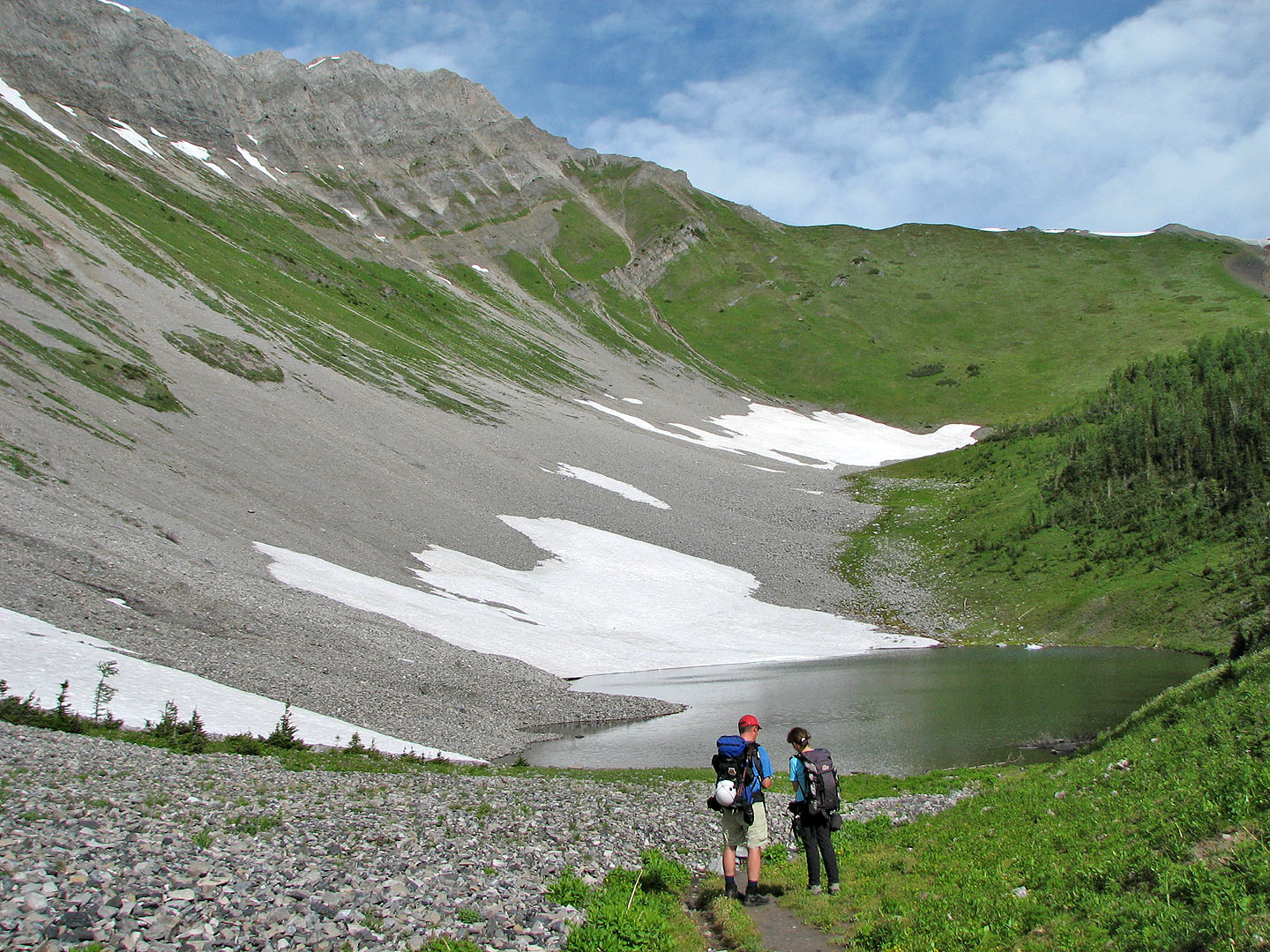
In a short time, the trees thinned, and we skirted the right edge of a tarn. We continued on the trail until it was evident we would reach the North Peak quicker if we left the trail and cut across the slope as shown in the guidebook.
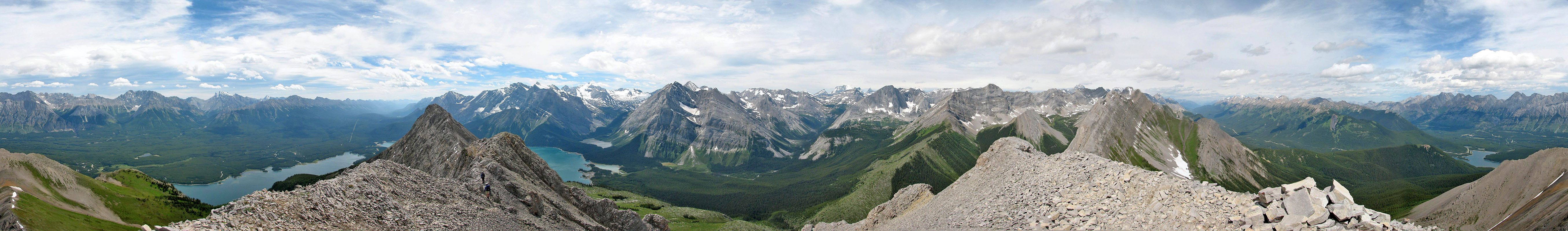
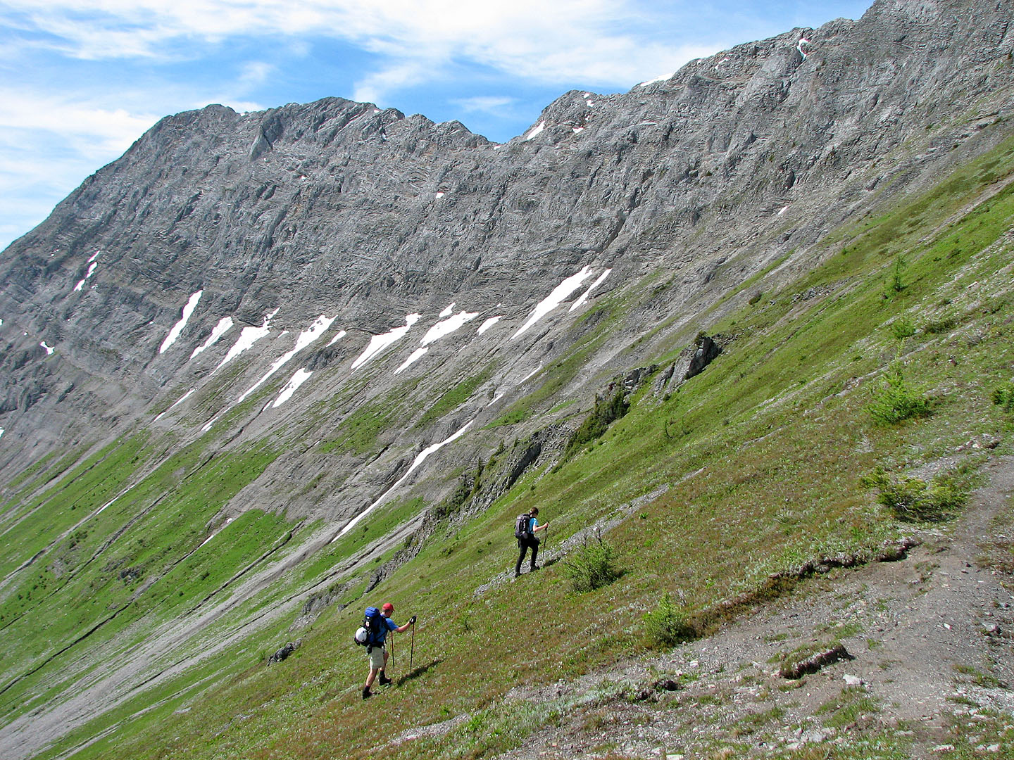
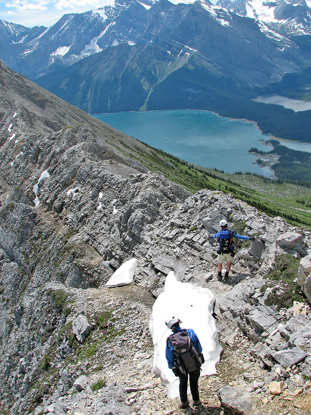
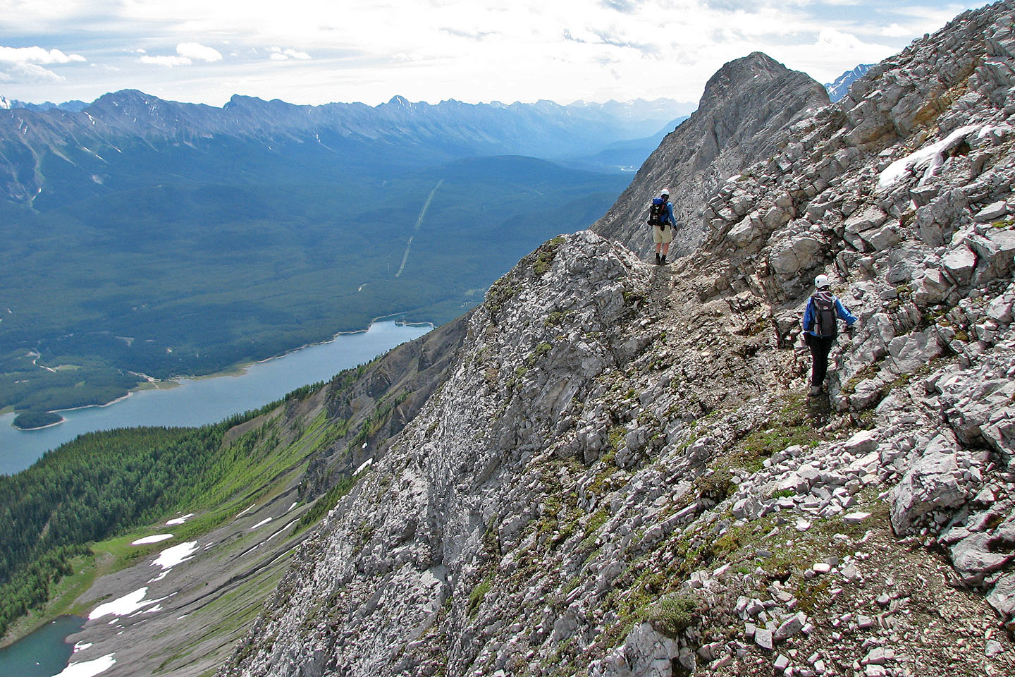
Once off the grassy slopes and onto rock, we worked our way up a steep gully. Neither trail nor cairns marked the way, so we were left to our own design. I had fallen behind, but Phil was quick to assist Dinah up some of the trickier sections. Scrambling here wasn't fun because of loose rock and steep terrain, so we were glad to reach the ridge crest where a short walk took us to the summit of the North Peak. It was windy, and we were greeted by good if hazy views of distant peaks. Fortunately we never saw any of the predicted showers for the afternoon. I took a summit panorama, and we continued to the South Peak.
The traverse was straightforward, mostly a hike with a few short scrambling sections. Because of the high winds, gusting at times, we often held onto rock where the ridge narrowed and was exposed. When we came to the uninspiring South Peak, we found some communications apparatus perched on the top but no cairn as we expected. As we headed down the east slope, we were already discussing other scrambles we would like to do this season.
Postscript: Since posting this, Indefatigable trail has been decommissioned and should not be used. For more information, see my Mount Indefatigable South Peak trip.
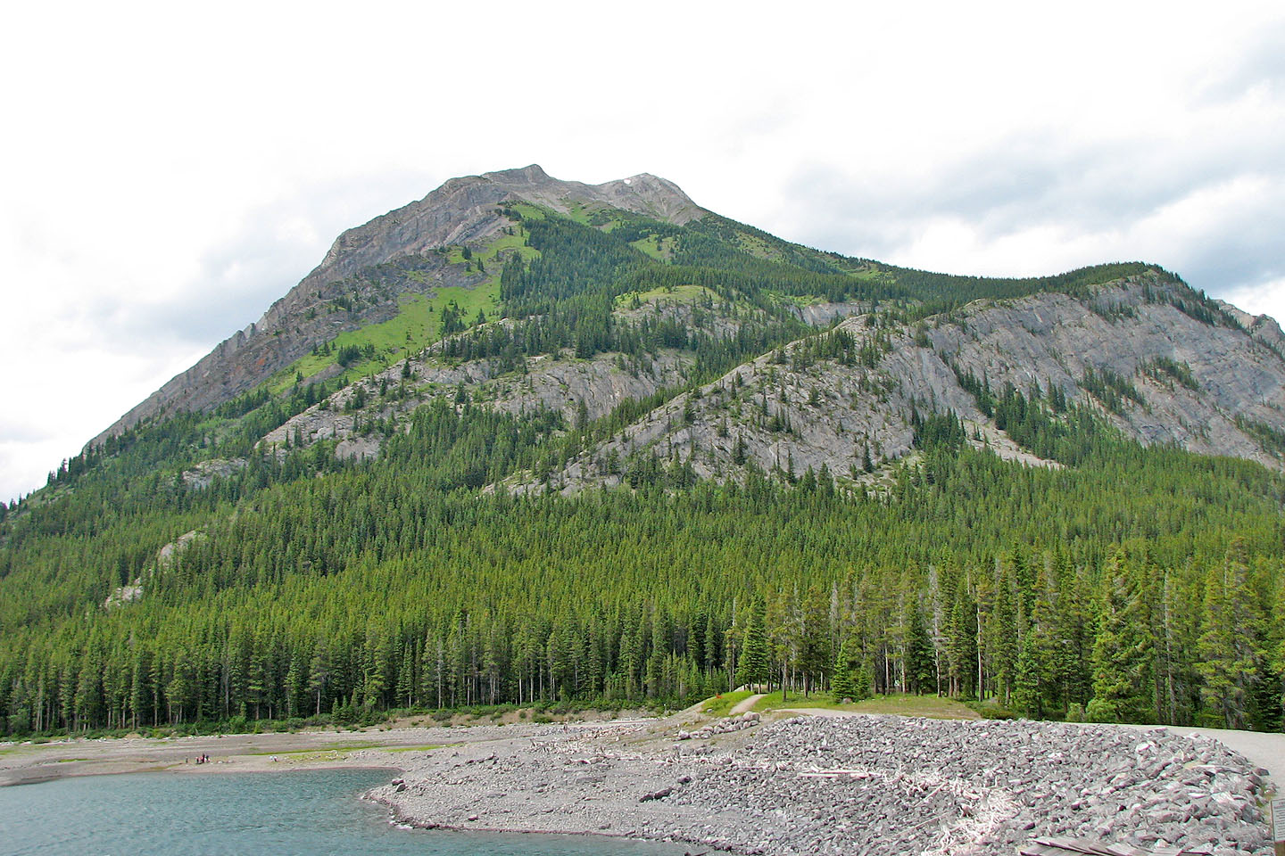
Mount Indefatigable seen from the trailhead
Hiking up the trail to the alpine tarn
North Peak overlooks the tarn
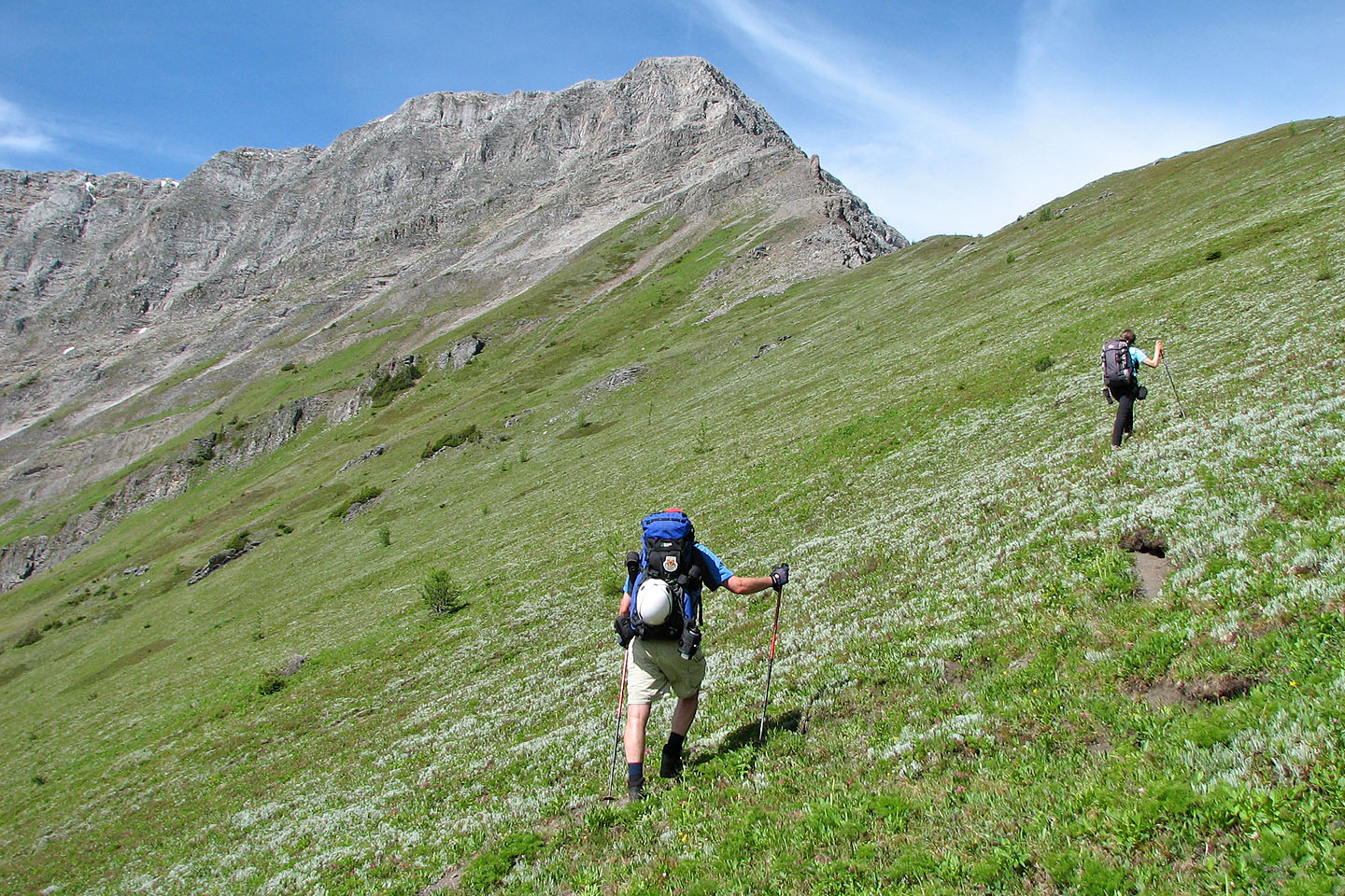
North Peak from the slope
Looking back at the tarn
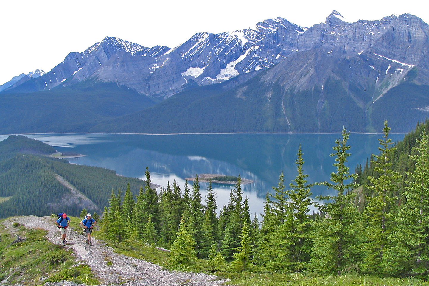
Phil and Dinah will soon join me on the ridge crest
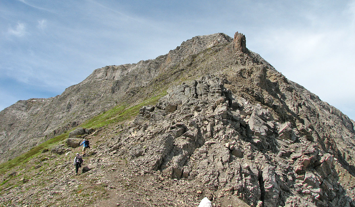 North Peak from the col
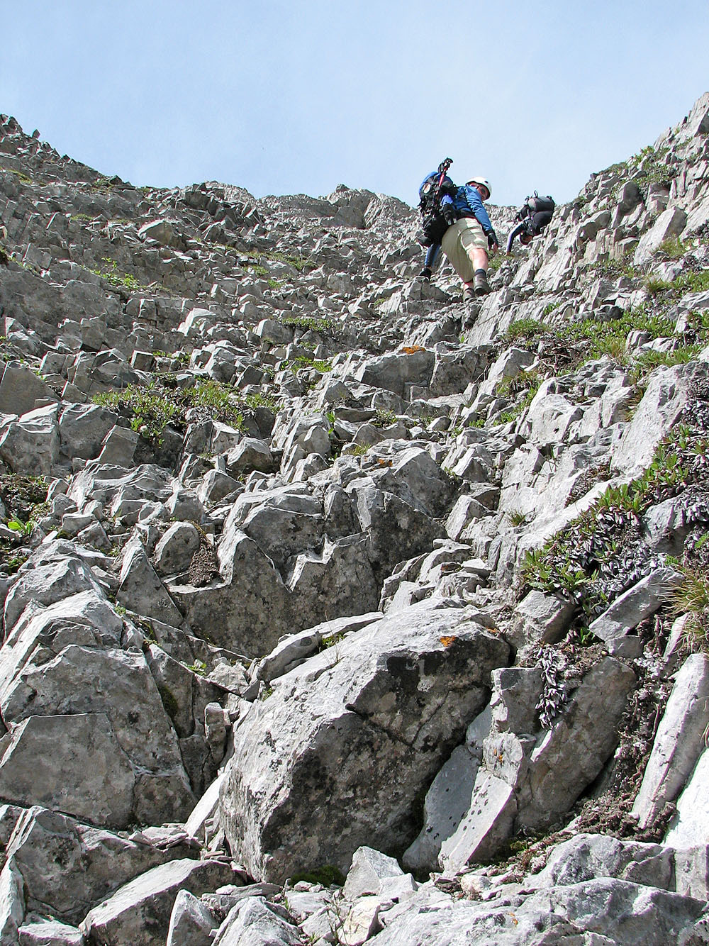
Steep ascent up a gully
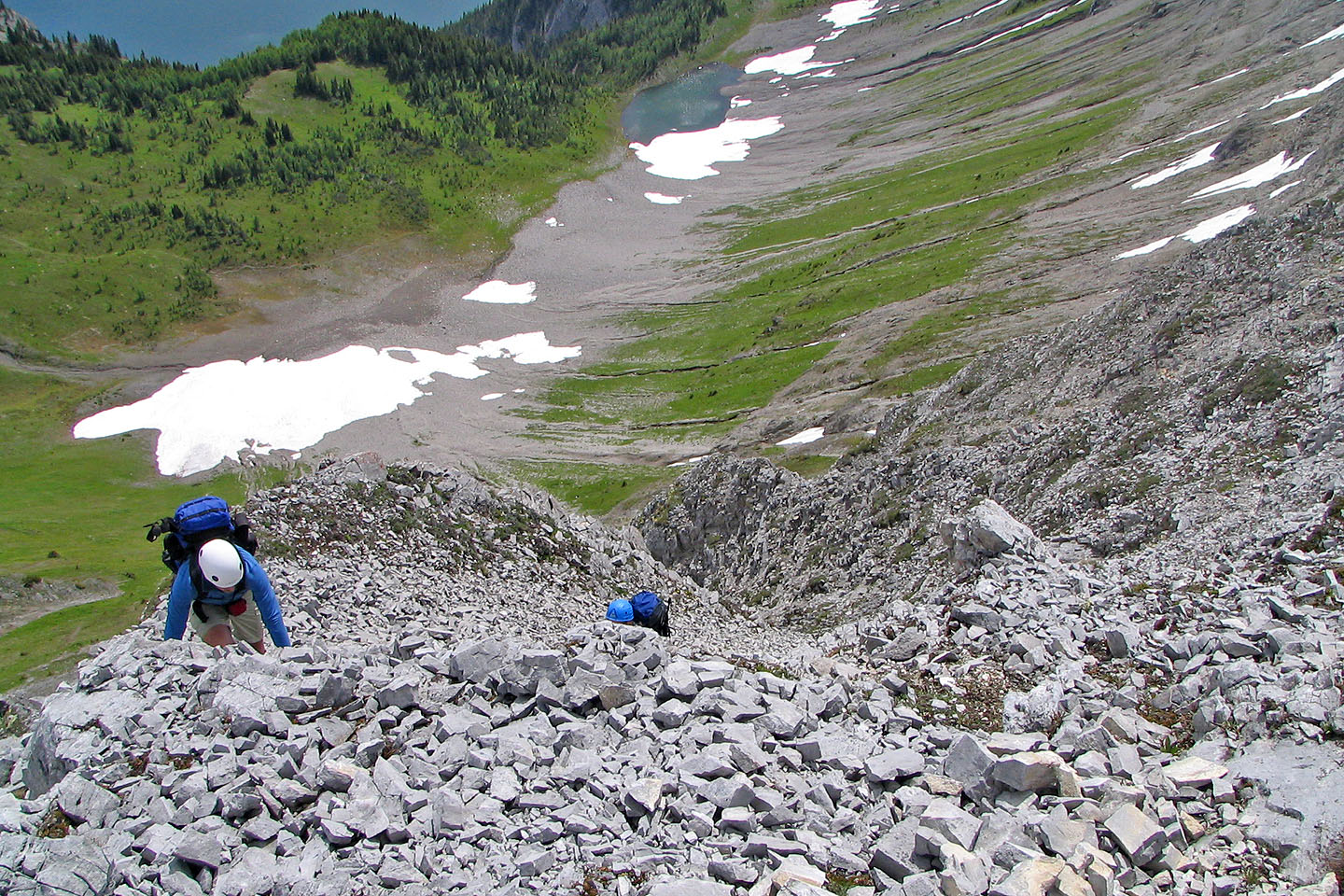
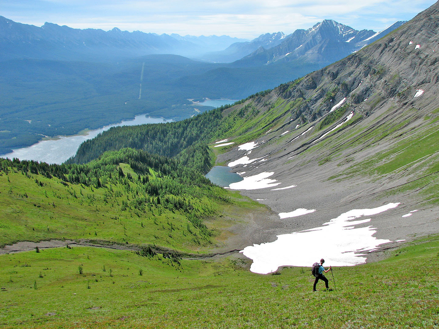
Looking down from near the summit
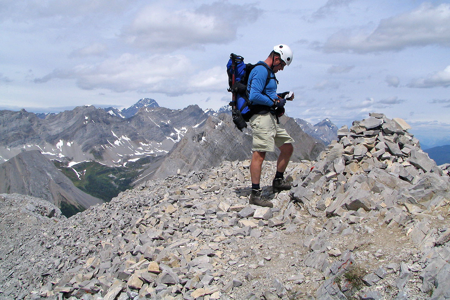
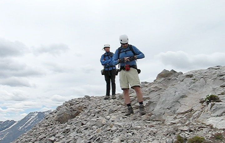
Phil reads the register at the summit
Much of the first section of the traverse stays left of the crest
Still on the left side looking to get back on the ridge crest
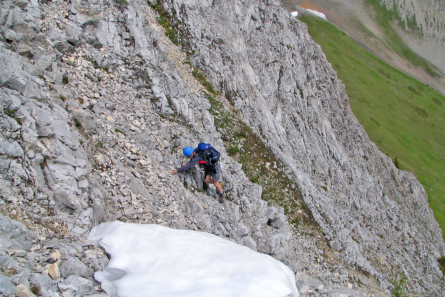
Scrambling up to regain the ridge
Back on the ridge
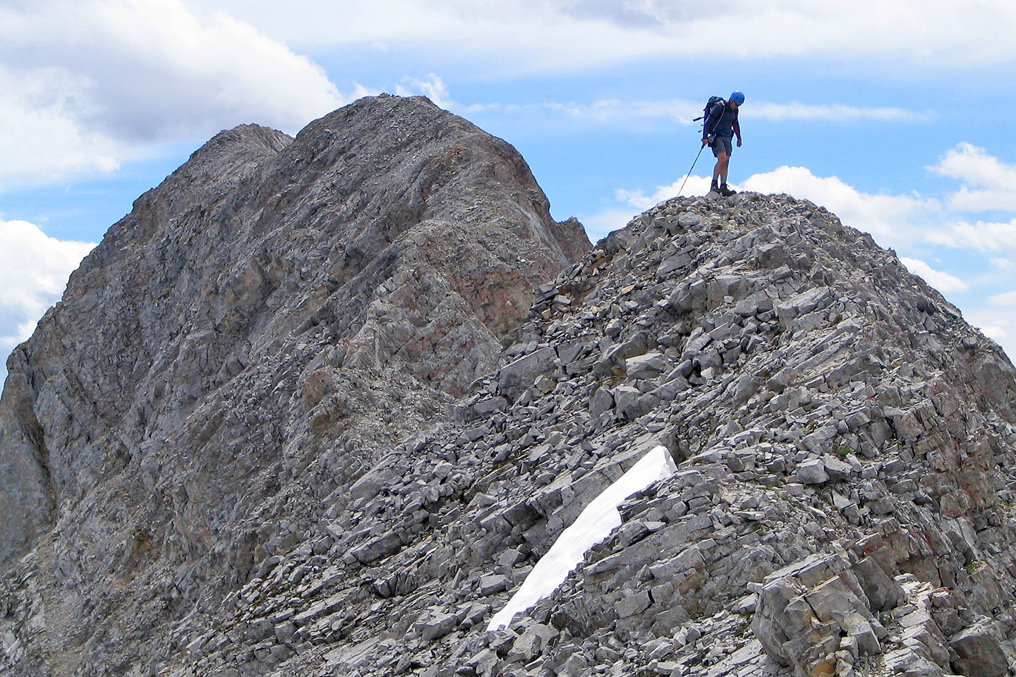
North Peak in the background
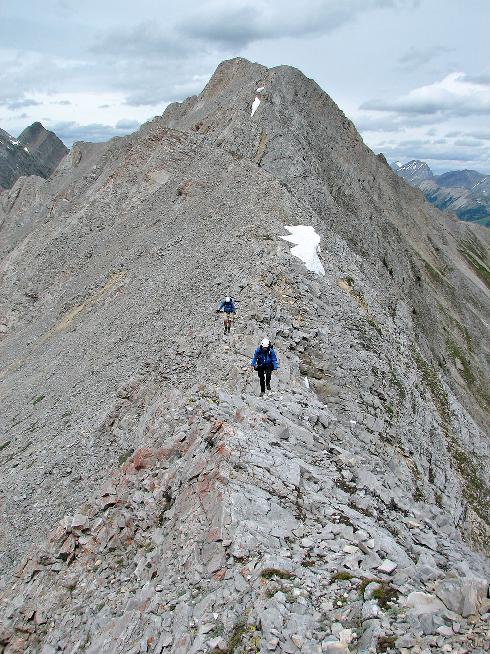
Looking back along the ridge
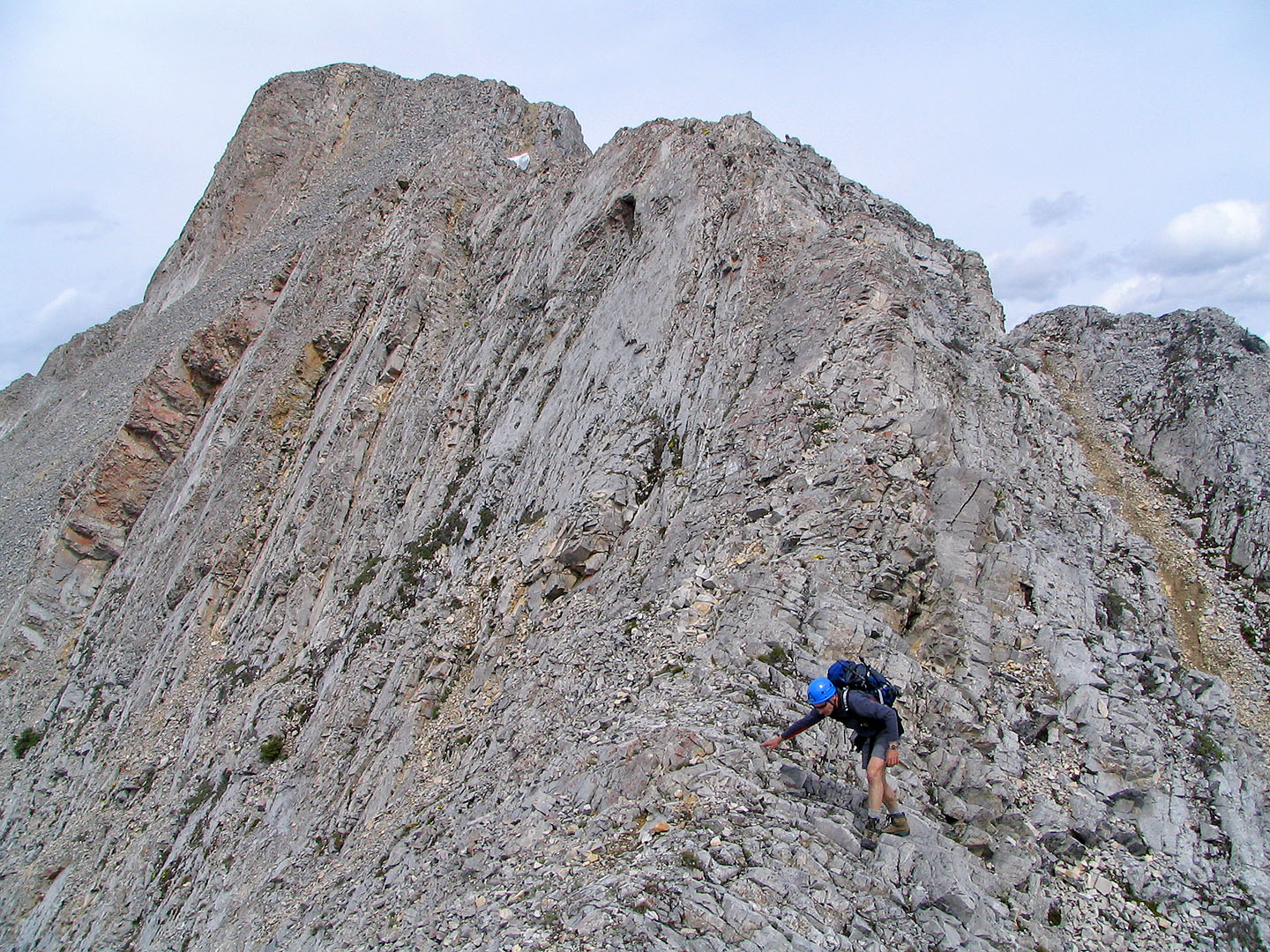
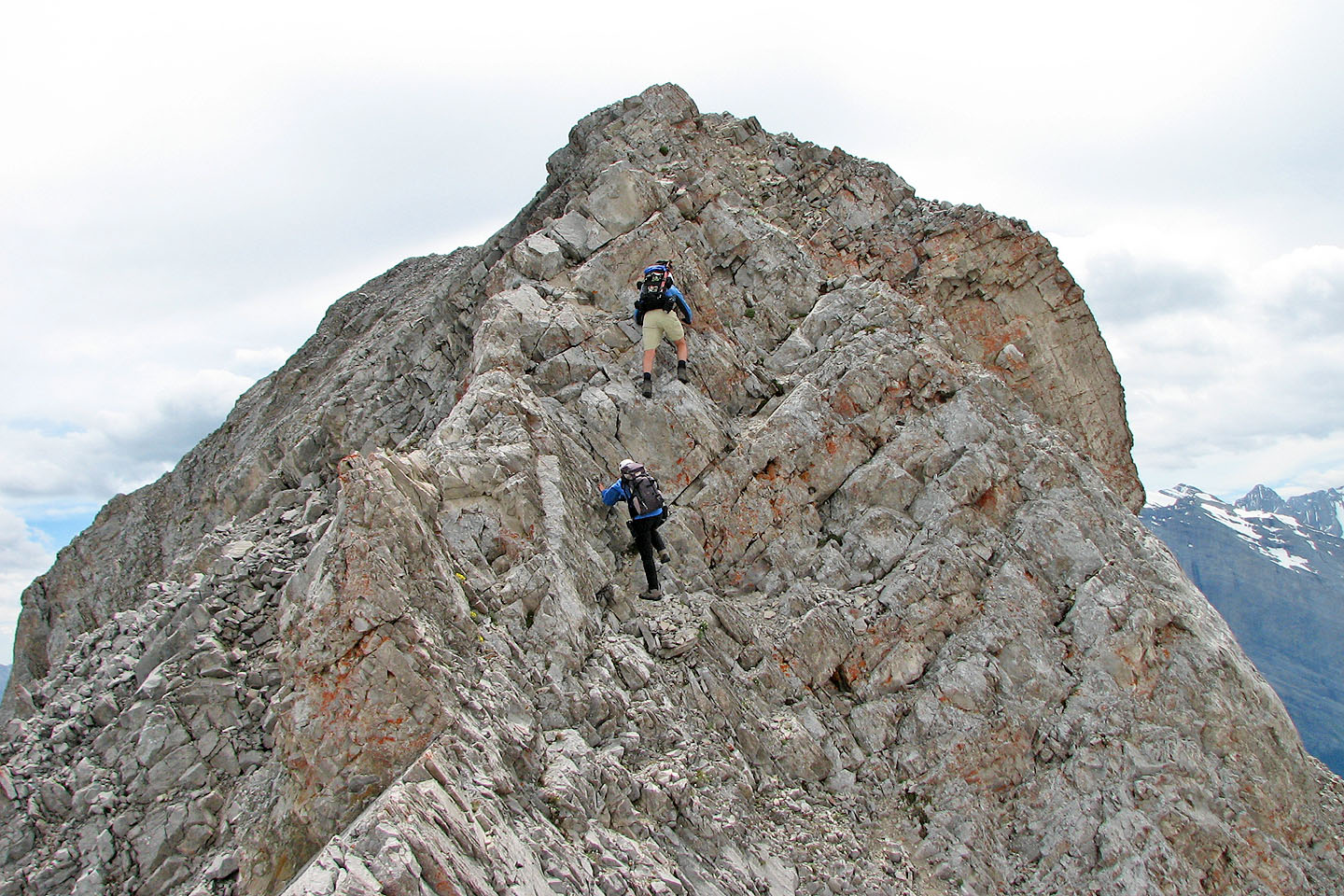 A nice bit of scrambling before the South
Peak
A nice bit of scrambling before the South
Peak
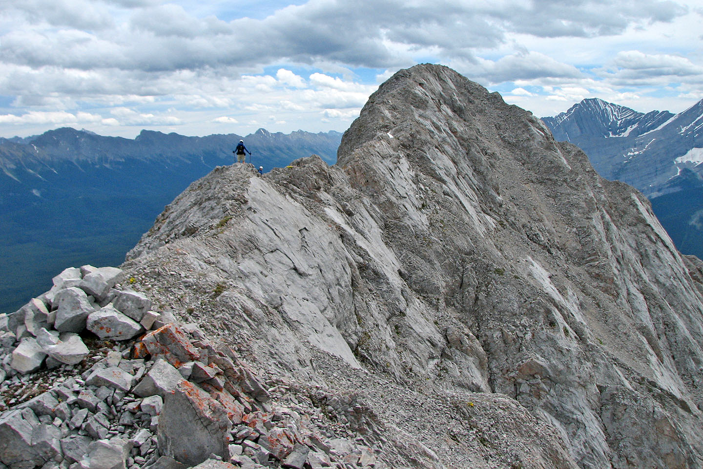
South Peak ahead: easier than it looks
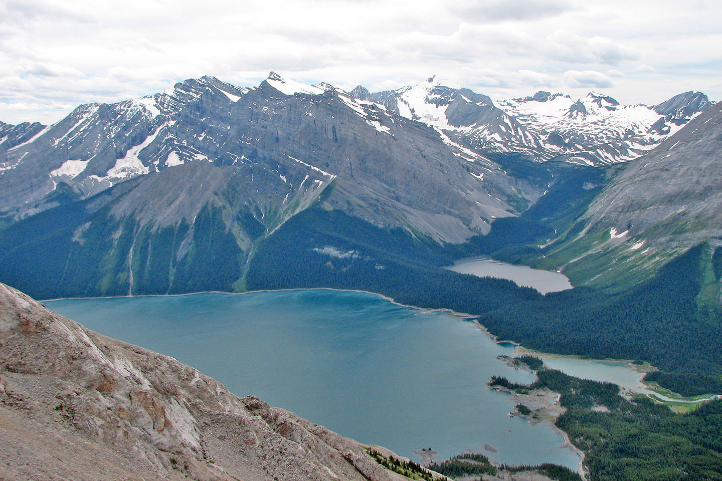
Upper Kananaskis Lake and Hidden Lake
On the summit of South Peak
82 J/11 Kananaskis Lakes