bobspirko.ca | Home | Canada Trips | US Trips | Hiking | Snowshoeing | MAP | About
Mount Bosworth
Yoho National Park, BC
August 6, 2004
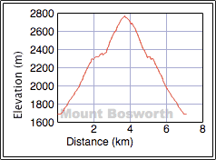
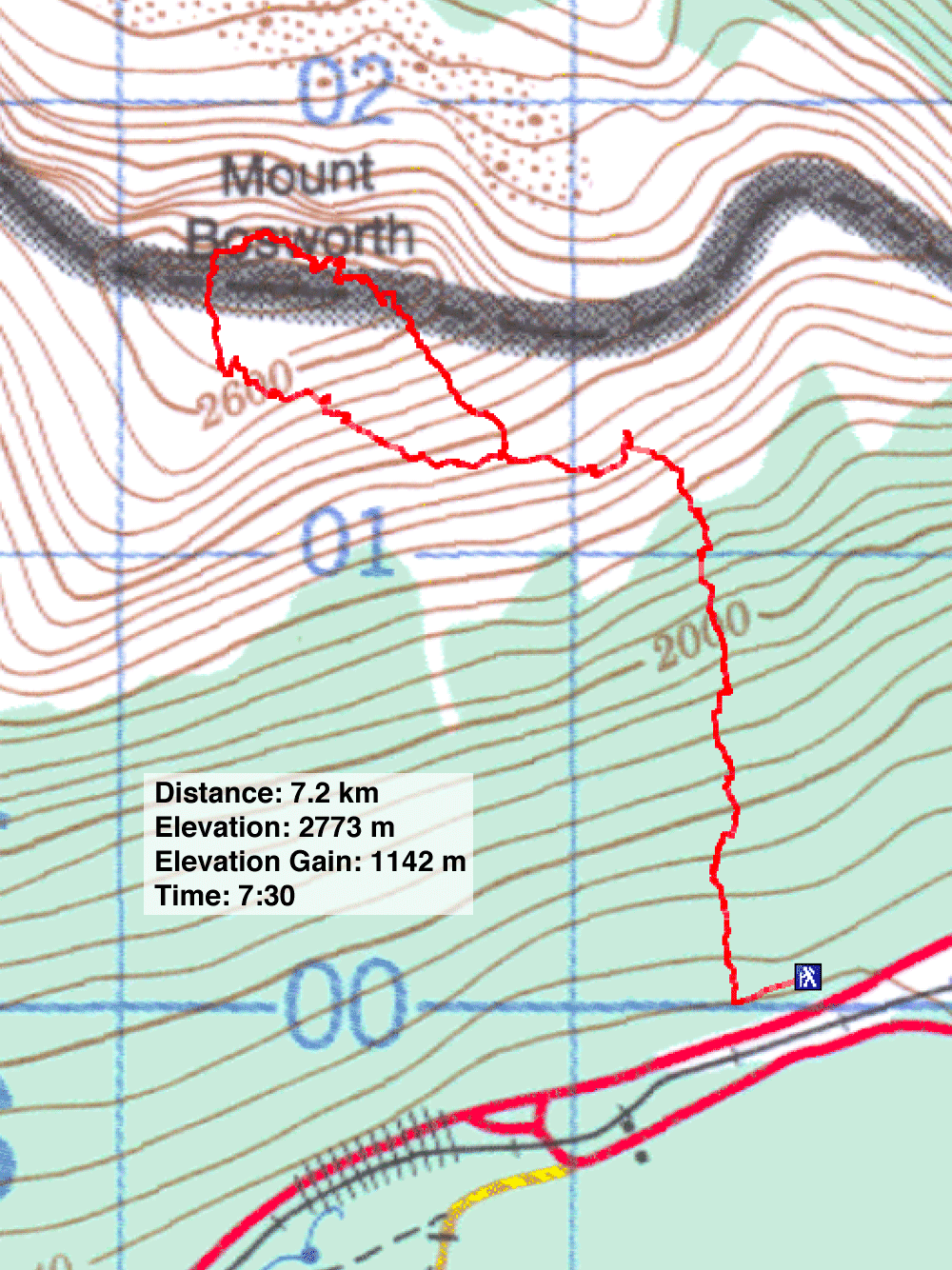
Distance: 7.2 km (4.5 mi)
Cumulative Elevation Gain: 1160 m (3806 ft)
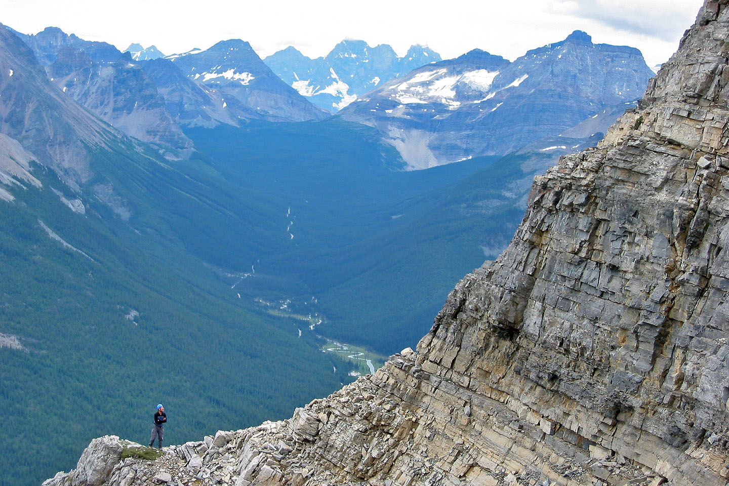
After making a navigation error, Dinah and I found more thrills on Mount Bosworth than we bargained for. On our ascent, we ended up in the wrong gully, in the gully west of the second gully where the final ascent is normally made. Instead of being east of the summit block, we found ourselves in a steep gully west of the summit. We scrambled up 130 m of difficult rock that tested our routefinding and climbing abilities. While exciting, it was also frightening. We doubted we could safely return the same way.
The trip began with a hike up an avalanche slope from the Trans-Canada Highway. Above the treeline, we started traversing left but strayed too far. When we reached a large gully below the summit that splits into several narrow gullies higher up, we realised we were off-course. Above us, a black band of rock held huge snow cornices. We crossed the big gully to the branch gully farthest west, away from under the fearsome cornices. The gully started as a deep V, so steep and deep we couldn't reach the bottom and had to ascend the left side at first.
This narrow gully was mostly a hands-on, straight-up ascent. It was more difficult than downclimbing the crux on the correct route in the guidebook, and it was much longer. Fortunately, it was mostly solid rock.
However, we weren’t sure if we could reach the summit. More worrisome was having to downclimb this steep and tricky gully if we were stopped somewhere. On the way up, we found a carabiner attached to a strap from some long-ago climb. It was a discouraging sign as we had no rope.
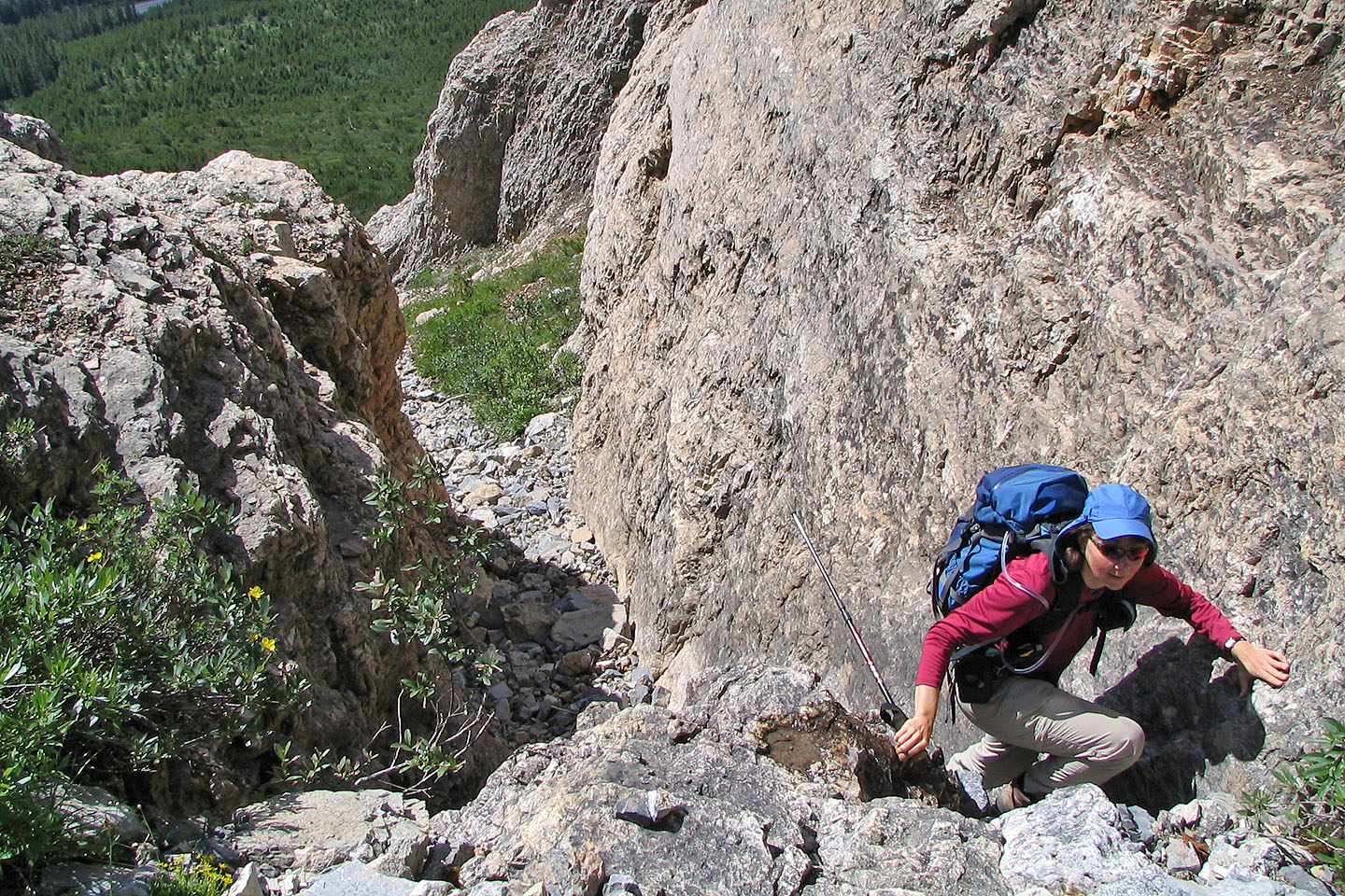
Eventually, we crawled out of the gully at the base of the black rock band where we breathed a sign of relief. Above us was another 30 m of difficult scrambling, although not as technical as the gully.
We soon found ourselves next to the end of the snow cornice with only a brown rock band to ascend. After scrambling up it, we breathed another sigh of relief. We appeared on an open talus slope that led to a rocky hump west of the summit. This hump, where there were remains of a tower or some such apparatus, was connected to the summit block by a short ridge. But to reach the ridge, we had to drop down a sheer cliff. Fortunately, there was a chimney in the cliff face that we easily downclimbed. Minutes later, we were standing next to the summit cairn.
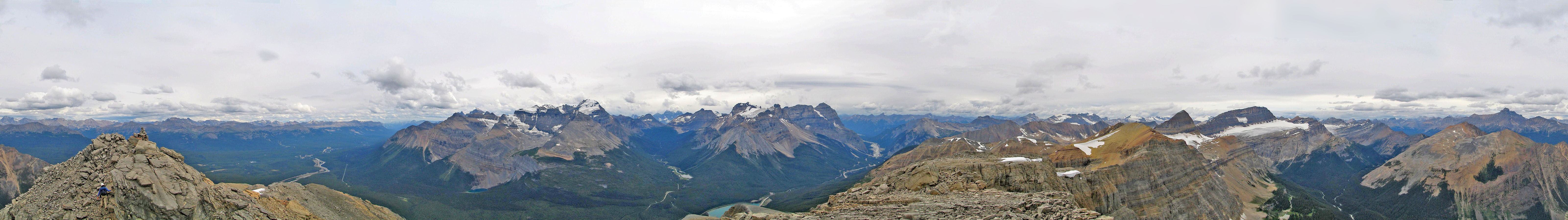
From the summit, we spotted cairns headed down the east ridge. We followed the cairns marking the book route for Mount Bosworth. Compared to our ascent gully, the established route was a cakewalk.
KML and GPX Tracks (Normal Route)
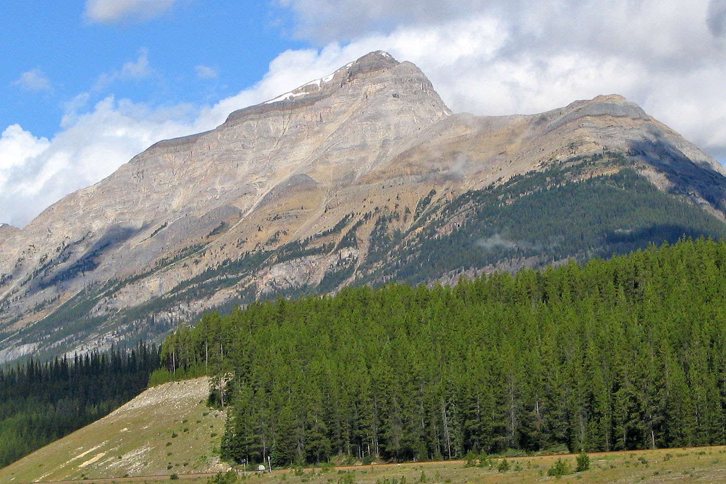
View of Mount Bosworth from the highway. We climbed up the black rock band just left of the lowest cornice.
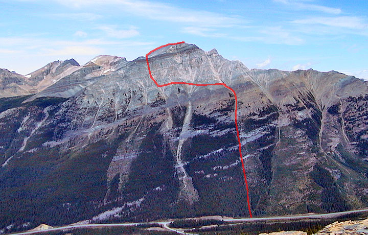
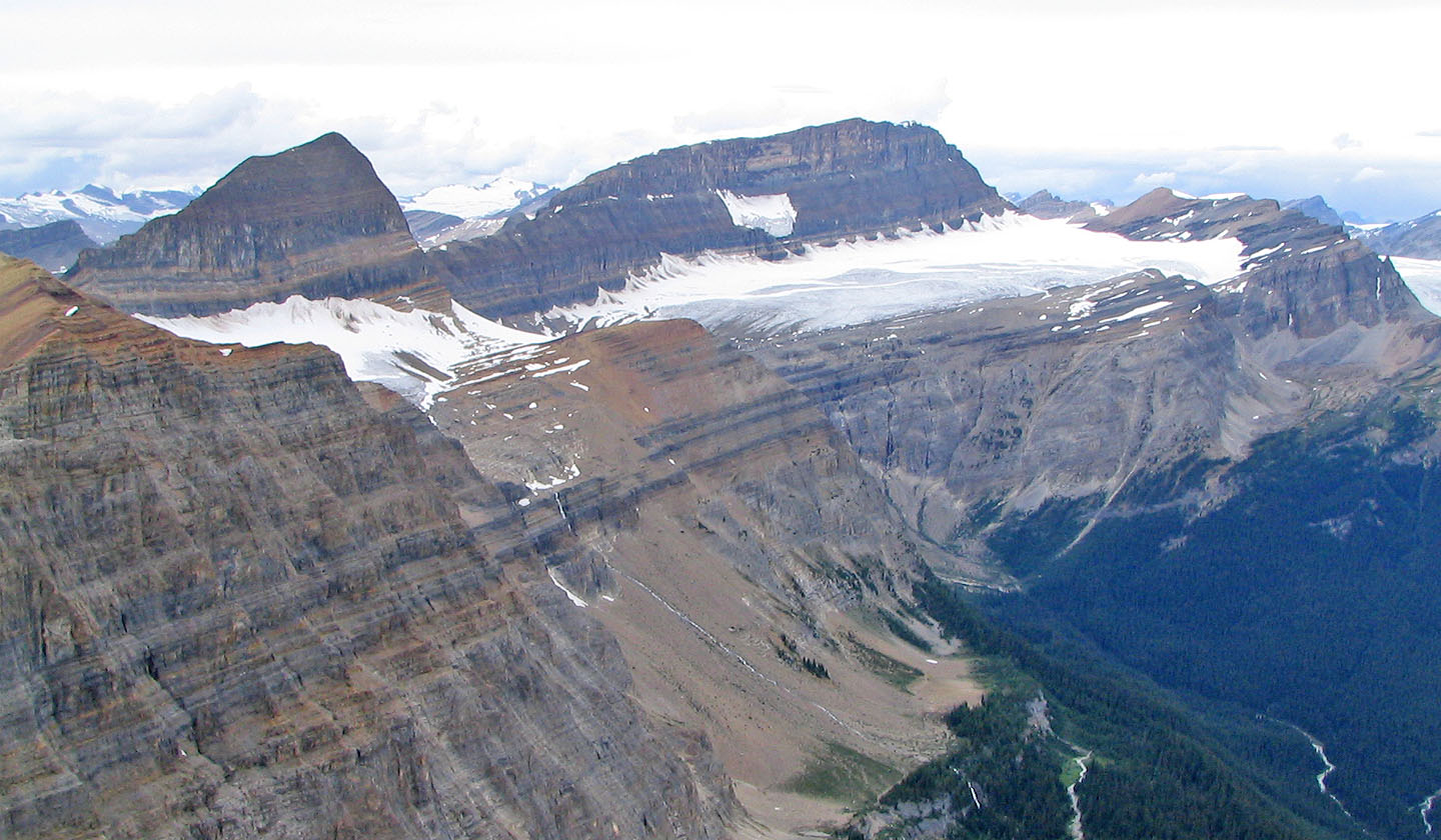
Our approximate ascent route up as viewed from Narao Peak, but I don't recommend it!
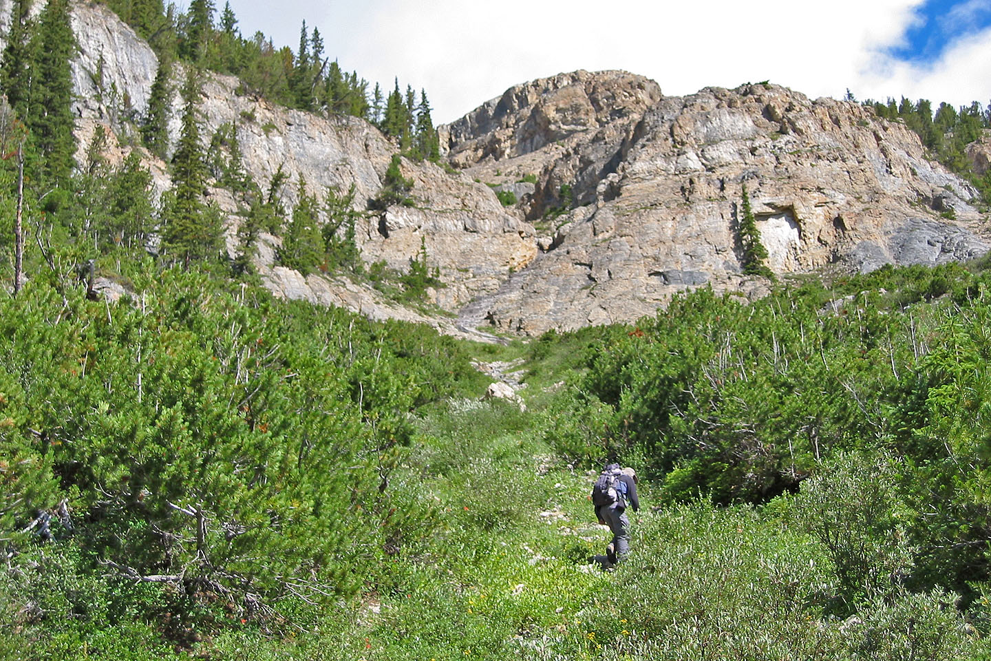
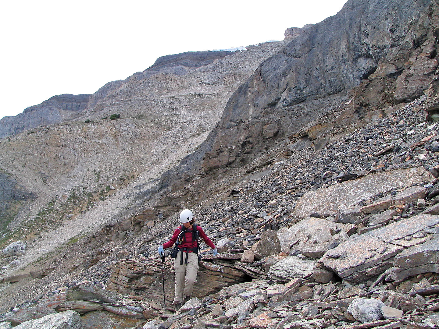
Heading to the gully near the start
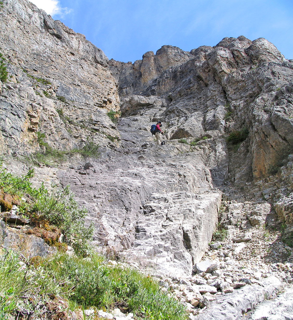
Dinah in the gully
Dinah reaches the top of the rocks
Looking back
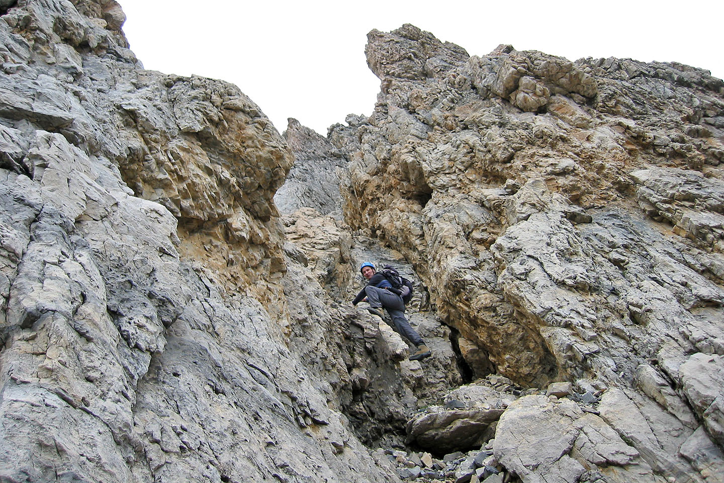
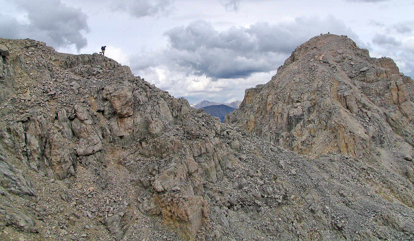
Now off route: typical scrambling in the narrow gully below the west ridge
Steep rock everywhere
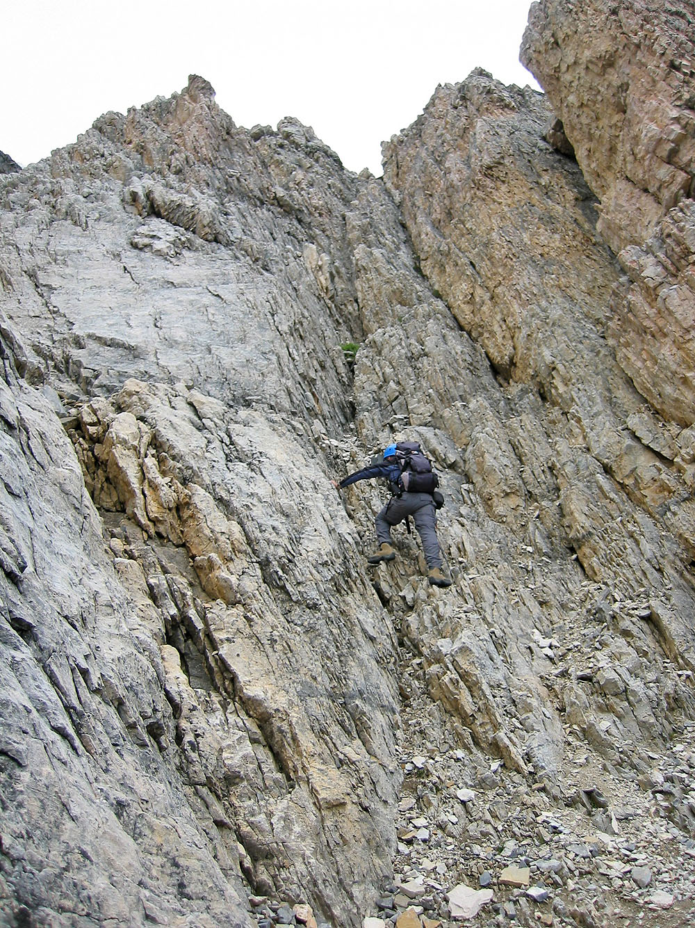
Cool rock but scary: we didn't want to downclimb it if forced to turn back
Looking down at Dinah at the top of the gully
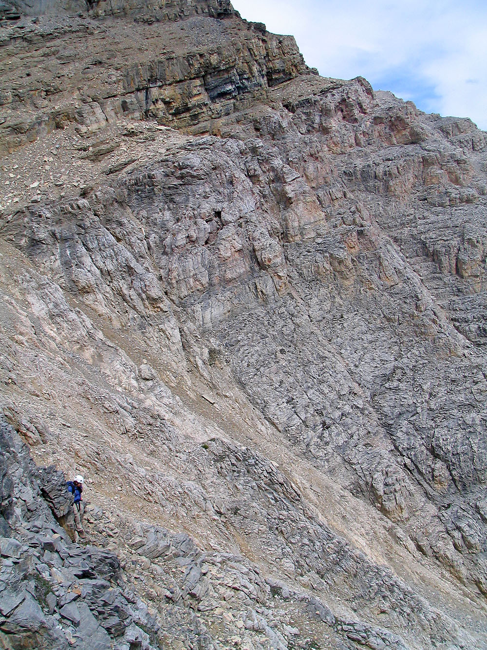
At the base of the black rock band, left of the gully we just climbed, I checked around the corner, but we
decided to climb up to the right of this steep section.
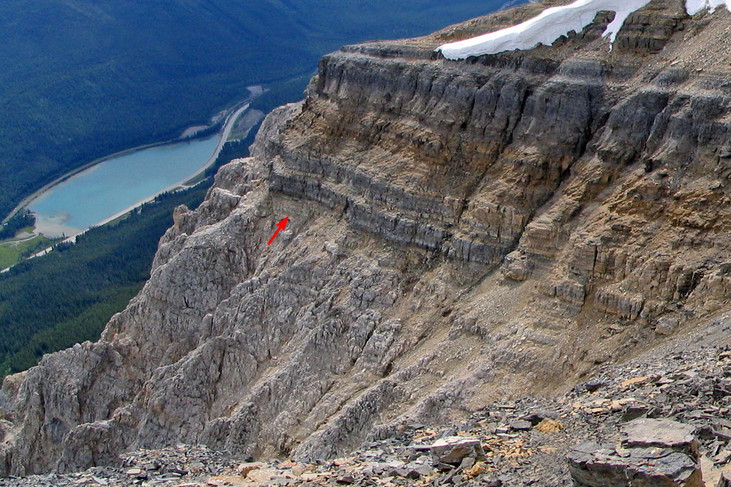
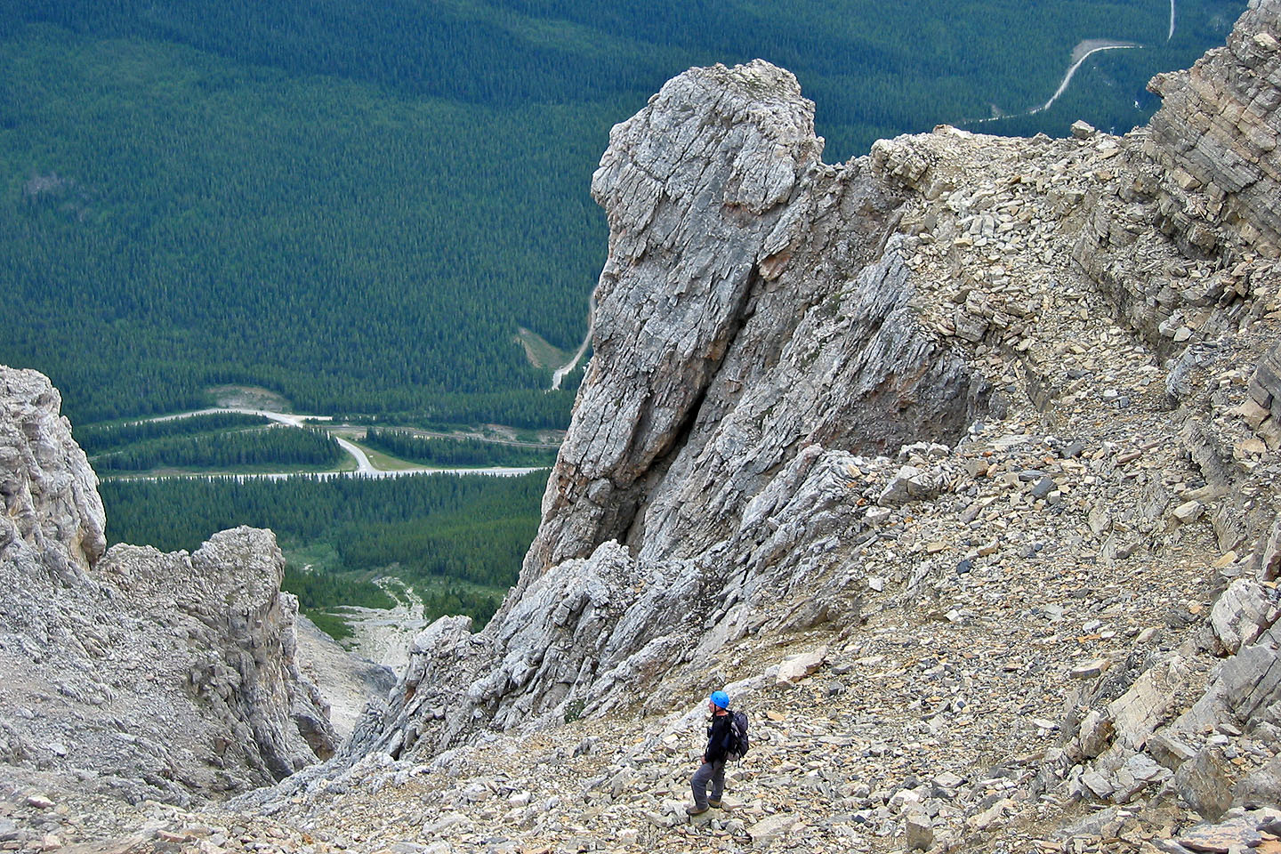
Our route after coming out of the gully. We ended up left of the cornice. (In the previous photo, I was standing
on the shoulder left of the arrow.) The rock bands were easier to ascend than the gully! (mouse over to back up)
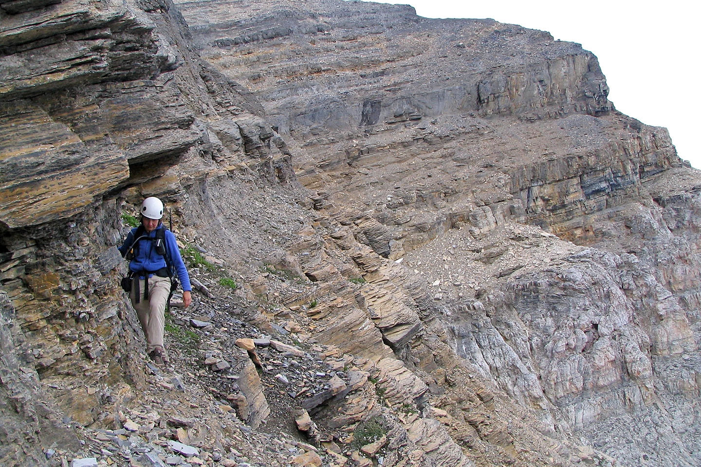
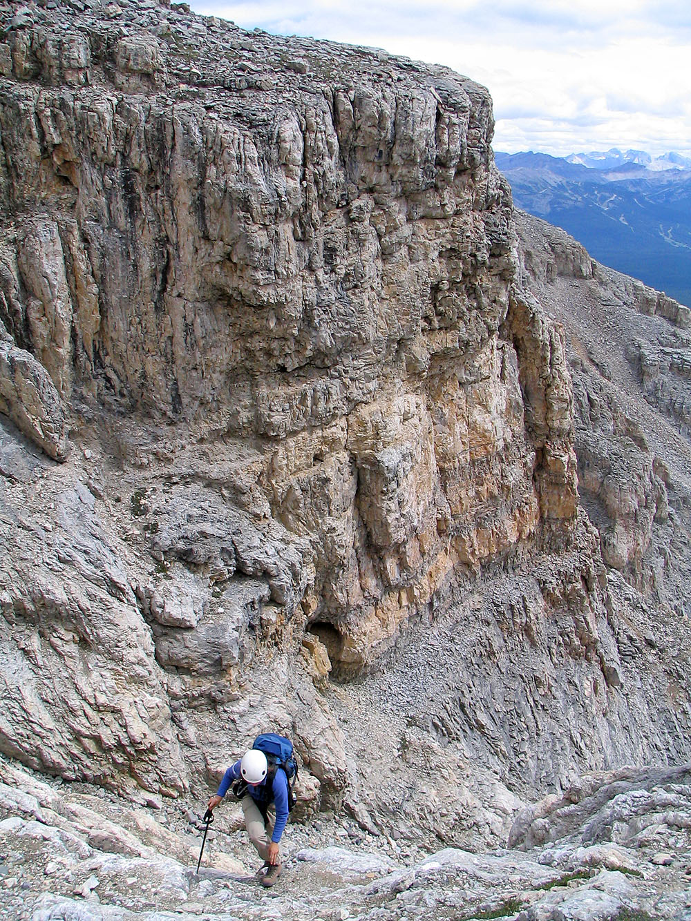
Looking for a way up the black rock band
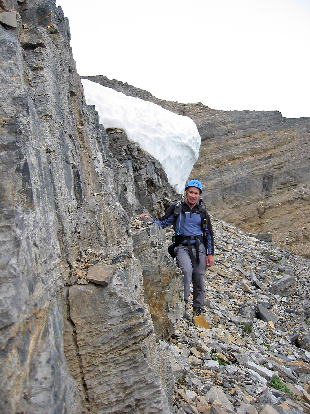
We reached the cornice and last rock band
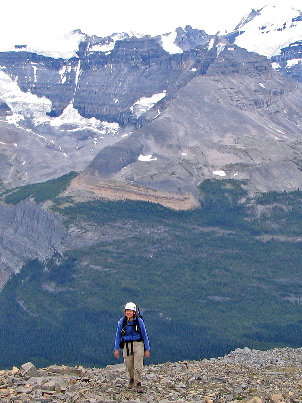
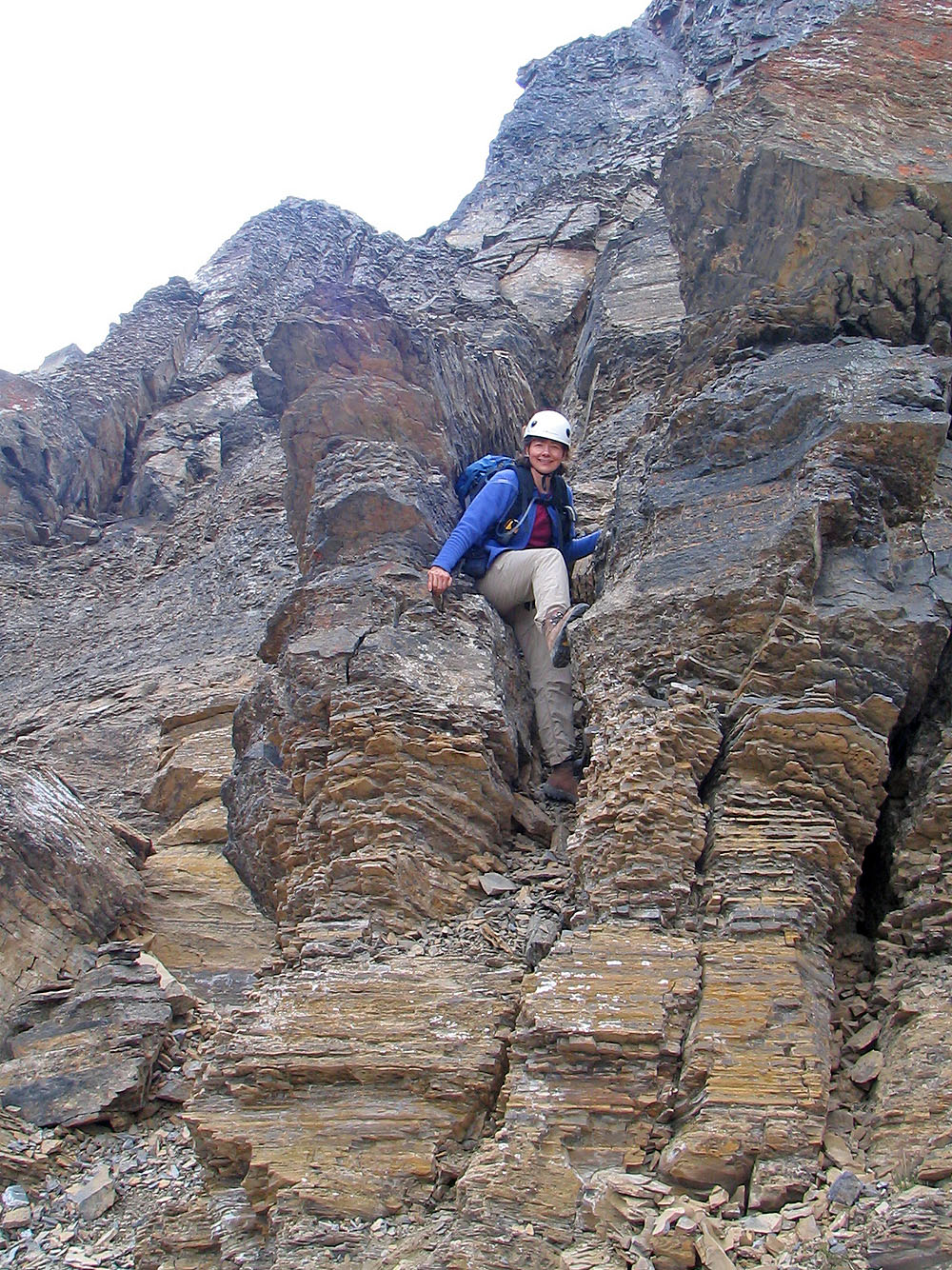
After a prolonged, intense scramble, Dinah smiles after reaching safe
ground. Behind her is Narao Peak.
We continued climbing although we didn't know what lay ahead
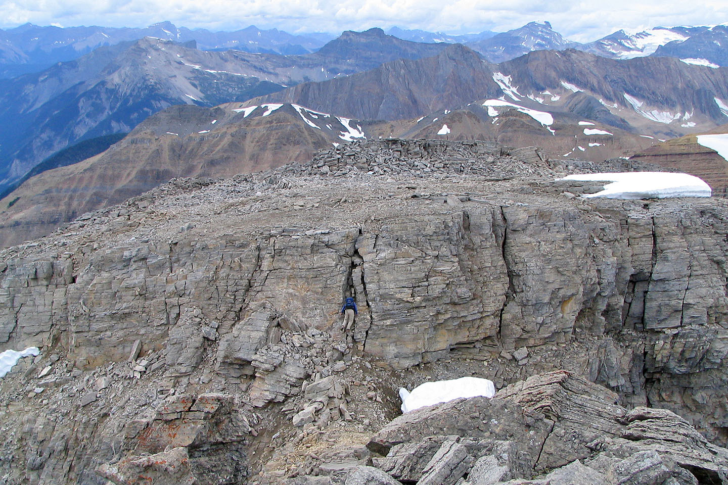
Dinah slithers down a crack to get to the summit ridge
A few steps away from the summit
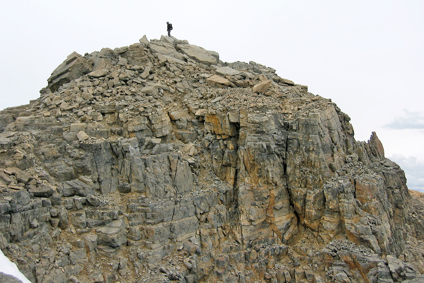
On the summit
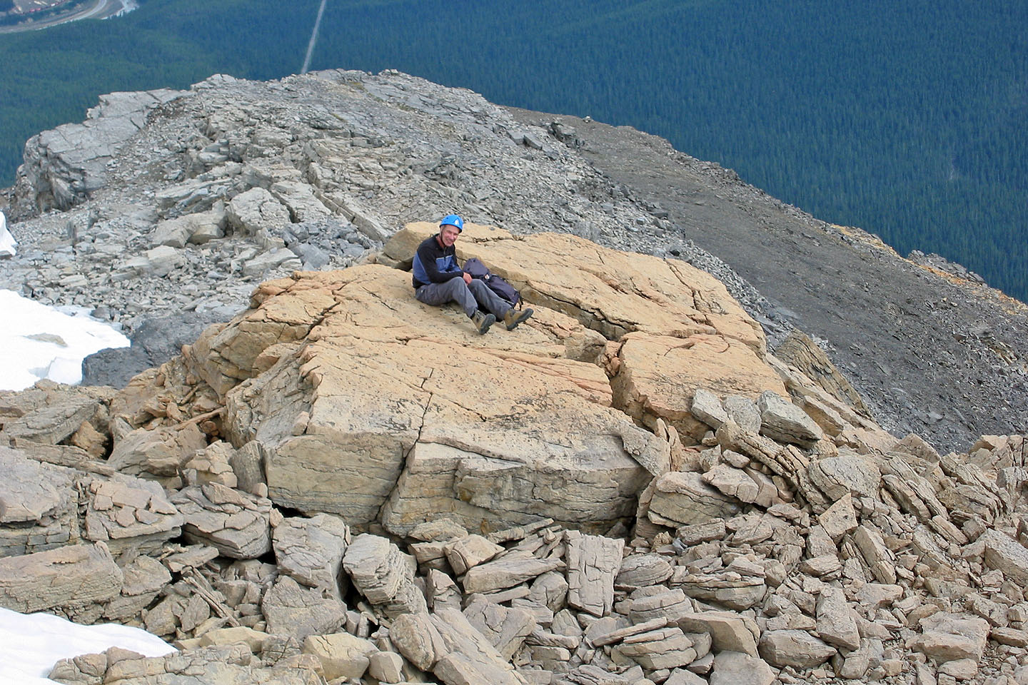
Taking a well-deserved break near the summit
Scrambling down the black cliff band
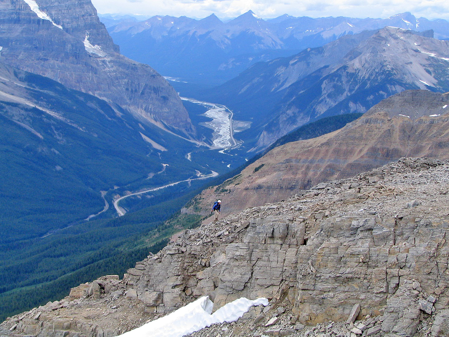
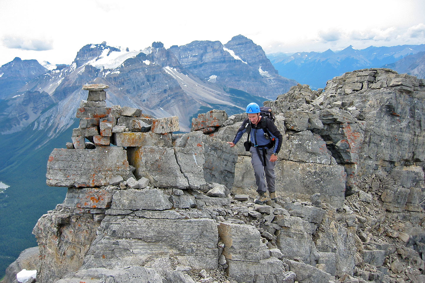
Coming down the proper route
 I couldn't resist checking out the buttress
above me
I couldn't resist checking out the buttress
above me
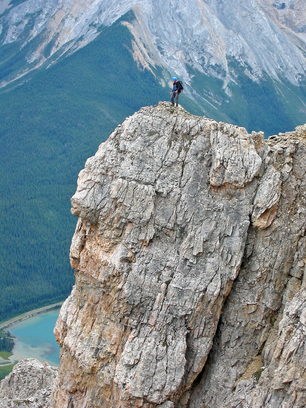
On the buttress
Looking down at Ross Lake
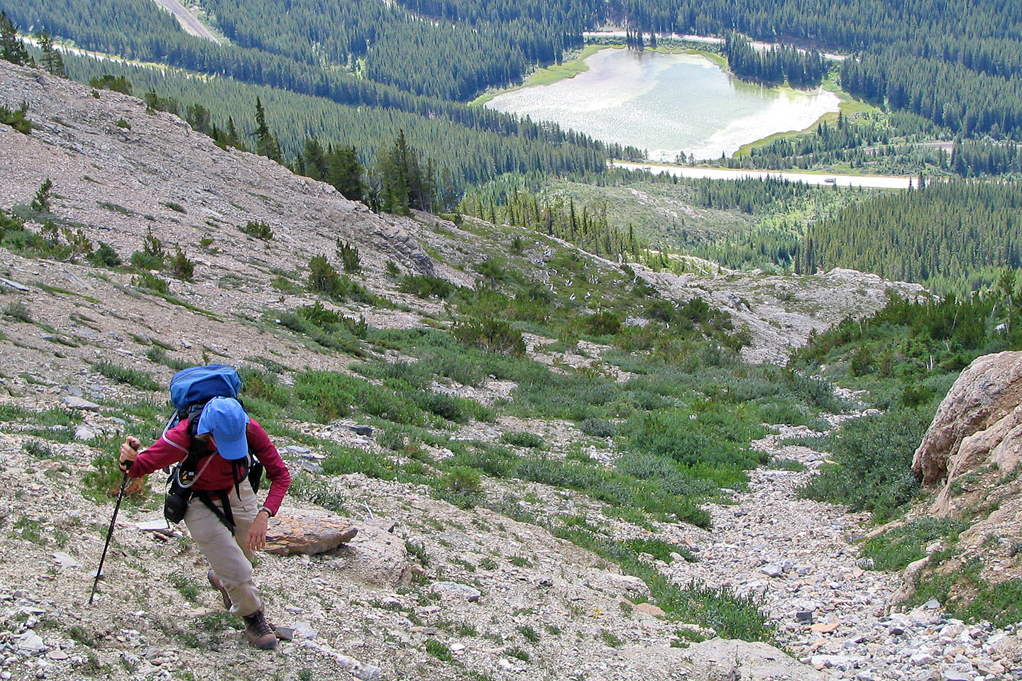
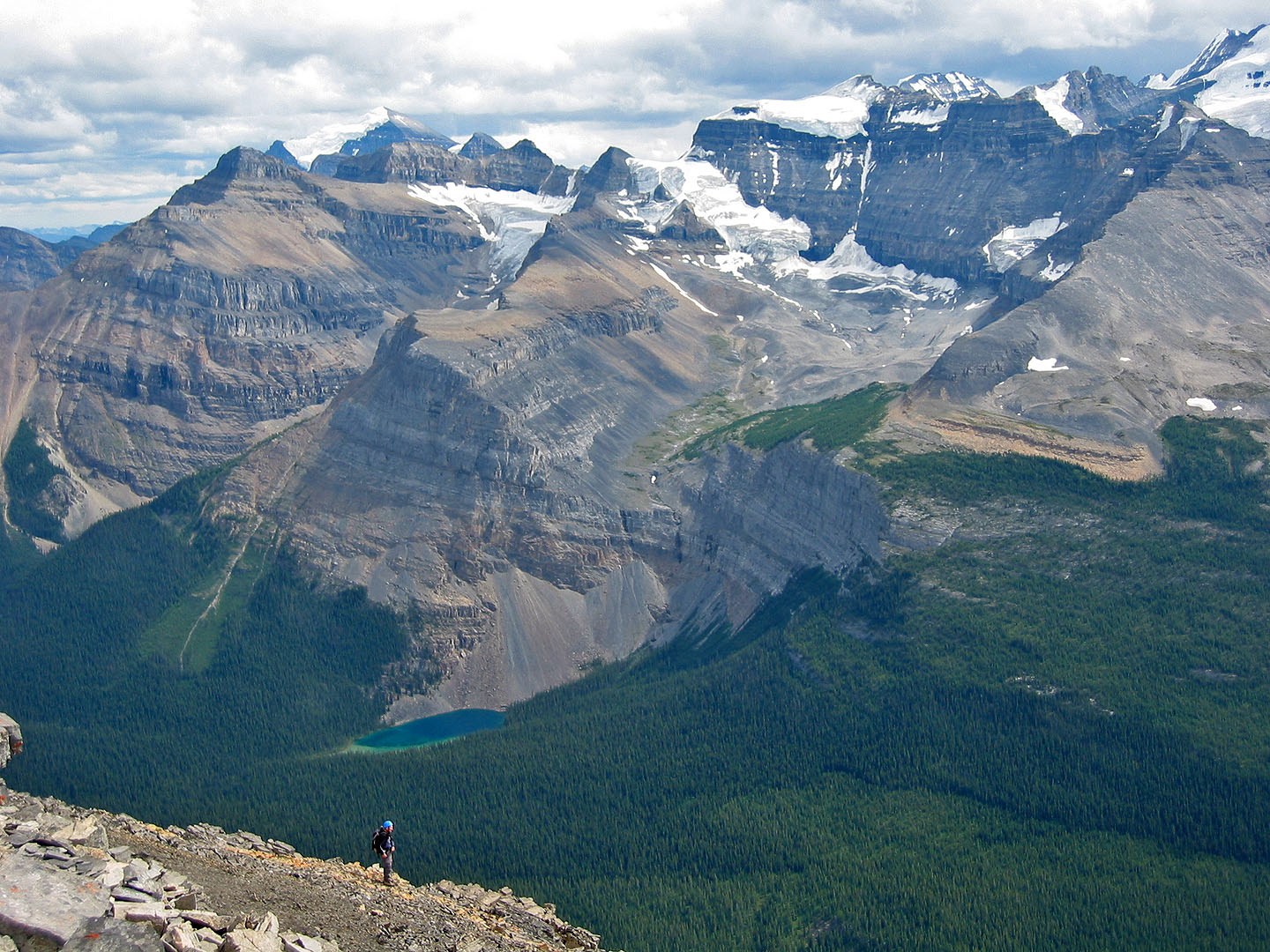
Looking back at our descent
82 N/8 Lake Louise